Circle line (London Underground)

Last updated

Circle line
Circle line flag box.svg
Au Morandarte Flickr S7 21330 on Circle Line, Aldgate (9672093333).jpg
A Circle line S7 Stock train at Aldgate
Overview
Stations36
Colour on map Corporate Yellow (with black outline until 1990) [1]
Website tfl.gov.uk
Service
Type Rapid transit
System London Underground
Depot(s) Hammersmith Edgware Road Depot
Rolling stock S7 Stock
Ridership141.627 million (2019) [lower-alpha 1] [2] passenger journeys
History
OpenedInfrastructure opened in stages between 1863(161 years ago) (1863) and 1884; shown as a separate line on the Tube map from 1949
Last extension13 December 2009
Technical
Line length27 km (17 mi)
CharacterSub-surface
Track gauge 1,435 mm (4 ft 8+12 in) standard gauge
London Underground
Bakerloo
Central
Circle
District
Hammersmith & City
Jubilee
Metropolitan
Northern
Piccadilly
Victoria
Waterloo & City
London Overground
Liberty
Lioness
Mild may
Suffragette
Weaver
Wind rush
Other TfL Modes
DLR
Elizabeth line
London Trams

The Circle line is a spiral-shaped London Underground line, running from Hammersmith in the west to Edgware Road and then looping around central London back to Edgware Road. The railway is below ground in the central section and on the loop east of Paddington. Unlike London's deep-level lines, the Circle line tunnels are just below the surface and are of similar size to those on British main lines. Printed in yellow on the Tube map, the 17-mile (27 km) line serves 36 stations, including most of London's main line termini. Almost all of the route, and all the stations, are shared with one or more of the three other sub-surface lines, namely the District, Hammersmith & City and Metropolitan lines. On the Circle and Hammersmith & City lines combined, over 141 million passenger journeys were recorded in 2019.

Contents

The first section became operational in 1863 when the Metropolitan Railway opened the world's first underground line between Paddington and Farringdon with wooden carriages and steam locomotives. The same year a select committee report recommended an "inner circle" of lines connecting the London railway termini, and the Metropolitan District Railway (commonly known as the District Railway) was formed to build the southern portion of the line.

In 1871, services began between Mansion House and Moorgate via Paddington, jointly operated by the two companies. Due to conflict between the two companies it was not until October 1884 that the inner circle was completed. The line was electrified in 1905, and in 1933 the companies were amalgamated into the London Passenger Transport Board. In 1949, the Circle line appeared as a separate line for the first time on the Tube map. In 2009, the closed loop around the centre of London on the north side of the River Thames was broken at Edgware Road and extended west to become a spiral to Hammersmith.

Starting in 2015, the signalling system was upgraded as part of a programme to increase peak-hour capacity on the line. The six-car C Stock trains were replaced from 2012 to 2014 by new seven-car S Stock trains.

History

Origins

High Street Kensington in 1892 High Street Kensington 1892.jpg
High Street Kensington in 1892

In 1863, the Metropolitan Railway, the world's first underground railway, opened in London between Paddington and Farringdon, connecting the Great Western Railway's relatively remote terminus at Paddington with Euston and King's Cross stations and the City, London's financial district. In the same year, a select committee report recommended an "inner circle" of railway lines connecting the London termini that had been built or were under construction. In the next year, the Metropolitan District Railway (commonly known as the District Railway) was formed to build and operate a railway from South Kensington to Tower Hill. The Metropolitan western extension from a new station at Paddington to South Kensington opened in 1868. By May 1870, the District Railway had opened its line from West Brompton to Blackfriars via Gloucester Road and South Kensington, services being operated at first by the Metropolitan. [3] In 1871, the District had built a terminus at Mansion House, and on 18 November 1876 the Metropolitan opened its terminus at Aldgate. [4] Because of the conflict between the two companies, it took an Act of Parliament before further work was done on the inner circle. [5] In 1882, the Metropolitan extended its line from Aldgate to a temporary station at Tower Hill and the District completed its line to Whitechapel. On 6 October 1884, the temporary station was replaced with a joint station and the inner circle was complete. [6] [7] The Metropolitan provided the clockwise, or "outer rail", trains; the District the "inner rail", or anti-clockwise. [8] Many breakdowns occurred, due to the unbalanced wear and tear inflicted upon the train and carriages caused by travelling in a single circular direction. Equally, services were further disrupted due to petty squabbles between the two rivals including an incident whereby the Metropolitan Railway forcibly removed (using three trains) the District Railway's parked carriages which had been chained to the track. [9]

Other circle routes

As well as the inner circle, other routes circumnavigated London, although these were not complete loops. From 1872, the L&NWR began an "outer circle" service from Broad Street to Mansion House via Willesden Junction and Earl's Court, diverting an earlier service that had run to Victoria; and the GWR began a "middle circle" service from Moorgate to Mansion House via Latimer Road and Earl's Court. Both of these routes were cut back to Earl's Court: the "middle circle" in 1900 and the "outer circle" in 1909. The GWR service survived as a shuttle service from the Hammersmith & City line to Addison Road, now Kensington (Olympia), until 1940. [8]

The Midland Railway briefly ran a super outer circle from St Pancras to Earl's Court from 1878 to 1880. [8] London Overground now runs services between Clapham Junction, Willesden Junction and Dalston Junction and between Dalston Junction and Clapham Junction.

Electrification

The joint Metropolitan and District Railway experimental electric train that ran between Earl's Court and High Street Kensington in 1900 Experimental Train.jpg
The joint Metropolitan and District Railway experimental electric train that ran between Earl's Court and High Street Kensington in 1900

Wooden carriages were originally hauled by steam locomotives leading to smoke-filled stations and carriages, unpopular with passengers. At the start of the 20th century, the District and Metropolitan were seeing increased competition in central London from the new electric underground tube lines and trams, and conversion to electric traction was seen as the way forward. [10] Experiments were carried out on the Earl's Court to High Street Kensington section, and a jointly-owned six-carriage train began passenger service in 1900. Following this, an AC system was suggested, and this was accepted by both parties. However, the District was looking for a way to raise the finance needed and in 1901 found an investor, the American Charles Yerkes. He formed the Underground Electric Railways of London (UERL), and his experience in the United States led him to favour DC, with third-rail pick-up similar to that in use on the City & South London Railway and Central London Railway. After arbitration by the Board of Trade, the DC system was taken up, and the railways began electrifying the routes, using multiple-unit stock. [11]

The District and Metropolitan Railways bought different designs of electric multiple unit. Both had open saloons; the Metropolitan trains with gated ends, the District B Stock with sliding doors in the middle of each car. [12] When their introduction was attempted on 1 July 1905, a Metropolitan train overturned the third rail on the District Railway, requiring all Metropolitan trains to be modified before running again on the District lines. A fully electric service began on 24 September, initially with six-car trains, later reduced to four-car. [13] The Metropolitan trains were soon modified to enclose the gated end [14] and eventually to add sliding doors in the middle. [15] Trains were increased to five cars in 1918 and the Metropolitan introduced new stock in 1921, with three pairs of sliding double doors on trailer cars. [16] In 1926 the Metropolitan took over all inner circle workings except for three trains on Sundays. [17]

London Transport

O Stock was used on the Circle line 1947-70. Here photographed at Barking in 1980. CO Stock at Barking.jpg
O Stock was used on the Circle line 1947–70. Here photographed at Barking in 1980.
The Circle line before extension to Hammersmith Circle Line (old).svg
The Circle line before extension to Hammersmith

On 1 July 1933, the Metropolitan and the District Railways were amalgamated with other Underground railways, tramway companies and bus operators to form the London Passenger Transport Board. Metropolitan Railway electric multiple units were refurbished in 1934 at Acton Works to become eighteen five-car trains of Circle Stock, at first painted red and cream, later painted red all over to reduce costs. These trains included first-class accommodation, [18] but this was downgraded in 1940. [19] From 1947, these were replaced by five-car trains of O and P Stock, with doors remotely operated by the guard, released by the transfer of F Stock to the Uxbridge line. [20] The 1933 London Underground Beck map shows a Metropolitan line north of High Street Kensington and Mark Lane stations and a District line south of these points. [21] On the 1947 map, the Metropolitan and District lines were shown together in the same colour [22] and two years later in 1949 the Circle line was shown separately on the map. [23]

In 1959–1960, Circle line trains were increased to six cars, the same length as those operating on the Hammersmith & City line, and the stock of the two lines was integrated with maintenance concentrated at Hammersmith depot, allowing Neasden depot to concentrate on the new A Stock. [24] Aluminium C Stock trains, with public address systems and originally unpainted, replaced these trains from 1970. [25] One person operation of the trains was proposed in 1972 but, due to conflict with the trade unions, was not introduced until 1984. [26] In 2003, the infrastructure of the Circle line was partly privatised in a public–private partnership, managed by the Metronet consortium. Metronet went into administration in 2007 and the local government body Transport for London took over responsibilities. [27]

On 7 July 2005, at about 08:50, bombs exploded on two Circle line trains. One was travelling between Liverpool Street and Aldgate and the other was at Edgware Road. The bombs killed 15 people, including the two suicide bombers. [28] [29] Following the attacks, the whole of the Circle line was closed until 8 August. [30]

A day before a ban on drinking alcohol on public transport in London came into force, a party was held on 31 May 2008, mainly on the Circle line. Thousands of people attended and 17 were arrested by police due to disorderly behaviour, eventually causing several stations to be closed. [31]

Extension

Prior to 13 December 2009, Circle line trains travelled in both directions around a simple loop with 27 stations and 12.89 miles (20.75 km) of track. In 2006, there were fourteen trains in service on the line with an interval between trains of 8+12 minutes during peak hours and 8 minutes off-peak; the minimum running time around the circle off-peak was 51+12 minutes, [32] although timetabled stops at stations extended this. [lower-alpha 2]

In December 2009, the Circle line was extended to include the Hammersmith & City route from Edgware Road to Hammersmith. Rather than continuously running around the circle, trains now travel from Hammersmith to Edgware Road, generally going around the circle once before terminating at Edgware Road, and returning via the same route; occasionally, trains may also continue clockwise through Edgware Road to additional stations. The change was made to improve reliability and increase the service frequency on the Hammersmith branch. [34]

In March 2020, following the UK government's implementation of lockdown restricting all non-essential travel, the Circle line, along with the Waterloo & City line, was suspended. [35]

Route

Map

Circle line & London map.svg
The route of the Circle line since 13 December 2009 and the London boroughs it serves

Railway line

Circle line
BSicon HUBa@F.svg
BSicon uvCONTgq.svg
BSicon BLa.svg
BSicon uvBHFq.svg
BSicon HUB.svg
BSicon uvCONTfq.svg
BSicon BLe.svg
BSicon uKACCa.svg
BSicon HUBe.svg
Hammersmith
H&c line roundel (no text).svg
BSicon uKRW+l.svg
BSicon uKRWgr.svg
BSicon uKDSTe.svg
BSicon HUBa@f-R.svg
BSicon MSTR.svg
BSicon uhSTRa@g.svg
BSicon HUB-Rq.svg
BSicon HUBa@f-L.svg
Hammersmith depot
BSicon HUB-R.svg
Gnome-searchtool.svg
BSicon uhHST.svg
BSicon HUB-L.svg
Goldhawk Road
BSicon HUB-R.svg
BSicon uehHST.svg
BSicon HUB-L.svg
Shepherd's Bush (MR)
BSicon HUB-R.svg
BSicon uhHST.svg
BSicon HUB-L.svg
Shepherd's Bush Market
BSicon HUB-R.svg
BSicon BLc2.svg
BSicon uehHST.svg
BSicon BLc3.svg
BSicon HUB-L.svg
White City
BSicon utdCONTgq.svg
BSicon utSTRq.svg
BSicon HUB-R.svg
BSicon KBL1.svg
BSicon uhACC.svg
BSicon utSTRq.svg
BSicon KBL4.svg
BSicon utBHFe@gq.svg
BSicon HUB-L.svg
BSicon udCONTfq.svg
Wood Lane H&c line roundel (no text).svg
BSicon dCONTgq.svg
BSicon uexkSTR2+r.svg
BSicon STRq.svg
BSicon HUB-R.svg
BSicon uexhkSTRc3a.svg
BSicon MSTR.svg
BSicon uhSTR.svg
BSicon STRq.svg
BSicon STRq.svg
BSicon HUB-L.svg
BSicon dCONTfq.svg
BSicon hkSTR-c1a.svg
BSicon HUB-R.svg
BSicon uehkABZg+4.svg
BSicon HUB-L.svg
BSicon HUBe@g-R.svg
BSicon MSTR.svg
BSicon uhHST.svg
BSicon HUB-Lq.svg
BSicon HUBe@g-L.svg
Latimer Road
BSicon uhHST.svg
Ladbroke Grove
BSicon HUBa@f-R.svg
BSicon uhSTRe.svg
BSicon HUB-Rq.svg
BSicon STRc2.svg
BSicon HUBa@f-L.svg
BSicon d-CONT3.svg
BSicon HUB-R.svg
Gnome-searchtool.svg
BSicon uHST.svg
BSicon exlHST-2.svg
BSicon ABZ1+3f.svg
BSicon exlHST-2~RR.svg
BSicon HUB-L.svg
BSicon cSTRc4.svg
Westbourne Park
BSicon exlHSTc2.svg
BSicon HUB-R.svg
BSicon exlHST-2~GG.svg
BSicon exlHST-4~FF.svg
BSicon umKRZ3+1u.svg
BSicon tSTRa@f.svg
BSicon exlHSTc4.svg
BSicon HUB-L.svg
BSicon STR+1.svg
BSicon exlHST-4~LL.svg
BSicon HUB-R.svg
BSicon uHST.svg
BSicon tSTRc2.svg
BSicon exlHST-4.svg
BSicon tSTR3.svg
BSicon HUB-L.svg
Royal Oak
BSicon STR.svg
BSicon tSTRc2.svg
BSicon HUB-R.svg
BSicon uSTR.svg
BSicon tSTR3+1.svg
BSicon tSTRc4.svg
BSicon HUB-L.svg
BSicon tSTR+1~F.svg
BSicon HUB-R.svg
BSicon XPLTal.svg
BSicon KINTe.svg
BSicon tdSTR3+1-.svg
BSicon XPLTeq.svg
BSicon utINTa@f.svg
BSicon tSTRc4.svg
BSicon HUB-L.svg
Paddington Bakerloo line roundel (no text).svg District line roundel (no text).svg H&c line roundel (no text).svg Elizabeth line roundel (no text).svg Heathrow Express icon RDT.svg National Rail logo.svg
Bayswater
BSicon utSTR+l.svg
BSicon utHSTeaq.svg
BSicon tSTR+1~G.svg
BSicon utBHFeaq.svg
BSicon lINT.svg
BSicon XPLTe.svg
BSicon utABZg+r.svg
BSicon HUB-L.svg
Central line roundel (no text).svg District line roundel (no text).svg Notting Hill Gate
BSicon utBHF.svg
BSicon tCONTf.svg
BSicon HUBe@g-R.svg
BSicon utBS2c2.svg
BSicon utSHI2gr.svg
BSicon HUB-Lq.svg
BSicon HUBe@g-L.svg
BSicon utdSTR.svg
BSicon PORTALg.svg
BSicon lv-KRZu+F.svg
BSicon uvKBHFe-BHF.svg
Edgware Road District line roundel (no text).svg H&c line roundel (no text).svg
District line roundel (no text).svg High Street Kensington
BSicon utBHFea.svg
BSicon utdSTR.svg
BSicon utSTRc2.svg
BSicon utd-CONT3.svg
BSicon utdCONTgq.svg
BSicon utABZgr+r.svg
BSicon utBHF-L.svg
BSicon utdSTRc2.svg
BSicon ulBHF-R.svg
BSicon utBHF3+1.svg
BSicon utcdSTRc4.svg
Baker Street Bakerloo line roundel (no text).svg H&c line roundel (no text).svg Jubilee line roundel (no text).svg Metropolitan line roundel (no text).svg
District line roundel (no text).svg Piccadilly line roundel (no text).svg Gloucester Road
BSicon utBHF.svg
BSicon utdABZg+1.svg
BSicon utSTRc4.svg
District line roundel (no text).svg Piccadilly line roundel (no text).svg South Kensington
BSicon utBHFea.svg
BSicon utHST.svg
Great Portland Street
BSicon utSTR.svg
BSicon HUBa@f-R.svg
BSicon BLaq.svg
BSicon utINT.svg
BSicon HUB-Rq.svg
BSicon BLeq.svg
BSicon lINTACC.svg
BSicon HUBa@f-L.svg
Euston Square H&c line roundel (no text).svg Metropolitan line roundel (no text).svg
Sloane Square
BSicon utHSTea.svg
BSicon HUB-R.svg
Gnome-searchtool.svg
BSicon utINTACC.svg
BSicon HUB-L.svg
King's Cross St Pancras
H&c line roundel (no text).svg Metropolitan line roundel (no text).svg Northern line roundel (no text).svg
Piccadilly line roundel (no text).svg Victoria line roundel (no text).svg
National Rail logo.svg
Eurostar icon RDT (2023).svg
National Rail logo.svg District line roundel (no text).svg Victoria line roundel (no text).svg Victoria
BSicon utINTACC.svg
BSicon HUB-R.svg
BSicon utSTR.svg
BSicon tSTR+l~L.svg
BSicon extBS2l.svg
BSicon tSTR+l~R.svg
BSicon HUB-L.svg
BSicon tdCONTfq.svg
St James's Park
BSicon utHST.svg
BSicon HUB-R.svg
BSicon uemvHST.svg
BSicon vPORTAL@f.svg
BSicon vPORTAL@g.svg
BSicon HUB-L.svg
BSicon FERRY.svg District line roundel (no text).svg Jubilee line roundel (no text).svg Westminster
BSicon utINTACC.svg
BSicon HUB-R.svg
BSicon uexldHST.svg
BSicon utdSTRe@f.svg
BSicon tdSTRe@f.svg
BSicon HUB-L.svg
Clerkenwell not built
BSicon FERRY.svg Bakerloo line roundel (no text).svg District line roundel (no text).svg Northern line roundel (no text).svg Embankment
BSicon utINT.svg
BSicon HUB-R.svg
BSicon cSTRc2.svg
BSicon udSTR.svg
BSicon d-KRZ3+1o.svg
BSicon d-STR+3.svg
BSicon HUB-L.svg
Temple
BSicon utHST.svg
BSicon HUB-R.svg
BSicon dSTR+1.svg
BSicon udSTR.svg
BSicon dKRZc4o.svg
BSicon tCONT4+f.svg
BSicon HUB-L.svg
BSicon utSTR.svg
BSicon HUB-R.svg
BSicon cdSTRc2.svg
BSicon mvBHF.svg
BSicon xdABZg3.svg
BSicon XPLTaq.svg
BSicon lvINTACC.svg
BSicon BLc2.svg
BSicon cXPLTq.svg
BSicon KBL3.svg
BSicon XPLTeq.svg
BSicon tINTACC.svg
BSicon HUB-L.svg
Farringdon H&c line roundel (no text).svg Metropolitan line roundel (no text).svg Elizabeth line roundel (no text).svg National Rail logo.svg
National Rail logo.svg BSicon FERRY.svg District line roundel (no text).svg Blackfriars
BSicon dCONTgq.svg
BSicon INTACCq.svg
BSicon PORTALl.svg
BSicon utSTR.svg
BSicon tHSTq.svg
BSicon tSTRr+1a@g.svg
BSicon HUB-R.svg
BSicon extdSTRa.svg
BSicon dSTRc4.svg
BSicon utSTRa.svg
BSicon BL~L.svg
BSicon BL~R.svg
BSicon tSTR.svg
BSicon HUB-L.svg
Mansion House
BSicon utHST.svg
BSicon HUB-R.svg
BSicon exvHST.svg
BSicon uv-HST.svg
BSicon vPORTAL@f.svg
BSicon vPORTAL@g.svg
BSicon BLr+g.svg
BSicon ulHST~R.svg
BSicon tSTR.svg
BSicon HUB-L.svg
Barbican Elizabeth line roundel (no text).svg
National Rail logo.svg District line roundel (no text).svg Cannon Street
BSicon utINT.svg
BSicon extBS2+l.svg
BSicon utBS2c2.svg
BSicon HUB-R.svg
BSicon extBS2c4.svg
BSicon utSHI2gr.svg
BSicon tSTR.svg
BSicon HUB-L.svg
DLR no-text roundel.svg Central line roundel (no text).svg District line roundel (no text).svg Northern line roundel (no text).svg W&c line roundel (no text).svg Monument
BSicon utINT.svg
BSicon HUB-R.svg
BSicon extdKBHFe-L.svg
BSicon exBLeq.svg
BSicon exlBHF-R.svg
BSicon utvKINTe-INT.svg
BSicon BLf+r.svg
BSicon lINT~R.svg
BSicon BLc3.svg
BSicon tSTR.svg
BSicon HUB-L.svg
Moorgate H&c line roundel (no text).svg Metropolitan line roundel (no text).svg Northern line roundel (no text).svg Elizabeth line roundel (no text).svg National Rail logo.svg
BSicon uetHST.svg
BSicon HUBe@g-R.svg
BSicon BLc1.svg
BSicon utXINT-L.svg
BSicon HUB-Lq.svg
BSicon XPLTeq.svg
BSicon tSTR.svg
BSicon KBL4.svg
BSicon lINTACC.svg
BSicon HUBe@g-L.svg
Liverpool Street Central line roundel (no text).svg H&c line roundel (no text).svg Metropolitan line roundel (no text).svg Elizabeth line roundel (no text).svg Overground roundel (no text).svg National Rail logo.svg
BSicon FERRY.svg District line roundel (no text).svg Tower Hill
BSicon utSTR2.svg
BSicon lINT.svg
BSicon BLa.svg
BSicon utSTRc3.svg
BSicon utSTR.svg
BSicon tCONTf.svg
BSicon lINTACC.svg
BSicon utSTRc1.svg
BSicon BLe.svg
BSicon utSTRl+4-.svg
BSicon utSTR2+4.svg
BSicon lKRZo+R-.svg
BSicon MSTR3.svg
BSicon ulvBHFq.svg
BSicon utSTRc23.svg
BSicon utvSTRa@fq.svg
BSicon utSTRr-.svg
BSicon utSTR3.svg
BSicon ut-STRr.svg
Aldgate Metropolitan line roundel (no text).svg
BSicon utSTRc1.svg
BSicon utABZ+14.svg
BSicon utSTRc4.svg
BSicon utCONTf.svg

The Circle line is 17 miles (27 km) long with 36 stations. [36] Almost all of its track, and all of its stations, are shared with the other London Underground sub-surface lines: the Hammersmith & City line from Hammersmith to just north of Aldgate; the Metropolitan line from Baker Street to Aldgate; and the District line from Tower Hill station to Edgware Road station, [37] (except for a short connecting section near Gloucester Road). The line is electrified with a four-rail DC system: a central conductor rail is energised at −210 V and a rail outside the running rail at +420 V, giving a potential difference of 630 V. [38] The running rails are not electrified. Much of the 2-mile-35-chain (3.9 km) double track railway from the Hammersmith terminus to Westbourne Park station is on a 20-foot (6.1 m) high brick viaduct. [39]

East of Westbourne Park the line passes beneath the Great Western Main Line before resurfacing at Royal Oak station and running alongside the tracks of the main line to an island platform just north of the suburban platforms at Paddington station. [37] The line enters a cut and cover tunnel at the end of the platforms and meets the District line and the other end of the Circle line from Bayswater at Praed Street Junction before passing through Edgware Road station in a cutting. After King's Cross St Pancras station the line exits the tunnel before passing over the Ray Street Gridiron beneath which pass the City Widened Lines which are currently used by Thameslink services. [37] [40] The line continues underground after Farringdon station; there are bay platforms at Moorgate station. [37]

After passing through Aldgate station, the terminus of the Metropolitan line, the line joins the District line shortly before Tower Hill; this part of the line includes stations on the Victoria Embankment, on the north bank of the Thames, as far as Westminster station. [37] West of Gloucester Road station the line turns off the District main line to join the District line's Edgware Road branch just before High Street Kensington station. [37] In Bayswater the line is in a cutting, concealed from above by a façade of two five-storey houses at Nos 23 and 24 Leinster Gardens. [41] Trains then call at the second Paddington station on Praed Street before rejoining the Hammersmith & City line at Praed Street junction and terminating at the four-platform Edgware Road station. [37]

Services

As of December 2012, there are six trains per hour, calling at all stations, [42] requiring 18 trains in service. [36] The journey from Edgware Road around the loop and continuing to Hammersmith takes 72 minutes off-peak. [42] Together with the Hammersmith & City line over 114 million passenger journeys are made each year. [43] Paddington and all stations on the loop are within Zone 1, with those on the line to Hammersmith in Zone 2. [44]

Two trains per day run from Barking to Edgware Road via Victoria (as of February 2015). [45]

Announcements

Historically there has been difficulty in relaying the direction of travel a train is headed in a clear message: variations such as "eastbound" and "westbound", and "clockwise" and "anti-clockwise" can be ambiguous. As passengers became more accustomed to digital devices, TfL considered stopping such announcements and now uses key stations along the route to describe a service (e.g. "via. High Street Kensington"). [46] [47]

Rolling stock

From 1970 to 2014, services were provided using six-car C69 stock trains, each car having mostly transverse seating and four sets of double doors per side to minimise loading times. [48]

The C69 stock trains were replaced by seven-car S Stock trains, the first running on the Circle line on 2 September 2013. [49] [50] [51] By June 2014 all services were provided by S7 Stock trains. The trains are part of Bombardier's Movia family, [52] and have a top speed of 62 mph (100 km/h). [52] A 7-car S Stock train has a capacity of 865 passengers compared to 739 for the 6-car C Stock train it replaced. [53] [54] With a length of 117 metres (384 ft), the S Stock trains are 24 metres (79 ft) longer than the 93-metre (305 ft) long C stock train, and required station platforms to be lengthened before their introduction. [55]

Depot

The line's depot is at Hammersmith, [lower-alpha 3] close to Hammersmith station, originally built by the Great Western Railway to be operated by the Metropolitan Railway when the joint Hammersmith & City Railway was electrified in the early 20th century. [56] Sidings at Barking, Farringdon and near High Street Kensington (known as Triangle Sidings) stable trains overnight. [36]

Four Lines Modernisation (4LM)

It was planned that a new signalling system would be used first on the sub-surface lines from the end of 2016, [57] but signalling contractor Bombardier was released from its contract by agreement in December 2013 amid heavy criticism of the procurement process [58] and London Underground subsequently awarded the contract for the project to Thales in August 2015. [59]

With the introduction of S7 Stock, the track, electrical supply, and signalling systems are being upgraded in a programme planned to increase peak-hour capacity on the line by 27 per cent by the end of 2023. [57] [60] [61] A single control room for the sub-surface railway opened at Hammersmith on 6 May 2018, and Communications Based Train Control (CBTC) provided by Thales will progressively replace 'fixed block' signalling equipment dating back to the 1940s. [57] [62]

The rollout of CBTC has been split into sections, each known as a Signal Migration Area (SMA), and are located on the line as follows: [63]

Circle line Signal Migration Areas
SMA [lower-roman 1] fromtostatusdate
0.5HammersmithLatimer RoadCompletedMarch 2019
1Latimer RoadPaddingtonCompletedSeptember 2019
2PaddingtonEuston SquareCompletedSeptember 2019
3Euston SquareMonumentCompletedMarch 2021
4MonumentSloane SquareCompletedApril 2021
5Sloane SquarePaddingtonCompletedMarch 2022
  1. SMAs 6–14 concerns parts of the District, Hammersmith & City, and Metropolitan lines.

List of stations

StationImageOpened [7] Additional informationPosition
Hammersmith Wheelchair symbol.svg Hammersmith tube station (Hammersmith & City Line) in London, spring 2013 (2).JPG 13 June 1864Moved to current position 1 December 1868. [7] Connects with Hammersmith & City Line. 51°29′39″N000°13′30″W / 51.49417°N 0.22500°W / 51.49417; -0.22500 (01 - Hammersmith tube station)
Goldhawk Road Goldhawk Road stn east entrance.JPG 1 April 1914 51°30′07″N000°13′37″W / 51.50194°N 0.22694°W / 51.50194; -0.22694 (02 - Goldhawk Road tube station)
Shepherd's Bush Market Shepherd's Bush Market stn east entrance.JPG 13 June 1864Moved to current position 1 April 1914. [7] Renamed from "Shepherd's Bush" in 2008. [64] 51°30′21″N000°13′35″W / 51.50583°N 0.22639°W / 51.50583; -0.22639 (03 - Shepherd's Bush Market tube station)
Wood Lane Wheelchair symbol.svg Wood Lane tube station 8.jpg 1 May 1908Open as Wood Lane (Exhibition) 1908–14 and as required from 1920 as Wood Lane (White City). Renamed White City in 1947 and closed in 1959, [7] until re-opened as Wood Lane on 12 October 2008. [65] 51°30′35″N000°13′27″W / 51.50972°N 0.22417°W / 51.50972; -0.22417 (04 - Wood Lane tube station)
Latimer Road Latimer Road tube stn entrance close-up 2012.JPG 16 December 1868Closed from 17 January to 1 August 2011 for engineering and refurbishment works. [66] 51°30′50″N000°13′02″W / 51.51389°N 0.21722°W / 51.51389; -0.21722 (05 - Latimer Road tube station)
Ladbroke Grove Ladbroke Grove station.jpg 13 June 1864Opened as Notting Hill, renamed Notting Hill & Ladbroke Grove in 1880, Ladbroke Grove (North Kensington) in 1919, and Ladbroke Grove in 1938. [7] 51°31′02″N000°12′38″W / 51.51722°N 0.21056°W / 51.51722; -0.21056 (06 - Ladbroke Grove tube station)
Westbourne Park Westbourne Park tube station 1.jpg 1 February 1866Moved to current position 1 November 1871, [7] and a Great Western Main Line station from 1871 to 1992. [67] 51°31′16″N000°12′04″W / 51.52111°N 0.20111°W / 51.52111; -0.20111 (07 - Westbourne Park tube station)
Royal Oak Royal Oak tube station Entrance.jpg 30 October 1871Also a Great Western Main Line station after opening [68] until 1934. 51°31′09″N000°11′17″W / 51.51917°N 0.18806°W / 51.51917; -0.18806 (08 - Royal Oak tube station)
Paddington Wheelchair symbol.svg Elizabeth line roundel (no text).svg National Rail logo.svg Paddington tube stn Hammersmith & City westbound look east.JPG 10 January 1863Opened as Paddington (Bishop's Road), renamed in 1948. [7]
Connects with Bakerloo and District lines, Elizabeth line and National rail services from Paddington main line station.
51°31′07″N000°10′46″W / 51.51861°N 0.17944°W / 51.51861; -0.17944 (09 - Paddington station (Circle and Hammersmith & City lines))
Edgware Road EdgwareRdHammersmith.jpg 10 January 1863Connects with District and the anti-clockwise Circle lines. 51°31′12″N000°10′04″W / 51.52000°N 0.16778°W / 51.52000; -0.16778 (10 - Edgware Road tube station)
Baker Street BakerStEntrance.JPG 10 January 1863Connects with Bakerloo, Jubilee and Metropolitan lines. 51°31′19″N000°09′25″W / 51.52194°N 0.15694°W / 51.52194; -0.15694 (11 - Baker Street tube station)
Great Portland Street Great Portland St Tube Station.jpg 10 January 1863Opened as Portland Road, renamed Great Portland Street in 1917. Named Great Portland Street & Regent's Park 1923–33. [7] 51°31′26″N000°08′38″W / 51.52389°N 0.14389°W / 51.52389; -0.14389 (12 - Great Portland Street tube station)
Euston Square Euston Square stn south entrance.JPG 10 January 1863Opened as Gower Street and renamed in 1909. [7] Street connection with London Overground and National rail services from Euston main line station. 51°31′33″N000°08′09″W / 51.52583°N 0.13583°W / 51.52583; -0.13583 (13 - Euston Square tube station)
King's Cross St Pancras Wheelchair symbol.svg ThameslinkSymbol.svg National Rail logo.svg Eurostar icon RDT (2023).svg King's Cross St Pancras tube stn Euston Rd NE entrance.JPG 10 January 1863Opened as King's Cross, renamed King's Cross & St. Pancras in 1925 and King's Cross St. Pancras in 1933. Moved to current position in 1941. [7]
Connects with Northern, Piccadilly and Victoria lines and National and International Rail Services from St Pancras and King's Cross main line stations.
51°31′49″N000°07′27″W / 51.53028°N 0.12417°W / 51.53028; -0.12417 (14 - King's Cross St Pancras tube station)
Farringdon Wheelchair symbol.svg Elizabeth line roundel (no text).svg ThameslinkSymbol.svg National Rail logo.svg Farringdon station building.JPG 10 January 1863Interchangeable with National Rail (Thameslink) services and the Elizabeth line. Opened as Farringdon Street, and moved to current position in 1865. Renamed Farringdon & High Holborn in 1922 and Farringdon in 1936. [7] 51°31′12″N000°06′19″W / 51.52000°N 0.10528°W / 51.52000; -0.10528 (15 - Farringdon station)
Barbican Barbican station entrance.JPG 23 December 1865Opened as Aldersgate Street, then Aldersgate in 1910, Aldersgate & Barbican in 1923 and Barbican in 1968. [7] 51°31′13″N000°05′52″W / 51.52028°N 0.09778°W / 51.52028; -0.09778 (16 - Barbican tube station)
Moorgate Elizabeth line roundel (no text).svg National Rail logo.svg Moorgate entrance Mgate.JPG 23 December 1865Opened as Moorgate Street, renamed in 1924. [7]
Connects with Northern line and National rail services from the main line Northern City Line. The Elizabeth line is interchangeable via Liverpool Street Station owing to the long platforms.
51°31′07″N000°05′19″W / 51.51861°N 0.08861°W / 51.51861; -0.08861 (17 - Moorgate station)
Liverpool Street Elizabeth line roundel (no text).svg Overground roundel (no text).svg National Rail logo.svg Liverpool Street station entrance Bishopsgate.JPG 11 July 1875From February to July 1875 trains used platforms in the mainline station. [69]
Connects with Central and Hammersmith & City lines and London Overground, Elizabeth line and National rail services from Liverpool Street mainline station. Elizabeth Line services via Stratford and Shenfield from platforms 15, 16 and 17.
51°31′04″N000°04′59″W / 51.51778°N 0.08306°W / 51.51778; -0.08306 (18 - Liverpool Street station)
Aldgate Aldgate-Station-Entrance.jpg 18 November 1876Connects with Metropolitan line. 51°30′50″N000°04′34″W / 51.51389°N 0.07611°W / 51.51389; -0.07611 (19 - Aldgate tube station)
Tower Hill Wheelchair symbol.svg Tower hill entrance.jpg 25 September 1882The Metropolitan Railway opened "Tower of London", however closed this in 1884 as the District Railway had opened "Mark Lane" nearby. This station was renamed "Tower Hill" in 1946 and moved to the site of the "Tower of London" station in 1967. [7] [70] Connects with District line, DLR from Tower Gateway, National rail services from Fenchurch Street mainline station, and Riverboat services from Tower Pier 51°30′36″N000°04′34″W / 51.51000°N 0.07611°W / 51.51000; -0.07611 (20 - Tower Hill tube station)
Monument DLR no-text roundel.svg Monument station east entrance.JPG 6 October 1884Opened as Eastcheap, renamed The Monument in 1884. [7] Escalator connection to Bank station giving connections with Central, Northern, Waterloo & City and DLR. 51°30′47″N000°05′17″W / 51.51306°N 0.08806°W / 51.51306; -0.08806 (21 - Bank–Monument station)
Cannon Street National Rail logo.svg CannonStreet.jpg 6 October 1884Connects with Cannon Street main line station. 51°30′37″N000°05′27″W / 51.51028°N 0.09083°W / 51.51028; -0.09083 (22 - Cannon Street station)
Mansion House Mansionhouse300.jpg 3 July 1871 51°30′44″N000°05′39″W / 51.51222°N 0.09417°W / 51.51222; -0.09417 (23 - Mansion House tube station)
Blackfriars Wheelchair symbol.svg ThameslinkSymbol.svg National Rail logo.svg Blackfriars tube stn and Thameslink northern entrance close up 2012.JPG 30 May 1870Connects with National rail services from Blackfriars main line station, including Thameslink services, and Riverboat services from Blackfriars Pier 51°30′42″N000°06′11″W / 51.51167°N 0.10306°W / 51.51167; -0.10306 (24 - Blackfriars station)
Temple Templetube.jpg 30 May 1870Opened as The Temple. [7] 51°30′40″N000°06′52″W / 51.51111°N 0.11444°W / 51.51111; -0.11444 (25 - Temple tube station)
Embankment Embankment station.jpg 30 May 1870Opened as Charing Cross, renamed Charing Cross Embankment in 1974 and to the current name from 1976. [7] Connects with Bakerloo and Northern lines, National rail services from Charing Cross main line station, and Riverboat services from Embankment Pier 51°30′25″N000°07′19″W / 51.50694°N 0.12194°W / 51.50694; -0.12194 (26 - Embankment tube station)
Westminster Wheelchair symbol.svg Westminster station entrance Portcullis House.JPG 24 December 1868Opened as Westminster Bridge, renamed in 1907. [7] Connects with Jubilee line. 51°30′04″N000°07′30″W / 51.50111°N 0.12500°W / 51.50111; -0.12500 (27 - Westminster tube station)
St James's Park St James's Park stn entrance Palmer Street.JPG 24 December 1868The former London Underground Headquarters offices, 55 Broadway, were built over the station. 51°29′58″N000°08′04″W / 51.49944°N 0.13444°W / 51.49944; -0.13444 (28 - St James's Park tube station)
Victoria Wheelchair symbol.svg National Rail logo.svg London Victoria station -14Oct2008.jpg 24 December 1868Connects with Victoria line, National rail services from Victoria main line station and Victoria bus station. 51°29′48″N000°08′41″W / 51.49667°N 0.14472°W / 51.49667; -0.14472 (29 - London Victoria station)
Sloane Square Sloane Square stn entrance.JPG 24 December 1868 51°29′33″N000°09′24″W / 51.49250°N 0.15667°W / 51.49250; -0.15667 (30 - Sloane Square tube station)
South Kensington South Kensington station.jpg 24 December 1868Connects with Piccadilly line. 51°29′39″N000°10′26″W / 51.49417°N 0.17389°W / 51.49417; -0.17389 (31 - South Kensington tube station)
Gloucester Road GloucesterRoadTube.jpg 1 October 1868Opened as Brompton (Gloucester Road), renamed in 1907. [7] Connects with Piccadilly and District lines. 51°29′41″N000°10′59″W / 51.49472°N 0.18306°W / 51.49472; -0.18306 (32 - Gloucester Road tube station)
High Street Kensington High Street Kensington station October 2013.jpg 1 October 1868Opened as Kensington (High Street) and name gradually changed by 1880. [7] Connects with District line Edgware Road branch. 51°30′03″N000°11′33″W / 51.50083°N 0.19250°W / 51.50083; -0.19250 (33 - High Street Kensington tube station)
Notting Hill Gate Notting Hill Gate Tube Station.jpg 1 October 1868Connects with Central line. 51°30′32″N000°11′49″W / 51.50889°N 0.19694°W / 51.50889; -0.19694 (34 - Notting Hill Gate tube station)
Bayswater Bayswater Station Exterior.jpg 1 October 1868Opened as Bayswater, renamed Bayswater (Queen's Road) & Westbourne Grove in 1923, Bayswater (Queen's Road) in 1933 and Bayswater (Queensway) in 1946, after which the suffix was gradually dropped. [7] 51°30′43″N000°11′17″W / 51.51194°N 0.18806°W / 51.51194; -0.18806 (35 - Bayswater tube station)
Paddington Elizabeth line roundel (no text).svg National Rail logo.svg Paddington subsurface station building.jpg 1 October 1868Opened as Paddington (Praed Street), renamed in 1948. [7] Connects with Bakerloo and Hammersmith & City lines, Elizabeth line and National rail services from Paddington main line station.

51°30′56″N000°10′32″W / 51.51556°N 0.17556°W / 51.51556; -0.17556 (36 - Paddington station (District line platforms))

The line then continues to Edgware Road where trains terminate, then reverse to traverse the loop in an anticlockwise direction to Hammersmith.

Urban myths

Owing to its historically circular nature, the line has generated many urban myths over the years, including a dead man travelling around undiscovered, a school or office using the service to save infrastructure costs and, as an April fool in the Independent , a new particle accelerator to coexist alongside passenger services. [46] [71] [72]

See also

Notes and references

Notes

  1. combined figures for Circle and Hammersmith & City lines
  2. For example the 22:26 outer rail (clockwise) service from Aldgate was booked to arrive back at Aldgate at 23:22 after waiting at Gloucester Road (for 1+12 minutes), Edgware Road (2+12 minutes) and Baker Street (12 minute). [33]
  3. Position: 51°29′52″N000°13′31″W / 51.49778°N 0.22528°W

Related Research Articles

<span class="mw-page-title-main">Metropolitan line</span> London Underground line

The Metropolitan line, colloquially known as the Met, is a London Underground line between Aldgate in the City of London and Amersham and Chesham in Buckinghamshire, with branches to Watford in Hertfordshire and Uxbridge in Hillingdon. Printed in magenta on the tube map, the line is 41.4 miles (66.7 km) in length and serves 34 stations. Between Aldgate and Finchley Road, the track is mostly in shallow "cut and cover" tunnels, apart from short sections at Barbican and Farringdon stations. The rest of the line is above ground, with a loading gauge of a similar size to those on main lines. Just under 94 million passenger journeys were made on the line in 2019.

<span class="mw-page-title-main">District line</span> London Underground line

The District line is a London Underground line running from Upminster in the east and Edgware Road in the west to Earl's Court in west London, where it splits into multiple branches. One branch runs to Wimbledon in south-west London and a short branch, with a limited service, only runs for one stop to Kensington (Olympia). The main route continues west from Earl's Court to Turnham Green after which it divides again into two western branches, to Richmond and Ealing Broadway.

<span class="mw-page-title-main">Hammersmith & City line</span> London Underground line

The Hammersmith & City line is a London Underground line that runs between Hammersmith in west London and Barking in east London. Coloured pink on the Tube map, it serves 29 stations over 15.8 miles (25.5 km). Between Farringdon and Aldgate East it skirts the City of London, the capital's financial heart, hence the line's name. Its tunnels are just below the surface and are a similar size to those on British main lines. Most of the track and all stations are shared with the District, Circle or Metropolitan lines. Over 141 million passenger journeys are made each year on the Hammersmith & City and Circle lines.

<span class="mw-page-title-main">Baker Street tube station</span> London Underground station

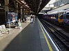
Baker Street is a London Underground station at the junction of Baker Street and the Marylebone Road in the City of Westminster. It is one of the original stations of the Metropolitan Railway (MR), the world's first underground railway, opened on 10 January 1863.

<span class="mw-page-title-main">Bayswater tube station</span> London Underground station

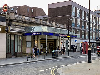
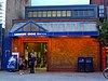
Bayswater is a London Underground station in the Bayswater area of the City of Westminster. The station is on the Circle and District lines, between Notting Hill Gate and Paddington stations and is in Travelcard Zone 1. It is less than 100 metres (330 ft) away from the Central line's Queensway station.

<span class="mw-page-title-main">Edgware Road tube station (Circle, District and Hammersmith & City lines)</span> London Underground station on the Circle, District and Hammersmith & City lines

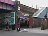
Edgware Road is a London Underground station on the Circle, District and Hammersmith & City lines, located on the corner of Chapel Street and Cabbell Street, within Travelcard zone 1. A separate station of the same name but served by the Bakerloo line is located about 150 metres away on the opposite side of Marylebone Road.

<span class="mw-page-title-main">Earl's Court tube station</span> London Underground station

Earl's Court tube station is a Grade II listed London Underground station in Earl's Court, London, on the District and Piccadilly lines. It is an important interchange for both lines and is situated in both Travelcard Zone 1 and Zone 2. The station has an eastern entrance on Earl's Court Road and a western entrance on Warwick Road. Another former entrance allowed passengers to enter the station from the other side of Warwick Road, via a ticket hall and subway leading to a concourse beneath the District line platforms. Earl's Court is a step-free tube station; the Earls Court Road entrance provides lift access between street and platform levels.

<span class="mw-page-title-main">Aldgate tube station</span> London Underground station

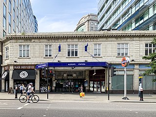
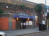
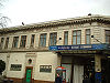
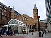
Aldgate is a London Underground station near Aldgate in the City of London. The station is on the Circle line between Tower Hill and Liverpool Street, and is the eastern terminus of the Metropolitan line. It is in Travelcard Zone 1.

<span class="mw-page-title-main">St Mary's (Whitechapel Road) tube station</span> Disused station on the London Underground

St. Mary's was a station on the District and Metropolitan lines of the London Underground. It was located between Whitechapel and Aldgate East stations, in the East End of London.

<span class="mw-page-title-main">Metropolitan Railway</span> Underground railway in London 1863–1933

The Metropolitan Railway was a passenger and goods railway that served London from 1863 to 1933, its main line heading north-west from the capital's financial heart in the City to what were to become the Middlesex suburbs. Its first line connected the main-line railway termini at Paddington, Euston, and King's Cross to the City. The first section was built beneath the New Road using cut-and-cover between Paddington and King's Cross and in tunnel and cuttings beside Farringdon Road from King's Cross to near Smithfield, near the City. It opened to the public on 10 January 1863 with gas-lit wooden carriages hauled by steam locomotives, the world's first passenger-carrying designated underground railway.

<span class="mw-page-title-main">Westbourne Park tube station</span> London Underground station

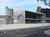
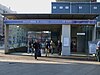
Westbourne Park is a London Underground station in the Notting Hill area of the Royal Borough of Kensington and Chelsea. It is on the Circle and Hammersmith and City lines, between Ladbroke Grove and Royal Oak stations, and is in Travelcard Zone 2.

<span class="mw-page-title-main">District Railway</span> Former underground railway in London (1868–1933)

The Metropolitan District Railway, also known as the District Railway, was a passenger railway that served London, England, from 1868 to 1933. Established in 1864 to complete an "inner circle" of lines connecting railway termini in London, the first part of the line opened using gas-lit wooden carriages hauled by steam locomotives. The Metropolitan Railway operated all services until the District Railway introduced its own trains in 1871. The railway was soon extended westwards through Earl's Court to Fulham, Richmond, Ealing and Hounslow. After completing the inner circle and reaching Whitechapel in 1884, it was extended to Upminster in Essex in 1902.

<span class="mw-page-title-main">History of the London Underground</span>

The history of the London Underground began in the 19th century with the construction of the Metropolitan Railway, the world's first underground railway. The Metropolitan Railway, which opened in 1863 using gas-lit wooden carriages hauled by steam locomotives, worked with the District Railway to complete London's Circle line in 1884. Both railways expanded, the Metropolitan eventually extending as far as Verney Junction in Buckinghamshire, more than 50 miles (80 km) from Baker Street and the centre of London. The first deep-level tube line, the City and South London Railway, opened in 1890 with electric trains. This was followed by the Waterloo & City Railway in 1898, the Central London Railway in 1900, and the Great Northern and City Railway in 1904. The Underground Electric Railways Company of London (UERL) was established in 1902 to fund the electrification of the District Railway and to complete and operate three tube lines, the Baker Street and Waterloo Railway, the Charing Cross, Euston and Hampstead Railway and the Great Northern, Piccadilly and Brompton Railway, which opened during 1906–1907. By 1907, the District and Metropolitan Railways had electrified the underground sections of their lines.

<span class="mw-page-title-main">Middle Circle</span> Railway line in London from 1872 to 1905

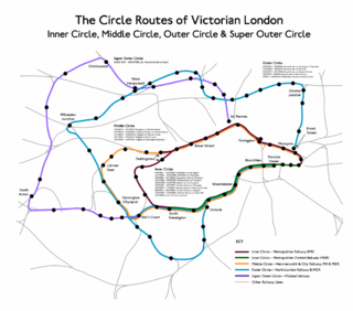
The Middle Circle was a Great Western Railway service in London that operated from 1872 to 1905. The route was from the District Railway station at Mansion House to Earl's Court, then via the West London Railway to Latimer Road on to the Hammersmith & City Railway and then via the Metropolitan Railway to the City of London. Although not a complete circuit, it was one of several 'circle' routes around London that opened at the same time, such as the 'inner circle' that is today's Circle line. Trains would run once every 30 minutes. In 1900 the service was cut back to run from Earl's Court to Aldgate, and ended in 1905.

The transport system now known as the London Underground began in 1863 with the Metropolitan Railway, the world's first underground railway. Over the next forty years, the early sub-surface lines reached out from the urban centre of the capital into the surrounding rural margins, leading to the development of new commuter suburbs. At the turn of the nineteenth century, new technology—including electric locomotives and improvements to the tunnelling shield—enabled new companies to construct a series of "tube" lines deeper underground. Initially rivals, the tube railway companies began to co-operate in advertising and through shared branding, eventually consolidating under the single ownership of the Underground Electric Railways Company of London (UERL), with lines stretching across London.

London's Metropolitan Railway (MR) amalgamated with other underground railways, tramway companies and bus operators on 1 July 1933, to form the London Passenger Transport Board (LPTB); the MR became the Board's Metropolitan line.

<span class="mw-page-title-main">History of the District line</span>

The history of the District line started in 1864 when the Metropolitan District Railway was created to create an underground 'inner circle' connecting London's railway termini. The first part of the line opened using Metropolitan Railway gas-lit wooden carriages hauled by steam locomotives. The District introduced its own trains in 1871 and was soon extended westwards through Earl's Court to Fulham, Richmond, Ealing and Hounslow. After completing the 'inner circle' and reaching Whitechapel in 1884, it was extended to Upminster in East London in 1902. To finance electrification at the beginning of the 20th century, American financier Charles Yerkes took it over and made it part of his Underground Electric Railways Company of London (UERL) group. Electric propulsion was introduced in 1905, and by the end of the year electric multiple units operated all of the services.

<span class="mw-page-title-main">Paddington tube station (Circle and Hammersmith & City lines)</span> London Underground station

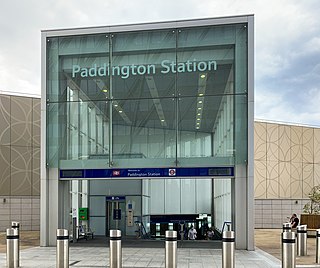
Paddington is a London Underground station served by the Circle and Hammersmith & City lines. It is located adjacent to the north side of Paddington mainline station and has entrances from within the mainline station and from Paddington Basin. The station is between Royal Oak and Edgware Road and is in London Fare Zone 1.

<span class="mw-page-title-main">Paddington tube station (Bakerloo, Circle and District lines)</span> London Underground station

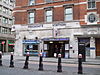
Paddington is a London Underground station served by the Bakerloo, Circle and District lines. It is located on Praed Street to the south of Paddington mainline station and has entrances from Praed Street and from within the mainline station. On the Bakerloo line the station is between Warwick Avenue and Edgware Road and on the Circle and District lines it is between Bayswater and Edgware Road. It is in London Fare Zone 1.

References

  1. Leboff & Demuth 1999, p. 50.
  2. "London Assembly Questions to the Mayor". London Assembly. 2022. Retrieved 29 February 2024.
  3. Green 1987, pp. 7–9.
  4. Green 1987, pp. 10–11.
  5. Green 1987, p. 12.
  6. Simpson 2003, pp. 23–4.
  7. 1 2 3 4 5 6 7 8 9 10 11 12 13 14 15 16 17 18 19 20 21 22 23 Rose 2007.
  8. 1 2 3 Bruce 1983, p. 11.
  9. Bextor, Robin (2013). Little Book of the London Underground. Woking: Demand Media Limited. ISBN   9781909217379.
  10. Horne 2003, p. 28.
  11. Green 1987, p. 25.
  12. Bruce 1983, pp. 33, 37.
  13. Bruce 1983, p. 40.
  14. Bruce 1983, p. 37.
  15. Bruce 1983, p. 39.
  16. Bruce 1983, p. 71.
  17. Bruce 1983, pp. 40–41.
  18. Bruce 1983, pp. 76–77.
  19. Green 1987, p. 51.
  20. Bruce 1983, p. 94.
  21. Green 1987, p. 33.
  22. Green 1987, p. 54.
  23. "1949 tube map". Archived from the original on 15 August 2007. Retrieved 5 March 2012.
  24. Bruce 1983, p. 95.
  25. Bruce 1983, p. 114.
  26. Croome, Desmond F.; Jackson, Alan Arthur (1993). Rails Through the Clay: A History of London's Tube Railways. Capital Transport. p. 468. ISBN   978-1-85414-151-4.
  27. "PPP Performance Report" (PDF). Transport for London. 2010. pp. 7–8. Archived from the original (PDF) on 26 April 2012. Retrieved 7 March 2012.
  28. "7 July Bombings: Edgware Road". BBC News. Retrieved 24 November 2012.
  29. "7 July Bombings: Aldgate". BBC News. Retrieved 24 November 2012.
  30. Day & Reed 2010, p. 217.
  31. "Tube drinks party sparks mayhem". BBC News. 1 June 2008. Retrieved 23 August 2012.
  32. Working Timetable No. 21, from 11 June 2006. London Underground. 20 April 2006. pp. 2–3.
  33. Working Timetable No. 21, from 11 June 2006. London Underground. 20 April 2006. p. 45.
  34. "Circle Line extended to the west". BBC News. 5 March 2009. Retrieved 24 November 2011.
  35. "Decision to cut Tube services caused overcrowding, say watchdogs". City A.M. London. 20 April 2020. Retrieved 23 April 2020.
  36. 1 2 3 "Circle line facts". Transport for London. Archived from the original on 1 January 2012. Retrieved 5 December 2012.
  37. 1 2 3 4 5 6 7 "Detailed London Transport Map". cartometro.com. Archived from the original on 28 July 2020. Retrieved 23 November 2012.
  38. Martin, Andrew (26 April 2012). Underground, Overground: A Passenger's History of the Tube. Profile Books. pp. 137–138. ISBN   978-1-84765-807-4 . Retrieved 7 December 2012.
  39. Jackson 1986, p. 38.
  40. Jackson 1986, p. 48.
  41. Jackson 1986, pp. 52–53.
  42. 1 2 "Hammersmith to Edgware Road Circle line timetable". Transport for London. Retrieved 9 December 2012. In the Tube timetable - Tube station box select "Hammersmith (H&C Line)" and press Get Timetable. Select Edgware Road timetable and then view timetable.
  43. "Performance: LU Performance Data Almanac". Transport for London. 2012. Archived from the original on 14 February 2013. Retrieved 17 January 2013.
  44. "Standard Tube Map" (PDF). Transport for London. Archived from the original (PDF) on 26 June 2008. Retrieved 8 December 2012.
  45. Elledge, Jonn (2 November 2015). "London Underground: Why are Circle line trains showing up at Whitechapel?". CityMetric. Retrieved 14 July 2017.
  46. 1 2 Martin, Andrew (2012). Underground Overground: A passenger's history of the Tube. Pine Street, London: Profile Books Ltd. ISBN   978-1846684784.
  47. "London Underground voice announcements". ilyabirman.net. Retrieved 2 October 2018.
  48. Hardy, Brian (1997). London Underground Rolling Stock (14 ed.). Harrow: Capital Transport. pp. 44–46. ISBN   185414-193-7.
  49. "S Stock trains take to Circle line". Global Rail News. 3 September 2013. Archived from the original on 26 September 2017. Retrieved 3 September 2013.
  50. Prentice, Paul (18 September 2013). "S Stock trains enter service on the Circle and District lines". Rail. No. 731. p. 26.
  51. Hendy, Peter (December 2013). "Commissioner's Report" (PDF). Transport for London. p. 5. Archived from the original (PDF) on 24 December 2013. Retrieved 21 December 2013.
  52. 1 2 "Metro — London, United Kingdom". Bombardier. Retrieved 27 January 2011.
  53. "Rolling Stock: C Stock". Transport for London. Archived from the original on 5 November 2012. Retrieved 25 November 2012.
  54. "Rolling Stock: S stock". Transport for London. Archived from the original on 29 December 2013. Retrieved 10 January 2012. Note: The table erroneously says "Length per car", instead of "Length per train".
  55. "'S' stock making its mark". Modern Railways. London. December 2010. p. 46.
  56. Jackson 1986, p. 185.
  57. 1 2 3 Abbott, James (January 2013). "Sub-surface renewal". Modern Railways. pp. 38–41.
  58. "London Underground and Bombardier abandon Tube signalling contract". International Railway Journal. 3 January 2014. Retrieved 2 June 2020.
  59. "London Underground resignalling reaches milestone". International Railway Journal. 13 October 2017. Retrieved 2 June 2020.
  60. "Our Upgrade Plan" (PDF). Transport for London. February 2011. Archived from the original (PDF) on 17 August 2012. Retrieved 7 December 2012.
  61. "Four Lines Modernisation". Transport for London. Retrieved 2 June 2020.
  62. Stewart, Rob (January 2013). "Cityflo 650 to control the SSR". Modern Railways. pp. 42–43.
  63. "4LM signalling update". Underground News. Vol. 706. London Underground Railway Society. October 2020. p. 572.
  64. "Modernisation complete as Shepherd's Bush Tube station re-opens" (Press release). Transport for London. 7 October 2008. Archived from the original on 16 August 2012. Retrieved 6 February 2013.
  65. "New Wood Lane Underground station opens" (Press release). Transport for London. 14 October 2008. Retrieved 8 December 2012.
  66. "Latimer Road station to close for three months for engineering works" (Press release). Transport for London. 14 January 2011.
  67. Butt 1995, p. 244.
  68. Butt 1995, p. 200.
  69. Jackson 1986, p. 70.
  70. Jackson 1986, p. 110.
  71. "Hadron Collider II planned for Circle Line". The Independent. London. 1 April 2010. Retrieved 2 October 2018.
  72. "April 1st: So, were you fooled...?". The Independent. London. 2 April 2010. Retrieved 2 October 2018.

Bibliography

  • Butt, R. V. J. (1995). The Directory of Railway Stations: details every public and private passenger station, halt, platform and stopping place, past and present (1st ed.). Patrick Stephens Ltd. ISBN   1-8526-0508-1.
  • Bruce, J Graeme (1983). Steam to Silver. A history of London Transport Surface Rolling Stock. Capital Transport. ISBN   0-904711-45-5.
  • Day, John R; Reed, John (2010). The Story of London's Underground. Capital Transport. ISBN   978-1-85414-341-9.
  • Green, Oliver (1987). The London Underground: An illustrated history. Ian Allan. ISBN   0-7110-1720-4.
  • Horne, Mike (2003). The Metropolitan Line . Capital Transport. ISBN   1-85414-275-5.
  • Jackson, Alan (1986). London's Metropolitan Railway. David & Charles. ISBN   0-7153-8839-8.
  • Leboff, David; Demuth, Tim (1999). No Need to Ask!. Capital Transport. ISBN   1-85414-215-1.
  • Rose, Douglas (December 2007) [1980]. The London Underground: A Diagrammatic History (8th ed.). Capital Transport. ISBN   978-1-85414-315-0.
  • Simpson, Bill (2003). A History of the Metropolitan Railway. Volume 1: The Circle and Extended Lines to Rickmansworth. Lamplight Publications. ISBN   1-899246-07-X.

Further reading

Template:Attached KML/Circle line (London Underground)
KML is from Wikidata