
Azerley is a hamlet and civil parish in the Harrogate district of North Yorkshire, England. It is about 4 miles (6 km) north-west of Ripon.

Arkendale is a village and civil parish in the Harrogate district of North Yorkshire, England. It is 6 miles (10 km) north-east of Harrogate town, and a had a population of 278 according to the 2001 census, increasing to 394 at the 2011 census. It has a pub, a village hall and a church and is close to Staveley village.
Birdsall is a village and civil parish in North Yorkshire, England. According to the 2001 census it had a population of 180, increasing to 343 at the 2011 Census. The village is about four miles south of Malton and the parish also includes the village of North Grimston.

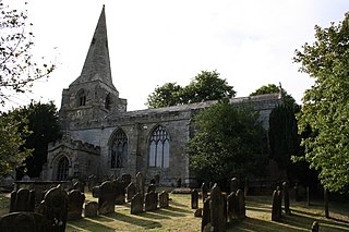
Brearton is a village and civil parish in the Harrogate borough of North Yorkshire, England, situated about 3 miles (4.8 km) north of Knaresborough. The village is mentioned in the Domesday Book and its name derives from the Old English Brer-Tun, which means the town where the briars grew.
Brompton is a civil parish in the Scarborough district of North Yorkshire, England, containing the villages of Brompton-by-Sawdon and Sawdon.

Broughton is a village and civil parish in North Yorkshire, England. Broughton is situated 1.5 miles (2.4 km) north-west of Malton. According to the 2011 census the parish had a population of 212, a reduction from the 2001 census when it stood at 233.
Burniston is a village and civil parish in the Scarborough borough of North Yorkshire, England. It is situated about four miles north of Scarborough itself, on the A171 road. According to the 2011 UK census Burniston parish had a population of 1,523, an increase on the 2001 UK census figure of 1,389. With all the new houses at River Meadows, the population is now roughly 1,500. The parish council is Burniston Parish Council.

Burythorpe is a village and civil parish in North Yorkshire, England, about 4 miles (6 km) south of Malton. According to the 2001 census it had a population of 289, reducing marginally to 286 at the Census 2011. The Whitegrounds barrow is nearby.

Byland with Wass is a civil parish in the former Ryedale district of North Yorkshire, England. According to the 2001 census it had a population of 120, increasing to an estimated 160 in 2015. It covers Byland Abbey and Wass, in the North York Moors, and shares a parish council with Oldstead.

Caldwell is a village and civil parish in the Richmondshire district of North Yorkshire, England, close to the border with County Durham and approximately 10 miles west of Darlington. According to the 2011 UK census the parish had a population of 138, increasing from 115 at the 2001 census.

Calton is a village and civil parish in the Craven district of North Yorkshire, England, on the River Aire in Airedale. In both the 2001 and 2011 Censuses the population was less than 100, so details were included in the civil parish of Flasby with Winterburn. In 2015, North Yorkshire County Council estimated the population of the village to be 60.

Carlton is a village in the civil parish of Carlton Town in the Richmondshire district of North Yorkshire, England. According to the 2011 Census it had a population of 232. Carlton Town, the formal name of the civil parish, distinguishes the parish from the adjacent civil parish of Carlton Highdale, historically part of the manor of Carlton. The village is in the Yorkshire Dales National Park, near the River Cover in Coverdale.

Huby is a village and civil parish in the Hambleton District of North Yorkshire, England, about nine and a half miles north of York and five miles south-east of Easingwold. The village has a small shop, post office, fish and chip shop, a Chinese takeaway, a pub, motel rooms, a Methodist church, a sports ground complete with a pavilion, a B&B motel and a village hall.

Romanby is a village and civil parish in the Hambleton District of North Yorkshire, England. Romanby is situated just south-west of Northallerton, and at the 2001 UK census had a population of 6,051, increasing to 6,177 at the 2011 Census.

Wykeham is a small village and civil parish in the Scarborough district of North Yorkshire, England, on the outskirts of Scarborough and the southern boundary of the North York Moors National Park.
Little Langton is a hamlet and civil parish in North Yorkshire, England. The population of the hamlet was estimated at 50 in 2015. As the population remained less than 100 at the 2011 census, details were included in the civil parish of Thrintoft.
Eastfield is a town and civil parish in North Yorkshire, England. It was granted town status in January 2016. It is directly south of Scarborough and is sometimes described as one of its suburbs.

Stirton with Thorlby is a civil parish in the Craven district of North Yorkshire, England. The parish includes the settlements of Stirton and Thorlby. The population at the 2011 census was 204, an increase on the 2001 census figure of 173.
Swinton is a village and civil parish in North Yorkshire, England. It is about 2 miles (3.2 km) west of Malton on the B1257 road, and is on the edge of the Howardian Hills AONB to the immediate north. The village appears in the Domesday Book as 'Swintune' which is derived from 'pig farm'.
St Martin's is a civil parish in North Yorkshire, England. It is located south of the town of Richmond, covering the residential areas south of the River Swale, including the former Richmond railway station and Holly Hill.


