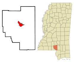
Columbia is a U.S. city in and the county seat of Marion County, Mississippi,[4] United States. Formed six years before Mississippi was admitted to statehood, Columbia was named for Columbia, South Carolina, from which many of the early settlers had migrated. The population was 5,864 as of the 2020 census,[3] down from 6,582 in 2010.
Columbia is the county seat of Marion County, which was created out of Amite County in 1811, encompassing the southwest quarter of the current state of Mississippi. Before statehood in 1816, there were three territorial census/poll tax records taken of what was deemed Marion County at the time. These records reveal that during 1813, several Lott men arrived and settled on the Pearl River in what is now Columbia. In 1813, William Lott was the largest slave holder near present-day Columbia, owning 28 people. There were five men, who settled south of present-day Columbia on 2,789 acres (1,129ha) of land with 65 enslaved people. North of present-day Columbia, on what was the earliest attempt at a town, was Timothy Terrell on 3,151 acres (1,275ha) with 32 slaves.
The land on which the current city of Columbia resides was first purchased for cash on April 18, 1820, by William Lott and John Lott. This land is Township 3 East, Range 18 West, Section 5 (640 acres), which is now the center of Columbia. Other early patent holders of Columbia include James Phillips, Jr., and John Cooper (1825), in Section 4 next to John and William Lott.[5][6]
Columbia was officially incorporated on June 25, 1819, becoming the fourth municipality in the state of Mississippi. It served as the temporary capital of Mississippi from November 1821, when the 5th session of the Mississippi Legislature first met there, until 1822. In that year, a special session of the legislature met in Columbia, inaugurating Governor Walter Leake, and selecting LeFleur's Bluff (now Jackson) as the permanent capital.
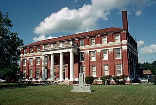
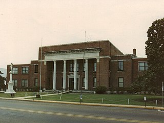
Columbia, "The City of Charm on the River Pearl", has always been in danger of flooding, due to its bordering the Pearl River. The county courthouse, with its records dating back to pre-statehood, has managed to survive war, floods, tornadoes and hurricanes. In its first 100 years, Columbia relied on the Pearl River for transportation of goods. The river was much deeper and wider than it is now. Steamboat captains, such as John Black, lived in Columbia.[7]
During the Civil War, Union troops under the command of General John Wynn Davidson camped outside Columbia, taking provisions from the local population. The courthouse was spared. The Southern Claims Commission Files detail these events.[8]
In 1935, Mississippi's first rodeo was held in Columbia. In 2016, the Mississippi Rodeo Hall of Fame was founded and headquartered in Columbia.
During the civil rights movement, Columbia and Marion County were the site of peaceful demonstrations, due to the diligent insistence of non-violence by Sheriff John Homer Willoughby. The town is known for its citizens ability to work together.[9]
In 2005, Columbia suffered extensive damage from Hurricane Katrina. Once again, the courthouse survived. There was very limited looting, and citizens worked together with local churches, civic officials, and law enforcement to provide for citizens during the extensive power loss. Individuals immediately began helping their neighbors clear roads and escape being trapped in debris.
The day after Hurricane Katrina struck, several inmates took advantage of the storm damage and escaped from the Marion County Jail (some of whom had been charged with murder). Marion County deputies along with the help of the Mississippi National Guard and Kentucky State Police, captured all but one escapee, who was later apprehended in Texas just before he could get to the Mexican border.
Former Mississippi governor and Columbia native Hugh L. White introduced white squirrels to the area, and they are still common in Columbia City Park. White's home still stands today, a stately reminder of architecture of the past.
In 2014, a tornado measuring EF3 on the Enhanced Fujita scale struck Columbia, causing widespread damage.[10] Mutual aid took place between Columbia, Mississippi, and Columbia, South Carolina, following this natural disaster and the 1,000 year flood in South Carolina,[11]
Geography
Columbia is in southern Mississippi, on the east bank of the Pearl River. It is in north-central Marion County, 84 miles (135km) by highway south of Jackson, the state capital, and 118 miles (190km) north of New Orleans. U.S. Route 98 passes through the south side of the city, leading east 33 miles (53km) to Hattiesburg and west 41 miles (66km) to McComb. Mississippi Highway 13 passes through the center of Columbia, leading north 25 miles (40km) to Prentiss and southeast 31 miles (50km) to Lumberton. State Highway 44 leads northeast from Columbia 21 miles (34km) to Sumrall.
According to the U.S. Census Bureau, the city of Columbia has a total area of 6.8 square miles (18km2), of which 0.004 square miles (0.010km2), or 0.06%, are water.[2]
Climate
According to the Köppen Climate Classification system, Columbia has a humid subtropical climate, abbreviated "Cfa" on climate maps. The hottest temperature recorded in Columbia was 113°F (45.0°C) on June 7, 1915, while the coldest temperature recorded was 4°F (−15.6°C) on January 11, 1982 and January 21, 1985.[12]
Climate data for Columbia, Mississippi, 1991–2020 normals, extremes 1903–present
The city of Columbia is served by the Columbia School District, with Columbia High School as the public high school. Prior to January 1970, black students were educated in a separate system with sub-par facilities, including John J. Jefferson High school, which became the middle school in January 1970 when the schools were integrated. White politicians called for a public boycott of the school system.[18] At that time, around 100 white students left the public school system to attend the newly founded whites-only Columbia Academy, which was created in September 1969 as a segregation academy to avoid racial integration.[19] A few students also left to attend Improve Academy, another segregation academy founded by the Improve Baptist Church.[20] There are also two other public schools that are in Columbia, East Marion High School and West Marion High School. Both of these schools are under the same district called Marion County Schools. East Marion High school is located just outside of town on the East side of the Pearl River, while West Marion is located on the West side of the Pearl River in Foxworth. East Marion is one largely connected building that houses grades K-12, but West Marion has a primary school as well as a high school.
Hugh L. White, former Columbia mayor and two-term Governor of Mississippi
Related Research Articles
Marion County is a county located in the U.S. state of Mississippi. As of the 2020 census, the population was 24,441. Its county seat is Columbia. Marion County is named for American Revolutionary War guerrilla leader Francis Marion also known as The Swamp Fox.
Lawrence County is a county located in the U.S. state of Mississippi. As of the 2020 census, the population was 12,016. Its county seat is Monticello. The county is named for the naval hero James Lawrence.
Lamar County is a county located in the U.S. state of Mississippi. As of the 2020 census, the population was 64,222. Its county seat is Purvis. Named for Confederate Lucius Quintus Cincinnatus Lamar, the county was carved out of Marion County to the west in 1904.
Mount Olive is a town in Covington County, Mississippi, United States. The population was 895 at the 2020 census.
Moss Point is a city in Jackson County, Mississippi, United States. The population was 12,147 in 2020, a decline from the figure of 13,704 in 2010. The Moss Point Historic District and several individual buildings are listed on the National Register of Historic Places' Jackson County listings.
Sumrall is a town in Lamar County, Mississippi. It is part of the Hattiesburg, Mississippi Metropolitan Statistical Area. The population was 1,421 at the 2010 census.
Madison is the 11th most populous city in Mississippi, located in Madison County, 13 miles (21 km) north of the state capital, Jackson. The population was 27,747 at the 2020 census, up from 24,149 in 2010. It is part of the Jackson Metropolitan Statistical Area.
Philadelphia is a city in and the county seat of Neshoba County, Mississippi, United States. The population was 7,118 at the 2020 census.
Picayune is the largest city in Pearl River County, Mississippi, United States. The population was 11,885 at the 2020 census. The city is located approximately 45 miles (72 km) from New Orleans, Hattiesburg, and Gulfport–Biloxi. The Stennis Space Center is 10 miles (16 km) away. Picayune is part of the New Orleans–Metairie–Hammond combined statistical area.
Greenville is the 9th most populous city in Mississippi. It is the county seat of Washington County. The population was 29,670 at the 2020 census. It is located in the area of historic cotton plantations and culture known as the Mississippi Delta.
Pascagoula is a city in Jackson County, Mississippi, United States. It is the principal city of the Pascagoula metropolitan area, and is part of the Gulfport–Biloxi–Pascagoula Combined Statistical Area and the Gulfport-Biloxi metropolitan area. The population was 22,392 at the 2010 census, down from 26,200 at the 2000 census. In 2019 the population was 21,699. It is the county seat of Jackson County.
Hattiesburg is the 5th most populous city in the U.S. state of Mississippi, located primarily in Forrest County and extending west into Lamar County. The city population was 45,989 at the 2010 census, with the population now being 48,730 in 2020. Hattiesburg is the principal city of the Hattiesburg Metropolitan Statistical Area, which encompasses Covington, Forrest, Lamar, and Perry counties. The city is located in the Pine Belt region.
Vernal, the county seat and largest city in Uintah County, is in northeastern Utah, approximately 175 miles (280 km) east of Salt Lake City and 20 miles (32 km) west of the Colorado border. As of the 2020 census, the city population was 10,079. The population has since grown to 10,432 as of the 2022 population estimate.
Lumberton is a city in Lamar and Pearl River counties, Mississippi, United States. It is part of the Hattiesburg, Mississippi Metropolitan Statistical Area. The population was 2,086 at the 2010 census.
Pearl River Community College is a public community college in Poplarville, Mississippi. It was founded as Pearl River County Agricultural High School in 1909 and became the first junior college in Mississippi in 1921.
Earl Wesley Bascom was an American painter, printmaker, sculptor, cowboy, rodeo performer, inventor, and Hollywood actor. Raised in Canada, he portrayed in works of fine art his own experiences of cowboying and rodeoing across the American and Canadian West. Bascom was awarded the Pioneer Award by the ProRodeo Hall of Fame in 2016 and inducted into several halls of fame including the Canadian Pro Rodeo Hall of Fame in 1984. Bascom was called the "Cowboy of Cowboy Artists," the "Dean of Rodeo Cowboy Sculpture" and the "Father of Modern Rodeo." He was a participant member of the Church of Jesus Christ of Latter-day Saints.
Mississippi's 4th congressional district covers the southeastern region of the state. It includes all of Mississippi's Gulf Coast, stretching ninety miles between the Alabama border to the east and the Louisiana border to the west, and extends north into the Pine Belt region. It includes three of Mississippi's four most heavily populated cities: Gulfport, Biloxi, and Hattiesburg. Other major cities within the district include Bay St. Louis, Laurel, and Pascagoula. The district is currently represented by Republican Mike Ezell. With a Cook Partisan Voting Index rating of R+22, it is the most Republican district in Mississippi.
Foxworth is an unincorporated community and census-designated place (CDP) in Marion County, Mississippi, United States. As of the 2020 census, it had a population of 523.
The Church of Jesus Christ of Latter-day Saints in Mississippi refers to the Church of Jesus Christ of Latter-day Saints and its members in Mississippi. The first small branch was established in 1842. It has since grown to 22,189 members in 49 congregations.
Rose Bascom also known as Texas Rose Bascom is a 1981 National Cowgirl Museum and Hall of Fame trick rider inductee.
↑ "Resolution R-2016-053 To Honor the City of Columbia, Mississippi With Official Sisterhood for its Assistance during the October 2015 Flood" (PDF). City of Columbia SC. August 16, 2016.
↑ Wolfe, Buster (December 3, 2011). "Last Slave to Receive Marker". Columbian Progress. pp.1, 3. Archived from the original on March 30, 2019. Retrieved March 30, 2019. Forty years after his funeral, Sylvester Magee of Columbia - who is considered the last American slave - will be getting a headstone on his grave because the Marion Historical Society and Stacy Nolan of Southern Monument in Foxworth.
This page is based on this Wikipedia article Text is available under the CC BY-SA 4.0 license; additional terms may apply. Images, videos and audio are available under their respective licenses.