Columbia City, Indiana

Last updated

Columbia City, Indiana
Columbia-city-downtown.jpg
Downtown Columbia City
Whitley County Indiana Incorporated and Unincorporated areas Columbia City Highlighted 1814716.svg
Location of Columbia City in Whitley County, Indiana.
Coordinates: 41°09′45″N85°29′50″W / 41.16250°N 85.49722°W / 41.16250; -85.49722
Country United States
State Indiana
County Whitley
Township Columbia
Government
  Type Mayor-council government
   Mayor Ryan Daniel (R) [1]
Area
[2]
  Total5.47 sq mi (14.17 km2)
  Land5.45 sq mi (14.12 km2)
  Water0.02 sq mi (0.05 km2)
Elevation
[3]
869 ft (265 m)
Population
 (2020)
  Total9,892
  Density1,813.71/sq mi (700.34/km2)
Time zone UTC-5 (EST)
  Summer (DST) UTC-4 (EDT)
ZIP code
46725
Area code 260
FIPS code 18-14716 [4]
GNIS feature ID2393606 [3]
Website http://www.columbiacity.net

Columbia City is a city in Columbia Township, Whitley County, in the U.S. state of Indiana. [3] The population was 9,892 at the 2020 Census, up from 8,750 at the 2010 Census, estimated to be 10,064 in 2023. [5] The city is the county seat of Whitley County, [6] and is the largest community therein. It is part of the Fort Wayne MSA.

Contents

History

Whitley County Courthouse Columbia-city-indiana-courthouse.jpg
Whitley County Courthouse

The first non-Native American settlers arrived in 1837 as a result of the end of the Black Hawk War and the Erie Canal. They were from New England - "Yankee" Settlers, descendants of the English Puritans who settled New England in the colonial era. They were primarily members of the Congregational Church though due to the Second Great Awakening many of them had converted to Methodism and some had become Baptists before coming to what is now Columbia City.

Columbia City was founded in 1839, originally just being called "Columbia". The name was later changed in 1854 since there was already a city named Columbia in the state. Many public debates were held to discuss different names for the city, but it was later only reduced to two: "Beaver" and "Columbia City." Eventually, the name Columbia City was selected. [7]

The completion of the Pittsburgh, Fort Wayne, & Chicago Railway in 1856 brought rapid growth to the small town, and from 1865 to 1875 the population would have tripled. Columbia City was incorporated in the state of Indiana in 1888. [8]

The Whitley County Courthouse was designed (1888–1891) by Brentwood S. Tolan, of Fort Wayne, Indiana. The building was added to the National Register of Historic Places in 1979. The Thomas R. Marshall House was added to the register in 1983 and the Columbia City Historic District was added in 1987. [9]

Geography

City Hall building. Columbia-city-indiana-city-hall.jpg
City Hall building.

According to the 2010 census, Columbia City has a total area of 5.601 square miles (14.51 km2), of which 5.58 square miles (14.45 km2) (or 99.63%) is land and 0.021 square miles (0.05 km2) (or 0.37%) is water. [10]

Climate

According to the Köppen Climate Classification system, Columbia City has a hot-summer humid continental climate, abbreviated "Dfa" on climate maps. The hottest temperature recorded in Columbia City was 103 °F (39.4 °C) on June 26, 1988, while the coldest temperature recorded was −24 °F (−31.1 °C) on January 1921, 1994. [11]

Climate data for Columbia City, Indiana, 1991–2020 normals, extremes 1963–present
MonthJanFebMarAprMayJunJulAugSepOctNovDecYear
Record high °F (°C)66
(19)
72
(22)
84
(29)
88
(31)
94
(34)
103
(39)
101
(38)
98
(37)
96
(36)
89
(32)
77
(25)
70
(21)
103
(39)
Mean maximum °F (°C)53.9
(12.2)
56.7
(13.7)
69.6
(20.9)
78.8
(26.0)
86.0
(30.0)
91.2
(32.9)
91.6
(33.1)
89.8
(32.1)
88.2
(31.2)
81.5
(27.5)
66.9
(19.4)
56.1
(13.4)
93.3
(34.1)
Mean daily maximum °F (°C)31.7
(−0.2)
35.4
(1.9)
46.4
(8.0)
59.4
(15.2)
70.4
(21.3)
79.3
(26.3)
82.5
(28.1)
80.7
(27.1)
75.2
(24.0)
62.7
(17.1)
48.6
(9.2)
36.7
(2.6)
59.1
(15.0)
Daily mean °F (°C)24.0
(−4.4)
27.0
(−2.8)
36.9
(2.7)
48.6
(9.2)
59.8
(15.4)
69.1
(20.6)
72.3
(22.4)
70.4
(21.3)
63.8
(17.7)
52.1
(11.2)
39.9
(4.4)
29.5
(−1.4)
49.4
(9.7)
Mean daily minimum °F (°C)16.2
(−8.8)
18.5
(−7.5)
27.4
(−2.6)
37.8
(3.2)
49.2
(9.6)
58.9
(14.9)
62.1
(16.7)
60.2
(15.7)
52.5
(11.4)
41.6
(5.3)
31.2
(−0.4)
22.3
(−5.4)
39.8
(4.3)
Mean minimum °F (°C)−6.6
(−21.4)
−1.0
(−18.3)
9.5
(−12.5)
21.9
(−5.6)
33.2
(0.7)
44.8
(7.1)
50.7
(10.4)
48.3
(9.1)
38.4
(3.6)
27.0
(−2.8)
15.5
(−9.2)
2.9
(−16.2)
−10.4
(−23.6)
Record low °F (°C)−24
(−31)
−17
(−27)
−6
(−21)
7
(−14)
24
(−4)
36
(2)
39
(4)
36
(2)
27
(−3)
17
(−8)
0
(−18)
−22
(−30)
−24
(−31)
Average precipitation inches (mm)2.54
(65)
1.95
(50)
2.62
(67)
3.81
(97)
4.34
(110)
4.62
(117)
3.86
(98)
4.07
(103)
3.00
(76)
2.85
(72)
2.98
(76)
2.43
(62)
39.07
(993)
Average snowfall inches (cm)7.0
(18)
6.5
(17)
3.0
(7.6)
0.3
(0.76)
0.0
(0.0)
0.0
(0.0)
0.0
(0.0)
0.0
(0.0)
0.0
(0.0)
0.0
(0.0)
1.2
(3.0)
3.4
(8.6)
21.4
(54.96)
Average precipitation days (≥ 0.01 in)11.59.09.811.312.311.39.59.78.610.110.211.0124.3
Average snowy days (≥ 0.1 in)5.33.81.70.30.00.00.00.00.00.00.63.615.3
Source 1: NOAA [12]
Source 2: National Weather Service [11]

Economy

About 12 percent of Columbia City's population is employed in the manufacturing sector. This makes it one of the most important sectors in the city. Currently there are 6 businesses employing 50 - 350 people in the city. Those six companies are 80/20, Coupled Products, LLC, Alcoils, inc., Reelcraft Industries, Inc. ChromaSource, Inc. and Kilgore Manufacturing Company, Inc.

The city also has agricultural roots with it contributing heavily to its economy. Columbia City is 25 miles away from Fort Wayne, 20 miles away from Warsaw, and 69 miles away from South Bend, making it a strategic location for business.

Demographics

Historical population
CensusPop.Note
1860 887
1870 1,66387.5%
1880 2,24434.9%
1890 3,02734.9%
1900 2,975−1.7%
1910 3,44815.9%
1920 3,4991.5%
1930 3,8058.7%
1940 4,21910.9%
1950 4,74512.5%
1960 4,8031.2%
1970 4,9112.2%
1980 5,0913.7%
1990 5,70612.1%
2000 7,07724.0%
2010 8,75023.6%
2020 9,89213.1%
U.S. Decennial Census [13] [ failed verification ] 2020 [14]

2010 census

As of the census [15] of 2010, there were 8,750 people, 3,658 households, and 2,235 families residing in the city. The population density was 1,568.1 inhabitants per square mile (605.4/km2). There were 3,944 housing units at an average density of 706.8 per square mile (272.9/km2). The racial makeup of the city was 96.7% White, 0.5% African American, 0.3% Native American, 0.5% Asian, 0.6% from other races, and 1.4% from two or more races. Hispanic or Latino of any race were 2.2% of the population.

There were 3,658 households, of which 30.9% had children under the age of 18 living with them, 42.4% were married couples living together, 13.9% had a female householder with no husband present, 4.8% had a male householder with no wife present, and 38.9% were non-families. 33.5% of all households were made up of individuals, and 14.2% had someone living alone who was 65 years of age or older. The average household size was 2.32 and the average family size was 2.93.

The median age in the city was 36.1 years. 24.9% of residents were under the age of 18; 9.1% were between the ages of 18 and 24; 26.7% were from 25 to 44; 23.9% were from 45 to 64; and 15.3% were 65 years of age or older. The gender makeup of the city was 47.6% male and 52.4% female.

2000 census

As of the census [4] of 2000, there were 7,077 people, 3,018 households, and 1,874 residing in the city. The population density was 1,359.5 inhabitants per square mile (524.9/km2). There were 3,191 housing units at an average density of 613.0 per square mile (236.7/km2). The racial makeup of the city was 98.11% White, 0.32% African American, 0.44% Native American, 0.08% Asian, 0.03% Pacific Islander, 0.34% from other races, and 0.68% from two or more races. Hispanic or Latino of any race were 1.20% of the population.

There were 3,018 households, out of which 30.6% had children under the age of 18 living with them, 45.8% were married couples living together, 12.4% had a female householder with no husband present, and 37.9% were non-families. 33.6% of all households were made up of individuals, and 15.1% had someone living alone who was 65 years of age or older. The average household size was 2.27 and the average family size was 2.89.

In the city, the population was spread out, with 24.4% under the age of 18, 9.9% from 18 to 24, 29.1% from 25 to 44, 18.8% from 45 to 64, and 17.7% who were 65 years of age or older. The median age was 36 years. For every 100 females, there were 89.2 males. For every 100 females age 18 and over, there were 85.8 males.

The median income for a household in the city was $36,112, and the median income for a family was $47,357. Males had a median income of $34,803 versus $21,740 for females. The per capita income for the city was $19,296. About 4.5% of families and 6.4% of the population were below the poverty line, including 5.8% of those under age 18 and 9.8% of those age 65 or over.

Government

The city government consists of a mayor and a five-member city council. The mayor is elected in a citywide vote, along with the city councilperson-at-large. The remaining four council members are elected from individual city districts: northeast, southeast, southwest and northwest. There is also a city clerk-treasurer who is elected in a citywide vote.

The Columbia City post office has been in operation since 1854. [16]

Healthcare

Education

The town has a lending library, the Peabody Public Library. [18]

Notable People

Related Research Articles

<span class="mw-page-title-main">Whitley County, Indiana</span> County in Indiana, United States

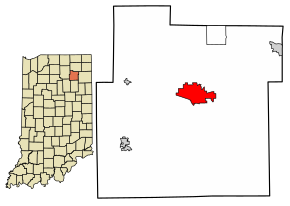
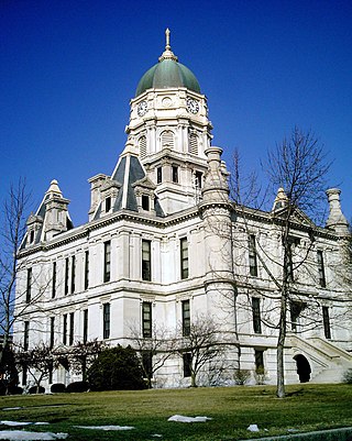
Whitley County is a rural county in the U.S. state of Indiana. As of the 2020 United States census, the population was 36,825. Whitley County is the 49th largest county in Indiana. The county seat is Columbia City. The county has the highest county number (92) on Indiana license plates, as it is alphabetically the last in the state's list of counties. It is part of the Fort Wayne Metropolitan Statistical Area and the Fort Wayne–Huntington–Auburn Combined Statistical Area.

<span class="mw-page-title-main">Watertown, Florida</span> CDP in Florida, United States

Watertown is a census-designated place (CDP) in Columbia County, Florida, United States. It had a population of 3,018 at the 2020 census, up from 2,829 at the 2010 census. It is part of the Lake City, Florida Micropolitan Statistical Area.

<span class="mw-page-title-main">Greendale, Indiana</span> City in Indiana, United States

Greendale is a city in Dearborn County, Indiana, United States. The population was 4,602 at the 2020 census, up 82 since the 2010 Census.

<span class="mw-page-title-main">West Harrison, Indiana</span> Town in Indiana, United States

West Harrison is a town in Harrison Township, Dearborn County, Indiana, United States. The population was 289 at the 2010 census.

<span class="mw-page-title-main">Rochester, Indiana</span> City in Indiana

Rochester is a city in, and the county seat of, Fulton County, Indiana, United States. The population was 6,270 at the 2020 census.

<span class="mw-page-title-main">Jasonville, Indiana</span> City in Indiana, United States

Jasonville is a city in Greene County, Indiana, United States. The population was 1,966 as of the 2020 census. It is the westernmost community in the Bloomington, Indiana, Metropolitan Statistical Area, approximately 15 miles closer to Terre Haute than to Bloomington.

<span class="mw-page-title-main">Stilesville, Indiana</span> Town in Indiana, United States

Stilesville is a town in Franklin Township, Hendricks County, Indiana, United States. The population was 316 at the 2010 Census.

<span class="mw-page-title-main">Roanoke, Indiana</span> Town in Indiana, United States

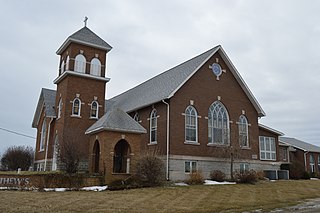
Roanoke is a town in Jackson Township, Huntington County, Indiana, United States. The population was 1,762 at the 2020 census. Roanoke is governed by a town council. Town offices include the clerk treasurer, utilities department, police department, and volunteer fire department. The town has a public elementary school. WOWO and WRNP have transmitter towers in Roanoke, along U.S. Highway 24. For many years, television station WPTA was licensed to Roanoke, though that station's studios and transmitter have always been located in nearby Fort Wayne.

<span class="mw-page-title-main">Kendallville, Indiana</span> City in Indiana, United States

Kendallville is a city in Wayne Township, Noble County, in the U.S. state of Indiana. The population was 10,205 at the 2021 census.

<span class="mw-page-title-main">Ligonier, Indiana</span> City in Indiana, United States

Ligonier is a city in Perry Township, Noble County, in the U.S. state of Indiana. The population was 4,568 at the 2020 census.

<span class="mw-page-title-main">Rising Sun, Indiana</span> City in Indiana, United States

Rising Sun is a city in Randolph Township and the county seat of Ohio County, Indiana, United States, along the Ohio River. It is also the only incorporated community in the county. The population of Rising Sun was 2,304 at the 2010 census.

<span class="mw-page-title-main">Parker City, Indiana</span> Town in Indiana, United States

Parker City is a town in Monroe Township, Randolph County, in the U.S. state of Indiana. The population was 1,419 at the 2010 census.

<span class="mw-page-title-main">Churubusco, Indiana</span> Town in Whitley County, Indiana

Churubusco ; often shortened to Busco, is a town located near the headwaters of the Eel River in the extreme northeast corner of Whitley County, Indiana, United States, in Smith Township, about 16 miles (26 km) northwest of Fort Wayne. The population was 1,796 at the 2010 census.

<span class="mw-page-title-main">Larwill, Indiana</span> Town in Indiana, United States

Larwill is a town in Richland Township, Whitley County, in the U.S. state of Indiana. The population was 283 at the 2010 census.

<span class="mw-page-title-main">South Whitley, Indiana</span> Town in Indiana, United States

South Whitley is a town in Cleveland Township, Whitley County, in the U.S. state of Indiana. The population was 1,751 at the 2010 census. South Whitley is a town in the Midwestern tradition of red brick buildings and tree-lined streets.

<span class="mw-page-title-main">Solon, Iowa</span> City in Iowa, United States

Solon is a city located in Johnson County, Iowa, United States. Part of the Iowa City, Iowa Metropolitan Statistical Area, it is located a few miles from Lake MacBride State Park and the larger cities of Coralville and Iowa City. The population was 3,018 at the time of the 2020 census.

<span class="mw-page-title-main">Whitley City, Kentucky</span> Census-designated place in Kentucky, United States

Whitley City is an unincorporated community and census-designated place (CDP) in McCreary County, Kentucky, United States. The population was 968 at the 2020 census, down from 1,170 in 2010. It is the county seat of McCreary County. Whitley City is one of two unincorporated county seats in Kentucky.

Good Hope Township is a township in Itasca County, Minnesota, United States. The population was 99 at the 2010 census.

<span class="mw-page-title-main">North Vernon, Indiana</span> City in Indiana, United States

North Vernon is a city in Jennings County, Indiana, United States. The population was 6,608 as of the 2020 census.

<span class="mw-page-title-main">Thorncreek Township, Whitley County, Indiana</span> Township in Indiana, United States

Thorncreek Township is one of nine townships in Whitley County, Indiana, United States. As of the 2020 census, its population was 4,159 and it contained 1,909 housing units.

References

  1. "Mayor's Office – Columbia City".
  2. "2020 U.S. Gazetteer Files". United States Census Bureau. Retrieved March 16, 2022.
  3. 1 2 3 U.S. Geological Survey Geographic Names Information System: Columbia City, Indiana
  4. 1 2 "U.S. Census website". United States Census Bureau . Retrieved January 31, 2008.
  5. "Columbia City, Indiana Population 2023". worldpopulationreview.com. Retrieved October 14, 2023.
  6. "Find a County". National Association of Counties. Archived from the original on May 31, 2011. Retrieved June 7, 2011.
  7. "About Columbia City – Columbia City" . Retrieved August 6, 2023.
  8. "Columbia City, Indiana - City Information, Fast Facts, Schools, Colleges, and More". citytowninfo.com. Retrieved August 6, 2023.
  9. "National Register Information System". National Register of Historic Places . National Park Service. July 9, 2010.
  10. "G001 - Geographic Identifiers - 2010 Census Summary File 1". United States Census Bureau. Archived from the original on February 13, 2020. Retrieved July 28, 2015.
  11. 1 2 "NOAA Online Weather Data – NWS Northern Indiana". National Weather Service. Retrieved November 17, 2023.
  12. "U.S. Climate Normals Quick Access – Station: Columbia City, IN". National Oceanic and Atmospheric Administration. Retrieved November 17, 2023.
  13. "Census of Population and Housing". Census.gov. Retrieved June 4, 2015.
  14. "QuickFacts: Columbia city, Indiana". census.gov. Retrieved February 25, 2022.
  15. "U.S. Census website". United States Census Bureau . Retrieved December 11, 2012.
  16. "Whitley County". Jim Forte Postal History. Retrieved July 6, 2016.
  17. "Faith Christian Academy of Whitly County". Faith Christian. Retrieved August 14, 2015.
  18. "Indiana public library directory" (PDF). Indiana State Library. Archived from the original (PDF) on February 18, 2017. Retrieved March 17, 2018.