Concrete, Washington

Last updated

Concrete
Concrete, Washington
Welcome to concrete.jpg
Concrete's town welcome sign, which was chainsaw-carved from cedar logs
Seal of Concrete, Washington.png
Skagit County Washington Incorporated and Unincorporated areas Concrete Highlighted.svg
Location of Concrete, Washington
Coordinates: 48°32′21″N121°44′50″W / 48.53917°N 121.74722°W / 48.53917; -121.74722
Country United States
State Washington
County Skagit
Area
[1]
  Total1.21 sq mi (3.13 km2)
  Land1.17 sq mi (3.04 km2)
  Water0.04 sq mi (0.09 km2)
Elevation
276 ft (84 m)
Population
 (2020)
  Total801
  Density660/sq mi (260/km2)
Time zone UTC−8 (Pacific (PST))
  Summer (DST) UTC−7 (PDT)
ZIP code
98237
Area code 360
FIPS code 53-14380 [2]
GNIS feature ID1518004 [3]
Website Town of Concrete

Concrete is a town in north-central Skagit County, Washington, United States. It is part of the Mount Vernon-Anacortes, Washington Metropolitan Statistical Area, and had a population of 801 at the 2020 census. [4]

Contents

Early history

Portland Superior Cement Silos in Concrete, at Superior Avenue and Highway 20. The words "Welcome to Concrete" were painted on for the filming of This Boy's Life Concrete silos in autumn.jpg
Portland Superior Cement Silos in Concrete, at Superior Avenue and Highway 20. The words "Welcome to Concrete" were painted on for the filming of This Boy's Life

The town of Concrete has undergone several incarnations, the earliest being a settlement at the northwestern junction of the Baker and Skagit Rivers, known as "Minnehaha." Amasa "Peg-Leg" Everett was one of the earliest settlers and in 1890, the townsite was platted by another settler, Magnus Miller. Shortly thereafter, a post office was established and the town name changed to "Baker." In 1905, a settlement across the Baker River came into being due to the building of the Washington Portland Cement Company and was named "Cement City." After the Superior Portland Cement Company plant was built in Baker in 1908, it was decided to merge the two towns. Inhabitants of the new community settled on the name "Concrete" and the town was so christened and officially incorporated on May 8, 1909. [5]

Notable buildings and landmarks

Concrete is home to a number of historic buildings and engineering milestones. [6]

Henry Thompson Bridge

Henry Thompson Bridge Baker River Bridge (2006-07-06), 02.jpg
Henry Thompson Bridge

Built in 1916–1918 and so named for the Scottish immigrant, local settler, and Skagit County Commissioner who promoted its construction. The naming occurred after Henry Thompson was killed by a logging train in 1918. [7] At the time, its graceful arch was the longest single-span reinforced concrete bridge in the world [8] or perhaps just in the West [7] and has been listed on the Washington State and National Historic Register since 1976. [9] Until 1972, when the Washington State Department of Transportation re-routed Highway 20 (then known as Star Route 20) outside the town, the Thompson Bridge was the only connecting thoroughfare across the Baker River and into eastern Skagit County.

The bridge was originally designed by Bowerman and McCloy Consulting Engineers and built by J.R. Wood Contractors (both of Seattle). [7] It underwent a complete rehabilitation in 2003-2004. The engineer for the rehabilitation was Entranco, Inc. of Bellevue (who has since been acquired by AECOM) and the contractor for the rehabilitation was One Way Construction of Sedro-Woolley.

Concrete High School

Concrete High School Concrete High School.jpg
Concrete High School

Concrete High School [10] was built in 1952. Constructed with the typical and necessary scholastic appointments and one visible and unusual difference: the central portion of the building was built over the road leading to it. To make the best use of the property, South Superior Avenue passes beneath the building. The building replaced the previous high school building in the center of town. The hallways and the wood shop were used during the filming of the Michael Caton-Jones film, This Boy's Life in 1993. Concrete High School's school colors are purple and gold and their team mascot is the Lion. CHS's sports teams participate in the Northwest 1B/2B league under the Washington Interscholastic Activities Association. Concrete's Future Business Leaders of America was the fastest growing in the state during the 2012-13 school year. [11]

Concrete Herald building

Concrete Herald Building Concrete herald building.jpg
Concrete Herald Building

Located in the heart of Concrete Town Center on Main Street, the Concrete Herald Building was originally built in 1918 as a Model T Ford garage complete with a gas-station out front. When the building was later converted to be the Brommer Logging facility, a large apartment was added to the upper story. It was shortly after this that Concrete Herald owner and editor Charles M. "Chuck" Dwelley took over the building and made it into a modern printing facility and new home of The Concrete Herald (established in 1910). When Robert and June Fader purchased the newspaper upon Dwelley's retirement in late 1970, the building remained the home for the weekly. When the building and newspaper were sold in 1990, the facility became a printing shop until the current owners turned the first floor into a liquor store franchise through the state liquor control board. The Concrete Herald Building has remained a liquor store to this date. As for Concrete Herald, Concrete Mayor Jason Miller has given rebirth to the newspaper after purchasing the Upriver Community News from another local resident. As of May 6, 2009, Concrete Herald began a monthly publication schedule. The newspaper is sold in various locations throughout Skagit County. [12]

Town Hall

Concrete's Town Hall Concrete town hall.jpg
Concrete's Town Hall

Originally built in 1908 as a grade-school, this wooden, clapboard building was originally located on Main Street across from the bank where classes were taught until 1910. When the building was no longer used as a schoolhouse, it was moved to its present location on West Main Street, next to the current post office. In its present location, the building has served alternately as a library, senior-citizen center, the city's current town hall with a satellite office for the Skagit County Sheriff's Department.

Concrete Theatre

Originally built in 1923, the stage of the Concrete Theatre has entertained audiences with vaudeville, boxing matches, silent films and later what were known as "the talkies". The building is listed on the Washington Heritage Register [13] Over the decades, the theatre changed hands many times but retained its original layout as a one-screen movie theatre. In 2009, it was purchased by new owners and refurbished. The venue now seats 130, has a full stage and dance floor, and a refurbished balcony that seats 8. In 2012, the community helped raise funds to purchase a digital projector to keep the theatre alive. In 2021, the Concrete Theatre expanded by purchasing the building next door. Originally the Monrad Grocery built in 1915, the expanded space now features an ice cream parlor, as well as the theatre box office and an additional meeting/screening room.

Lower Baker Dam

Lower Baker Dam Lower baker dam.jpg
Lower Baker Dam

At the time Lower Baker Dam was completed in 1925 and two years later raised to 293 feet (89 m), it was the highest hydroelectric dam in the world.[ citation needed ] It is currently owned, operated, and maintained by Puget Sound Energy.

Concrete Post Office Concrete post office.jpg
Concrete Post Office

Author Tobias Wolff spent a large part of his teenage years in the Concrete area. Wolff's memoir This Boy's Life chronicles his early life living in eastern Skagit County and attending Concrete High School (referred to as "Chinook High School" in the novel). In 1993, the novel was also turned into a feature film starring Leonardo DiCaprio, Robert De Niro, and Ellen Barkin. The movie's exterior scenes of Concrete (as well as some interior scenes) were filmed in the town of Concrete and the surrounding area and a number of local residents were used as extras. In order to fit the "look" of 1950s-era Concrete, the town itself was transformed back in time "Hollywood style" for the weeks that filming took place in 1992.

Geography

Concrete (below center) is located in the broad glacier-carved valley of the Skagit River at its confluence with Baker River (mostly hidden by trees). Skagit River 8685.JPG
Concrete (below center) is located in the broad glacier-carved valley of the Skagit River at its confluence with Baker River (mostly hidden by trees).

According to the United States Census Bureau, the town has a total area of 1.24 square miles (3.21 km2), of which, 1.22 square miles (3.16 km2) is land and 0.02 square miles (0.05 km2) is water. [14]

The town lies mostly on the north bank of the Skagit River, and is split into half by the lower Baker River (a tributary to the Skagit River). Mount Baker, a stratovolcano, lies northwest of Concrete and Mount Shuksan lies almost directly north. Both peaks are part of the North Cascades range.

Climate

The town has a warm summer Mediterranean climate (Csb) with cool winters and warm summers. [15]

Climate data for Concrete, Washington
MonthJanFebMarAprMayJunJulAugSepOctNovDecYear
Record high °F (°C)65
(18)
74
(23)
82
(28)
93
(34)
96
(36)
106
(41)
102
(39)
102
(39)
102
(39)
87
(31)
77
(25)
63
(17)
106
(41)
Mean daily maximum °F (°C)41.7
(5.4)
47.3
(8.5)
53.1
(11.7)
60.3
(15.7)
66.9
(19.4)
71.0
(21.7)
76.8
(24.9)
76.9
(24.9)
71.0
(21.7)
60.8
(16.0)
49.0
(9.4)
42.9
(6.1)
59.8
(15.4)
Daily mean °F (°C)36.4
(2.4)
40.0
(4.4)
44.2
(6.8)
49.8
(9.9)
55.8
(13.2)
60.2
(15.7)
64.5
(18.1)
64.7
(18.2)
60.0
(15.6)
52.0
(11.1)
43.0
(6.1)
38.0
(3.3)
50.7
(10.4)
Mean daily minimum °F (°C)31.1
(−0.5)
32.8
(0.4)
35.2
(1.8)
39.3
(4.1)
44.7
(7.1)
49.4
(9.7)
52.2
(11.2)
52.5
(11.4)
49.0
(9.4)
43.3
(6.3)
37.1
(2.8)
33.1
(0.6)
41.6
(5.4)
Record low °F (°C)−1
(−18)
1
(−17)
11
(−12)
25
(−4)
29
(−2)
35
(2)
38
(3)
31
(−1)
30
(−1)
10
(−12)
7
(−14)
0
(−18)
−1
(−18)
Average precipitation inches (mm)9.5
(240)
6.8
(170)
6.7
(170)
4.4
(110)
3.3
(84)
2.7
(69)
1.4
(36)
1.7
(43)
3.5
(89)
6.8
(170)
10.5
(270)
10.3
(260)
67.6
(1,711)
Source: [16]

Demographics

Historical population
CensusPop.Note
1910 945
1920 924−2.2%
1930 736−20.3%
1940 85916.7%
1950 760−11.5%
1960 84010.5%
1970 573−31.8%
1980 5923.3%
1990 73524.2%
2000 7907.5%
2010 705−10.8%
2020 80113.6%
U.S. Decennial Census [17]

2010 census

As of the 2010 census, [18] there were 705 people, 295 households, and 179 families residing in the town. The population density was 577.9 inhabitants per square mile (223.1/km2). There were 358 housing units at an average density of 293.4 per square mile (113.3/km2). The racial makeup of the town was 91.5% White, 0.3% African American, 2.0% Native American, 0.4% Asian, 1.1% Pacific Islander, 1.6% from other races, and 3.1% from two or more races. Hispanic or Latino of any race were 5.5% of the population.

There were 295 households, of which 31.5% had children under the age of 18 living with them, 42.0% were married couples living together, 12.2% had a female householder with no husband present, 6.4% had a male householder with no wife present, and 39.3% were non-families. 29.2% of all households were made up of individuals, and 9.2% had someone living alone who was 65 years of age or older. The average household size was 2.39 and the average family size was 2.93.

The median age in the town was 40.4 years. 26.2% of residents were under the age of 18; 6.4% were between the ages of 18 and 24; 22.4% were from 25 to 44; 32.9% were from 45 to 64; and 12.1% were 65 years of age or older. The gender makeup of the town was 51.2% male and 48.8% female.

2000 census

As of the 2000 census, [2] there were 790 people, 300 households, and 198 families residing in the town. The population density was 650.3 people per square mile (252.1/km2). There were 335 housing units at an average density of 275.8 per square mile (106.9/km2). The racial makeup of the town was 92.78% White, 2.53% Native American, 0.89% Asian, 1.14% from other races, and 2.66% from two or more races. Hispanic or Latino of any race were 2.66% of the population.

There were 300 households, out of which 37.0% had children under the age of 18 living with them, 45.3% were married couples living together, 14.3% had a female householder with no husband present, and 33.7% were non-families. 27.7% of all households were made up of individuals, and 11.7% had someone living alone who was 65 years of age or older. The average household size was 2.63 and the average family size was 3.19.

In the town, the population was spread out, with 34.1% under the age of 18, 5.4% from 18 to 24, 28.6% from 25 to 44, 20.8% from 45 to 64, and 11.1% who were 65 years of age or older. The median age was 33 years. For every 100 females, there were 97.0 males. For every 100 females age 18 and over, there were 100.4 males.

The median income for a household in the town was $29,375, and the median income for a family was $34,464. Males had a median income of $34,083 versus $17,083 for females. The per capita income for the town was $12,492. About 8.4% of families and 14.0% of the population were below the poverty line, including 15.4% of those under age 18 and 8.8% of those age 65 or over.

Transportation

Mears Field (3W5), formerly known as Concrete Municipal Airport, is located one mile south of Concrete at an elevation of 267 ft MSL.

Related Research Articles

<span class="mw-page-title-main">Skagit County, Washington</span> County in Washington, United States

Skagit County is a county in the U.S. state of Washington. As of the 2020 census, the population was 129,523. The county seat and largest city is Mount Vernon. The county was formed in 1883 from Whatcom County and is named for the Skagit Indian tribe, which has been indigenous to the area prior to European-American settlement.

<span class="mw-page-title-main">Chatom, Alabama</span> City in and county seat of Washington County, Alabama

Chatom is a town in Washington County, Alabama, United States. It incorporated in 1949. Chatom is the county seat of Washington County, holding the distinction since 1907. The town's population was 1,288 At the 2010 census, up from 1,193 in 2000.

<span class="mw-page-title-main">Bristol, Indiana</span> Town in Indiana, United States

Bristol is a town in Washington Township, Elkhart County, Indiana, United States. The population was 1,602 at the 2010 census.

<span class="mw-page-title-main">Speedway, Indiana</span> Town in the United States

Speedway is a town in Wayne Township, Marion County, Indiana, United States. The population was 13,952 at the 2020 census, up from 11,812 in 2010. Speedway, which is an enclave of Indianapolis, is the home of the Indianapolis Motor Speedway.

<span class="mw-page-title-main">Zachary, Louisiana</span> City in Louisiana, United States

Zachary is a city in East Baton Rouge Parish, Louisiana, United States. It lies 16 miles (26 km) north of the city of Baton Rouge, and had a population of 14,960 at the 2010 census, up from 11,275 in 2000. At the 2020 census, Zachary's population increased to 19,316.

<span class="mw-page-title-main">Clarington, Ohio</span> Village in Ohio, United States

Clarington is a village in Monroe County, Ohio, United States, along the Ohio River. The population was 280 at the 2020 census.

<span class="mw-page-title-main">Ritzville, Washington</span> City in Washington, United States

Ritzville is a city in Adams County, Washington, United States. The population was 1,767 at the 2020 census. It is the county seat of Adams County. The city is part of the Othello, WA Micropolitan Area, which comprises all of Adams County, and is part of the larger Moses Lake-Othello, WA Combined Statistical Area.

<span class="mw-page-title-main">West Richland, Washington</span> City in Washington, United States

West Richland is a city in Benton County, Washington. The population was 16,295 at the time of the 2020 census. The city is part of the Tri-Cities metropolitan area, whose principal cities are Richland, Kennewick, and Pasco.

<span class="mw-page-title-main">Wilkeson, Washington</span> Town in Washington, United States

Wilkeson is a town in Pierce County, Washington, United States. The population was 499 at the 2020 census.

<span class="mw-page-title-main">Alger, Washington</span> CDP in Washington, United States

Alger is a census-designated place (CDP) in Skagit County, Washington, United States. The population was 507 at the 2020 census. It is included in the Mount Vernon–Anacortes, Washington Metropolitan Statistical Area.

<span class="mw-page-title-main">Burlington, Washington</span> City in Washington, United States

Burlington is a city in Skagit County, Washington, United States. Its population was recorded as 9,152 in the 2020 census. Burlington is located approximately halfway between Seattle and Vancouver, Canada. The city is included in the Mount Vernon–Anacortes, Washington Metropolitan Statistical Area.

<span class="mw-page-title-main">Hamilton, Washington</span> Town in Washington, United States

Hamilton is a town in Skagit County, Washington, United States. The population was 299 at the 2020 census. It is included in the Mount Vernon-Anacortes, Washington Metropolitan Statistical Area.

<span class="mw-page-title-main">La Conner, Washington</span> Town in Washington, United States

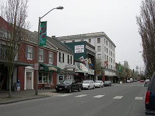
La Conner is a town in Skagit County, Washington, United States with a population of 965 at the 2020 census. It is included in the Mount Vernon–Anacortes, Washington Metropolitan Statistical Area. The town hosts several events as part of the annual Skagit Valley Tulip Festival held in April.

<span class="mw-page-title-main">Lyman, Washington</span> Town in Washington, United States

Lyman is a town in Skagit County, Washington, United States. The population was 423 at the 2020 census. It is included in the Mount Vernon-Anacortes, Washington Metropolitan Statistical Area.

<span class="mw-page-title-main">Marblemount, Washington</span> CDP in Washington, United States

Marblemount is a census-designated place in Skagit County, Washington, United States. The population was 286 at the 2020 census. It is included in the Mount Vernon–Anacortes, Washington Metropolitan Statistical Area.

<span class="mw-page-title-main">Mount Vernon, Washington</span> County Seat of Skagit County, Washington, United States

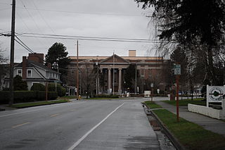
Mount Vernon is the most populous city in, and county seat of, Skagit County, Washington, United States. A central location in the Skagit River Valley, the city is located 51 miles south of the U.S.–Canada border and in between Vancouver, British Columbia and Seattle. The population was 35,219 at the 2020 census., making it the 35th most-populous city in Washington, with a larger 62,966 people living in its urban area. It is one of two principal cities of and included in the Mount Vernon-Anacortes, Washington Metropolitan Statistical Area, covering most of Skagit County.

<span class="mw-page-title-main">Sedro-Woolley, Washington</span> City in Washington, United States

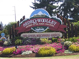
Sedro-Woolley is a city in Skagit County, Washington, United States. It is part of the Mount Vernon–Anacortes, Washington Metropolitan Statistical Area and had a population of 12,421 at the 2020 census. The city is home to North Cascades National Park.

<span class="mw-page-title-main">Stevenson, Washington</span> City in Washington, United States

Stevenson is a city in the Columbia River Gorge National Scenic Area along the Columbia River in Skamania County, Washington, United States. It is the county seat of Skamania County and home to the Skamania County Court House and Sheriff's Office. The population was 1,465 at the 2010 census, a 22% increase over 2000.

<span class="mw-page-title-main">Waitsburg, Washington</span> City in Washington, United States

Waitsburg is a city in Walla Walla County, Washington, United States. The population was 1,166 at the 2020 census. Waitsburg has a unique city classification in Washington state, being the state's only city which still operates under its territorial charter.

<span class="mw-page-title-main">Marlinton, West Virginia</span> Town in West Virginia, United States

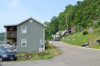
Marlinton is a town in and the county seat of Pocahontas County, West Virginia, United States. The population was 998 at the 2020 census. Located along the Greenbrier River, it is known for its scenery.

References

  1. "2019 U.S. Gazetteer Files". United States Census Bureau. Retrieved August 7, 2020.
  2. 1 2 "U.S. Census website". United States Census Bureau . Retrieved January 31, 2008.
  3. "US Board on Geographic Names". United States Geological Survey. October 25, 2007. Retrieved January 31, 2008.
  4. "Census Bureau profile: Concrete, Washington". United States Census Bureau. May 2023. Retrieved May 9, 2024.
  5. "Skagit Settlers: Trials and Triumphs, 1890–1920", Published by Skagit County Historical Society, 1975
  6. All information on these buildings and landmarks have been referenced from the local history book, "So They Called The Town Concrete," written by Charles M. Dwelley, published by The Concrete Herald, 1980; reprint 2004, 2009. It contains reputable knowledge of Concrete.
  7. 1 2 3 "Baker River Bridge HAER No. WA-105" (PDF). memory.loc.gov. August 1993. Retrieved April 3, 2013.[ permanent dead link ]
  8. The Concrete Herald, October 16, 1968 [ dead link ]
  9. Archived July 23, 2011, at the Wayback Machine
  10. "High School". Concrete.k12.wa.us. Retrieved February 15, 2013.
  11. Shelton-Jenck, Gordon (January 28, 2013). "MEMBERSHIP GROWTH!". FBLA Newsletter. Archived from the original on April 16, 2013.
  12. "concrete-herald.com". concrete-herald.com. Retrieved February 15, 2013.
  13. Archived July 27, 2011, at the Wayback Machine
  14. "US Gazetteer files 2010". United States Census Bureau. Archived from the original on January 25, 2012. Retrieved December 19, 2012.
  15. "Hamilton, Washington Travel Weather Averages (Weatherbase)". Weatherbase. Retrieved August 20, 2019.
  16. "Monthly Averages for Concrete, WA". weatherbase.com. Retrieved August 20, 2019.
  17. United States Census Bureau. "Census of Population and Housing" . Retrieved August 31, 2014.
  18. "U.S. Census website". United States Census Bureau . Retrieved December 19, 2012.