
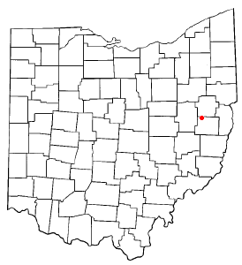
Harrison County is a county located in the U.S. state of Ohio. As of the 2020 census, the population was 14,483, making it the fifth-least populous county in Ohio. Its county seat and largest village is Cadiz. The county is named for General William Henry Harrison, who was later President of the United States.

Carroll County is a county located in the state of Ohio. As of the 2020 census, the population was 26,721. Its county seat is Carrollton, while its largest village is Minerva. It is named for Charles Carroll of Carrollton, the last surviving signer of the Declaration of Independence.
Leesville is a village in southwestern Carroll County, Ohio, United States. The population was 127 at the 2020 census. It is part of the Canton–Massillon metropolitan area.

Sherrodsville is a village in southwestern Carroll County, Ohio, United States. The population was 222 at the 2020 census. It is part of the Canton–Massillon metropolitan area.
Bowerston is a village in Harrison County, Ohio, United States. The population was 398 at the 2010 census.

Jewett is a village in Harrison County, Ohio, United States. The population was 692 at the 2010 census.

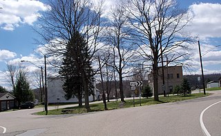
Scio is a village in northern Harrison County, Ohio, United States. The population was 673 at the 2020 census.

New Rumley is an unincorporated community in central Rumley Township, Harrison County, Ohio, United States. It is famous for being the birthplace of George Armstrong Custer.

Somerdale is an unincorporated community in northeastern Fairfield Township, Tuscarawas County, Ohio, United States. It has a post office with the ZIP code 44678. It lies along State Route 212, Conotton Creek and the Wheeling and Lake Erie Railway east of Zoar.
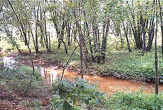
Huff Run is a 9.9 mile (15.9 km) long tributary of the Conotton Creek in eastern Ohio within Sandy Township and Rose Township. Conotton Creek is a tributary of the Ohio River via the Tuscarawas River and the Muskingum River. Mineral City is the only incorporated town within the Huff Run Watershed.
The Panhandle Trail is a rail trail in southern Pennsylvania and the Northern Panhandle of West Virginia. It occupies an abandoned railroad corridor that had been known as the Panhandle route which has been converted to a bicycle and walking trail. The rail line between Burgettstown and Weirton was closed in 1994, but Burgettstown to Walkers Mill closed in 1996. The original section of the trail is the West Virginia section, where the trail was called the Harmon Creek Trail, for the adjacent Harmon Creek. When Pennsylvania built its section, both states agreed to call it the Panhandle Trail. Although the Panhandle Trail occupies 29 miles of the Panhandle Route, the remaining portion of the route is owned by the Pittsburgh and Ohio Central Railroad, but it is no longer used.
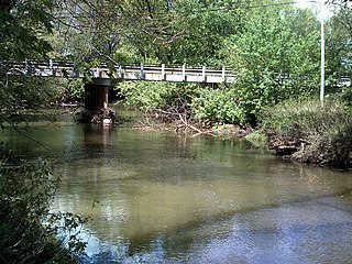
Conotton Creek is a tributary of the Tuscarawas River, 38.7 miles (62.3 km) long, in eastern Ohio in the United States. Via the Tuscarawas, Muskingum and Ohio Rivers, it is part of the watershed of the Mississippi River, draining an area of 286 square miles (741 km²) in Carroll, Harrison and Tuscarawas County, Ohio. The source is at 1240 feet and the mouth is at 874 feet. Dover Dam, downstream on the Tuscarawas river, is normally dry, but can impound a reservoir on Conotton and tributaries to a pool elevation of 916 feet for downstream flood control by the Corps of Engineers. From its source in eastern Harrison County, Ohio the creek flows west northwest through Jewitt, Scio, Conotton, Bowerston, Leesville, Sherrodsville, New Cumberland and Somerdale before reaching its mouth in central Tuscarawas County, Ohio. The Wheeling and Lake Erie Railway is situated in the valley. Ohio State Route 151 runs in the valley from near the source to Bowerston. Ohio State Route 212 run along the valley from Bowerston to the mouth. The Conotton Creek Trail runs from Bowerston to Jewett.

State Route 212 is a two-lane east–west state highway that runs within Stark, Tuscarawas, Carroll, and Harrison Counties in eastern Ohio. The western terminus of SR 212 is at U.S. Route 250 near Beach City, and its eastern terminus is at SR 151 in Bowerston. The route passes through rural areas but passes through small villages including Beach City, Bolivar, Zoar, Sherrodsville, and Leesville. It largely follows the valleys formed by the Tuscarawas River and Conotton Creek.

Leavittsville is an unincorporated community in Monroe Township, Carroll County, Ohio, United States. The community is part of the Canton–Massillon Metropolitan Statistical Area. The community is served by the Sherrodsville post office, ZIP code 44675.

Pattersonville is an unincorporated community in Augusta Township, Carroll County, Ohio, United States. The community is part of the Canton–Massillon Metropolitan Statistical Area. The community is serviced by the Minerva, Ohio post office, ZIP code 44657 . It is located on the Still Fork creek and the Ohi-Rail Corporation (OHIC) railroad.

New Cumberland is an unincorporated community in Warren Township, Tuscarawas County, Ohio, United States. The community is served by the Mineral City, Ohio post office, ZIP code 44656. It is located on Conotton Creek, State Route 212 and the Wheeling and Lake Erie Railway.

Conotton is an unincorporated community in North Township, Harrison County, Ohio, United States. The community is serviced by the Bowerston post office, ZIP Code 44695. It is located near Conotton Creek, State Route 151 and the Wheeling and Lake Erie Railway. According to the GNIS the community has also been known as Masterville.
Germano is an unincorporated community in German Township, Harrison County, Ohio, United States. The community is served by the post office at Jewett, ZIP code 43986. It is located near the source of Jefferson Creek, a tributary of Conotton Creek. Germano is located on State Routes 9 and 646.

State Route 646 is a 28.78-mile-long (46.32 km) state highway in Harrison and Jefferson Counties in eastern Ohio. The route runs from US 250 in Stock Township, northwest of Cadiz, to SR 43 in Island Creek Township, just outside Wintersville.

The Ohio and Erie Canal Towpath Trail is a multi-use trail that follows part of the former route of the Ohio & Erie Canal in Northeast Ohio.

