Copper Harbor, Michigan

Last updated

Copper Harbor, Michigan
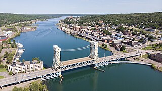
Aerial panorama of Copper Harbor, Michigan 2020-08-31.jpg
Aerial view of the Copper Harbor community
Copper Harbor, MI location.png
Location within Keweenaw County
USA Michigan location map.svg
Red pog.svg
Copper Harbor
Location within the state of Michigan
Usa edcp location map.svg
Red pog.svg
Copper Harbor
Location within the United States
Coordinates: 47°28′08″N87°53′18″W / 47.46889°N 87.88833°W / 47.46889; -87.88833
CountryUnited States
State Michigan
County Keweenaw
Township Grant
Established1844
Area
[1]
  Total2.43 sq mi (6.28 km2)
  Land1.51 sq mi (3.92 km2)
  Water0.91 sq mi (2.37 km2)
Elevation
605 ft (184 m)
Population
 (2020)
  Total136
  Density89.89/sq mi (34.71/km2)
Time zone UTC−5 (Eastern (EST))
  Summer (DST) UTC−4 (EDT)
ZIP code(s)
49918
49950 (Mohawk)
Area code 906
FIPS code 26-18100 [2]
GNIS feature ID623809 [3]
Website Copper Harbor

Copper Harbor is an unincorporated community and census-designated place (CDP) located in Keweenaw County in the U.S. state of Michigan. It is located within Grant Township. The population of the CDP was 136 as of the 2020 census. [4]

Contents

The community is located at the northern tip of the Keweenaw Peninsula and is the northernmost permanently populated community in the state. Due to its natural environment and surroundings, which include Fort Wilkins Historic State Park, Copper Harbor is marketed as an all-season tourist destination. [5] [6]

Etymology

The name of the community, Copper Harbor, alludes to the former use of its harbor as a port for shipping copper mined from local deposits during the mid-19th century. [7]

History

A mileage sign along US Highway 41 (US 41) in Copper Harbor, giving the distance to Miami, Florida, the highway's southern terminus. Copper Harbor-Miami.jpg
A mileage sign along US Highway 41 (US 41) in Copper Harbor, giving the distance to Miami, Florida, the highway's southern terminus.

The Keweenaw Peninsula and the area that would become the Copper Country was home to the Ojibwe people prior to European settlement. In 1836, the Upper Peninsula was officially ceded from the Native American Chippewa to the United States following the signing of the Treaty of Washington. The treaty was signed in the national capital, Washington, D.C., by Henry Schoolcraft and Native American representatives from the Ojibwe and Odawa nations. [8]

Copper Harbor was host to the first mineral land agency throughout the entire Lake Superior District. Captain Walter Cunningham was appointed by the United States Department of War to act as a Special Agent to the area. As soon as wayfinding was established in the spring of 1843, Cunningham had come to the area and opened his office, which was thereafter named the "Government House". It was positioned on Porter's Island, a small rocky island just opposite of present-day downtown Copper Harbor. [6]

The Pittsburgh and Boston Copper Harbor Mining Company, formed by John Hayes of Cleveland, Ohio, began excavating some pits near Haye's Point in Copper Harbor in 1844. It was a small development at first, but its mine was modern for its time, and the company struck it rich in 1845. The Pittsburgh and Boston mine operations were some of the first in the state of Michigan. [6] [9] [10] [11]

A few years later, the Central Mine, Cliff Mine, and others were opened and became successful. [12] [11] [13] [6] [9] However, by 1870 the copper resources in the community had been largely worked out. [10] [6]

The community of Copper Harbor was listed as a newly-organized census-designated place for the 2010 census, meaning it now has officially defined boundaries and population statistics. [14]

Geography

In 2010, Copper Harbor was listed as a census-designated place. The CDP contains a total area of 2.43 square miles (6.29 km2), of which 1.51 square miles (3.91 km2) is land and 0.92 square miles (2.38 km2) (37.86%) is water. [15]

Copper Harbor is located at the northern edge of the Keweenaw Peninsula, which also extends for several miles to the east. Copper Harbor has its own post office and ZIP Code (49918). [16] [17] Some areas within the community and the surrounding area may use the Mohawk 49950 ZIP Code. [18]

Beyond the community center, there are thick forests, limited roadways, and few developments. [19] [20]

Relative to other communities in the Keweenaw, Copper Harbor is 9 miles (14.5 km) from Mandan, 12 miles (19.3 km) north of Delaware, and 16 miles (25.7 km) east of Eagle Harbor. The village of Ahmeek is the nearest incorporated community at 30 miles (48.3 km) to the southwest. [6] [9] [21] [22] [23]

Climate

Copper Harbor has a humid continental climate. [24] Summers are warm but rarely hot due to the moderating influence of Lake Superior, while winters are cold and snowy, albeit milder than areas on similar parallels to the west, due to the low-scale maritime moderation. Although winter temperatures are similar to those in the nearest large metropolitan city Minneapolis, a couple of degrees latitude south-west, the main difference is that April is also a winter month in Copper Harbor, since the marine effects delay spring. The temperature lag effect is so great that March holds the town's record low, and April's record low temperatures are not much warmer than those of December.

Climate data for Copper Harbor, Michigan (Fort Wilkins Historic State Park), 1991–2020 normals, extremes 1972–2020
MonthJanFebMarAprMayJunJulAugSepOctNovDecYear
Record high °F (°C)46
(8)
55
(13)
75
(24)
80
(27)
89
(32)
94
(34)
99
(37)
94
(34)
95
(35)
83
(28)
71
(22)
56
(13)
99
(37)
Mean maximum °F (°C)38.8
(3.8)
43.2
(6.2)
53.5
(11.9)
65.1
(18.4)
78.6
(25.9)
84.1
(28.9)
86.9
(30.5)
86.1
(30.1)
82.0
(27.8)
72.6
(22.6)
55.4
(13.0)
43.7
(6.5)
89.1
(31.7)
Mean daily maximum °F (°C)22.8
(−5.1)
24.6
(−4.1)
33.8
(1.0)
44.0
(6.7)
57.4
(14.1)
67.1
(19.5)
73.2
(22.9)
73.4
(23.0)
66.0
(18.9)
51.9
(11.1)
39.0
(3.9)
28.5
(−1.9)
48.5
(9.2)
Daily mean °F (°C)17.0
(−8.3)
17.4
(−8.1)
25.6
(−3.6)
36.0
(2.2)
48.0
(8.9)
56.7
(13.7)
63.8
(17.7)
64.9
(18.3)
58.1
(14.5)
45.4
(7.4)
33.4
(0.8)
23.4
(−4.8)
40.8
(4.9)
Mean daily minimum °F (°C)11.2
(−11.6)
10.1
(−12.2)
17.4
(−8.1)
28.1
(−2.2)
38.5
(3.6)
46.4
(8.0)
54.4
(12.4)
56.3
(13.5)
50.3
(10.2)
38.9
(3.8)
27.8
(−2.3)
18.2
(−7.7)
33.1
(0.6)
Mean minimum °F (°C)−2.9
(−19.4)
−6.0
(−21.1)
−3.0
(−19.4)
15.3
(−9.3)
28.8
(−1.8)
37.4
(3.0)
45.5
(7.5)
46.6
(8.1)
38.8
(3.8)
28.8
(−1.8)
15.0
(−9.4)
3.2
(−16.0)
−6.7
(−21.5)
Record low °F (°C)−18
(−28)
−22
(−30)
−23
(−31)
−2
(−19)
16
(−9)
31
(−1)
42
(6)
32
(0)
30
(−1)
21
(−6)
−5
(−21)
−11
(−24)
−23
(−31)
Average precipitation inches (mm)2.24
(57)
1.89
(48)
1.70
(43)
2.68
(68)
3.55
(90)
3.07
(78)
3.02
(77)
2.63
(67)
3.71
(94)
3.72
(94)
2.60
(66)
2.33
(59)
33.14
(842)
Source: NOAA [25] [26]

Notable attractions

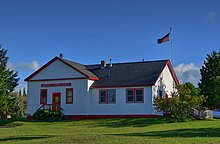
Copper Harbor Schoolhouse in 2020 Copper Harbor School 2020-08-31.jpg
Copper Harbor Schoolhouse in 2020

Demographics

Historical population
CensusPop.Note
2020 136
U.S. Decennial Census [42]

According to the 2020 census, the CDP had a population of 136. According to the 2021 American Community Survey, its median household income was $54,583. [4]

Transportation

Highways

Ferry services

Copper Harbor contains a ferry port that provides transportation to Isle Royale National Park. The Isle Royale Line, Inc. (formerly named Isle Royale Ferry Service) operates the Isle Royale Queen IV out of Copper Harbor during the warmer months from May to September. The ferry takes 3.5 hours to travel 60 miles (97 km) across Lake Superior to Rock Harbor.

See also

Related Research Articles

<span class="mw-page-title-main">Houghton, Michigan</span> City in Michigan, United States

Houghton is the largest city and county seat of Houghton County in the U.S. state of Michigan. Located on the Keweenaw Peninsula, Houghton is the largest city in the Copper Country region. It is the fifth-largest city in the Upper Peninsula, with a population of 8,386 at the 2020 census. Houghton is the principal city of the Houghton micropolitan area, which includes all of Houghton and Keweenaw counties. Houghton lies upon the Keweenaw Waterway, a partly natural, partly artificial waterway connecting at both ends to Lake Superior. Across the waterway from Houghton lies the city of Hancock.

<span class="mw-page-title-main">Keweenaw County, Michigan</span> County in Michigan, United States

Keweenaw County is a county in the western Upper Peninsula of the U.S. state of Michigan. As of the 2020 census, the county's population was 2,046, making it Michigan's least populous county. It is also the state's largest county by total area, including the waters of Lake Superior, as well as the state's northernmost county. The county seat is Eagle River.
<span class="mw-page-title-main">Torch Lake Township, Houghton County, Michigan</span> Civil township in Michigan, United States

Torch Lake Township is a civil township of Houghton County in the U.S. state of Michigan. As of the 2020 census, the population of the township was 1,893. The township was established in 1886 and is one of the largest townships in Houghton County by area. It is surrounded by the Torch Lake, the Portage Lake, and Lake Superior. As well as a large number of unincorporated communities, the township also includes a portion of the Baraga State Forest which lies along the shores of Keweenaw Bay. The township borders Schoolcraft Township to the north, Osceola Township to the northwest, and Chassell Township to the southwest. The community of Hubbell serves as the major population center of the township, as well as hosting the Township Hall itself. The mostly uninhabited 91-acre Rabbit Island, located offshore in Lake Superior, is a part of the township.

<span class="mw-page-title-main">Allouez Township, Michigan</span> Civil township in Michigan, United States

Allouez Township is a civil township of Keweenaw County in the U.S. state of Michigan. The population was 1,428 at the 2020 census.

<span class="mw-page-title-main">Eagle Harbor Township, Michigan</span> Civil township in Michigan, United States

Eagle Harbor Township is a civil township of Keweenaw County in the U.S. state of Michigan. The population was 217 at the 2020 census. The township is located on the Keweenaw Peninsula and also includes the southwestern portion of Isle Royale National Park.
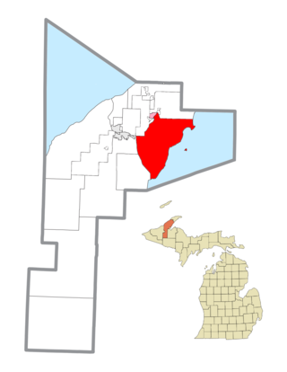
<span class="mw-page-title-main">Grant Township, Keweenaw County, Michigan</span> Civil township in Michigan, United States

Grant Township is a civil township of Keweenaw County in the U.S. state of Michigan. The population was 275 at the 2020 census. Grant Township is one of the most isolated municipalities in Michigan, as it forms the tip of the Keweenaw Peninsula, which projects into Lake Superior.

<span class="mw-page-title-main">Houghton Township, Michigan</span> Civil township in Michigan, United States

Houghton Township is a civil township of Keweenaw County in the U.S. state of Michigan. The population was 72 at the 2020 census.

The Keweenaw Peninsula is the northernmost part of Michigan's Upper Peninsula. It projects into Lake Superior and was the site of the first copper boom in the United States, leading to its moniker of "Copper Country." Its major industries are now logging and tourism, as well as jobs related to Michigan Technological University.

<span class="mw-page-title-main">M-26 (Michigan highway)</span> State highway in Michigan, United States

M-26 is a 96.355-mile-long (155.068 km) state trunkline highway in the U.S. state of Michigan, running from two miles (3.2 km) east of Rockland to its junction with US Highway 41 (US 41) in Copper Harbor. It generally runs southwest-to-northeast in the western half or Michigan's Upper Peninsula. The northernmost segment, which closely parallels the shore of Lake Superior on the west side of the Keweenaw Peninsula, is highly scenic.

<span class="mw-page-title-main">Eagle Harbor, Michigan</span> Census-designated place & unincorporated community in Michigan, United States

Eagle Harbor is an unincorporated community and census-designated place located on the north side of the Keweenaw Peninsula within Eagle Harbor Township, Keweenaw County in the U.S. State of Michigan. Its population was 69 as of the 2020 census. M-26 passes through this community. This hamlet was especially popular with the sailors in days past, as it had a good steamboat landing and is about equally distant from Sault Sainte Marie, Michigan, and Duluth, Minnesota. It was the first stop for supplies for the many boats on Lake Superior.

<span class="mw-page-title-main">Keweenaw Waterway</span> Canal across the Keweenaw Peninsula, Michigan

The Keweenaw Waterway is a partly natural, partly artificial waterway which cuts across the Keweenaw Peninsula of Michigan; it separates Copper Island from the mainland. Parts of the waterway are variously known as the Keweenaw Waterway, Portage Canal, Portage Lake Canal, Portage River, Lily Pond, Torch Lake, and Portage Lake. The waterway connects to Lake Superior at its north and south entries, with sections known as Portage Lake and Torch Lake in between. The primary tributary to Portage Lake is the Sturgeon River.

<span class="mw-page-title-main">Eagle River, Michigan</span> Census-designated place & unincorporated community in Michigan, United States

Eagle River is an unincorporated community and census-designated place (CDP) in the U.S. state of Michigan. It is the county seat of Keweenaw County. Its population was 65 at the 2020 census, which makes it by far the least-populated county seat in the state of Michigan. As an unincorporated community, Eagle River has no legal autonomy and is part of Allouez Township and Houghton Township.
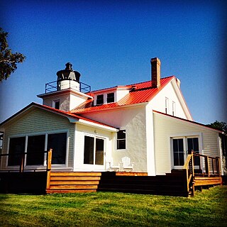
<span class="mw-page-title-main">Eagle River Light</span> Lighthouse in Michigan, United States

The Eagle River Light is a decommissioned lighthouse at the mouth of the Eagle River in the community of Eagle River on the Keweenaw Peninsula in the U.S. state of Michigan.
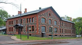
<span class="mw-page-title-main">Keweenaw National Historical Park</span> U.S. national historical park in Michigan

Keweenaw National Historical Park is a unit of the U.S. National Park Service. Established in 1992, the park celebrates the life and history of the Keweenaw Peninsula in the Upper Peninsula of the U.S. state of Michigan. It is a federal-local cooperative park made up of two primary units, the Calumet Unit and the Quincy Unit, and almost two dozen cooperating "Heritage Sites" located on federal, state, and privately owned land in and around the Keweenaw Peninsula. The National Park Service owns approximately 1,700 acres (690 ha) in the Calumet and Quincy Units. Units are located in Baraga, Houghton, Keweenaw, and Ontonagon counties.

<span class="mw-page-title-main">National Register of Historic Places listings in Keweenaw County, Michigan</span>

The following is a list of Registered Historic Places in Keweenaw County, Michigan.
     This National Park Service list is complete through NPS recent listings posted April 26, 2024.

<span class="mw-page-title-main">Fort Wilkins Historic State Park</span> Park in Michigan, United States

Fort Wilkins Historic State Park is a historical park operated by the Michigan Department of Natural Resources at Copper Harbor, Michigan. The park preserves the restored 1844 army military outpost, Fort Wilkins, which was placed on the National Register of Historic Places in 1970. The state park's 700 acres (280 ha) include camping and day-use facilities as well as the Copper Harbor Lighthouse, built in 1866. The park is a "Cooperating Site" of the Keweenaw National Historical Park.

Brockway Mountain Drive is an 8.8-mile-long (14.2 km) scenic roadway just west of Copper Harbor in the Upper Peninsula of Michigan in the United States. Drivers can access the road from State Highway M-26 on either end near Eagle Harbor to the west or Copper Harbor to the east in the Keweenaw Peninsula. The drive runs along the ridge of Brockway Mountain on the Keweenaw Fault and climbs to 1,320 feet (402 m) above sea level, 720 feet (219 m) above the surface of Lake Superior. Several viewpoints along the route allow for panoramas of Copper Harbor, Lake Superior, and undeveloped woodland. On a clear day, Isle Royale is visible approximately 50 miles (80 km) in distance from the top of the mountain.

Mohawk is an unincorporated community and census-designated place (CDP) in the U.S. state of Michigan. Located in Keweenaw County, it is within Allouez Township. As an unincorporated community, Mohawk has no legally defined boundaries or population statistics of its own but does have its own post office with the 49950 ZIP Code. The ZIP includes most of mainland Keweenaw County and also uses the Eagle Harbor and Eagle River designations.

<span class="mw-page-title-main">U.S. Route 41 in Michigan</span> U.S. Highway in Michigan

US Highway 41 (US 41) is a part of the United States Numbered Highway System that runs from Miami, Florida, to the Upper Peninsula of the US state of Michigan. In Michigan, it is a state trunkline highway that enters the state via the Interstate Bridge between Marinette, Wisconsin, and Menominee, Michigan. The 278.769 miles (448.635 km) of US 41 that lie within Michigan serve as a major conduit. Most of the highway is listed on the National Highway System. Various sections are rural two-lane highway, urbanized four-lane divided expressway and the Copper Country Trail National Scenic Byway. The northernmost community along the highway is Copper Harbor at the tip of the Keweenaw Peninsula. The trunkline ends at a cul-de-sac east of Fort Wilkins State Park after serving the Central Upper Peninsula and Copper Country regions of Michigan.
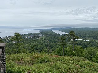
<span class="mw-page-title-main">Lake Fanny Hooe</span> Lake in Keweenaw County, Michigan, United States

Lake Fanny Hooe is a 227-acre (92 ha) lake in Keweenaw County, Michigan. The Garden Brook connects Lake Fanny Hooe to Lake Superior, 800 feet (240 m) to the north. The community of Copper Harbor lies to the north west side of the lake. Home to a U.S. Army fort built in 1844, Fort Wilkins Historic State Park is also situated between Lake Fanny Hooe and Lake Superior.

References

  1. "2020 U.S. Gazetteer Files". United States Census Bureau. Retrieved May 21, 2022.
  2. "U.S. Census website". United States Census Bureau . Retrieved January 31, 2008.
  3. U.S. Geological Survey Geographic Names Information System: Copper Harbor, Michigan
  4. 1 2 "Explore Census Data". data.census.gov. Retrieved August 3, 2023.
  5. Michigan Economic Development Corporation (2021). "Keweenaw Convention & Visitors Bureau: Copper Harbor" . Retrieved August 4, 2021.
  6. 1 2 3 4 5 6 7 8 9 10 11 12 Monette, Clarence J. (1975). Some Copper Country Names And Places. Lake Linden, Michigan. ISBN   0-942363-04-3.{{cite book}}: CS1 maint: location missing publisher (link)
  7. Lankton, Larry (2010). Hollowed Ground. Wayne State University Press. pp. 13–14. ISBN   9780814334904.
  8. Magnaghi, Russell M. (2009). Native Americans of Michigan's Upper Peninsula: A Chronology to 1900 (2nd ed.). Marquette, Michigan: Center for Upper Peninsula Studies. ISBN   978-0-557-33460-5.
  9. 1 2 3 4 5 6 7 8 9 Molloy, Lawrence J. (2011). A Guide to Michigan's Historic Keweenaw Copper District: Photographs, Maps, and Tours of the Keweenaw—Past and Present. Great Lakes GeoScience. ISBN   978-0-9791772-1-7.
  10. 1 2 Dunbar, Willis Frederick; May, George S. (1995). Michigan: A History of the Wolverine State. Grand Rapids: Wm. B. Eerdmans Publishing. p. 358.
  11. 1 2 Whittlesey, Charles (1852). 4000 Years of Copper Country History. Greenlee Printing.
  12. "Copper Mining History and Copper Harbor Michigan". www.exploringthenorth.com. Retrieved May 15, 2019.
  13. Mansfield, John Brandt (1899). History of the Great Lakes. J. H. Beers & Co. p. 199.
  14. "Michigan: 2010 Population and Housing Unit Counts 2010 Census of Population and Housing" (PDF). 2010 United States Census . United States Census Bureau. September 2012. p. III-6. Retrieved August 8, 2016.
  15. "Michigan: 2010 Population and Housing Unit Counts 2010 Census of Population and Housing" (PDF). 2010 United States Census . United States Census Bureau. September 2012. p. 31 Michigan. Retrieved March 7, 2021.
  16. Google (August 4, 2021). "49918 ZIP Code map" (Map). Google Maps . Google. Retrieved August 4, 2021.
  17. UnitedStatesZipCodes.org (2021). "ZIP Code 49918: Copper Harbor (Calumet)" . Retrieved August 4, 2021.
  18. Google (August 4, 2021). "49950 ZIP Code map" (Map). Google Maps . Google. Retrieved August 4, 2021.
  19. 1 2 3 Vachon, Paul (2015). Michigan's Upper Peninsula. Berkeley, California: Avalon Travel. ISBN   978-1-61238-986-8.
  20. 1 2 3 Penrod, John (2001). Michigan's Copper Country: Michigan's Historic Wilderness. Berrien Center, Michigan. ISBN   0-942618-69-6.{{cite book}}: CS1 maint: location missing publisher (link)
  21. "Seeing The Light - Eagle Harbor Range Lights". www.terrypepper.com. Retrieved May 22, 2019.
  22. 1 2 "Copper Harbor Rear Range (Michigan) - 1910". uslhs.org. Retrieved May 22, 2019.
  23. White, Mel (2016). National Geographic Complete National Parks of the United States (Second ed.). Washington, D.C.: National Geographic Partners. ISBN   978-1-4262-1692-3.
  24. "Copper Harbor, Michigan Climate Summary". Weatherbase. Retrieved November 10, 2015.
  25. "NowData - NOAA Online Weather Data". National Oceanic and Atmospheric Administration. Retrieved September 2, 2021.
  26. "Station: Copper Harbor FT WILKINS, MI". U.S. Climate Normals 2020: U.S. Monthly Climate Normals (19912020). National Oceanic and Atmospheric Administration. Retrieved September 2, 2021.
  27. "Hunter's Point Park - Grant Township". April 22, 2016. Archived from the original on April 22, 2016. Retrieved May 22, 2019.
  28. "End of US highway 41". US Ends .com. Retrieved May 15, 2019.[ self-published source ]
  29. "Terminus of U.S. 41 at Copper Harbor, Autumn Scenic Drive". TakeMyTrip.com. May 13, 2018. Retrieved May 21, 2019.
  30. Hintz, Martin (1998). America The Beautiful: Michigan . Danbury, Connecticut: Children's Press. ISBN   0-516-20636-2.
  31. 1 2 National Geographic Guide to State Parks of the United States (Fifth ed.). Washington, D.C.: National Geographic Partners. 2018. ISBN   978-1-4262-1885-9.
  32. 1 2 3 National Geographic Guide to Scenic Highways & Byways: The 300 Best Drives in the U.S. Washington, D.C. 2018. ISBN   978-1-4262-1905-4.{{cite book}}: CS1 maint: location missing publisher (link)
  33. "schoolcopperharbor". schoolcopperharbor. Retrieved May 20, 2019.
  34. "Copper Country Intermediate School District". Hancock, Michigan. Retrieved May 20, 2019.
  35. "Annual Festivals Keweenaw Michigan". Keweenaw Convention & Visitor’s Bureau. Retrieved May 20, 2019.
  36. "Lake Fanny Hooe Resort & Campground. Located at Keweenaw's Copper Harbor, in Michigan's Upper Peninsula". www.fannyhooe.com. Retrieved May 22, 2019.
  37. "Lake Fanny Hooe". Keweenaw Convention & Visitor’s Bureau. Retrieved May 22, 2019.
  38. James, Barry C. (2000). Lighting the Way: A History Of The Copper Harbor Lighthouse. Copper Harbor, Michigan: Fort Wilkins Natural History Association. ISBN   0-9675103-0-9.
  39. "MI State Historic Preservation Objects". June 12, 2012. Archived from the original on June 12, 2012. Retrieved May 22, 2019.
  40. Howard, Philip J. (2014). Yankee Yooper On The Keweenaw. Xlibris Corporation. ISBN   978-1-4931-8789-8. LCCN   2014905453.
  41. "Michigan / Copper Harbor Old Rear Range light - plate (mitko)". World of Lighthouses. Retrieved May 22, 2019.
  42. "Census of Population and Housing". Census.gov. Retrieved June 4, 2016.