Related Research Articles

Callaway County is a county located in the U.S. state of Missouri. As of the 2020 United States Census, the county's population was 44,283. Its county seat is Fulton. With a border formed by the Missouri River, the county was organized November 25, 1820, and named for Captain James Callaway, grandson of Daniel Boone. The county has been historically referred to as "The Kingdom of Callaway" after an incident in which some residents confronted Union troops during the U.S. Civil War.

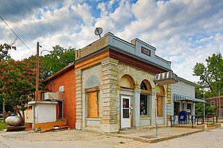
Mokane is a small city in southern Callaway County, Missouri, United States. The population was 185 at the 2010 census. It is part of the Jefferson City Metropolitan Statistical Area.

Ste. Genevieve is a city in Ste. Genevieve Township and is the county seat of Ste. Genevieve County, Missouri, United States. The population was 4,999 at the 2020 census. Founded in 1735 by French Canadian colonists and settlers from east of the river, it was the first organized European settlement west of the Mississippi River in present-day Missouri. Today, it is home to Ste. Genevieve National Historical Park, the 422nd unit of the National Park Service.
Tebbetts is an unincorporated community in southern Callaway County, Missouri, United States. It is part of the Jefferson City, Missouri Metropolitan Statistical Area. Tebbetts is located on Route 94, approximately 8 miles (13 km) east of Jefferson City, on the north edge of the Missouri River floodplain.

Auxvasse Township is one of eighteen townships in Callaway County, Missouri, USA. As of the 2010 census, its population was 1,000.

NOTE: Cedar Township in Callaway County no longer contains the town of Cedar City since boundary changes creating Summit Township from its former southern sector sometime between 1883 and 1897. This has caused some confusion in historical, geographic, and genealogical research—see "History" section below.

Cote Sans Dessein Township is one of eighteen townships in Callaway County, Missouri, USA. As of the 2010 census, its population was 1,122.

East Fulton Township is one of eighteen townships in Callaway County, Missouri, USA. As of the 2010 census, its population was 10,231.

McCredie Township is one of eighteen townships in Callaway County, Missouri, USA. As of the 2010 census, its population was 760.

Round Prairie Township is one of eighteen townships in Callaway County, Missouri, USA. As of the 2010 census, its population was 1038.

Saint Aubert Township is one of eighteen townships in Callaway County, Missouri, USA. As of the 2010 census, its population was 1,969.

Summit Township is one of eighteen townships in Callaway County, Missouri, USA. As of the 2010 census, its population was 8,873.
Bartonville, MO, was the second town named as the county seat of Gasconade County, in 1825. It was abandoned to the Gasconade River after severe flooding. Its location in Township 43, Range 7 West was not identified again until 1998, when a researcher found a notice of sheriff's sale which included a legal description of the "Bartonville tract". Bartonville, a lost town, was situated in what is now Osage County, across the Gasconade River from Cooper Hill.

Lamine Township is one of 14 civil townships in Cooper County, in the U.S. state of Missouri. Twenty-two of Missouri's 114 counties, including Cooper County, have civil township governments. The other 92 counties have townships which are geographical but not governmental (civil). According to the 1860 Census, the population of Lamine Township was 830 . As of the 2020 Census, Lamine Township's population was 257.
The Boonslick, or Boone's Lick Country, is a cultural region of Missouri along the Missouri River that played an important role in the westward expansion of the United States and the development of Missouri's statehood in the early 19th century. The Boone's Lick Road, a route paralleling the north bank of the river between St. Charles and Franklin, Missouri, was the primary thoroughfare for settlers moving westward from St. Louis in the early 19th century. Its terminus in Franklin marked the beginning of the Santa Fe Trail, which eventually became a major conduit for Spanish trade in the Southwestern United States. Later it connected to the large emigrant trails, including the Oregon and California Trails, used by pioneers, gold-seekers and other early settlers of the West. The region takes its name from a salt spring or "lick" in western Howard County, used by Nathan and Daniel Morgan Boone, sons of famed frontiersman Daniel Boone.

Cinque Hommes is one of the eight townships located in Perry County, Missouri, in the United States of America.
Union is one of the eight townships located in Perry County, Missouri, in the United States of America.

The Bois Brule Bottom is an alluvial floodplain in Bois Brule Township in Perry County, Missouri stretching between Bois Brule Creek to the west and the Mississippi River to the east.
Shamrock is an unincorporated community in Shamrock Township in the northeast corner of Callaway County, in the U.S. state of Missouri. The community is on Missouri Route B two miles west of the Loutre River. Auxvasse is ten miles to the west, Montgomery City is about nine miles east and Williamsburg is five miles south.
Linn Township is an inactive township in Moniteau County, in the U.S. state of Missouri.
References
- ↑ Chamois, Missouri, 15 Minute Topographic Quadrangle, USGS, 1890
- ↑ Bright, William. "Native American Place Names in the Louisiana Purchase". p. 358. CiteSeerX 10.1.1.1015.3344 .
- ↑ History of Callaway County in the Illustrated Historical Atlas of Callaway County MO; Edwards Brothers of Missouri, 1876, page 7
- ↑ "Callaway County Place Names, 1928–1945 (archived)". The State Historical Society of Missouri. Archived from the original on June 24, 2016. Retrieved September 7, 2016.
{{cite web}}: CS1 maint: bot: original URL status unknown (link) - ↑ Description of Cotes Sand Dessein in 1817
- ↑ U.S. Geological Survey Geographic Names Information System: Cote Sans Dessein (historical)
- ↑ "Post Offices". Jim Forte Postal History. Archived from the original on March 6, 2016. Retrieved September 7, 2016.
- ↑ Kingdom of Callaway Historical Society "A History of Callaway County Missouri 1984". Fulton MO: (author published), 1983.
- ↑ Kingdom of Callaway Historical Society: "Combined Illustrated Historical Atlas of Callaway County, Mo. 1876-1897-1919". Mt Vernon IN: Windmill Publications, 1994.
- ↑ Oxford Hachette French Dictionary / Le Grand Dictionnaire Hachette-Oxford, Oxford University Press, Oxford UK, 2007.
