Crescent Beach, St. Johns County, Florida

Last updated

Crescent Beach, Florida
CDP
Crescent Beach, Florida.jpg
St. Johns County Florida Incorporated and Unincorporated areas Crescent Beach Highlighted.svg
Location in St. Johns County and the state of Florida
Coordinates: 29°45′56″N81°15′11″W / 29.76556°N 81.25306°W / 29.76556; -81.25306
Country Flag of the United States.svg  United States
State Flag of Florida.svg  Florida
County   St. Johns
Area
[1]
  Total1.46 sq mi (3.78 km2)
  Land1.44 sq mi (3.72 km2)
  Water0.02 sq mi (0.05 km2)
Elevation
7 ft (2 m)
Population
 (2020)
  Total844
  Density586.93/sq mi (226.58/km2)
Time zone UTC-5 (Eastern (EST))
  Summer (DST) UTC-4 (EDT)
ZIP Code
32080
Area code 904
FIPS code 12-15325 [2]
GNIS feature ID0307927 [3]

Crescent Beach is an unincorporated census-designated place in St. Johns County, Florida, United States. The population was 844 at the 2020 census, down from 931 at the 2010 census. [4] It is part of the Jacksonville, Florida Metropolitan Statistical Area.

Contents

Geography

Crescent Beach is located at 29°45′56″N81°15′11″W / 29.76556°N 81.25306°W / 29.76556; -81.25306 (29.765550, -81.253023). [5]

According to the United States Census Bureau, the community has a total area of 1.5 square miles (3.9 km2), all land.

Demographics

Historical population
CensusPop.Note
1990 1,081
2000 985−8.9%
2010 931−5.5%
2020 844−9.3%
U.S. Decennial Census [6]

As of the census [2] of 2000, there were 985 people, 530 households, and 299 families residing in the community. The population density was 646.2 inhabitants per square mile (249.5/km2). There were 1,535 housing units at an average density of 1,007.1 per square mile (388.8/km2). The racial makeup of the community was 97.36% White, 0.10% African American, 0.51% Native American, 0.41% Asian, 0.20% Pacific Islander, and 1.42% from two or more races. Hispanic or Latino of any race were 0.81% of the population.

There were 530 households, out of which 9.4% had children under the age of 18 living with them, 50.8% were married couples living together, 3.2% had a female householder with no husband present, and 43.4% were non-families. 35.3% of all households were made up of individuals, and 16.6% had someone living alone who was 65 years of age or older. The average household size was 1.86 and the average family size was 2.33.

The population was spread out, with 8.8% under the age of 18, 4.5% from 18 to 24, 17.6% from 25 to 44, 32.8% from 45 to 64, and 36.3% who were 65 years of age or older. The median age was 57 years. For every 100 females, there were 105.6 males. For every 100 females age 18 and over, there were 100.4 males.

The median income for a household in the community was $39,821, and the median income for a family was $49,712. Males had a median income of $42,750 versus $29,091 for females. The per capita income for the community was $32,279. None of the families and 8.9% of the population were living below the poverty line, including no under eighteens and 4.8% of those over 64.

Education

It is in the St. Johns County School District. [7]

Zoned schools include W. D. Hartley Elementary School, [8] Gamble Rogers Middle School, [9] and Pedro Menendez High School. [10]

Related Research Articles

<span class="mw-page-title-main">Black Diamond, Florida</span> Census-designated place in Florida, US

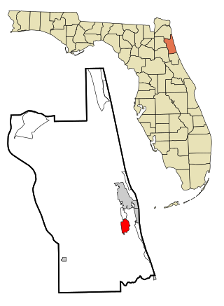
Black Diamond is a census-designated place (CDP) in Citrus County, Florida, United States. The population was 1,255 at the 2020 census, up from 1,101 at the 2010 census. It is part of the Homosassa Springs, Florida Metropolitan Statistical Area.

<span class="mw-page-title-main">Marineland, Florida</span> Town in the state of Florida, United States

The town of Marineland was established in 1940, and is in both Flagler and St. Johns counties, Florida, United States. Marineland is located 18 miles (29 km) south of St. Augustine along Route A1A. The population was 15 in the 2020 census.

<span class="mw-page-title-main">Butler Beach, Florida</span> CDP in Florida, United States

Butler Beach is a census-designated place (CDP) in St. Johns County, Florida, United States. The population was 4,978 at the time of the 2020 United States Census, up from 4,951 at the 2010 census. It is part of the Jacksonville, Florida Metropolitan Statistical Area. Established by Frank B. Butler, who had been successful operating a grocery store and became a political activist, it was a resort for African Americans. The Lincolnville businessman bought land in the area between the Atlantic Ocean and the Matanzas River, and offered beach access to African Americans. It was the only beach open to them between Jacksonville and Daytona Beach.

<span class="mw-page-title-main">Fruit Cove, Florida</span> CDP in Florida, United States

Fruit Cove is a census-designated place (CDP) in St. Johns County, Florida, United States. It is located in the community of St. Johns. The population was 32,143 at the 2020 census, up from 29,362 at the 2010 census. It is part of the Jacksonville, Florida Metropolitan Statistical Area.

<span class="mw-page-title-main">Hastings, Florida</span> Town in the state of Florida, United States

Hastings is an unincorporated census-designated place and agricultural center in St. Johns County, Florida, United States, 18 miles (29 km) southwest of St. Augustine. It was formerly an incorporated town, but it was dissolved in 2018 after a vote by residents. The population was 1,262 at the 2020 census, up from 580 at the 2010 census. It is part of the Jacksonville, Florida Metropolitan Statistical Area.

<span class="mw-page-title-main">Palm Valley, Florida</span> CDP in Florida, United States

Palm Valley is a census-designated place (CDP) in St. Johns County, Florida, United States. The population was 21,827 at the 2020 census, up from 20,019 at the 2010 census. It is part of the Jacksonville, Florida Metropolitan Statistical Area.

<span class="mw-page-title-main">Sawgrass, Florida</span> CDP in Florida, United States

Sawgrass is a census-designated place (CDP) in St. Johns County, Florida, United States. The population was 5,385 at the 2020 census, up from 4,880 at the 2010 census. The area is located in Ponte Vedra Beach and part of the Jacksonville, Florida Metropolitan Statistical Area. Sawgrass is home to The Players Championship (TPC), established in 1974. The tournament offers the highest prize fund of any tournament in golf.

<span class="mw-page-title-main">St. Augustine Shores, Florida</span> CDP in Florida, United States

St. Augustine Shores is a census-designated place (CDP) in St. Johns County, Florida, United States. As of the 2020 census, the population was 8,706, up from 7,359 at the 2010 census. It is part of the Jacksonville, Florida Metropolitan Statistical Area.

<span class="mw-page-title-main">Vilano Beach, Florida</span> Census-designated place in Florida, United States

Vilano Beach is an unincorporated community and census-designated place (CDP) and in St. Johns County, Florida, United States. It was listed as the Villano Beach CDP by the U.S. Census Bureau from 2010 to 1990; however, the name was corrected to Vilano Beach for the 2020 census. The population was 2,514 at the 2020 census, down from 2,678 at the 2010 census. It is part of the Jacksonville, Florida Metropolitan Statistical Area.

<span class="mw-page-title-main">Candler-McAfee, Georgia</span> Place in Georgia, United States

Candler-McAfee is an unincorporated community and census-designated place (CDP) in DeKalb County, Georgia, United States. It is located east of Atlanta approximately 10 miles (16 km) east of Downtown Atlanta and to the south of Decatur, Georgia The population was 23,025 at the 2010 census.

<span class="mw-page-title-main">Hapeville, Georgia</span> City in Georgia, United States

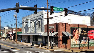
Hapeville, established 1891, is a city in Fulton County, Georgia, United States. Hapeville is 2.5 square miles wide and located inside I-285 between the city of Atlanta to its north and the Atlanta International Airport to its south. The population was 6,553 at the 2020 census, an increase of 180 residents from the 2010 census. Hapeville is named for Dr. Samuel Hape, one of the area's original landowners and its first mayor. Dr. Hape and other members of his family are buried in Atlanta's Oakland Cemetery.

<span class="mw-page-title-main">St. Augustine Beach, Florida</span> City in Florida, United States

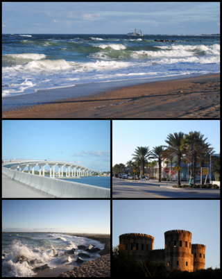
St. Augustine Beach is a city in St. Johns County, Florida, United States. The population was 6,803 at the 2020 US census, up from 6,176 at the 2010 census. It is part of the Jacksonville, Florida Metropolitan Statistical Area.

<span class="mw-page-title-main">St. Augustine South, Florida</span> CDP in Florida, United States

St. Augustine South is a census-designated place (CDP) in St. Johns County, Florida, United States. The population was 5,066 at the 2020 census, up from 4,998 at the 2010 census. It is part of the Jacksonville, Florida Metropolitan Statistical Area.

<span class="mw-page-title-main">West Haven-Sylvan, Oregon</span> CDP in Oregon, United States

West Haven-Sylvan is a census-designated place (CDP) in Washington and Multnomah counties, Oregon, United States, north of U.S. Route 26. As of the 2020 census, the CDP population was 9,299.

<span class="mw-page-title-main">East Brandywine Township, Pennsylvania</span> Township in Pennsylvania, United States

East Brandywine Township is a township in Chester County, Pennsylvania, United States. The population was 9,746 at the 2020 census.

<span class="mw-page-title-main">Hillcrest, Texas</span> Village in Texas, United States

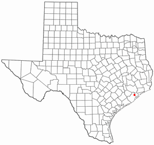
Hillcrest is a village in Brazoria County, Texas, United States. The population was 730 at the 2010 census.

<span class="mw-page-title-main">Fifth Street, Texas</span> Census-designated place in Texas, United States

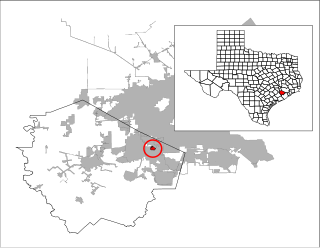
Fifth Street is a census-designated place (CDP) located in the extraterritorial jurisdiction of Stafford within Fort Bend County, Texas, United States. The population was 2,284 at the 2020 census. Fifth Street is within the ZIP code 77477. Therefore, residents of Fifth Street have an address of Stafford, Texas.

<span class="mw-page-title-main">Pleak, Texas</span> Village in Texas, United States

Pleak is a village in Fort Bend County, Texas, United States, within the Houston–Sugar Land–Baytown metropolitan area. It is on Texas State Highway 36, south of Rosenberg. Its population was 971 at the 2020 census.

<span class="mw-page-title-main">Nocatee, Florida</span> Planned community in Florida

Nocatee is an unincorporated planned community and census-designated place (CDP) located primarily in northern St. Johns County, Florida. The population was 22,503 at the 2020 census, up from 4,524 at the 2010 census, an increase of nearly 400%. It is part of the Jacksonville, Florida Metropolitan Statistical Area. As of 2020, the community consists of twenty-two neighborhoods, some of which are specialized for certain age groups. The community blends a variety of neighborhoods with schools, parks, recreation, offices, shopping, and restaurants. Part of the development lies within Jacksonville city limits in Duval County, although the CDP lies entirely within St. Johns County. It is near Ponte Vedra Beach in Florida's First Coast region and sits on 13,323 acres (5,392 ha) of land. It was approved in 2001 as a Development of Regional Impact (DRI) under Section 380.06 of the Florida Statutes.

<span class="mw-page-title-main">Lake Butler, Orange County, Florida</span> Census-designated place in Florida, United States

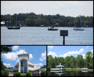
Lake Butler is a census-designated place (CDP) and unincorporated area, completely surrounding the town of Windermere, in Orange County, Florida, United States. The population was 15,400 at the 2010 census, up from 7,062 at the 2000 census. It is part of the Orlando–Kissimmee–Sanford, Florida Metropolitan Statistical Area.

References

  1. "2020 U.S. Gazetteer Files". United States Census Bureau. Retrieved October 31, 2021.
  2. 1 2 "U.S. Census website". United States Census Bureau . Retrieved January 31, 2008.
  3. "US Board on Geographic Names". United States Geological Survey. October 25, 2007. Retrieved January 31, 2008.
  4. "Explore Census Data". data.census.gov. Retrieved May 16, 2024.
  5. "US Gazetteer files: 2010, 2000, and 1990". United States Census Bureau. February 12, 2011. Retrieved April 23, 2011.
  6. "Census of Population and Housing". Census.gov. Retrieved June 4, 2016.
  7. "2020 CENSUS - CENSUS BLOCK MAP: Crescent Beach CDP, FL" (PDF). U.S. Census Bureau . Retrieved August 1, 2022. - Compare with the school zone maps.
  8. "St. Johns County Elementary School Attendance Zones 2021 - 2022 W. D. Hartley Elementary School" (PDF). St. Johns County School District. Archived from the original (PDF) on December 3, 2021. Retrieved December 3, 2021. - See index of maps
  9. "St. Johns County Middle School Attendance Zones 2021 - 2022 Gamble Rogers Middle School" (PDF). St. Johns County School District. Archived from the original (PDF) on December 3, 2021. Retrieved December 3, 2021. - See index of maps
  10. "St. Johns County High School Attendance Zones 2021 - 2022 Pedro Menendez High School" (PDF). St. Johns County School District. Archived from the original (PDF) on December 3, 2021. Retrieved December 3, 2021. - See index of maps