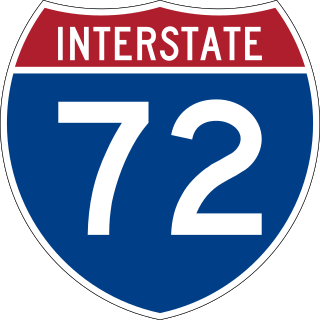
Interstate 72 (I-72) is an Interstate Highway in the midwestern United States. Its western terminus is in Hannibal, Missouri, at an intersection with U.S. Route 61 (US 61); its eastern terminus is at Country Fair Drive in Champaign, Illinois. The route runs through the major cities of Decatur, Illinois, and Springfield, Illinois. In 2006, the Illinois General Assembly dedicated all of I-72 as Purple Heart Memorial Highway. The stretch between Springfield and Decatur is also called Penny Severns Memorial Expressway, and the section between mile 35 and the Mississippi River is known as the Free Frank McWorter Historic Highway.
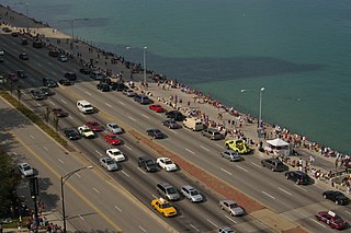
Lake Shore Drive is a multilevel expressway that runs alongside the shoreline of Lake Michigan, and adjacent to parkland and beaches, in Chicago. Except for the portion north of Foster Avenue, Lake Shore Drive is designated as part of U.S. Highway 41.
The Avenue of the Saints is a 563-mile-long (906 km) highway in the Midwestern United States that connects St. Louis, Missouri and St. Paul, Minnesota.
William R. Allen Road, also known as Allen Road, the Allen Expressway and colloquially as the Allen, is a short expressway and arterial road in Toronto. It starts as a controlled-access expressway at Eglinton Avenue West, heading north to just south of Transit Road, then continues as an arterial road north to Kennard Avenue, where it continues as Dufferin Street. Allen Road is named after Metro Toronto chairman William R. Allen and is maintained by the City of Toronto. Landmarks along the road include the Lawrence Heights housing project, Yorkdale Shopping Centre and Downsview Park, and Downsview Airport. A section of the Line 1 Yonge–University subway is located within the median of the expressway from Eglinton Avenue to north of Wilson Avenue.
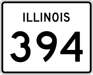
Illinois Route 394, also known as the Calumet Expressway, is a 14.6-mile-long (23.5 km) four-lane state highway that travels north from a junction with IL 1 south of Crete to an interchange in South Holland with Interstate 294/Interstate 94/Interstate 80. Although not an Interstate Highway, Illinois 394 is an Interstate-standard highway from its junction with Sauk Trail at Sauk Village to its northern terminus at the I-294/I-94/I-80 interchange in South Holland. IL 394 functions as a bypass of IL 1 to the west, of which it was formerly part, and provides access to southern suburbs of Chicago.
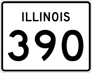
Illinois Route 390 (IL 390), previously known as the Elgin–O'Hare Expressway, now known as the Elgin–O'Hare Tollway, is a 9.8-mile-long (15.8 km) electronic toll highway in northeastern Illinois. IL 390 currently connects U.S. Route 20 in Hanover Park to the interchange with Illinois Route 83 and Thorndale Avenue in Wood Dale. The only other towns it borders are Schaumburg and Roselle. Construction is underway to extend the road from IL 83 to the western edge of O'Hare International Airport.

Interstate 88 (I-88) is an Interstate Highway in the US state of Illinois that runs from an interchange with I-80 near Silvis and Moline to an interchange with I-290 and I-294 in Hillside, near Chicago. I-88 is 140.60 miles (226.27 km) long. This route is not contiguous with I-88 in New York. Since 2010, most of I-88 has been part of the Chicago–Kansas City Expressway. The highway also runs through the cities of Aurora, Naperville, DeKalb, and Dixon. East of Rock Falls, the route is a part of the Illinois Tollway system.

Route 37 is a state highway running 3.47 miles (5.58 km) in Providence County and Kent County, Rhode Island, United States. A freeway for its entire length, it serves the cities of Cranston and Warwick and is also a major east–west freeway in the Providence metropolitan area, linking T. F. Green Airport with Interstate 295. The western terminus of Route 37 is an at-grade intersection with Natick Avenue in Cranston. The freeway has numbered interchanges with I-295, Rhode Island Route 2, Pontiac Avenue, and I-95 before terminating at a trumpet interchange with U.S. Route 1 in Warwick.

The cancelled expressways in Toronto were a planned series of expressways in Toronto, Ontario, Canada that were only partially built or cancelled due to public opposition. The system of expressways was intended to spur or handle growth in the suburbs of Toronto, but were opposed by citizens within the city of Toronto proper, citing the demolition of homes and park lands, air pollution, noise and the high cost of construction. The Spadina Expressway, planned since the 1940s, was cancelled in 1971 after being only partially constructed. After the Spadina cancellation, other expressway plans, intended to create a 'ring' around the central core, were abandoned.
Black Creek Drive is a four lane north–south arterial road in Toronto, Ontario, Canada. It connects Weston Road and Humber Boulevard with Highway 401 via Highway 400, the latter of which it forms a southerly extension. Black Creek Drive officially transitions into Highway 400 at the Maple Leaf Drive overpass, southeast of Jane Street. The roadway is named after the Black Creek ravine, which it parallels for most of its route. It features a maximum speed limit of 70 km/h (43 mph). As a municipal road, it is patrolled by the Toronto Police Service.

Illinois Route 137 is a 23.49-mile-long (37.80 km) state highway in northeast Illinois. It runs from the Wisconsin Border north of Winthrop Harbor south to North Chicago, west to Libertyville, and then back northwest to Grayslake, terminating at IL 83 just south of IL 120.
The Mount Hood Freeway is a partially constructed but never to be completed freeway alignment of U.S. Route 26 and Interstate 80N, which would have run through southeast Portland, Oregon. Related projects would have continued the route through the neighboring suburb of Gresham, out to the city of Sandy.
The Mid-City Transitway is a concept for the use of the right-of-way formerly proposed for the Crosstown Expressway in Chicago, Illinois. The uses being studied include a bus-only rapid-transit road, a truck-only bypass around the city center, or a rail rapid transit system.
The Chicago Central Area Transit Plan, generally referred to as the Chicago Central Area Transit Project (CCATP) in the 1970s, was an extensive study of the rapid transit system in downtown Chicago; the study had begun in 1965.
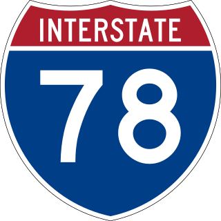
Interstate 78 (I-78) is a part of the Interstate Highway System that runs from Union Township, Lebanon County, Pennsylvania, to New York City. In the US state of New York, I-78 extends 0.5 miles (0.80 km). The entirety of I-78 consists of the Holland Tunnel, which crosses under the Hudson River from New Jersey and ends at an exit rotary in Lower Manhattan. The tunnel and its approaches are maintained by the Port Authority of New York and New Jersey (PANYNJ).

Interstate 94 (I-94) generally runs north–south through the northeastern portion of the US state of Illinois, in Lake and Cook counties. It is signed east–west in Illinois in accordance with its general alignment across the country, with west signage aligned with northbound travel and vice versa. I-94 in Illinois is 61.53 miles (99.02 km) long.

Minnesota State Highway 62 (MN 62) is a highway in the Twin Cities region of Minnesota. The route was part of County Road 62 (CR 62) until 1988, when a portion of the route was inherited by the state. The western terminus of the highway is at Interstate 494 (I-494) in Eden Prairie, where the roadway continues west as CR 62 to CR 101. The eastern terminus of the route is at the junction with I-494 in Inver Grove Heights. Locally, the original portion of the route in Hennepin County is known as "the Crosstown Highway" or simply "the Crosstown," though signage with this name does not appear on the highway itself, but only on local streets adjacent to the road. It is also used as an alternate name, even by the Minnesota Department of Transportation (MnDOT). The route is 18.6 miles (29.9 km) in length.
Conduit Avenue is an arterial road in New York City, the vast majority of which is in Queens. The divided highway runs from Atlantic Avenue in Cypress Hills, Brooklyn to Hook Creek Boulevard in Rosedale, Queens at the Nassau County border. The thoroughfare is named after an aqueduct in its right-of-way.
The Oklahoma City Boulevard is an urban thoroughfare in Oklahoma City, Oklahoma, US. The highway makes use of the former right-of-way of Interstate 40 (I-40), which was relocated to the south along a former rail alignment due to increased traffic and visible wear on parts of the freeway. A $85 million project by the Oklahoma Department of Transportation (ODOT) with funds from the US Department of Transportation began construction in 2011.
Highway revolts have occurred in cities and regions across the United States. In many cities, there remain unused highways, abruptly terminating freeway alignments, and short stretches of freeway in the middle of nowhere, all of which are evidence of larger projects which were never completed. In some instances, freeway revolts have led to the eventual removal or relocation of freeways that had been built.

