Dayton, Oregon

Last updated

Dayton, Oregon
Joel Palmer House front left P2294.jpeg
Yamhill County Oregon Incorporated and Unincorporated areas Dayton Highlighted.svg
Location in Oregon
Coordinates: 45°13′11″N123°04′41″W / 45.21972°N 123.07806°W / 45.21972; -123.07806
Country United States
State Oregon
County Yamhill
Incorporated 1880
Government
   Mayor Annette Frank
Area
[1]
  Total0.84 sq mi (2.17 km2)
  Land0.84 sq mi (2.17 km2)
  Water0.00 sq mi (0.00 km2)
Elevation
[2]
161 ft (49 m)
Population
 (2020) [3]
  Total2,678
  Density3,203.35/sq mi (1,236.55/km2)
Time zone UTC-8 (Pacific)
  Summer (DST) UTC-7 (Pacific)
ZIP code
97114
Area code 503
FIPS code 41-18250 [4]
GNIS feature ID2410299 [2]
Website www.daytonoregon.gov

Dayton is a city in Yamhill County, Oregon, United States. The population was 2,678 at the 2020 census.

Contents

History

The city was founded in 1850 by Andrew Smith and Joel Palmer. [5] Palmer, who also served as superintendent of Indian affairs for Oregon, [5] built a flour mill there. Dayton was named for Smith's hometown, Dayton, Ohio. [5] Dayton post office was opened in 1851, with Christopher Taylor serving as postmaster.

There are many historic landmarks throughout the city. The oldest standing structure is the Joel Palmer House, built in 1852 or 1857. It has been on the National Register of Historic Places since March 16, 1987, and has been painstakingly restored. Since 1996, it has been home to a four-star restaurant of the same name as the historic house.

Nearby, in Courthouse Square Park, is the Fort Yamhill Block House, which was brought to Dayton in 1911 to prevent its demolition. The structure had been built by Willamette Valley settlers on Fort Hill in the Grand Ronde Valley in 1855 and 1856. John G. Lewis, a citizen of Dayton, secured permission from authorities to move the logs to Dayton, where they were reassembled. [5]

Geography

Fort Yamhill blockhouse, in Courthouse Square Park Fort Yamhill blockhouse - Dayton, Oregon.jpg
Fort Yamhill blockhouse, in Courthouse Square Park

Dayton is located in the Willamette Valley, approximately 25 miles (40 km) southwest of Portland and seven miles (11 km) east of McMinnville.

According to the United States Census Bureau, the city has a total area of 0.84 square miles (2.18 km2), all of it land. [6]

Demographics

Historical population
CensusPop.Note
1880 368
1890 304−17.4%
1900 293−3.6%
1910 45354.6%
1920 448−1.1%
1930 375−16.3%
1940 50634.9%
1950 71942.1%
1960 673−6.4%
1970 94941.0%
1980 1,40948.5%
1990 1,5268.3%
2000 2,11938.9%
2010 2,53419.6%
2020 2,6785.7%
U.S. Decennial Census [7] [3]

2010 census

As of the census [8] of 2010, there were 2,534 people, 797 households, and 624 families living in the city. The population density was 3,016.7 inhabitants per square mile (1,164.8/km2). There were 843 housing units at an average density of 1,003.6 per square mile (387.5/km2). The racial makeup of the city was 79.2% White, 0.5% African American, 1.0% Native American, 0.9% Asian, 14.7% from other races, and 3.7% from two or more races. Hispanic or Latino of any race were 29.9% of the population.

There were 797 households, of which 48.6% had children under the age of 18 living with them, 58.8% were married couples living together, 14.1% had a female householder with no husband present, 5.4% had a male householder with no wife present, and 21.7% were non-families. 15.8% of all households were made up of individuals, and 6.2% had someone living alone who was 65 years of age or older. The average household size was 3.18 and the average family size was 3.52.

The median age in the city was 32.8 years. 32.6% of residents were under the age of 18; 7.8% were between the ages of 18 and 24; 26.6% were from 25 to 44; 22.9% were from 45 to 64; and 10.1% were 65 years of age or older. The gender makeup of the city was 49.6% male and 50.4% female.

2000 census

As of the census [4] of 2000, there were 2,119 people, 641 households, and 516 families living in the city. The population density was 2,935.4 inhabitants per square mile (1,133.4/km2). There were 656 housing units at an average density of 908.7 per square mile (350.9/km2). The racial makeup of the city was 80.70% White, 1.56% African American, 1.18% Native American, 0.52% Asian, 11.80% from other races, and 4.25% from two or more races. Hispanic or Latino of any race were 26.19% of the population.

There were 641 households, out of which 49.6% had children under the age of 18 living with them, 60.4% were married couples living together, 15.1% had a female householder with no husband present, and 19.5% were non-families. 15.4% of all households were made up of individuals, and 6.4% had someone living alone who was 65 years of age or older. The average household size was 3.31 and the average family size was 3.66.

In the city, the population was spread out, with 36.7% under the age of 18, 7.7% from 18 to 24, 30.2% from 25 to 44, 17.7% from 45 to 64, and 7.6% who were 65 years of age or older. The median age was 29 years. For every 100 females, there were 96.0 males. For every 100 females age 18 and over, there were 96.1 males.

The median income for a household in the city was $40,556, and the median income for a family was $43,047. Males had a median income of $32,500 versus $23,125 for females. The per capita income for the city was $13,140. About 11.7% of families and 14.1% of the population were below the poverty line, including 16.6% of those under age 18 and 12.5% of those age 65 or over.

Economy

Dayton is a rural community, with many people involved in agriculture such as vegetable, berry, nut, nursery plants, wheat production and dairy farming. The vineyards and wineries located in the Willamette Valley AVA and the Dundee Hills AVA are an increasing source of direct economic activity as well as a source of visitors to the city. [9]

Transportation

Dayton is served by three signed Oregon state highways and one unsigned state highway:

Prior to the construction of Highway 18 as a limited-access bypass of Dayton and McMinnville, Highway 233 continued east on its old route (SE Amity-Dayton Highway) into downtown Dayton, where it was named Ferry Street. The highway crossed the Yamhill River via ferry to the northeast side of the river at what is now called Alderman Park. There, Highway 233 continued northeast along SE Kreder Road to its northern terminus at what was then numbered as US Route 99W. During this period, the northern terminus of Highway 221 was located at its intersection with Ferry Street.

Government

Sometime in the late 19th century to early 20th century, land was donated for the construction of a city hall and library by a community member named Mary Gilkey. The current city hall and library used to be a firehouse. The library is part of the Chemeketa Cooperative Regional Library Service.

Education

Dayton has three schools within the Dayton School District: Dayton Grade School, Dayton Middle School and Dayton High School. [10] The school mascot is the Pirate.

Notable people

See also

Related Research Articles

<span class="mw-page-title-main">Tigard, Oregon</span> City in Oregon, United States

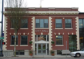
Tigard is a city in Washington County, Oregon, United States. The population was 54,539 at the 2020 census, making it the 12th most populous city in Oregon. Incorporated in 1961, the city is located south of Beaverton and north of Tualatin, and is part of the Portland metropolitan area. Interstate 5 and Oregon Route 217 are the main freeways in the city, with Oregon Route 99W and Oregon Route 210 serving as other major highways. Public transit service is provided by TriMet, via several bus routes and the WES Commuter Rail line.

<span class="mw-page-title-main">Washington County, Oregon</span> County in Oregon, United States

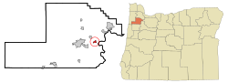
Washington County is one of 36 counties in the U.S. state of Oregon and part of the Portland metropolitan area. The 2020 census recorded the population as 600,372, making it the second most populous county in the state and most populous "Washington County" in the United States. Hillsboro is the county seat and largest city, while other major cities include Beaverton, Tigard, Cornelius, Banks, Gaston, Sherwood, North Plains, and Forest Grove, the county's oldest city. Originally named Twality when created in 1843, the Oregon Territorial Legislature renamed it for the nation's first president in 1849 and included the entire northwest corner of Oregon before new counties were created in 1854. The Tualatin River and its drainage basin lie almost entirely within the county, which shares its boundaries with the Tualatin Valley. It is bordered on the west and north by the Northern Oregon Coast Range, on the south by the Chehalem Mountains, and on the north and east by the Tualatin Mountains, or West Hills.

<span class="mw-page-title-main">Yamhill County, Oregon</span> County in Oregon, United States

Yamhill County is one of the 36 counties in the U.S. state of Oregon. As of the 2020 census, the population was 107,722. The county seat is McMinnville. Yamhill County was named after the Yamhelas, members of the Kalapuya Tribe.

<span class="mw-page-title-main">Polk County, Oregon</span> County in Oregon, United States

Polk County is one of the 36 counties in the U.S. state of Oregon. As of the 2020 census, the population was 87,433. The county seat is Dallas. The county is named for James Knox Polk, the 11th president of the United States.

<span class="mw-page-title-main">Marion County, Oregon</span> County in Oregon, United States

Marion County is one of the 36 counties in the U.S. state of Oregon. The population was 345,920 at the 2020 census, making it the 5th most populous county in Oregon. The county seat is Salem, which is also the state capital of Oregon. The county was originally named the Champooick District, after Champoeg, a meeting place on the Willamette River. On September 3, 1849, the territorial legislature renamed it in honor of Francis Marion, a Continental Army general from South Carolina who served in the American Revolutionary War.

<span class="mw-page-title-main">Monroe, Oregon</span> City in Benton County, Oregon

Monroe is a city in Benton County, Oregon, United States. The population was 651 at the 2018 census. It is part of the Corvallis, Oregon Metropolitan Statistical Area. Monroe is located midway between Eugene and Corvallis along Highway 99W.

<span class="mw-page-title-main">Creswell, Oregon</span> City in Oregon, United States

Creswell is a city in the Willamette Valley of Lane County, Oregon, United States, located 13 miles (21 km) south of Eugene, Oregon. The population at the 2010 census was 5,031.

<span class="mw-page-title-main">Stayton, Oregon</span> City in Oregon, United States

Stayton is a city in Marion County, Oregon, United States, located 12 miles (19 km) southeast of the state capital, Salem, on Oregon Route 22. It is south of Sublimity and east of Aumsville. Located on the North Santiam River, Stayton is a regional agricultural and light manufacturing center. The population was 8,244 at the 2020 census. Established in 1872, it was incorporated in 1891. Stayton is part of the Salem Metropolitan Statistical Area.

<span class="mw-page-title-main">Independence, Oregon</span> City in Oregon, United States

Independence is a city in Polk County, Oregon, United States, on the west bank of the Willamette River along Oregon Route 51, and east of nearby Monmouth. It is part of the Salem Metropolitan Statistical Area. Thirty square blocks of the oldest part of Independence form the National Register of Historic Places-listed Independence Historic District.

<span class="mw-page-title-main">Monmouth, Oregon</span> City in Oregon, United States

Monmouth is a city in Polk County in the U.S. state of Oregon. It was named for Monmouth, Illinois, the origin of its earliest settlers. The population is 11,110 at the 2020 Census and it is part of the Salem Metropolitan Statistical Area.

<span class="mw-page-title-main">Forest Grove, Oregon</span> City in Oregon, United States

Forest Grove is a city in Washington County, Oregon, United States, 25 miles (40 km) west of Portland. Originally a small farm town, it is now primarily a commuter town in the Portland metro area. Settled in the 1840s, the town was platted in 1850, then incorporated in 1872, making it the first city in Washington County. The population was 21,083 at the 2010 census, an increase of 19.1% over the 2000 figure (17,708).

<span class="mw-page-title-main">Sherwood, Oregon</span> City in Oregon, United States

Sherwood is a city in Washington County, Oregon, United States. Located in the southeast corner of the county, it is a residential community in the Tualatin Valley, southwest of Portland. The population was 20,450 at the 2020 census. Sherwood was first incorporated in 1893 as a town. Originally named Smockville after its founder, James Christopher Smock, the town was given its current name by local businessman Robert Alexander in 1891. The name "Sherwood" may have come from Sherwood, Michigan or the Sherwood Forest in England.

<span class="mw-page-title-main">Amity, Oregon</span> City in Oregon, United States

Amity is a city in Yamhill County, Oregon, United States. As of the 2020 Census, the population was 1,757.

<span class="mw-page-title-main">Dundee, Oregon</span> City in Oregon, United States

Dundee is a city in Yamhill County, Oregon, United States. The population was 3,238 at the 2020 census.

<span class="mw-page-title-main">Lafayette, Oregon</span> City in Oregon, United States

Lafayette is a city in Yamhill County, Oregon, United States on the Yamhill River and Oregon Route 99W. It was founded in 1846 and incorporated in 1878. The population was 4,423 at the 2020 census.

<span class="mw-page-title-main">McMinnville, Oregon</span> City in Oregon, United States

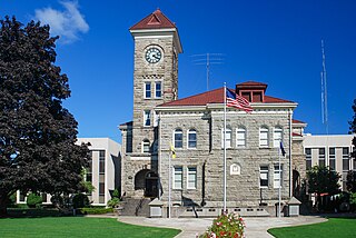
McMinnville is the county seat of and most populous city in Yamhill County, Oregon, United States. The city is named after McMinnville, Tennessee. As of the 2020 census, the city had a population of 34,319.

<span class="mw-page-title-main">Newberg, Oregon</span> City in Oregon, United States

Newberg is a city in Yamhill County, Oregon, United States. Located in the Portland metropolitan area, the city is home to George Fox University. As of the 2020 census, the city population was 25,138 making it the second most populous city in the county.

<span class="mw-page-title-main">Sheridan, Oregon</span> City in Oregon, United States

Sheridan is a city in Yamhill County, Oregon, United States. Platted in the 1860s when it received a post office, the city was incorporated in 1880. A major fire burned much of the city in 1913, and a flood covered much of the city in 1964. The population of the city as of the 2020 Census was 6,100, a decrease from 6,127 at the 2010 census.

<span class="mw-page-title-main">Yamhill, Oregon</span> City in Oregon, United States

Yamhill is a city in Yamhill County, Oregon, United States. Located in the northern part of the county, it is situated at the intersection of Oregon Route 47 and Oregon Route 240. The population was 1,147 at the 2020 census. Originally named North Yamhill, it was incorporated under that name by the Oregon Legislative Assembly on February 20, 1891.

<span class="mw-page-title-main">Willamina, Oregon</span> City in Oregon, United States

Willamina is a city in Polk and Yamhill Counties in the U.S. state of Oregon. The population was 2,239 at the 2020 census.

References

  1. "ArcGIS REST Services Directory". United States Census Bureau. Retrieved October 12, 2022.
  2. 1 2 U.S. Geological Survey Geographic Names Information System: Dayton, Oregon
  3. 1 2 "Census Population API". United States Census Bureau. Retrieved October 12, 2022.
  4. 1 2 "U.S. Census website". United States Census Bureau . Retrieved January 31, 2008.
  5. 1 2 3 4 McArthur, Lewis A.; McArthur, Lewis L. (2003) [1928]. Oregon Geographic Names (7th ed.). Portland, Oregon: Oregon Historical Society Press. p. 209–210. ISBN   978-0875952772.
  6. "US Gazetteer files 2010". United States Census Bureau. Archived from the original on July 2, 2012. Retrieved December 21, 2012.
  7. "Census of Population and Housing". Census.gov. Retrieved June 4, 2015.
  8. "U.S. Census website". United States Census Bureau . Retrieved December 21, 2012.
  9. "The Economic Impact of the Wine and Wine Grape Industries on the Oregon Economy 2013 | Oregon Wine Industry". industry.oregonwine.org. Retrieved March 12, 2017.
  10. "Dayton School District". Archived from the original on October 8, 2006. Retrieved November 15, 2006.
  11. "Dante Rosario Stats". Pro-Football-Reference. High School: Dayton (OR)
  12. "Dewey Sullivan – Coaching". Oregon Sports Hall of Fame & Museum. Dewey Sullivan coached football at Dayton High School from 1965 to 2006, compiling a record of 352-84-2.
  13. Krupke, Nick (April 30, 2017). "From Dayton to the UFC: Paige VanZant returns home to Oregon". KPTV. For myself, coming from the small town, I lived in Dayton, Oregon.