Deaver, Wyoming

Last updated

Deaver, Wyoming
Big Horn County Wyoming Incorporated and Unincorporated areas Deaver Highlighted 5619530.svg
Location of Deaver in Big Horn County, Wyoming.
Usa edcp location map.svg
Red pog.svg
Deaver, Wyoming
Location in the United States
Coordinates: 44°53′26″N108°35′49″W / 44.89056°N 108.59694°W / 44.89056; -108.59694
Country United States
State Wyoming
County Big Horn
Area
[1]
  Total1.01 sq mi (2.62 km2)
  Land1.01 sq mi (2.62 km2)
  Water0.00 sq mi (0.00 km2)
Elevation
4,108 ft (1,252 m)
Population
 (2010) [2]
  Total178
  Estimate 
(2019) [3]
181
  Density178.68/sq mi (69.01/km2)
Time zone UTC-7 (Mountain (MST))
  Summer (DST) UTC-6 (MDT)
ZIP code
82421
Area code 307
FIPS code 56-19530 [4]
GNIS feature ID1587452 [5]

Deaver is a town in Big Horn County, Wyoming, United States. The population was 178 at the 2010 census.

Contents

Geography

Deaver is located at 44°53′26″N108°35′49″W / 44.89056°N 108.59694°W / 44.89056; -108.59694 (44.890439, −108.596860). [6]

According to the United States Census Bureau, the town has a total area of 1.01 square miles (2.62 km2), all land. [7]

Climate

According to the Köppen Climate Classification system, Deaver has a cold desert climate, abbreviated "BWk" on climate maps. The hottest temperature recorded in Deaver was 106 °F (41 °C) on July 14, 1925, July 28, 1935, July 9, 2002, and July 13, 2002, while the coldest temperature recorded was −42 °F (−41 °C) on December 13, 1919. [8]

Climate data for Deaver, Wyoming, 1991–2020 normals, extremes 1919–present
MonthJanFebMarAprMayJunJulAugSepOctNovDecYear
Record high °F (°C)64
(18)
74
(23)
82
(28)
90
(32)
98
(37)
105
(41)
106
(41)
104
(40)
102
(39)
91
(33)
76
(24)
66
(19)
106
(41)
Mean maximum °F (°C)49.0
(9.4)
54.9
(12.7)
69.0
(20.6)
79.7
(26.5)
87.3
(30.7)
94.4
(34.7)
100.0
(37.8)
98.4
(36.9)
91.9
(33.3)
80.7
(27.1)
64.0
(17.8)
53.1
(11.7)
100.3
(37.9)
Mean daily maximum °F (°C)30.6
(−0.8)
36.6
(2.6)
50.8
(10.4)
59.9
(15.5)
69.6
(20.9)
79.9
(26.6)
89.5
(31.9)
87.8
(31.0)
76.7
(24.8)
61.2
(16.2)
45.4
(7.4)
32.9
(0.5)
60.1
(15.6)
Daily mean °F (°C)18.6
(−7.4)
24.3
(−4.3)
37.0
(2.8)
46.0
(7.8)
56.1
(13.4)
65.5
(18.6)
73.5
(23.1)
71.3
(21.8)
60.5
(15.8)
46.9
(8.3)
32.6
(0.3)
20.9
(−6.2)
46.1
(7.8)
Mean daily minimum °F (°C)6.5
(−14.2)
11.9
(−11.2)
23.3
(−4.8)
32.0
(0.0)
42.6
(5.9)
51.1
(10.6)
57.4
(14.1)
54.9
(12.7)
44.4
(6.9)
32.5
(0.3)
19.8
(−6.8)
8.8
(−12.9)
32.1
(0.0)
Mean minimum °F (°C)−14.8
(−26.0)
−8.6
(−22.6)
2.7
(−16.3)
16.2
(−8.8)
27.4
(−2.6)
38.5
(3.6)
46.7
(8.2)
43.1
(6.2)
30.5
(−0.8)
15.5
(−9.2)
−0.1
(−17.8)
−9.0
(−22.8)
−18.0
(−27.8)
Record low °F (°C)−38
(−39)
−39
(−39)
−24
(−31)
−11
(−24)
14
(−10)
23
(−5)
35
(2)
25
(−4)
11
(−12)
−6
(−21)
−23
(−31)
−42
(−41)
−42
(−41)
Average precipitation inches (mm)0.09
(2.3)
0.15
(3.8)
0.21
(5.3)
0.40
(10)
1.10
(28)
1.09
(28)
0.55
(14)
0.35
(8.9)
0.59
(15)
0.59
(15)
0.24
(6.1)
0.15
(3.8)
5.51
(140.2)
Average snowfall inches (cm)3.2
(8.1)
2.5
(6.4)
1.3
(3.3)
0.8
(2.0)
0.1
(0.25)
0.0
(0.0)
0.0
(0.0)
0.0
(0.0)
0.0
(0.0)
0.6
(1.5)
1.4
(3.6)
2.3
(5.8)
12.2
(30.95)
Average precipitation days (≥ 0.01 in)2.32.41.83.85.45.63.63.43.23.31.72.038.5
Average snowy days (≥ 0.1 in)2.01.90.80.50.10.00.00.00.00.40.71.98.3
Source 1: NOAA [9]
Source 2: National Weather Service [8]

Demographics

Historical population
CensusPop.Note
1920 142
1930 85−40.1%
1940 11130.6%
1950 1186.3%
1960 1212.5%
1970 112−7.4%
1980 17858.9%
1990 19911.8%
2000 177−11.1%
2010 1780.6%
2019 (est.)181 [3] 1.7%
U.S. Decennial Census [10]

2010 census

As of the census [2] of 2010, there were 178 people, 66 households, and 48 families residing in the town. The population density was 176.2 inhabitants per square mile (68.0/km2). There were 84 housing units at an average density of 83.2 per square mile (32.1/km2). The racial makeup of the town was 96.6% White, 2.8% from other races, and 0.6% from two or more races. Hispanic or Latino of any race were 6.7% of the population.

There were 66 households, of which 37.9% had children under the age of 18 living with them, 62.1% were married couples living together, 4.5% had a female householder with no husband present, 6.1% had a male householder with no wife present, and 27.3% were non-families. 18.2% of all households were made up of individuals, and 3% had someone living alone who was 65 years of age or older. The average household size was 2.70 and the average family size was 3.08.

The median age in the town was 39 years. 26.4% of residents were under the age of 18; 10.7% were between the ages of 18 and 24; 19.6% were from 25 to 44; 33.8% were from 45 to 64; and 9.6% were 65 years of age or older. The gender makeup of the town was 53.4% male and 46.6% female.

2000 census

As of the census [4] of 2000, there were 177 people, 65 households, and 44 families residing in the town. The population density was 174.0 people per square mile (67.0/km2). There were 80 housing units at an average density of 78.7 per square mile (30.3/km2). The racial makeup of the town was 94.92% White, 1.13% Native American, 2.82% from other races, and 1.13% from two or more races. Hispanic or Latino of any race were 8.47% of the population.

There were 65 households, out of which 46.2% had children under the age of 18 living with them, 60.0% were married couples living together, 4.6% had a female householder with no husband present, and 32.3% were non-families. 26.2% of all households were made up of individuals, and 9.2% had someone living alone who was 65 years of age or older. The average household size was 2.72 and the average family size was 3.34.

In the town, the population was spread out, with 35.0% under the age of 18, 6.8% from 18 to 24, 32.2% from 25 to 44, 17.5% from 45 to 64, and 8.5% who were 65 years of age or older. The median age was 30 years. For every 100 females, there were 110.7 males. For every 100 females age 18 and over, there were 101.8 males.

The median income for a household in the town was $31,071, and the median income for a family was $34,063. Males had a median income of $31,563 versus $15,938 for females. The per capita income for the town was $14,134. About 14.0% of families and 10.4% of the population were below the poverty line, including 6.3% of those under the age of eighteen and none of those 65 or over.

Education

Public education in Deaver is provided by Big Horn County School District Number 1. The district operates Rocky Mountain Middle/High School in Cowley, and Rocky Mountain Elementary School in Cowley.

Deaver has a public library, a branch of the Big Horn County Library System. [11]

Related Research Articles

<span class="mw-page-title-main">Summerfield, Illinois</span> Village in Illinois, United States

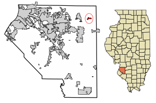
Summerfield is a village in St. Clair County, Illinois, United States. The population was 451 at the 2010 census.

<span class="mw-page-title-main">Sulphur Springs, Indiana</span> Town in Indiana, United States

Sulphur Springs is a town in Jefferson Township, Henry County, Indiana, United States. As of the 2010 census, the town's population was 399.

<span class="mw-page-title-main">Rowley, Iowa</span> City in Iowa, United States

Rowley is a city in Buchanan County, Iowa, United States. The population was 270 at the time of the 2020 census.

<span class="mw-page-title-main">Haddam, Kansas</span> City in Washington County, Kansas

Haddam is a city in Washington County, Kansas, United States. It is named after Haddam, Connecticut. As of the 2020 census, the population of the city was 110.

<span class="mw-page-title-main">Castle Hill, Maine</span> Town in the state of Maine, United States

Castle Hill is a town in Aroostook County, Maine, United States. The population was 373 people at the 2020 census.

<span class="mw-page-title-main">Dyer Brook, Maine</span> Town in the state of Maine, United States

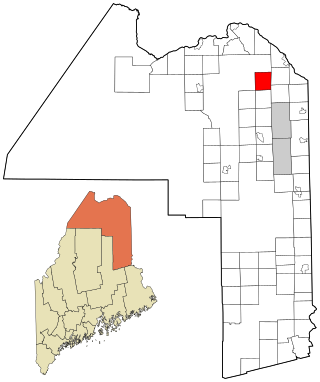
Dyer Brook is a town in Aroostook County, Maine, United States. The population was 215 at the 2020 census. Dyer Brook is also host to the local school, Southern Aroostook Community School.

<span class="mw-page-title-main">New Canada, Maine</span> Town in the state of Maine, United States

New Canada is a town in Aroostook County, Maine, United States. The population was 310 at the 2020 census.

<span class="mw-page-title-main">Oakfield, Maine</span> Town in the state of Maine, United States

Oakfield is a town in Aroostook County, Maine, United States. The population was 661 at the 2020 census. The village of Oakfield, listed as a census-designated place, is in the northwestern corner of the town.

<span class="mw-page-title-main">Stockholm, Maine</span> Town in the state of Maine, United States

Stockholm is a town in Aroostook County, Maine, United States. The population was 250 at the 2020 census.

<span class="mw-page-title-main">Gilead, Maine</span> Town in the state of Maine, United States

Gilead is a town in Oxford County, Maine, United States. Upon incorporation in 1804, it was named for the large quantity of Balm of Gilead trees in the town center. The population was 195 at the 2020 census.

<span class="mw-page-title-main">Upton, Maine</span> Town in the state of Maine, United States

Upton is a town in Oxford County, Maine, United States. The population was 69 at the 2020 census.

Woodville is a town in Penobscot County, Maine, United States. The population was 201 at the 2020 census.

Northfield is a town in Washington County, Maine, United States. The population was 178 at the 2020 census.

<span class="mw-page-title-main">Winifred, Montana</span> Town in Montana, United States

Winifred is a small town in rural north-central Fergus County, Montana, United States. It was founded in 1913 and provides services for its region's populace. The town population was 172 at the 2020 census. The current mayor is Travis Willson.

<span class="mw-page-title-main">Stockholm, South Dakota</span> Town in South Dakota, United States

Stockholm is a town in Grant County, South Dakota, United States. The population was 102 at the 2020 census.

<span class="mw-page-title-main">Keystone, South Dakota</span> Town in South Dakota, United States

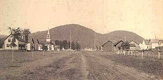
Keystone is a town in the Black Hills region of Pennington County, South Dakota, United States. The population was 240 at the 2020 census. It had its origins in 1883 as a mining town, and has since transformed itself into a resort town, serving the needs of the millions of visitors to the Mount Rushmore National Memorial, which is located just beyond the town limits. Keystone was heavily damaged in the 1972 Black Hills flood.

<span class="mw-page-title-main">Brentford, South Dakota</span> Town in South Dakota, United States

Brentford is a town in Spink County, South Dakota, United States. The population was 88 at the 2020 census.

<span class="mw-page-title-main">Poynor, Texas</span> Town in United States

Poynor is a town in Henderson County, Texas, United States. The population was 305 at the 2010 census.

<span class="mw-page-title-main">Bancroft, West Virginia</span> Town in West Virginia, United States

Bancroft is a town in Putnam County, West Virginia, United States, along the Kanawha River. The population was 389 at the 2020 census. It is part of the Huntington–Ashland metropolitan area.

<span class="mw-page-title-main">Flemington, West Virginia</span> Town in West Virginia, United States

Flemington is a town in Taylor County, West Virginia, United States. The population was 311 at the 2020 census. Flemington was incorporated in 1922 by the West Virginia Circuit Court, and named for James Fleming, an early settler in the area originally from Hampshire County.

References

  1. "2019 U.S. Gazetteer Files". United States Census Bureau. Retrieved August 7, 2020.
  2. 1 2 "U.S. Census website". United States Census Bureau . Retrieved December 14, 2012.
  3. 1 2 "Population and Housing Unit Estimates". United States Census Bureau. May 24, 2020. Retrieved May 27, 2020.
  4. 1 2 "U.S. Census website". United States Census Bureau . Retrieved January 31, 2008.
  5. "US Board on Geographic Names". United States Geological Survey. October 25, 2007. Retrieved January 31, 2008.
  6. "US Gazetteer files: 2010, 2000, and 1990". United States Census Bureau. February 12, 2011. Retrieved April 23, 2011.
  7. "US Gazetteer files 2010". United States Census Bureau. Archived from the original on January 25, 2012. Retrieved December 14, 2012.
  8. 1 2 "NOAA Online Weather Data". National Weather Service. Retrieved August 16, 2022.
  9. "U.S. Climate Normals Quick Access". National Oceanic and Atmospheric Administration. Retrieved August 16, 2022.
  10. "Census of Population and Housing". Census.gov. Retrieved June 4, 2015.
  11. "Wyoming Public Libraries". PublicLibraries.com. Retrieved June 13, 2019.