Dixie Overland Highway

Last updated

Dixie Overland Highway sign 1.svg

Dixie Overland Highway

Route information
Existed1914–present
Major junctions
West end San Diego, CA
East end Savannah, GA
Location
Country United States
Highway system

The Dixie Overland Highway was an auto trail across the southern United States. It was conceived in July 1914 by the Automobile Club of Savannah, which envisioned a practical all-year driving route from Georgia to California. It was originally developed as a cross-country route, from the Pacific Ocean to the Atlantic Ocean making history as the first ever ocean to ocean highway route. In 1925, the federal Joint Board on Interstate Highways created U.S. Route 80, largely following the route of the Dixie Overland Highway.

Contents

History

Established in 1914 by the Automobile Club of Savannah, the Dixie Overland Highway auto trail was the first major route connecting San Diego, California, and Savannah, Georgia. In July 1914, the Automobile Club of Savannah, Georgia, made a path-finding tour across the state of Georgia to Columbus. They found a practical route, constructed road made up about one-half of the route. A meeting was held in Columbus. It was determined to secure the construction of the entire highway. The cross Georgia highway continued to stretch the idea suggested by the pioneers, and a sea-to-sea highway.

An association was formed, officers were elected, and a plan of operation agreed voted upon. Construction was promoted and the use of the highway would be through the states of Georgia, Alabama, Mississippi, Louisiana, Texas, New Mexico, Arizona, and California. After investigating and researching where the most efficient points of interest would be in order to determine the location of the highway, a practical route was found, connecting the cities of Savannah, Columbus, Montgomery, Selma, Meridian, Jackson, Vicksburg, Shreveport, Dallas, Fort Worth, Alamogordo, El Paso, Lordsburg, Douglas, Phoenix, Yuma, San Diego, and Los Angeles, which were almost guaranteed to never be snowbound, and provide all-year road access.

It was then developed that the Dixie Overland Highway when constructed would be the shortest, straightest, and only year-round, ocean-to-ocean highway, in the United States. All highways east of the Mississippi and the most of those west of the river, were laid out for north and south travel. Making history as one of the most useful and historically important highways in the south. Especially valuable for military purposes due to the short distance freight.

The first meeting of the Dixie Overland Highway Association was held in Columbus on July 17, 1914, to celebrate the arrival of the pathfinders from Savannah. An organization was appointed. The following year, on July 24, the association met in Savannah for its second meeting. It received reports that the highway project was then about 50 percent constructed. The members then formed a permanent organization. On February 14, 1917, the Dixie Overland Highway Association was incorporated in the state of Georgia for a 20-year period as a nonprofit organization, Its purposes are to foster the construction and use of a highway from Savannah, Georgia, to Los Angeles, California, through eight states, seventy-four counties and nearly two hundred towns and villages; to strive for uniform, wise and equitable road legislation in the states of Georgia, Alabama, Mississippi, Louisiana, Texas, New Mexico, Arizona and California; to aid in bringing about efficient road administration; to seek continuous and systematic maintenance of all roads and their classification according to traffic requirements; to promote cooperation in 'units' or 'locals' on the parts of towns, cities, communities, precincts and other political subdivisions; to mark the highway; to give publicity to its historical character, by monuments, guide-books, bulletins and other printed matter; to affiliate and cooperate with other good roads associations. The Dixie Overland Highway Association debated on a definitive western end point for the Dixie Overland Highway in southern California. California politicians Stanley Hufflund and Ed Fletcher convinced the association in an August 1918 meeting to choose San Diego over Los Angeles. In May 1919, the Executive Committee of the Dixie Overland Highway Association approved San Diego as the western terminus and elected Colonel Ed Fletcher to be president of the association. [1]

Colonel Ed Fletcher

Ed Fletcher.jpg

Colonel Ed Fletcher began his San Diego career as a produce merchant, but branched out into water and land development. He and other San Diego boosters recognized that one of the main obstacles to its development was Los Angeles. Early in the century, Los Angeles, unlike San Diego, had a direct rail link to the east. In his self-published 1952 book Memoirs of Ed Fletcher, he described the celebration of the construction of the Dixie Overland Highway as a "gala occasion." Fletcher reprinted a tribute written two decades later called "A crystallized Hope" in the tribute it was stated that, "Newspapers in the southwest corner of America tell of another remarkable achievement—the completion of a national highway between San Diego and Phoenix with only 20 miles [32 km] unpaved between El Paso and San Diego. Twenty years ago this thing was projected as a dream of a super-realtor in San Diego, Ed Fletcher, and in the mind and heart of Governor Hunt, of Arizona. When the thing was started the projectors had to go by rail by way of Los Angeles in order to get to Yuma." [1]

In December 1911, 84 delegates from Arizona, California, and New Mexico met in Phoenix, Arizona, to form the Ocean-to-Ocean Transcontinental Highway Association. The goal was to select a route and promote construction of a highway across the country. Colonel Fletcher continued promoting a transcontinental route for San Diego. In 1912, he joined with other prominent San Diego citizens who raised $3,000 (equivalent to $91,000 in 2022 [2] ) as prize money and challenged Los Angeles interests to a race to Phoenix. Residents of Phoenix added $1,000 (equivalent to $30,300 in 2022 [2] ) in prize money. The competition began with a pathfinder race. Fletcher drove San Diego's entry, a Franklin provided by the Tribune-Gazette, from San Diego by way of El Centro, a distance of 360 miles (580 km). He arrived in Phoenix after a trip of 19 hours. The Los Angeles entry traveled by way of Blythe, a distance of about 425 miles (684 km)—or would have if the car had not broken down in the desert. The vehicle never reached Phoenix. The race had been part of a series of races that began in 1908, when the Automobile Club of Southern California conceived the idea as a way of promoting the Good Roads Movement.

There were raised many concerns about building the road from San Diego to Georgia, such as the sand dunes and desert territory that would need to be crossed, Fletcher continued to stay an activist and fight for the road to be built in San Diego. After years of fighting, Fletcher convinced the association in an August 1918 meeting to choose San Diego over Los Angeles. In May 1919, the Executive Committee of the Dixie Overland Highway Association approved San Diego as the western terminus, and elected Fletcher to be president of the association.

U.S. Route 80 today

Historic Route sign seen on California US 80 Historic US 80 (CA).svg
Historic Route sign seen on California US 80

Although The Dixie Overland Highway may contemporaneously be known as U.S. Route 80 (US 80), it was still the first road to reach the goal of developing an ocean-to-ocean highway system. The United States Numbered Highway System was created in November 1926, turning the Dixie Overland Highway into US 80. The only parts of the DOH that were not incorporated into US 80 were three sections in Georgia, two short sections in Alabama, and one across western Texas. US 80 today runs 161 miles (259 km). The entire segment west of Dallas, Texas, has been decommissioned in favor of various Interstate Highways and state highways. Currently, the highway's western terminus is at an interchange with Interstate 30 (I-30) on the Dallas–Mesquite, Texas city line. The highway's eastern terminus is in Tybee Island, Georgia near the interchange of I-516 and US 17 in Savannah, at the intersection of State Route 26, Butler Avenue, Inlet Avenue, and Tybrisa Street, near the Atlantic Ocean. [3] Between Jonesville, Texas, and Kewanee, Mississippi, US 80 runs parallel to or concurrently with I-20. US 80 also currently runs through Dallas, Texas; Shreveport, Louisiana; Jackson, Mississippi; Montgomery, Alabama; Columbus, Georgia; Macon, Georgia; and Savannah, Georgia.

Throughout the 1950s, US 80 grew to become a popular highway that often competed with US 66. At one point, more cars were recorded entering California on US 80 than on US 66. Like US 66, US 80 would grow to become a keystone highway in shaping American car culture. [4] This period of renaissance would be short lived, with the creation of the Interstate and Defense Highway System in 1957. Four Interstates were slated to replace US 80 as a major highway; Interstate 8 between San Diego and Yuma, Arizona, Interstate 10 between Tucson and Pecos, Texas, Interstate 20 between Pecos and Meridian, Mississippi and Interstate 16 between Macon, Georgia and Savannah. [5]

Between 1964 and 1991, US 80 was slowly removed in increments between Dallas and San Diego. US 80 was seen as obsolete to the western states, which favored the new Interstate highways in its place. As such, US 80 is no longer an active U.S. Highway in California, Arizona, New Mexico and western Texas. Today, I-8, I-10 and I-20 have largely replaced US 80 between Dallas and San Diego. Notable surviving sections of old US 80 include the entirety of both New Mexico State Road 80 and Arizona State Route 80, and all of County Route S80 in Imperial County, California. Other former sections of US 80, particularly in California and parts of Arizona, carry the title Old Highway 80 or similar variations of that name. Multiple efforts are working to designate whole sections of US 80 as a historic route. California became the first state to recognize Historic U.S. Route 80 in 2007. As of 2018, the states of California, Arizona and Louisiana recognize former and current sections of US 80 as a historic route. [6] [7]

See also

Related Research Articles

<span class="mw-page-title-main">Interstate 8</span> Interstate Highway in California and Arizona

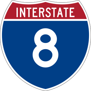
Interstate 8 (I-8) is an Interstate Highway in the southwestern United States. It runs from the southern edge of Mission Bay at Sunset Cliffs Boulevard in San Diego, California, almost at the Pacific Ocean, to the junction with I-10, just southeast of Casa Grande, Arizona. In California, the freeway travels through the San Diego metropolitan area as the Ocean Beach Freeway and the Mission Valley Freeway before traversing the Cuyamaca Mountains and providing access through the Imperial Valley, including the city of El Centro. Crossing the Colorado River into Arizona, I-8 continues through the city of Yuma across the Sonoran Desert to Casa Grande, in between the cities of Phoenix and Tucson.

<span class="mw-page-title-main">Interstate 10</span> Interstate Highway across the southern US

Interstate 10 (I-10) is the southernmost cross-country highway in the Interstate Highway System. I-10 is the fourth-longest Interstate in the United States at 2,460.34 miles (3,959.53 km), following I-90, I-80, and I-40. This freeway is part of the originally planned network that was laid out in 1956, and its last section was completed in 1990.

<span class="mw-page-title-main">Interstate 20</span> Interstate in southern US

Interstate 20 (I‑20) is a major east–west Interstate Highway in the Southern United States. I-20 runs 1,539 miles (2,477 km) beginning at an interchange with I-10 in Scroggins Draw, Texas, and ending at an interchange with I-95 in Florence, South Carolina. Between Texas and South Carolina, I-20 runs through northern Louisiana, Mississippi, Alabama, and Georgia. The major cities that I-20 connects to include Dallas, Texas; Shreveport, Louisiana; Jackson, Mississippi; Birmingham, Alabama; Atlanta, Georgia; and Columbia, South Carolina.

<span class="mw-page-title-main">League of American Bicyclists</span> Non-profit organization in the US

The League of American Bicyclists (LAB), officially the League of American Wheelmen, is a membership organization that promotes cycling for fun, fitness and transportation through advocacy and education. A Section 501(c)(3) nonprofit organization, the League is one of the largest membership organizations of cyclists in the United States.

<span class="mw-page-title-main">U.S. Route 80</span> Numbered Highway in the United States

U.S. Route 80 or U.S. Highway 80 (US 80) is a major east–west United States Numbered Highway in the Southern United States, much of which was once part of the early auto trail known as the Dixie Overland Highway. As the "0" in the route number indicates, it was originally a cross-country route, from the Pacific Ocean to the Atlantic Ocean. Its original western terminus was at Historic US 101 in San Diego, California. However, the entire segment west of Dallas, Texas, has been decommissioned in favor of various Interstate Highways and state highways. Currently, the highway's western terminus is at an interchange with Interstate 30 (I-30) on the Dallas–Mesquite, Texas city line. Its eastern terminus is in Tybee Island, Georgia near the Atlantic Ocean. Between Jonesville, Texas and Kewanee, Mississippi, US 80 runs parallel to or concurrently with Interstate 20. It also currently runs through Dallas, Texas; Shreveport, Louisiana; Jackson, Mississippi; Montgomery, Alabama; Columbus, Georgia; Macon, Georgia; and Savannah, Georgia.

<span class="mw-page-title-main">Arizona State Route 80</span> State highway in Arizona, United States

State Route 80 (SR 80) is a 120.20-mile (193.44-kilometre) long, roughly arc-shaped highway lying in southeastern Arizona. Starting in downtown Benson, the highway serves as the main route through the towns of St. David, Tombstone, Bisbee and Douglas before terminating at the New Mexico state line, becoming New Mexico State Road 80 (NM 80). SR 80 also acts as the national southern terminus of US 191 near Douglas and provides the only connection between the U.S. Highway and its business route in Douglas.

<span class="mw-page-title-main">Lee Highway</span> National auto trail crossing the United States

The Lee Highway was a national auto trail in the United States, connecting New York City and San Francisco, California, via the South and Southwest. After receiving a letter on January 15, 1919, from Dr. Samuel Myrtle Johnson of Roswell, New Mexico, David Carlisle Humphreys of Lexington, Virginia, put out a call for a meeting in Roanoke, Virginia, to form a new national highway association. On December 3, 1919, five hundred men from five states met in Roanoke to officially form the Lee Highway Association. The auto trail was named after Robert E. Lee.

The Bankhead Highway was a United States cross-country automobile highway connecting Washington, D.C., and San Diego. The Bankhead Highway's beginnings can be traced back to 1916 when the Bankhead Highway Association was organized to promote the highway's development. It was part of the National Auto Trail system. The road was named for Alabama politician John H. Bankhead, a leader in the early national road-building movement. In later years, several stretches of U.S. Route 78 in northwest Alabama were renamed for Bankhead's son, former U.S. Representative and Speaker of the House William B. Bankhead.

State Road 80 (NM 80) is 32.416-mile-long (52.168 km) north–south state road in southwestern New Mexico, between the Arizona state line near Rodeo and Interstate 10 (I-10) at Road Forks. Lying entirely within Hidalgo County, New Mexico, it is the only section of the old U.S. Route 80 (US 80) in New Mexico which still retains its number. The route was re-designated NM 80 in 1989. This is the reason why NM 80 has an even number designation despite the highway being north/south. From the south, SR 80 acts as a continuation of NM 80 into Arizona.

<span class="mw-page-title-main">U.S. Route 80 in Alabama</span> U.S. Highway in Alabama

U.S. Route 80 (US 80) is a major U.S. Highway in the American state of Alabama. The Alabama Department of Transportation internally designates the majority of US 80 throughout the state as State Route 8 (SR 8), save for parts of the route throughout Selma and near the Mississippi border. Serving as the main east to west highway through Alabama's Black Belt region, US 80 became well known as the main route for the 1965 Selma to Montgomery marches; it was the route along which the Civil Rights demonstrators walked, from Selma to Alabama, and the Edmund Pettus Bridge in Selma was the site of Bloody Sunday. The highway was also once a major transcontinental highway reaching from Tybee Island, Georgia, to San Diego, California, but has since been truncated to Dallas, Texas because it was largely replaced by the Interstate Highway System.

<span class="mw-page-title-main">Old Spanish Trail (auto trail)</span> Auto trail across the United States

The Old Spanish Trail was an auto trail that once spanned the United States with almost 2,750 miles (4,430 km) of roadway from ocean to ocean. It crossed eight states and 67 counties along the southern border of the United States. Work on the auto highway began in 1915 at a meeting held at the Battle House Hotel in Mobile, Alabama; and, by the 1920s, the trail linked St. Augustine, Florida, to San Diego, California, with its center and headquarters in San Antonio, Texas. The work at San Antonio, and indeed nationally, was overseen by an executive committee consisting of prominent San Antonio businessmen which met at the Gunter Hotel weekly.

<span class="mw-page-title-main">U.S. Route 80 in Texas</span> Highway in Texas

U.S. Route 80 is a U.S. highway that begins in the state of Texas in Dallas at an interchange with I-30. US 80 runs in an east–west direction for most of its length from Dallas to Louisiana. Before the advent of the Interstate Highway System, US 80 through Texas was once a vital link in a major transcontinental highway with the national western terminus being in San Diego, California rather than Dallas. Since 1991, most of US 80 in Texas has been decommissioned in favor of I-10, I-20 and I-30 between the New Mexico state line and its current western terminus.

The Teche Greyhound Lines, a highway-coach carrier, was a Greyhound regional operating company, based in New Orleans, Louisiana, USA, from 1934 until 1954, when it was merged into the Southeastern Greyhound Lines, a neighboring operating company.

<span class="mw-page-title-main">U.S. Route 80 in California</span> Former section of U.S. Highway in California, United States

U.S. Route 80 (US 80) was a U.S. highway in California that continued east across the country to Georgia. The western terminus of US 80 was in San Diego, California, and it continued east through the city on several different alignments through the years. The highway went through the Cuyamaca Mountains, encountering many switchbacks, before descending to El Centro. After passing through the sand dunes, the highway crossed the Colorado River into Yuma, Arizona.

<span class="mw-page-title-main">U.S. Route 80 in Arizona</span> 1926–1989 American highway

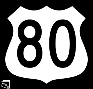
U.S. Route 80 (US 80) also known as the Ocean-to-Ocean Highway, the Broadway of America and the Jefferson Davis Memorial Highway was a major transcontinental highway that existed in the U.S. state of Arizona from November 11, 1926, to October 6, 1989. At its peak, US 80 traveled from the California border in Yuma to the New Mexico state line near Lordsburg. US 80 was an important highway in the development of Arizona's car culture. Like its northern counterpart, US 66, the popularity of travel along US 80 helped lead to the establishment of many unique road side businesses and attractions, including many iconic motor hotels and restaurants. US 80 was a particularly long highway, reaching a length of almost 500 miles (800 km) within the state of Arizona alone for most of the route's existence.

<span class="mw-page-title-main">U.S. Route 80 in New Mexico</span>

U.S. Route 80 was a major transcontinental highway in the U.S. state of New Mexico from November 11, 1926, to October 12, 1991. Nationally, US 80 stretched from San Diego, California to Tybee Island, Georgia, going through southern New Mexico from El Paso, Texas, through the towns of Las Cruces, Deming and Lordsburg before entering Arizona. US 80 was a modest 191 miles (307 km) long and was eventually replaced by Interstate 10 leading to the complete removal of US 80 in New Mexico. State Road 80 is a remnant of this route.

<span class="mw-page-title-main">Special routes of U.S. Route 80</span> Highway system

A total of ten special routes of U.S. Route 80 exist or did exist in the past.

<span class="mw-page-title-main">Ciénega Bridge</span> Historic bridge in Pima County, Arizona

Ciénega Bridge is an open-spandrel arch bridge which crosses Ciénega Creek and the Union Pacific Railroad near Vail, Arizona. Originally constructed in 1921, the bridge was part of U.S. Route 80, a major transcontinental highway, from 1926 to 1956. Being the oldest bridge of its kind in Arizona, the Ciénega Bridge is listed on the National Register of Historic Places. The bridge also holds the title of being the longest open-spandrel concrete arch bridge within the state. Currently, the bridge carries Marsh Station Road, which is part of Historic U.S. Route 80 as of 2018.

New Mexico State Road 418 is a 14-mile-long (23 km) state-maintained highway in the southwestern corner of New Mexico, running from Interstate 10 (I-10) to an intersection with Spruce Street in Deming. Originally, NM 418 was a section of U.S. Route 80 (US 80), a transcontinental highway running from San Diego, California, to Tybee Island, Georgia, but was bypassed when a new section of US 80 was built between the current western terminus of NM 418 and Pine Street in Deming.

State Road 478 (NM 478) is a 24.342-mile-long (39.175 km) state highway located entirely within Doña Ana County, New Mexico. Starting in Anthony and ending in Las Cruces, NM 478 was once a section of historic US 80, a major transcontinental highway between San Diego, California and Savannah, Georgia. In 1946, it also became part of U.S. Route 85, when the latter highway was extended south to the Mexican border in El Paso, Texas. US 80 and US 85 were rerouted onto a newer alignment to the east in the mid 1950s. This was also around the time the older highway was designated NM 478. For two years, the southern terminus of NM 478 also served as the national western terminus of US 80 until that highway was removed from New Mexico completely in 1991. Today, NM 478 remains on much the same route it has since it was first designated and serves several old US 80/US 85 communities long since bypassed by I-10

References

  1. 1 2 Weingroff, Richard F. (November 18, 2015). "U.S. Route 80 The Dixie Overland Highway". Highway History. Federal Highway Administration. Retrieved February 9, 2020.
  2. 1 2 1634–1699: McCusker, J. J. (1997). How Much Is That in Real Money? A Historical Price Index for Use as a Deflator of Money Values in the Economy of the United States: Addenda et Corrigenda (PDF). American Antiquarian Society. 1700–1799: McCusker, J. J. (1992). How Much Is That in Real Money? A Historical Price Index for Use as a Deflator of Money Values in the Economy of the United States (PDF). American Antiquarian Society. 1800–present: Federal Reserve Bank of Minneapolis. "Consumer Price Index (estimate) 1800–" . Retrieved May 28, 2023.
  3. "End of US highway 80". US Ends.com. Retrieved February 4, 2020.[ self-published source ]
  4. Wrenn, Candace (September 24, 2018). "Arizona's US Route 80 Gets Historic Designation". Arizona Public Media. Retrieved January 29, 2020.
  5. Public Roads Administration (August 14, 1957). Official Route Numbering for the National System of Interstate and Defense Highways as Adopted by the American Association of State Highway Officials (Map). Scale not given. Washington, DC: Public Roads Administration. Retrieved February 4, 2020 via Wikimedia Commons.
  6. Davis, Shaq (September 21, 2018). "Arizona's portion of U.S. Route 80, opened in 1926, wins 'Historic Road' status". Arizona Daily Star. Retrieved February 7, 2020.
  7. Guidry, Leigh (August 28, 2018). "Take the back roads with us. The Guidrys are cruising Louisiana's byways". The Daily Advertiser. Retrieved February 7, 2020.