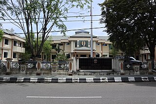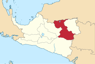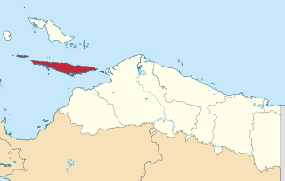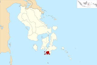
The Banggai Regency is a regency located at the eastern end of Central Sulawesi Province of Indonesia. It makes up a re-established regency (kabupaten), created on 4 October 1999 by splitting the existing Banggai Regency into this smaller Banggai Regency situated on the mainland of Sulawesi and a new Banggai Islands Regency comprising the offshore islands to the southeast which are separated from mainland Sulawesi by the Peleng Straits. The residual Banggai Regency covers an area of 9,672.70 km2 and had a population of 323,626 at the 2010 census and 362,275 at the 2020 census; the official estimate as at mid 2023 was 373,693.

South Solok Regency is a landlocked regency (kabupaten) of West Sumatra province, Indonesia. It covers an area of 3,346.20 km2, and had a population of 144,281 at the 2010 Census and 182,027 at the 2020 Census; the official estimate as at mid 2022 was 188,649 - comprising 96,301 males and 92,348 females. The seat of the administration is the town of Padang Aro.

South Hulu Sungai Regency is one of the regencies (kabupaten) in South Kalimantan province, Indonesia. It had an area of 1,804.94 km2, and a population of 212,485 at the 2010 Census and 228,006 at the 2020 Census; the official estimate as at mid 2023 was 237.319. The capital of the regency is the town of Kandangan, which is famous for its culinary ketupat Kandangan.

Central Hulu Sungai Regency is one of the regencies in the Indonesian province of South Kalimantan. The area is 1,770.77 km2 and the population was 243,460 at the 2010 Census and 258,721 at the 2020 Census; the official estimate as at mid 2023 was 268,360. The administrative centre is the town of Barabai.

South Bengkulu is a regency of Bengkulu Province, Indonesia, on the island of Sumatra. It originally comprised all of that part of Bengkulu Province situated to the southeast of the city of Bengkulu, but on 25 February 2003 this area was split into three parts, with the most southeastern districts split off to form a new Kaur Regency and the most northwestern districts split off to form a new Seluma Regency. The reduced South Bengkulu Regency now covers 1,186.10 km2, and had a population of 142,940 at the 2010 Census and 166,249 at the 2020 Census; the official estimate as at mid 2022 was 170,093. The regency's administrative centre is the coastal town of Manna.

Sorong Regency is a regency of the Southwest Papua province of Indonesia. It covers an area of 13,075.28 km2, and had a population of 70,619 at the 2010 Census, and 118,679 at the 2020 Census; the official estimate as of mid-2022 was 125,949. Its administrative centre is the town of Aimas. Sorong Regency surrounds Sorong City (Kota) on the landward side; the city is administratively independent of the Regency and is not included in the above statistics; Sorong City has an airport, Sorong Airport, which also serves the Regency.

Mojokerto Regency is a regency in East Java Province of Indonesia. It is part of the Surabaya metropolitan area which comprises Gresik Regency, Bangkalan Regency, Mojokerto Regency, Mojokerto City, Surabaya City, Sidoarjo Regency, and Lamongan Regency. The Regency covers an area of 969.36 km2. The population of the Regency was 908,004 in 2000, but had risen to 1,025,443 at the 2010 Census and to 1,119,209 at the 2020 Census; the official estimate as of mid-2022 was 1,133,584, and the total for mid-2023 was 1,145,400. Many of them earn their living as small farmers and craftsmen.

South Labuhanbatu Regency is a regency of North Sumatra Province of Indonesia, created on 21 July 2008 by being carved out of the southern districts of the existing Labuhanbatu Regency. The new South Labuhanbatu Regency covers an area of 3,596 square kilometres and according to the 2010 census it had a population of 277,673, which rose to 314,094 at the 2020 Census; the official estimate as at mid 2023 was 330,797. Its administrative headquarters are at the town of Kotapinang.

Supiori Regency is a regency in the Indonesian province of Papua. The Regency has an area of 634.24 km2 including the Aruri Islands group to the south, and had a population of 15,874 at the 2010 Census and 22,547 at the 2020 Census; the official estimate as at mid 2022 was 23,247 - comprising 12,056 males and 11,191 females. Until 8 January 2004, this area was part of the Biak Numfor Regency, from which it was split off in accordance with the Law dated 18 December 2003.

Puncak Regency is one of the regencies (kabupaten) in the Indonesian province of Central Papua; it is not to be confused with Puncak Jaya Regency, which is within the same province, and from whose western districts those districts now forming Puncak Papua Regency were separated in 2008. It covers an area of 7,396.47 km2, and had a population of 93,218 at the 2010 Census and 114,741 at the 2020 Census; the official estimate as of mid-2022 was 116,279. The administrative centre is at Ilaga. The name of the regency is currently being changed to Puncak Papua Regency.

Nabire Regency is one of the regencies (kabupaten) in the Indonesian province of Central Papua. It covers an area of 12,010.65 km2, and had a population of 129,893 at the 2010 Census and 169,136 at the 2020 Census, comprising 87,688 males and 81,448 females. The official estimate as at mid 2022 was 173,043 - comprising 90,823 males and 82,220 females. The administrative centre is the town of Nabire, which faces onto Cenderawasih Bay.

Keerom Regency is one of the regencies (kabupaten) in the Papua Province of Indonesia. It was formed from the eastern districts then within Jayapura Regency with effect from 12 November 2002. It covers an area of 9,365 km2, and had a population of 48,536 at the 2010 Census and 61,623 at the 2020 Census; the official estimate as at mid 2022 was 62,777. The regency's administrative centre is at Waris. It borders Green River Rural LLG and Amanab Rural LLG of Sandaun Province, Papua New Guinea.

Yapen Islands Regency is a regency (kabupaten) in Papua Province of eastern Indonesia. It covers an area of 2,432.49 km2 (939.19 sq mi), and had a population of 82,951 at the 2010 Census and 112,676 at the 2020 Census; the official estimate as at mid 2022 was 116,107. It comprises an archipelago which lies in Cenderawasih Bay off the north coast of Western New Guinea.
Central Halmahera Regency is a regency of North Maluku Province, Indonesia. The regency was originally formed on 15 August 1990 from part of the former North Maluku Regency, but on 25 February 2003 parts of the new regency were split off to form a separate East Halmahera Regency and the city of Kota Tidore Kepulauan. It now comprises just the southern half of the southeastern peninsula of Halmahera Island, together with part of the southern peninsula of that island.

Takalar Regency is a regency of South Sulawesi Province, Indonesia. It covers an area of 566.51 km2 and had a population of 269,603 at the 2010 census and 300,853 at the 2020 census; the official estimate for mid 2023 was 326,044. The entire regency lies within the official metropolitan area of the city of Makassar. The principal towns are at Galesong and Takalar, but the administrative centre is at Pattallassang.

South Minahasa Regency is a regency in North Sulawesi, Indonesia. Its capital is the town of Amurang. It was originally part of the Minahasa Regency until it was established as a separate regency on 25 February 2003. In turn, nearly four years later, a new Southeast Minahasa Regency was established as a separate regency from part of the South Minahasa Regency on 2 January 2007. The residual Regency now covers an area of 1,456.74 km2, and had a population of 195,553 at the 2010 Census; this had risen to 236,463 at the 2020 Census; the official estimate as at mid 2023 was 244,590.

Southeast Minahasa Regency is a regency in North Sulawesi, Indonesia. It covers a land area of 730.63 km2, and had a population of 100,443 at the 2010 Census; this had risen to 116,323 at the 2020 Census, and the official estimate as at mid 2023 was 118,946. It was established as a separate regency from the south-eastern part of the South Minahasa Regency on 2 January 2007. Its administrative centre is at the town of Ratahan.

Buru Regency is a regency of Maluku province, Indonesia. When it was first created on 4 October 1999, the regency encompassed the entire island ; but on 24 June 2008 the southern 40% of the island was split off to form a separate Buru Selatan Regency. The residual Buru Regency comprises the northern 60% of the island of Buru and covers an area of 7,595.58 km2. The population at the 2010 census was 108,445 and at the 2020 census this had increased to 135,238; the official estimate as at mid 2023 was 139,408. The principal town lies at Namlea.

South Manokwari Regency is a regency of West Papua Province of Indonesia. It was formed in 2013 from the southern districts of Manokwari Regency. The population of the area now comprised in the new regency was 18,564 at the 2010 Census, which rose to 35,949 at the 2020 Census; the official estimate as at mid 2022 was 38,648. The administrative centre is the town of Ransiki.

South Buton Regency is a regency located on Buton Island in Southeast Sulawesi Province of Indonesia. This regency was formed from the southern part of Buton Regency, from which it was separated by Act No.16 of 2014, dated 23 July 2014. It covers an area of 546.58 km2, and the population of the districts now comprising the new regency was 74,974 at the 2010 Census and 95,261 at the 2020 Census; the official estimate as at mid 2023 was 101,635. The regency capital is located in Batauga.


