Downing, Missouri

Last updated

Downing, Missouri
Downing Mo Depot.jpg
Historic Downing railroad depot
Schuyler County Missouri Incorporated and Unincorporated areas Downing Highlighted.svg
Location of Downing, Missouri
Coordinates: 40°29′14″N92°22′08″W / 40.48722°N 92.36889°W / 40.48722; -92.36889
Country United States
State Missouri
County Schuyler
Area
[1]
  Total0.66 sq mi (1.72 km2)
  Land0.66 sq mi (1.71 km2)
  Water0.01 sq mi (0.01 km2)
Elevation
[2]
873 ft (266 m)
Population
 (2020)
  Total300
  Density455.24/sq mi (175.73/km2)
Time zone UTC-6 (Central (CST))
  Summer (DST) UTC-5 (CDT)
ZIP code
63536
Area code 660
FIPS code 29-19990 [3]
GNIS feature ID2394558 [2]

Downing is a city in Schuyler County, Missouri, United States. As of the 2020 census, its population was 300. [4] It is part of the Kirksville Micropolitan Statistical Area.

Contents

History

Downing Jail. No longer in use. Downing Mo Jail.jpg
Downing Jail. No longer in use.

Although not being laid out as a town until 1872, the Downing area was one of the earliest settled areas of Schuyler County, with Henry Downing building a home and claiming land a few miles south of the area circa 1837. It was also near present-day Downing that the first school in the county was established. In the spring of 1841, a crude log cabin was built for use as a school near Henry Downing's home and Miss Esther Hathaway was employed as a teacher. [5] One of the early names for the unincorporated settlement was Cherry Grove.

During the Civil War, on July 1, 1862, a small skirmish took place near Cherry Grove. Cavalry from the second battalion, Eleventh Missouri State Militia, a pro-Union force, engaged a small number of Confederate troops under Colonel Joseph C. Porter. Porter's outnumbered forces were defeated, with four killed and several men and horses captured. The Union forces had one man badly injured, who would die a few days later. At the time of the skirmish, Porter was heavily involved in recruiting men in northeast Missouri for the Confederate cause. The following month, he would suffer a larger defeat some twenty-five miles southwest at the Battle of Kirksville.

In September 1872, the Missouri Town Company created the original town plat, naming it for the president of the company, H. H. Downing. [6] Land for the town, the railroad right of way, and depot were donated by James Prime, and the Missouri, Iowa, and Nebraska Railway [7] constructed the depot in April, 1872. [8] By the late 1880s, the Downing business district included four general stores, two drug stores, two grocers, two hardware stores, a restaurant, blacksmith, and two hotels. Manufacturing included two handle factories, a wagon maker, a hoop factory, a harness and saddle maker, and two combination saw/grist mills. Downing had two tobacco-buying warehouses in the late 1800s, with both reporting extensive business. At its peak in 1902, over 155,000 pounds of tobacco were dealt through the Downing warehouses. The town's location on the Keokuk & Western railroad provided opportunity for the convenient shipment of goods, crops, and livestock from the Downing area.

The Downing Railroad Depot was listed on the National Register of Historic Places in 1983 and now serves as a museum. [9] The depot was moved approximately one-quarter mile from its original trackside location and now serves as the centerpiece of a city park with other nearby buildings, including the former Downing jail.

Geography

A portion of the Downing, Missouri business district. Many buildings date before 1900. Downing Mo 1.jpg
A portion of the Downing, Missouri business district. Many buildings date before 1900.

Downing is located at 40°29′16″N92°22′5″W / 40.48778°N 92.36806°W / 40.48778; -92.36806 (40.487682, -92.368022). [10]

According to the United States Census Bureau, the city has a total area of 0.67 square miles (1.74 km2), of which 0.66 square miles (1.71 km2) is land and 0.01 square miles (0.03 km2) is water. [11]

Demographics

Historical population
CensusPop.Note
1880 152
1890 406167.1%
1900 50123.4%
1910 5132.4%
1920 56610.3%
1930 514−9.2%
1940 507−1.4%
1950 453−10.7%
1960 4632.2%
1970 406−12.3%
1980 46213.8%
1990 359−22.3%
2000 39610.3%
2010 335−15.4%
2020 300−10.4%
U.S. Decennial Census [12]

2010 census

As of the census [13] of 2010, there were 335 people, 160 households, and 90 families residing in the city. The population density was 507.6 inhabitants per square mile (196.0/km2). There were 195 housing units at an average density of 295.5 per square mile (114.1/km2). The racial makeup of the city was 97.6% White, 0.3% Asian, and 2.1% from two or more races. Hispanic or Latino of any race were 0.6% of the population.

There were 160 households, of which 25.0% had children under the age of 18 living with them, 43.1% were married couples living together, 8.8% had a female householder with no husband present, 4.4% had a male householder with no wife present, and 43.8% were non-families. 40.0% of all households were made up of individuals, and 20.6% had someone living alone who was 65 years of age or older. The average household size was 2.09 and the average family size was 2.79.

The median age in the city was 44.8 years. 20% of residents were under the age of 18; 10% were between the ages of 18 and 24; 20.7% were from 25 to 44; 27.3% were from 45 to 64; and 22.4% were 65 years of age or older. The gender makeup of the city was 47.8% male and 52.2% female.

2000 census

As of the census [3] of 2000, there were 396 people, 176 households, and 99 families residing in the city. The population density was 595.4 inhabitants per square mile (229.9/km2). There were 210 housing units at an average density of 315.7 per square mile (121.9/km2). The racial makeup of the city was 95.96% White, 0.25% Native American, 1.26% from other races, and 2.53% from two or more races. Hispanic or Latino of any race were 2.27% of the population.

There were 176 households, out of which 26.7% had children under the age of 18 living with them, 48.3% were married couples living together, 6.3% had a female householder with no husband present, and 43.2% were non-families. 39.2% of all households were made up of individuals, and 21.0% had someone living alone who was 65 years of age or older. The average household size was 2.25 and the average family size was 3.03.

In the city the population was spread out, with 25.8% under the age of 18, 7.8% from 18 to 24, 24.2% from 25 to 44, 21.5% from 45 to 64, and 20.7% who were 65 years of age or older. The median age was 38 years. For every 100 females, there were 80.8 males. For every 100 females age 18 and over, there were 79.3 males.

The median income for a household in the city was $18,864, and the median income for a family was $26,875. Males had a median income of $25,000 versus $13,750 for females. The per capita income for the city was $12,626. About 19.8% of families and 18.9% of the population were below the poverty line, including 19.5% of those under age 18 and 19.0% of those age 65 or over.

Related Research Articles

<span class="mw-page-title-main">Schuyler County, Missouri</span> County in Missouri, United States

Schuyler County is a county located in the northeastern portion of the U.S. state of Missouri. As of the 2020 census, its population was 4,032, making it the fourth-least populous county in Missouri. Its county seat is Lancaster. The county was organized February 14, 1845, from Adair County, and named for General Philip Schuyler, delegate to the Continental Congress and U.S. Senator from New York.

<span class="mw-page-title-main">Weldon, Iowa</span> City in Iowa, United States

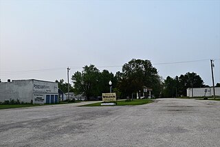
Weldon is a city in Clarke and Decatur counties of the U.S. state of Iowa. The population was 136 at the time of the 2020 census.

<span class="mw-page-title-main">Wheaton, Missouri</span> City in Missouri, United States

Wheaton is a city in Wheaton Township, Barry County, Missouri, United States. The population was 696 at the 2010 census.

<span class="mw-page-title-main">Hallsville, Missouri</span> City in Missouri, United States

Hallsville is a city in Boone County, Missouri. It is part of the Columbia metropolitan area. The population was 1,614 at the time of the 2020 census. Southeast of the town is Mount Zion Church and Cemetery, the site of the Battle of Mount Zion Church during the Civil War.

<span class="mw-page-title-main">Sturgeon, Missouri</span> City in Missouri, United States

Sturgeon is a city in Boone County, Missouri, United States. It is part of the Columbia, Missouri Metropolitan Statistical Area. The population was 872 at the 2010 census.

<span class="mw-page-title-main">Linneus, Missouri</span> City in Missouri, United States

Linneus is a small city in Linn County, Missouri, United States. The population was 281 at the 2020 census. It is the county seat of Linn County.

<span class="mw-page-title-main">Chamois, Missouri</span> City in Missouri, United States

Chamois is a city in Osage County, Missouri, United States. The population was 377 at the 2020 census. It is part of the Jefferson City, Missouri Metropolitan Statistical Area.

<span class="mw-page-title-main">Livonia, Missouri</span> Village in Missouri, United States

Livonia is a village in eastern Putnam County, Missouri, United States. The population was 52 at the 2020 census.

<span class="mw-page-title-main">Worthington, Missouri</span> Village in Missouri, United States

Worthington is a village in southeast Putnam County, Missouri, United States. The population was 47 at the 2020 census.

<span class="mw-page-title-main">Lancaster, Missouri</span> City in Missouri, United States

Lancaster is a city in Schuyler County, Missouri, United States. As of the 2020 census, its population was 675. It is the county seat of Schuyler County.

<span class="mw-page-title-main">Queen City, Missouri</span> City in Missouri, United States

For the place nicknamed "the Queen City of the Ozarks", see Springfield, Missouri.

<span class="mw-page-title-main">Shelbyville, Missouri</span> City in Missouri, United States

Shelbyville is a city in Shelby County, Missouri, United States. The population was 518 at the 2020 census. It is the county seat of Shelby County.

<span class="mw-page-title-main">Greendale, Missouri</span> City in Missouri, United States

Greendale is a city in St. Louis County, Missouri, United States. The population was 651 at the 2010 census.

<span class="mw-page-title-main">Velda City, Missouri</span> City in Missouri, United States

Velda City is a city in St. Louis County, Missouri, United States. The population was 1,420 at the 2010 census.

<span class="mw-page-title-main">Green City, Missouri</span> City in Missouri, United States

Green City is a city in northeast Sullivan County, Missouri, United States. The population was 657 at the 2010 census.

<span class="mw-page-title-main">Greencastle, Missouri</span> City in Missouri, United States

Greencastle is a city in eastern Sullivan County, Missouri, United States. The population was 224 at the 2020 census.

<span class="mw-page-title-main">Holts Summit, Missouri</span> City in Missouri, United States

Holts Summit is a small city in Callaway County, Missouri. The population was 3,247 at the time of the 2010 census. Holts Summit is located 7 miles (11 km) northeast of Jefferson City, Missouri's state capital. It is part of the Jefferson City Metropolitan Area.

<span class="mw-page-title-main">Berlin, North Dakota</span> City in North Dakota, United States

Berlin is a city in LaMoure County, North Dakota, United States. The population was 31 at the 2020 census. Berlin was founded in 1887.

<span class="mw-page-title-main">Greentop, Missouri</span> City in Missouri, United States

Greentop is a city in Adair and Schuyler counties, Missouri, United States. As of the 2020 census, its population was 388.

<span class="mw-page-title-main">Marceline, Missouri</span> City in Missouri, United States

Marceline is a city in Chariton and Linn counties in the U.S. state of Missouri. The population was 2,123 at the 2020 census.

References

  1. "ArcGIS REST Services Directory". United States Census Bureau. Retrieved August 28, 2022.
  2. 1 2 U.S. Geological Survey Geographic Names Information System: Downing, Missouri
  3. 1 2 "U.S. Census website". United States Census Bureau . Retrieved January 31, 2008.
  4. "2020: DEC Redistricting Data (PL 94-171)". United States Census Bureau . Retrieved November 18, 2021.
  5. A History of Northeast Missouri by Walter Williams. Lewis Publishing Co., Chicago, 1913. pp. 602-604
  6. History of Adair, Sullivan, Putnam, and Schuyler Counties, Missouri, Goodspeed Publishing Co., Chicago, 1888. page 730.
  7. "Abandoned Rails: The Keokuk and Western Railroad". www.abandonedrails.com. Retrieved July 24, 2016.
  8. Application for National Register of Historic Places, Missouri Department of Natural Resources, 1981
  9. "National Register Information System". National Register of Historic Places . National Park Service. July 9, 2010.
  10. "US Gazetteer files: 2010, 2000, and 1990". United States Census Bureau. February 12, 2011. Retrieved April 23, 2011.
  11. "US Gazetteer files 2010". United States Census Bureau. Archived from the original on July 2, 2012. Retrieved July 8, 2012.
  12. "Census of Population and Housing". Census.gov. Retrieved June 4, 2015.
  13. "U.S. Census website". United States Census Bureau . Retrieved July 8, 2012.