East Leavenworth, Missouri

Last updated

East Leavenworth is an unincorporated community in Platte County, Missouri, United States. [1] It is located on Route 45, approximately three miles east of Leavenworth, Kansas and is part of the Kansas City metropolitan area

Unincorporated area Region of land not governed by own local government

In law, an unincorporated area is a region of land that is not governed by a local municipal corporation; similarly an unincorporated community is a settlement that is not governed by its own local municipal corporation, but rather is administered as part of larger administrative divisions, such as a township, parish, borough, county, city, canton, state, province or country. Occasionally, municipalities dissolve or disincorporate, which may happen if they become fiscally insolvent, and services become the responsibility of a higher administration. Widespread unincorporated communities and areas are a distinguishing feature of the United States and Canada. In most other countries of the world, there are either no unincorporated areas at all, or these are very rare; typically remote, outlying, sparsely populated or uninhabited areas.
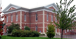
Platte County, Missouri U.S. county in Missouri

Platte County is a county located in the northwestern portion of the U.S. state of Missouri and is part of the Kansas City metropolitan area. As of the 2010 census, the population was 89,322. Its county seat is Platte City. The county was organized December 31, 1838, from the Platte Purchase, named for the Platte River. (Platte is derived from the French word for a low, shallow, or intermittent stream. The Kansas City International Airport is located in the county, approximately one mile west of Interstate 29 between mile markers 12 and 15. The land for the airport was originally in an unincorporated portion of Platte County before being annexed by Platte City, and eventually Kansas City.

Leavenworth, Kansas City and County seat in Kansas, United States

Leavenworth is the county seat and largest city of Leavenworth County, Kansas, United States and is part of the Kansas City metropolitan area. As of the 2010 census, the city population was 35,251. It is located on the west bank of the Missouri River. The site of Fort Leavenworth, built in 1827, the city became known in American history for its role as a key supply base in the settlement of the American West. During the American Civil War, many volunteers joined the Union Army from Leavenworth. The city has been notable as the location of several prisons, particularly the United States Disciplinary Barracks and United States Penitentiary, Leavenworth.

A post office called East Leavenworth was established in 1883, and remained in operation until 1966. [2] The community was so named on account of its location east of Leavenworth, Kansas. [3]

Related Research Articles

Kansas City, Kansas Consolidated city-county in Kansas, United States

Kansas City abbreviated as "KCK", is the third-largest city in the State of Kansas, the county seat of Wyandotte County, and the third-largest city of the Kansas City metropolitan area. It is situated at Kaw Point, which is the junction of the Missouri and Kansas rivers. It borders Johnson County, Kansas to the south and Kansas City, Missouri to the east, after which Kansas City Kansas is named. It is part of a consolidated city-county government known as the "Unified Government". Wyandotte County also includes the independent cities of Bonner Springs, Edwardsville, a portion of Lake Quivira, and the unincorporated area known as Loring. As of the 2010 census, the city had a population of 145,786 residents.

Waldron, Missouri unincorporated community in Missouri

Waldron is an unincorporated community in southwestern Platte County, Missouri in the United States. Waldron is located on the edge of the Missouri River floodplain approximately one mile southeast of Route 45. I-435 crosses the Missouri River 2.5 miles south of the community. The Burlington Northern Railroad passes the community. It is within the Kansas City metropolitan area.

Platte Bridge Railroad Tragedy

The Platte Bridge Railroad Tragedy was a bushwhacker attack on the Hannibal and St. Joseph Railroad during the American Civil War on September 3, 1861, in which the train derailed on a bridge over the Platte River east of St. Joseph, Missouri, killing between 17 and 20 and injuring 100. The bridge crosses the river in Buchanan County, between Marion Township on the east, and Washington Township on the west.

Kickapoo is an unincorporated community in Kickapoo Township, Leavenworth County, Kansas, USA.

New Market is an unincorporated community in northern Platte County, in the U.S. state of Missouri and is part of the Kansas City metropolitan area. The community is located on Missouri Route 371 about 1.5 miles south of the Platte-Buchanan county line. Dearborn is two miles to the northeast across U.S. Route 71 and Bee Creek flows past the west side of the community.

Bee Creek is a stream in Buchanan and Platte counties of the U.S. state of Missouri. It is a tributary of the Missouri River.

Beverly is an unincorporated community in Platte County, in the U.S. state of Missouri and is part of the Kansas City metropolitan area.

Dye is an unincorporated community in Platte County, in the U.S. state of Missouri and is part of the Kansas City metropolitan area.

Edgerton Junction is an unincorporated community in Platte County, in the U.S. state of Missouri and is part of the Kansas City metropolitan area.

Hoover is an unincorporated community in Platte County, in the U.S. state of Missouri and is part of the Kansas City metropolitan area.

Kerrville is an unincorporated community in Platte County, in the U.S. state of Missouri and is part of the Kansas City metropolitan area.

Linkville is a neighborhood of Kansas City, Missouri, United States.

Milton is a neighborhood of Kansas City, Missouri, United States.

Stillings is an unincorporated community in Platte County, in the U.S. state of Missouri and is part of the Kansas City metropolitan area.

Stubbs is an unincorporated community in Platte County, in the U.S. state of Missouri and is part of the Kansas City metropolitan area.

Tiffany Springs is a neighborhood of Kansas City, Missouri, United States.

West Platte is an unincorporated community in Platte County, in the U.S. state of Missouri and is part of the Kansas City metropolitan area.

Woodruff is an unincorporated community in Platte County, in the U.S. state of Missouri and is part of the Kansas City metropolitan area.

Weston Township is an inactive township in Platte County, in the U.S. state of Missouri.

References

  1. U.S. Geological Survey Geographic Names Information System: East Leavenworth, Missouri
  2. "Post Offices". Jim Forte Postal History. Retrieved 9 December 2016.
  3. "Platte County Place Names, 1928–1945". The State Historical Society of Missouri. Archived from the original on June 24, 2016. Retrieved December 9, 2016.

Coordinates: 39°18′52″N94°51′07″W / 39.31444°N 94.85194°W / 39.31444; -94.85194

Geographic coordinate system Coordinate system

A geographic coordinate system is a coordinate system that enables every location on Earth to be specified by a set of numbers, letters or symbols. The coordinates are often chosen such that one of the numbers represents a vertical position and two or three of the numbers represent a horizontal position; alternatively, a geographic position may be expressed in a combined three-dimensional Cartesian vector. A common choice of coordinates is latitude, longitude and elevation. To specify a location on a plane requires a map projection.