
Interstate 10 (I-10) is the southernmost transcontinental highway in the Interstate Highway System. I-10 is the fourth-longest Interstate in the United States at 2,460.34 miles (3,959.53 km), following I-90, I-80, and I-40. This freeway is part of the originally planned network that was laid out in 1956, and its last section was completed in 1990.

State Route 91 (SR 91) is a major east–west state highway in the U.S. state of California that serves several regions of the Greater Los Angeles urban area. A freeway throughout its entire length, it officially runs from Vermont Avenue in Gardena, just west of the junction with the Harbor Freeway, east to Riverside at the junction with the Pomona and Moreno Valley freeways.

The Arroyo Seco Parkway, also known as the Pasadena Freeway, is one of the oldest freeways built in the United States. It connects Los Angeles with Pasadena alongside the Arroyo Seco seasonal river. It is notable not only for being an early freeway, mostly opened in 1940, but for representing the transitional phase between early parkways and later freeways. It conformed to modern standards when it was built, but is now regarded as a narrow, outdated roadway. A 1953 extension brought the south end to the Four Level Interchange in downtown Los Angeles and a connection with the rest of the freeway system.
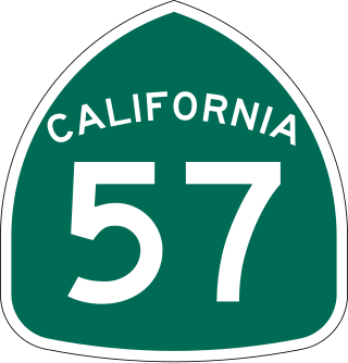
State Route 57 (SR 57), also known as the Orange Freeway for most of its length, is a north–south state highway in the Greater Los Angeles Area of the U.S. state of California. It connects the interchange of Interstate 5 (I-5) and SR 22 near downtown Orange, locally known as the Orange Crush, to the Glendora Curve interchange with I-210 and SR 210 in Glendora. The highway provides a route across several spurs of the Peninsular Ranges, linking the Los Angeles Basin with the Pomona Valley and San Gabriel Valley.

The Santa Ana Freeway is one of the principal freeways in Southern California, connecting Los Angeles and its southeastern suburbs including the freeway's namesake, the city of Santa Ana. The freeway begins at its junction with the San Diego Freeway, called the El Toro Y, in Irvine, signed as I-5. From there, it generally goes southeast to northwest to the East Los Angeles Interchange, where it takes the designation of U.S. Route 101 (US 101). It then proceeds 2.95 miles (4.75 km) northwest to the Four Level Interchange in downtown Los Angeles. Formerly, the entirety of the route was marked as US 101 until the 1964 highway renumbering, which truncated US 101 to the East Los Angeles Interchange and designated the rest of the freeway as I-5.

The Ventura Freeway is a freeway in southern California, United States, that runs from the Santa Barbara/Ventura county line to Pasadena in Los Angeles County. It is the principal east–west route through Ventura County and in the southern San Fernando Valley in Los Angeles County. From the Santa Barbara County line to its intersection with the Hollywood Freeway in the southeastern San Fernando Valley in Los Angeles, it is signed as U.S. Route 101 (US 101), which was built in the late 1950s and opened on April 5, 1960. The segments from the Santa Barbara County line to Sea Cliff, and from Solimar Beach to Oxnard, are also concurrent with State Route 1 (SR 1), although no signs mention SR 1 there. East of the Hollywood Freeway intersection, the Ventura Freeway is signed as State Route 134 (SR 134), which was built by 1971.

State Route 60 (SR 60) is an east–west state highway in the U.S. state of California. It serves the cities and communities on the eastern side of the Los Angeles metropolitan area and runs along the south side of the San Gabriel Valley. It functions as a bypass route of Interstate 10 (I-10) through the area between the East Los Angeles Interchange in Los Angeles and Beaumont. SR 60 provides a route across several spurs of the Peninsular Ranges, linking the Los Angeles Basin with the Pomona Valley and San Gabriel Valley. The highway also runs concurrently with SR 57 and I-215. Portions of SR 60 are designated as either the Pomona Freeway or the Moreno Valley Freeway.
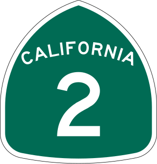
State Route 2 (SR 2) is a state highway in the U.S. state of California. It connects the Los Angeles Basin with the San Gabriel Mountains and the Victor Valley in the Mojave Desert. The highway's southwestern end is at the intersection of Centinela Avenue at the Santa Monica-Los Angeles border and its northeastern end is at SR 138 east of Wrightwood. The SR 2 is divided into four segments, and it briefly runs concurrently with U.S. Route 101 (US 101) and Interstate 210 (I-210). The southwestern section of SR 2 runs along a segment of the east–west Santa Monica Boulevard, an old routing of US 66, to US 101 in East Hollywood; the second section runs along segments of both the north–south Alvarado Street and Glendale Boulevard in Echo Park; the third section to I-210 in Glendale is known as the north–south Glendale Freeway; and the northeastern portion from I-210 in La Cañada Flintridge to SR 138 is designated as the Angeles Crest Highway.

The Four Level Interchange is the first stack interchange in the world. Completed in 1949 and fully opened in 1953 at the northern edge of Downtown Los Angeles, California, United States, it connects U.S. Route 101 to State Route 110. In 2006, the interchange was officially renamed in the memory of Los Angeles traffic and weather reporter Bill Keene.

State Route 23 is a state highway in the U.S. state of California that connects the Pacific coast and the Santa Monica Mountains to the Conejo and Santa Clara River valleys. It runs from Pacific Coast Highway in Malibu in Los Angeles County to Ventura Street in Fillmore in Ventura County.

The Southern California freeways are a vast network of interconnected freeways in the megaregion of Southern California, serving a population of 23 million people. The Master Plan of Metropolitan Los Angeles Freeways was adopted by the Regional Planning Commission in 1947 and construction began in the early 1950s. The plan hit opposition and funding limitations in the 1970s, and by 2004, only some 61% of the original planned network had been completed.

The Kellogg Interchange complex is a freeway interchange in Southern California, connecting the San Bernardino (Interstate 10), Orange, and Chino Valley freeways. The interchange is located at the boundary between the cities of San Dimas and Pomona about 25 miles (40 km) east of downtown Los Angeles. It is named for the nearby W. K. Kellogg Ranch, now home to Cal Poly Pomona.

The Orange Crush interchange, frequently called The Crush, is a freeway interchange in the cities of Orange and Santa Ana, California, near the city limits of the cities of Anaheim, and Garden Grove. The Disneyland Resort, The Outlets at Orange, St. Joseph Hospital, Children's Hospital of Orange County, the UCI Medical Center, Westfield MainPlace, Angel Stadium of Anaheim, Honda Center, Platinum Triangle and the Lamaroux Justice Center of the Superior Court of California of the County of Orange are all located at or near the interchange.

The Foothill Freeway is a freeway in the Los Angeles metropolitan area, California, United States, running from the Sylmar district of Los Angeles east to Redlands. The western segment is signed as Interstate 210 (I-210) from its western end at I-5 to SR 57 in Glendora, while the eastern segment is signed as State Route 210 (SR 210) to its eastern terminus at I-10. Under the California Streets and Highways Code, the entire Foothill Freeway is legally referred to as Route 210.
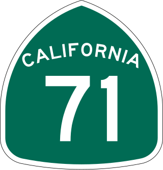
State Route 71 (SR 71) is a 15-mile (24 km) state highway in the U.S. state of California. Serving Riverside, San Bernardino, and Los Angeles counties, it runs from SR 91 in Corona to the Kellogg Interchange with I-10 and SR 57 on the border of Pomona and San Dimas. The segment from SR 91 to SR 83 in Chino Hills is called the Corona Freeway, formerly the Corona Expressway and before then the Temescal Freeway. SR 71 is designated as the Chino Valley Freeway between SR 83 and the Kellogg Interchange.
U.S. Route 101 (US 101) is a major north–south United States Numbered Highway, stretching from Los Angeles, California, to Tumwater, Washington. The California portion of US 101 is one of the last remaining and longest U.S. Routes still active in the state, and the longest highway of any kind in California. US 101 was also one of the original national routes established in 1926. Significant portions of US 101 between the Los Angeles area and the San Francisco Bay Area follow El Camino Real, the commemorative route connecting the former Alta California's 21 missions.
Foothill Boulevard is a major road in the city and county of Los Angeles, as well as an arterial road in the city and county of San Bernardino, stretching well over 60 miles (97 km) in length, with some notable breaks along the route. Like its name implies, Foothill Boulevard runs across the foothills of the San Gabriel and San Bernardino Mountains.
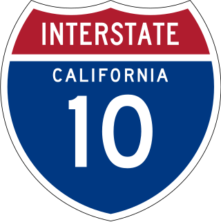
Interstate 10 (I-10) is a transcontinental Interstate Highway in the United States, stretching from Santa Monica, California, to Jacksonville, Florida. The segment of I-10 in California runs east from Santa Monica through Los Angeles, San Bernardino, and Palm Springs before crossing into the state of Arizona. In the Greater Los Angeles area, it is known as the Santa Monica and San Bernardino freeways, linked by a short concurrency on I-5 at the East Los Angeles Interchange. I-10 also has parts designated as the Rosa Parks and Sonny Bono Memorial freeways. Some parts were also formerly designated as the Christopher Columbus Transcontinental Highway. However, the California State Legislature removed this designation following the passage of a bill on August 31, 2022. I-10 is also known colloquially as "the 10" to Southern California residents (See also California English § Freeways).

Route 15, consisting of the contiguous segments of State Route 15 (SR 15) and Interstate 15 (I-15), is a major north–south state highway and Interstate Highway in the U.S. state of California, connecting San Bernardino, Riverside, and San Diego Counties. The route consists of the northernmost 289.24 miles (465.49 km) of I-15, which extends north through Nevada, Arizona, Utah, Idaho, and Montana to the Canada–US border. It is a major thoroughfare for traffic between San Diego and the Inland Empire, as well as between Southern California, Las Vegas, Nevada, and the Intermountain West.

Greater Los Angeles has a complex multimodal transportation infrastructure, which serves as a regional, national and international hub for passenger and freight traffic. The transportation system of Greater Los Angeles includes the United States' largest port complex, seven commuter rail lines, Amtrak service, a subway system within the city of Los Angeles, and numerous highways. Los Angeles is integrated into the Interstate Highway System by Interstate 5, Interstate 10, and Interstate 15, along with numerous auxiliary highways and state routes. Bus service is also included locally within the area by numerous local government agencies. Subways and light commuter rail lines are present within Los Angeles proper, allowing mass transportation within the city. Commuter railroads are run by Metrolink. Amtrak has numerous railroad lines that connect Los Angeles to the rest of the country.


