Brownstown is a borough in Cambria County, Pennsylvania, United States. The population was 744 at the 2010 census. It is part of the Johnstown, Pennsylvania Metropolitan Statistical Area and also part of Johnstown's urban area.

Cambria Township is a township in Cambria County, Pennsylvania, United States. The population was 5,781 at the 2020 census. It is part of the Johnstown, Pennsylvania Metropolitan Statistical Area and geographically surrounds the borough of Ebensburg, the Cambria County seat.
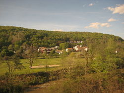
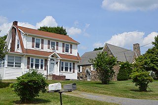
Carrolltown is a borough in Cambria County, Pennsylvania, United States. The population was 853 at the 2010 census, down from 1,049 at the 2000 census. It is part of the Johnstown, Pennsylvania Metropolitan Statistical Area.
Croyle Township is a township in Cambria County, Pennsylvania, United States. It is part of the Johnstown, Pennsylvania Metropolitan Statistical Area. The population was 2,339 at the 2010 census.

Daisytown is a borough in Cambria County, Pennsylvania, United States. It is part of the Johnstown, Pennsylvania Metropolitan Statistical Area. The population was 326 at the 2010 census.
Dale is a borough in Cambria County, Pennsylvania, United States. It is part of the Johnstown, Pennsylvania Metropolitan Statistical Area. The population was 1,234 at the 2010 census, down from 1,503 at the 2000 census.

East Carroll Township is a township in Cambria County, Pennsylvania, United States. The population was 1,654 at the 2010 census. It is part of the Johnstown, Pennsylvania Metropolitan Statistical Area.

East Conemaugh is a borough in Cambria County, Pennsylvania, United States. It is part of the Johnstown, Pennsylvania Metropolitan Statistical Area. The population was 1,220 at the 2010 census.

Ferndale is a borough in Cambria County, Pennsylvania, United States. It is part of the Johnstown, Pennsylvania Metropolitan Statistical Area. The population was 1,636 at the 2010 census, down from 1,834 at the 2000 census.
Geistown is a borough in Cambria County, Pennsylvania, United States. It is part of the Johnstown, Pennsylvania Metropolitan Statistical Area. The population was 2,467 at the 2010 census.

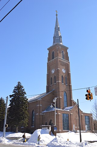
Hastings is a borough in Cambria County, Pennsylvania, United States. It is part of the Johnstown, Pennsylvania Metropolitan Statistical Area. The population was 1,278 at the 2010 census.

Loretto is a borough in Cambria County, Pennsylvania, United States. As of the 2010 census it had a population of 1,302. Like the rest of Cambria County, it is part of the Johnstown, Pennsylvania Metropolitan Statistical Area. Loretto is the home of Saint Francis University.
Northern Cambria is a borough in Cambria County, Pennsylvania, United States. It is part of the Johnstown, Pennsylvania Metropolitan Statistical Area. The population was 3,835 at the 2010 census.
Richland Township is a township in Cambria County, Pennsylvania, United States. The population was 12,814 at the 2010 census. It is part of the Johnstown, Pennsylvania Metropolitan Statistical Area.

Scalp Level is a borough in Cambria County, Pennsylvania, United States. It is part of the Johnstown, Pennsylvania Metropolitan Statistical Area. The population was 778 at the 2010 census.

South Fork is a borough in Cambria County, Pennsylvania, United States. It is part of the Johnstown, Pennsylvania Metropolitan Statistical Area. The population was 928 at the 2010 census, down from 1,138 at the 2000 census.

Southmont is a borough in Cambria County, Pennsylvania, United States. It is part of the Johnstown, Pennsylvania Metropolitan Statistical Area. The population was 2,284 at the 2010 census. It was incorporated in 1919 out of Upper Yoder Township.

Stonycreek Township is a township in Cambria County, Pennsylvania, United States. The population was 2,844 at the 2010 census, down from 3,204 at the 2000 census. It is part of the Johnstown, Pennsylvania Metropolitan Statistical Area.

Summerhill is a borough in Cambria County, Pennsylvania, United States. The population was 490 at the 2010 census.

Franklin is a borough in Cambria County, Pennsylvania, United States. It is part of the Johnstown, Pennsylvania Metropolitan Statistical Area. At the 2010 census the borough population was 323, down from 442 at the 2000 census.