Elk Falls, Kansas

Last updated

Elk Falls, Kansas
Elk County Kansas Incorporated and Unincorporated areas Elk Falls Highlighted.svg
Location within Elk County and Kansas
Map of Elk Co, Ks, USA.png
Coordinates: 37°22′24″N96°11′36″W / 37.37333°N 96.19333°W / 37.37333; -96.19333 [1]
Country United States
State Kansas
County Elk
Founded1870
Incorporated 1887 [2]
Named for Falls on Elk River
Government
[2]
  Type Mayor–Council
Area
[3]
  Total0.73 sq mi (1.89 km2)
  Land0.73 sq mi (1.88 km2)
  Water0.00 sq mi (0.00 km2)
Elevation
[1]
965 ft (294 m)
Population
 (2020) [4]
  Total113
  Density150/sq mi (60/km2)
Time zone UTC-6 (CST)
  Summer (DST) UTC-5 (CDT)
ZIP code
67345
Area code 620
FIPS code 20-20300
GNIS ID 2394648 [1]

Elk Falls is a city in Elk County, Kansas, United States, [1] along the Elk River. As of the 2020 census, the population of the city was 113. [4]

Contents

History

The first European-American house was built at Elk Falls in 1870, and a post office was opened that same year. [5] Elk Falls was named for a waterfall on the Elk River, near where the town developed. [6] Two early settlers in the rural community were the widow Prudence Crandall (who took back her maiden name after her husband died), an educator from Connecticut who had established the Canterbury Female Boarding School in the 1830s for African-American girls and young women; and her brother Hezekiah. They both died here and were buried in the town cemetery. [7]

Geography

According to the United States Census Bureau, the city has a total area of 0.87 square miles (2.25 km2), of which, 0.86 square miles (2.23 km2) is land and 0.01 square miles (0.03 km2) is water. [8]

Demographics

Historical population
CensusPop.Note
1880 513
1890 350−31.8%
1910 271
1920 203−25.1%
1930 28841.9%
1940 2942.1%
1950 276−6.1%
1960 179−35.1%
1970 124−30.7%
1980 15121.8%
1990 122−19.2%
2000 112−8.2%
2010 107−4.5%
2020 1135.6%
U.S. Decennial Census

2020 census

The 2020 United States census counted 113 people, 54 households, and 34 families in Elk Falls. [9] [10] The population density was 155.4 per square mile (60.0/km2). There were 55 housing units at an average density of 75.7 per square mile (29.2/km2). [10] [11] The racial makeup was 89.38% (101) white or European American (88.5% non-Hispanic white), 0.0% (0) black or African-American, 0.88% (1) Native American or Alaska Native, 0.0% (0) Asian, 0.0% (0) Pacific Islander or Native Hawaiian, 0.88% (1) from other races, and 8.85% (10) from two or more races. [12] Hispanic or Latino of any race was 5.31% (6) of the population. [13]

Of the 54 households, 20.4% had children under the age of 18; 46.3% were married couples living together; 13.0% had a female householder with no spouse or partner present. 27.8% of households consisted of individuals and 16.7% had someone living alone who was 65 years of age or older. [10] The average household size was 1.8 and the average family size was 2.5. [14] The percent of those with a bachelor’s degree or higher was estimated to be 30.1% of the population. [15]

26.5% of the population was under the age of 18, 1.8% from 18 to 24, 12.4% from 25 to 44, 30.1% from 45 to 64, and 29.2% who were 65 years of age or older. The median age was 56.2 years. For every 100 females, there were 85.2 males. [10] For every 100 females ages 18 and older, there were 76.6 males. [10]

The 2016-2020 5-year American Community Survey estimates show that the median household income was $26,667 (with a margin of error of +/- $21,261) and the median family income was $58,750 (+/- $31,140). [16] Approximately, 0.0% of families and 14.4% of the population were below the poverty line, including 0.0% of those under the age of 18 and 0.0% of those ages 65 or over. [17] [18]

2010 census

As of the census [19] of 2010, there were 107 people, 54 households, and 33 families residing in the city. The population density was 124.4 inhabitants per square mile (48.0/km2). There were 68 housing units at an average density of 79.1 per square mile (30.5/km2). The racial makeup of the city was 92.5% White, 1.9% Native American, 0.9% Asian, and 4.7% from two or more races. Hispanic or Latino of any race were 0.9% of the population.

There were 54 households, of which 16.7% had children under the age of 18 living with them, 50.0% were married couples living together, 9.3% had a female householder with no husband present, 1.9% had a male householder with no wife present, and 38.9% were non-families. 35.2% of all households were made up of individuals, and 22.2% had someone living alone who was 65 years of age or older. The average household size was 1.98 and the average family size was 2.52.

The median age in the city was 52.9 years. 16.8% of residents were under the age of 18; 2.9% were between the ages of 18 and 24; 9.3% were from 25 to 44; 42.9% were from 45 to 64; and 28% were 65 years of age or older. The gender makeup of the city was 45.8% male and 54.2% female.

2000 census

As of the census [20] of 2000, there were 112 people, 51 households, and 32 families residing in the city. The population density was 128.5 inhabitants per square mile (49.6/km2). There were 74 housing units at an average density of 84.9 per square mile (32.8/km2). The racial makeup of the city was 92.86% White, 0.89% Native American, 0.89% Asian, 0.89% from other races, and 4.46% from two or more races. Hispanic or Latino of any race were 3.57% of the population.

There were 51 households, out of which 23.5% had children under the age of 18 living with them, 58.8% were married couples living together, 2.0% had a female householder with no husband present, and 35.3% were non-families. 27.5% of all households were made up of individuals, and 11.8% had someone living alone who was 65 years of age or older. The average household size was 2.20 and the average family size was 2.70.

In the city, the population was spread out, with 19.6% under the age of 18, 4.5% from 18 to 24, 18.8% from 25 to 44, 37.5% from 45 to 64, and 19.6% who were 65 years of age or older. The median age was 48 years. For every 100 females, there were 107.4 males. For every 100 females age 18 and over, there were 104.5 males.

The median income for a household in the city was $20,893, and the median income for a family was $32,500. Males had a median income of $29,375 versus $20,250 for females. The per capita income for the city was $15,817. There were 6.7% of families and 2.9% of the population living below the poverty line, including no under eighteens and none of those over 64.

Education

The community is served by West Elk USD 282 public school district. West Elk High School is located in Howard. The West Elk High School mascot is Patriots. [21]

Related Research Articles

<span class="mw-page-title-main">Elk Run Heights, Iowa</span> City in Iowa, United States

Elk Run Heights is a city in Black Hawk County, Iowa, United States. The population was 1,069 at the 2020 census. It is part of the Waterloo–Cedar Falls Metropolitan Statistical Area.

<span class="mw-page-title-main">Reserve, Kansas</span> City in Brown County, Kansas

Reserve is a city in Brown County, Kansas, United States. As of the 2020 census, the population of the city was 67. It is located approximately 1.5 miles south of the Nebraska-Kansas border.

<span class="mw-page-title-main">Glasco, Kansas</span> City in Cloud County, Kansas

Glasco is a city in Cloud County, Kansas, United States. As of the 2020 census, the population of the city was 441.

<span class="mw-page-title-main">Waverly, Kansas</span> City in Coffey County, Kansas

Waverly is a city in Coffey County, Kansas, United States. As of the 2020 census, the population of the city was 574.

<span class="mw-page-title-main">Grenola, Kansas</span> City in Elk County, Kansas

Grenola is a city in Elk County, Kansas, United States. As of the 2020 census, the population of the city was 151.

<span class="mw-page-title-main">Howard, Kansas</span> City in Elk County, Kansas

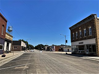
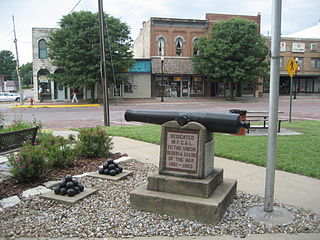
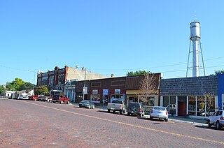
Howard is a city in and the county seat of Elk County, Kansas, United States. As of the 2020 census, the population of the city was 570.

<span class="mw-page-title-main">Longton, Kansas</span> City in Elk County, Kansas

Longton is a city in Elk County, Kansas, United States, along the Elk River. As of the 2020 census, the population of the city was 288.

<span class="mw-page-title-main">Hanston, Kansas</span> City in Hodgeman County, Kansas

Hanston is a city in Hodgeman County, Kansas, United States. As of the 2020 census, the population of the city was 259.

<span class="mw-page-title-main">Holton, Kansas</span> City in Jackson County, Kansas

Holton is a city in and the county seat of Jackson County, Kansas, United States. As of the 2020 census, the population of the city was 3,401.

<span class="mw-page-title-main">Oskaloosa, Kansas</span> City and County seat in Kansas, United States

Oskaloosa is a city in and the county seat of Jefferson County, Kansas, United States. As of the 2020 census, the population of the city was 1,110.

<span class="mw-page-title-main">Meade, Kansas</span> City in Meade County, Kansas

Meade is a city in and the county seat of Meade County, Kansas, United States. As of the 2020 census, the population of the city was 1,505.

<span class="mw-page-title-main">Elk City, Kansas</span> City in Montgomery County, Kansas

Elk City is a city in Montgomery County, Kansas, United States, along the Elk River. As of the 2020 census, the population of the city was 260.

<span class="mw-page-title-main">Ness City, Kansas</span> City in Ness County, Kansas

Ness City is a city in and the county seat of Ness County, Kansas, United States. As of the 2020 census, the population of the city was 1,329. Ness City is famous for its four-story Old Ness County Bank Building located downtown, and nicknamed Skyscraper of the Plains.

<span class="mw-page-title-main">Lyndon, Kansas</span> City in Osage County, Kansas

Lyndon is a city in, and the county seat of Osage County, Kansas, United States. As of the 2020 census, the population of the city was 1,037.

<span class="mw-page-title-main">Partridge, Kansas</span> City in Reno County, Kansas

Partridge is a city in Reno County, Kansas, United States. As of the 2020 census, the population of the city was 209.

<span class="mw-page-title-main">Belleville, Kansas</span> City in Republic County, Kansas

Belleville is a city in and the county seat of Republic County, Kansas, United States. As of the 2020 census, the population of the city was 2,007.

<span class="mw-page-title-main">Colwich, Kansas</span> City in Sedgwick County, Kansas

Colwich is a city in Sedgwick County, Kansas, United States, located northwest of Wichita. As of the 2020 census, the population of the city was 1,455.

<span class="mw-page-title-main">Argonia, Kansas</span> City in Sumner County, Kansas

Argonia is a city in Sumner County, Kansas, United States. As of the 2020 census, the population of the city was 456.

<span class="mw-page-title-main">Neosho Falls, Kansas</span> City in Woodson County, Kansas, United States

Neosho Falls is a city in Woodson County, Kansas, United States. As of the 2020 census, the population of the city was 134.

<span class="mw-page-title-main">Valley Falls, Rhode Island</span> Village and census-designated place in Rhode Island, US

Valley Falls is a village and census-designated place (CDP) in the town of Cumberland, Providence County, Rhode Island, United States. The population was 12,094 at the 2020 census.

References

  1. 1 2 3 4 U.S. Geological Survey Geographic Names Information System: Elk Falls, Kansas
  2. 1 2 "City of Elk Falls". The League of Kansas Municipalities. May 29, 2019.
  3. "2019 U.S. Gazetteer Files". United States Census Bureau. Retrieved July 24, 2020.
  4. 1 2 "Profile of Elk Falls, Kansas in 2020". United States Census Bureau. Archived from the original on May 4, 2022. Retrieved May 4, 2022.
  5. Blackmar, Frank Wilson (1912). Kansas: A Cyclopedia of State History, Embracing Events, Institutions, Industries, Counties, Cities, Towns, Prominent Persons, Etc. Standard Publishing Company. pp.  575.
  6. Gannett, Henry (1905). The Origin of Certain Place Names in the United States. Govt. Print. Off. pp.  117.
  7. "Prudence Crandall Interstate Memorial Marker", Travel Kansas
  8. "US Gazetteer files 2010". United States Census Bureau. Archived from the original on January 25, 2012. Retrieved July 6, 2012.
  9. "US Census Bureau, Table P16: HOUSEHOLD TYPE". data.census.gov. Retrieved January 2, 2024.
  10. 1 2 3 4 5 "US Census Bureau, Table DP1: PROFILE OF GENERAL POPULATION AND HOUSING CHARACTERISTICS". data.census.gov. Retrieved January 2, 2024.
  11. Bureau, US Census. "Gazetteer Files". Census.gov. Retrieved December 30, 2023.
  12. "US Census Bureau, Table P1: RACE". data.census.gov. Retrieved January 2, 2024.
  13. "US Census Bureau, Table P2: HISPANIC OR LATINO, AND NOT HISPANIC OR LATINO BY RACE". data.census.gov. Retrieved January 2, 2024.
  14. "US Census Bureau, Table S1101: HOUSEHOLDS AND FAMILIES". data.census.gov. Retrieved January 2, 2024.
  15. "US Census Bureau, Table S1501: EDUCATIONAL ATTAINMENT". data.census.gov. Retrieved January 2, 2024.
  16. "US Census Bureau, Table S1903: MEDIAN INCOME IN THE PAST 12 MONTHS (IN 2020 INFLATION-ADJUSTED DOLLARS)". data.census.gov. Retrieved January 2, 2024.
  17. "US Census Bureau, Table S1701: POVERTY STATUS IN THE PAST 12 MONTHS". data.census.gov. Retrieved January 2, 2024.
  18. "US Census Bureau, Table S1702: POVERTY STATUS IN THE PAST 12 MONTHS OF FAMILIES". data.census.gov. Retrieved January 2, 2024.
  19. "U.S. Census website". United States Census Bureau . Retrieved July 6, 2012.
  20. "U.S. Census website". United States Census Bureau . Retrieved January 31, 2008.
  21. "West Elk Schools". USD 282. Retrieved January 4, 2017.

Further reading