
Southern California is a geographic and cultural region that generally comprises the southern portion of the U.S. state of California. It includes the Los Angeles metropolitan area as well as the Inland Empire. The region generally contains ten of California's 58 counties: Los Angeles, San Diego, Orange, Riverside, San Bernardino, Kern, Ventura, Santa Barbara, San Luis Obispo, and Imperial counties.

The San Andreas Fault is a continental right-lateral strike-slip transform fault that extends roughly 1,200 kilometers (750 mi) through the U.S. state of California. It forms part of the tectonic boundary between the Pacific plate and the North American plate. Traditionally, for scientific purposes, the fault has been classified into three main segments, each with different characteristics and a different degree of earthquake risk. The average slip rate along the entire fault ranges from 20 to 35 mm per year.
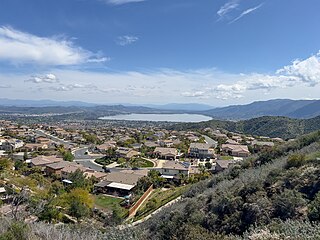
The Whittier Fault is a geologic fault located in eastern Los Angeles County in Southern California, that is one of the two upper branches of the Elsinore Fault Zone, with the Chino Fault the second.

The Temecula Valley is a graben rift valley in western Riverside County, California.
The Chino Fault extends along the eastern Chino Hills range region, from Corona in Riverside County to the Los Serranos, Chino Hills area of San Bernardino County in Southern California.

Laguna Salada is a vast dry lake some 10 meters below sea level in the Sonoran Desert of Baja California, 30 km (19 mi) southwest of Mexicali. This lake was called "Ha wi mək" in Cocopah language and "Ha-sa-ai" in Kumeyaay language. When dry, the flatness of the exposed lake bed sediments makes it a favoured location for recreational driving. It is also notorious for its dust storms when dry, usually the result of monsoonal thunderstorms during the summer. During times of significant rain the lagoon can fill completely with water, leaving the unpaved road along its west bank as the only means of traversing the area. Flanked by the Sierra de Los Cucapah and the Sierra de Juárez mountain ranges, the lake is approximately 60 km (37 mi) long and 17 km (11 mi) at its widest point.

The 2010 Baja California earthquake occurred on April 4 with a moment magnitude of 7.2 and a maximum Mercalli intensity of VII. The shock originated at south of Guadalupe Victoria, Baja California, Mexico.

The Laguna Salada Fault is a geological fault between the United States and Mexico. About 64–80 kilometers (40–50 mi) long, it straddles the Imperial County-California–Baja California border.

The Imperial Fault Zone is a system of geological faults located in Imperial County in the Southern California region, and adjacent Baja California state in Mexico. It cuts across the border between the United States and Mexico.
The Brawley Seismic Zone (BSZ), also known as the Brawley fault zone, is a predominantly extensional tectonic zone that connects the southern terminus of the San Andreas Fault with the Imperial Fault in Southern California. The BSZ is named for the nearby town of Brawley in Imperial County, California, and the seismicity there is characterized by earthquake swarms.
The 1940 El Centro earthquake occurred at 21:35 Pacific Standard Time on May 18 in the Imperial Valley in southeastern Southern California near the international border of the United States and Mexico. It had a moment magnitude of 6.9 and a maximum perceived intensity of X (Extreme) on the Mercalli intensity scale. It was the first major earthquake to be recorded by a strong-motion seismograph located next to a fault rupture. The earthquake was characterized as a typical moderate-sized destructive event with a complex energy release signature. It was the strongest recorded earthquake in the Imperial Valley, causing widespread damage to irrigation systems and killing nine people.
The 1892 Laguna Salada earthquake occurred at . It had an estimated moment magnitude of 7.1–7.2 and a maximum perceived intensity of VIII (Severe). The shock was centered near the Mexico–United States border and takes its name from a large dry lake bed in Baja California, Mexico. There were no reported casualties, but the event affected the then largely-uninhabited areas of northern Mexico and Southern California.
The 1979 Imperial Valley earthquake occurred at 16:16 Pacific Daylight Time on 15 October just south of the Mexico–United States border. It affected Imperial Valley in Southern California and Mexicali Valley in northern Baja California. The earthquake had a relatively shallow hypocenter and caused property damage in the United States estimated at US$30 million. The irrigation systems in the Imperial Valley were badly affected, but no deaths occurred. It was the largest earthquake to occur in the contiguous United States since the 1971 San Fernando earthquake eight years earlier.
The Elsinore Trough is a graben rift valley in Riverside County, southern California. It is created by the Elsinore Fault Zone.
Elsinore Valley is a graben rift valley in western Riverside County, California, a part of the Elsinore Trough. The Elsinore Valley is a graben between the Santa Ana Block to the southwest and the Perris Block on the northeast. It is a complex graben, divided lengthwise into several smaller sections by transverse faults.
The Perris Block is the central block of three major fault-bounded blocks of the northern part of the Peninsular Ranges. The Perris Block lies between the Santa Ana Block to the west and the San Jacinto Block to the east. The Perris Block, was named by Walter A. English in 1925 for the city of Perris, located near the center of the block.
Wolf Valley is a graben rift valley in the Elsinore Trough, in western Riverside County, California.
The 1968 Borrego Mountain earthquake occurred on April 8, at 18:28 PST in the geologically active Salton Trough of Southern California. The Salton Trough represents a pull-apart basin formed by movements along major faults. This region is dominated by major strike-slip faults one of them being the San Jacinto Fault which produced the 1968 earthquake. The mainshock's epicenter was near the unincorporated community of Ocotillo Wells in San Diego County. The moment magnitude (Mw ) 6.6 strike-slip earthquake struck with a focal depth of 11.1 km (6.9 mi). The zone of surface rupture was assigned a maximum Modified Mercalli intensity (MMI) of VII.
The 1915 Imperial Valley earthquakes were two destructive shocks centered near El Centro, California on June 22. The earthquakes measured 6.25 and occurred nearly one hour apart at 19:59 and 20:57 PST. Both shocks were assigned VIII (Severe) on the Modified Mercalli intensity scale. Heavy damage occurred in the areas of Mexicali and El Centro, amounting to $900,000. At least six people were killed in the earthquakes.

The San Diego Trough Fault Zone is a group of connected right-lateral strike-slip faults that run parallel to the coast of Southern California, United States, for 150–166 km (93–103 mi). The fault zone takes up 25% of the slip within the Inner Continental Borderlands. Portions of the fault get within 30 km (19 mi) of populated cities; however, the faults never reach shore. The north of the fault zone begins where the San Pedro Basin Fault Zone and the Santa Catalina Fault Zone meet, and the southern section terminates where it reaches the Bahía Soledad Fault. Seismic risk along the fault is high, with potential earthquake scenarios reaching up to magnitude 7.9 in the worst case. An earthquake of this size would devastate coastal areas.
