
Connecticut is the southernmost state in the New England region of the Northeastern United States. It is bordered by Rhode Island to the east, Massachusetts to the north, New York to the west, and Long Island Sound to the south. Its capital is Hartford and its most populous city is Bridgeport. Historically the state is part of New England as well as the tri-state area with New York and New Jersey. The state is named for the Connecticut River which approximately bisects the state. The word "Connecticut" is derived from various anglicized spellings of "Quinnetuket”, a Mohegan-Pequot word for "long tidal river".

New Haven is a city in the U.S. state of Connecticut. It is located on New Haven Harbor on the northern shore of Long Island Sound in New Haven County, Connecticut and is part of the New York City metropolitan area. With a population of 134,023 as determined by the 2020 U.S. census, New Haven is the third largest city in Connecticut after Bridgeport and Stamford and the principal municipality of Greater New Haven, which had a total 2020 population of 864,835.
Derby is a city in New Haven County, Connecticut, United States, approximately 8 miles west-northwest of New Haven. It is located in southwest Connecticut at the confluence of the Housatonic and Naugatuck Rivers. It borders the cities of Ansonia to the north and Shelton to the southwest, and the towns of Orange to the south, Seymour to the northwest, and Woodbridge to the east. The population was 12,325 at the 2020 census. It is the smallest city in Connecticut by area, at 5.3 square miles.
Uncasville is an area in the town of Montville, Connecticut, United States. It is a village in southeastern Montville, at the mouth of the Oxoboxo River where it flows into the Thames River. The name is now applied more generally to all of the east end of Montville, which is the area served by the Uncasville ZIP Code.

The Connecticut Colony or Colony of Connecticut, originally known as the Connecticut River Colony or simply the River Colony, was an English colony in New England which later became Connecticut. It was organized on March 3, 1636 as a settlement for a Puritan congregation, and the English permanently gained control of the region in 1637 after struggles with the Dutch. The colony was later the scene of a bloody war between the colonists and Pequot Indians known as the Pequot War. Connecticut Colony played a significant role in the establishment of self-government in the New World with its refusal to surrender local authority to the Dominion of New England, an event known as the Charter Oak incident which occurred at Jeremy Adams' inn and tavern.

New Haven Coliseum was a sports and entertainment arena located in downtown New Haven, Connecticut. Construction began in 1968 and was completed in 1972. The Coliseum was officially closed on September 1, 2002, by Mayor John DeStefano Jr., and demolished by implosion on January 20, 2007.
The Mill River is a river in New Haven County, Connecticut.

Area codes 203 and 475 are telephone area codes in the North American Numbering Plan (NANP) for the southwestern part of the U.S. state of Connecticut. The numbering plan area (NPA) is mostly coextensive with the Connecticut portion of the New York metropolitan area, and comprises most of Fairfield County, all of New Haven County, and a small portion of Litchfield County.
Connecticut's 2nd congressional district is a congressional district in the U.S. state of Connecticut. Located in the eastern part of the state, the district includes all of New London County, Tolland County, and Windham County, along with parts of Hartford, Middlesex, and New Haven counties. Principal cities include Enfield, Norwich, New London, and Groton.
Connecticut's 3rd congressional district is a congressional district in the U.S. state of Connecticut. Located in the central part of the state, the district includes the city of New Haven and its surrounding suburbs.

Cos Cob is a neighborhood and census-designated place in the town of Greenwich, Connecticut. It is located on the Connecticut shoreline in southern Fairfield County. It had a population of 6,770 at the 2010 census.
The Pitkin Tunnel or Pitkin Street Tunnel is a below-ground-level, roofed but not entirely enclosed roadway, in downtown New Haven, Connecticut, United States. It accommodates simultaneous motor vehicle traffic in both directions. The tunnel runs from the eastbound one-way Elm Street between Church and Orange Streets, with the southbound lanes of State Street between Court and Chapel Streets across from State Street station. It passes under Orange Street. It runs under or next to the New Haven City Hall and County Courthouse and the Federal Courthouse on Church Street, the local Emergency Operations Center, and at least three more buildings that house banks and the headquarters of United Illuminating, the electric utility serving much of New Haven and Fairfield counties.
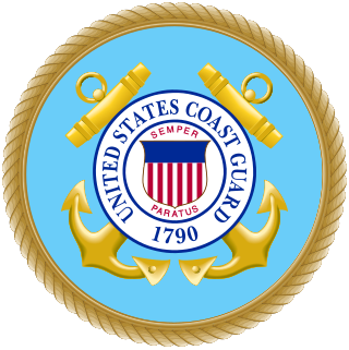
United States Coast Guard Station New Haven is located at 120 Woodward Avenue, New Haven, Connecticut 06512. It belongs to the Long Island Sound sector of operations.
Mill River is a primarily industrial neighborhood in the city of New Haven, Connecticut located between the Wooster Square and Fair Haven neighborhoods.

WQGN-FM is a commercial radio station licensed to Groton, Connecticut, and serving the New London - Groton area. It broadcasts a CHR/Top 40 radio format and is owned by Cumulus Media. WQGN carries several nationally syndicated shows including The Kidd Kraddick Morning Show and the Carson Daly Top 30. The radio studios and offices are located on Governor Winthrop Boulevard in New London.

Miya's was a restaurant in New Haven, Connecticut, United States, credited as the first sustainable sushi restaurant in the world. The restaurant was founded by Yoshiko Lai, a Japanese nutritionist. As of 2021, they are permanently closed.
West Rock is a neighborhood of the city of New Haven, Connecticut.
Tryon's Raid occurred in July 1779, during the American Revolutionary War, in which 2700 men, led by British Major General William Tryon, raided the Connecticut ports of New Haven, Fairfield, and Norwalk. They destroyed military and public stores, supply houses, and ships as well as private homes, churches, and other public buildings. The raids were ineffectually resisted by militia forces.

The United Illuminating Company (UI) is a regional electric distribution company based in Orange, Connecticut. Established in 1899, UI is engaged in the purchase, transmission, distribution and sale of electricity and related services to 325,000 residential, commercial and industrial customers in 17 towns and cities in the greater New Haven and Bridgeport areas. It is a subsidiary of Avangrid.
The Storrs Agricultural Experiment Station (SAES) is an American agricultural experiment station operated by the University of Connecticut and founded in 1887. Part of UConn's College of Agriculture, Health, and Natural Resources, the SAES directs agriculture-related research while the university's Cooperative Extension Service engages in community education and outreach. Kumar Venkitanarayanan is the Station's associate director. Its offices are located in the W. B. Young Building in Storrs.
