Fairfax, Vermont

Last updated
Fairfax, Vermont
Fairfax, Vermont (17129795518).jpg
A house in Fairfax during winter
Franklin County Vermont incorporated and unincorporated areas Fairfax highlighted.svg
Location in Franklin County and the state of Vermont.
Coordinates: 44°41′50″N72°59′52″W / 44.69722°N 72.99778°W / 44.69722; -72.99778 Coordinates: 44°41′50″N72°59′52″W / 44.69722°N 72.99778°W / 44.69722; -72.99778
Country United States
State Vermont
County Franklin
Communities Fairfax
Fairfax Falls
Huntsville
North Fairfax
Sanderson Corner
Area
  Total40.4 sq mi (104.7 km2)
  Land39.8 sq mi (103.2 km2)
  Water0.6 sq mi (1.5 km2)
Elevation
659 ft (201 m)
Population
 (2020)
  Total5,014
  Density126/sq mi (48.6/km2)
Time zone UTC-5 (Eastern (EST))
  Summer (DST) UTC-4 (EDT)
ZIP code
05454
Area code(s) 802
FIPS code 50-24925 [1]
GNIS feature ID1462092 [2]
Website www.fairfax-vt.gov

Fairfax is a town in Franklin County, Vermont, United States. The population was 5,014 at the 2020 census. [3]

Contents

Geography

The New England town of Fairfax is in southern Franklin County and is bordered by Chittenden County to the south. According to the United States Census Bureau, the town has a total area of 40.4 square miles (104.7 km2), of which 39.8 square miles (103.2 km2) is land and 0.58 square miles (1.5 km2), or 1.44%, is water. [4] The Lamoille River, a tributary of Lake Champlain, flows from east to west across the southern part of the town, passing through the communities of Fairfax and Fairfax Falls.

Demographics

Historical population
CensusPop.
1790 254
1800 786209.4%
1810 1,30165.5%
1820 1,3594.5%
1830 1,72927.2%
1840 1,91911.0%
1850 2,11110.0%
1860 1,987−5.9%
1870 1,956−1.6%
1880 1,820−7.0%
1890 1,523−16.3%
1900 1,338−12.1%
1910 1,318−1.5%
1920 1,244−5.6%
1930 1,2490.4%
1940 1,229−1.6%
1950 1,129−8.1%
1960 1,24410.2%
1970 1,3669.8%
1980 1,80532.1%
1990 2,48537.7%
2000 3,76551.5%
2010 4,28513.8%
2020 5,01417.0%
U.S. Decennial Census [5]

As of the census [1] of 2010, there were 4,285 people, 1,591 households, and 1,226 families residing in the town. The population density was 105.8 people per square mile (40.8/km2). There were 1,683 housing units at an average density of 41.6 per square mile (16.0/km2). The racial makeup of the town was 97.8% White and 1.3% Hispanic or Latino. There were 39.8% of households under the age of 18 living with them, 64.2% were married couples living together, 8.2% had a female householder with no husband present, and 22.9% were non-families and 16.0% of all households were made up of individuals, and 16.2% had someone living alone who was 65 years of age or older. The average household size was 2.69 and the average family size was 3.00.

The median income for a household in the town was $70,348, and the median income for a family was $77,159. The per capita income for the town was $18,632. About 2.7% of families and 4.8% of the population were below the poverty line, including 6.7% of those under age 18 and 4.1% of those age 65 or over.

Education

Bellows Free Academy – Fairfax, is a public K–12 school in Fairfax. The school has an average graduating class of 80 from students drawn from Fairfax and the surrounding towns of Fletcher, Georgia, Fairfield, and Westford. As of 2010, the school's per-pupil tuition is $9,870 [6] paid by the towns (sometimes from outside the school district) who send the students to the school.

Hiram Bellows bought 4 acres (1.6 ha) of land and left money for the construction of a free school in Fairfax, Vermont. 'Bellows Free Academy – Fairfax and Saint Albans' was built from the money earned in stocks willed to the town by Bellows. The stocks had been invested in the Chicago Rock Island Railway. When the stocks had earned $250,000, the school was constructed. [7] The original school burned on January 14, 1941, [7] and the current school is its replacement. The school's team name is The Bullets. It competes as a Division III school. School colors are maroon and white.

Notable people

Related Research Articles

Lamoille County, Vermont County in Vermont, United States

Lamoille County is a county located in the U.S. state of Vermont. As of the 2020 census, the population was 25,945, and it is the third-least populous county in Vermont. Its shire town is the town of Hyde Park, while Morristown is the county's largest town by population as well as its main commercial center. The county was created in 1835 and organized the following year.

Franklin County, Vermont County in Vermont, United States

Franklin County is a county located in the U.S. state of Vermont. As of the 2020 census, the population was 49,946. Its county seat is the city of St. Albans. It borders the Canadian province of Quebec. The county was created in 1792 and organized in 1796. Franklin County is part of the Burlington metropolitan area.

Chittenden County, Vermont County in Vermont, United States

Chittenden County is the most populous county in the U.S. state of Vermont. As of the 2020 census, the population was 168,323. The county seat is Vermont's most populous municipality, the city of Burlington. The county has over a quarter of Vermont's population and more than twice the population of Vermont's second most populous county, Rutland. The county also has more than twice the population density of Vermont's second most dense county, Washington. The county is named for Vermont's first governor and one of the framers of its constitution as an independent republic and later U.S. state, Thomas Chittenden.

Colchester, Vermont Town in Vermont, United States

Colchester is a town in Chittenden County, Vermont, United States. As of the 2020 census, the population of Colchester was 17,524. It is the fourth-most populous municipality and second-most populous town in the state of Vermont. Colchester borders Burlington, Vermont's most populous municipality. The town is directly to Burlington's north on the eastern shore of Lake Champlain, to the west of the Green Mountains. The Vermont National Guard is based in the town, and it is also home to Saint Michael's College and the Vermont campus of Southern New Hampshire University.

Hinesburg, Vermont Town in Vermont, United States

Hinesburg is a town in Chittenden County, Vermont, United States. The town was named for Abel Hine, town clerk. The population was 4,698 at the 2020 census.

Westford, Vermont Town in Vermont, United States

Westford is a town in Chittenden County, Vermont, United States. The population was 2,062 at the 2020 census.

Bakersfield, Vermont Town in Vermont, United States

Bakersfield is a town in Franklin County, Vermont, United States. The population was 1,273 at the 2020 census.

Fletcher, Vermont Town in Vermont, United States

Fletcher is a town in Franklin County, Vermont, United States. The population was 1,346 at the 2020 census.

Georgia, Vermont Town in Vermont, United States

Georgia is a town in Franklin County, Vermont, United States. The population was 4,845 at the 2020 census.

Highgate, Vermont Town in Vermont, United States

Highgate is a town in Franklin County, Vermont, United States. The population was 3,472 at the 2020 census. The town is on the Canada–US border and is a border town with Philipsburg, Quebec.

Montgomery, Vermont Town in Vermont, United States

Montgomery is a town in Franklin County, Vermont, United States. The population as of the 2020 census was 1,184. In 1963, part of Avery's Gore in Franklin County became part of Montgomery, with the other section becoming part of Belvidere in Lamoille County.

Richford, Vermont Town in Vermont, United States

Richford is a town in Franklin County, Vermont, United States, located along the Canada–United States border. The population was 2,346 at the 2020 census.

Morrisville, Vermont Village in Vermont, United States

Morrisville is a village in the town of Morristown, Lamoille County, Vermont, United States. As of the 2020 census, the village population was 2,086. Morrisville has two country clubs, a hospital, a school featuring Greek architecture and an airport. The hospital and one of the country clubs are named after Alexander Copley, a philanthropist who donated much of the money for their construction. Copley also donated a large sum of money for the construction of the town's high school that is currently called Peoples Academy.

Wolcott, Vermont Town in Vermont, United States

Wolcott is a town in Lamoille County, Vermont, United States. The town was named for General Oliver Wolcott, a signer of the Declaration of Independence. The population was 1,670 at the 2020 census.

Rockingham, Vermont Town in Vermont, United States

Rockingham is a Town in Windham County, on the southeastern Vermont border in the United States, along the Connecticut River. As of the 2020 census, the population was 4,832. Rockingham includes the incorporated villages of Bellows Falls and Saxtons River, as well as a large rural area west of Interstate 91.

Hartford, Vermont Town in Vermont, United States

Hartford is a town in Windsor County in the U.S. state of Vermont. It is on the New Hampshire border, at the intersection of Interstates 89 and 91. It is the site of the confluence of the White and Connecticut rivers; the Ottauquechee River also flows through the town. The town is composed of five unincorporated villages: Hartford, Quechee, West Hartford, White River Junction and Wilder. As of the 2020 census, the population was 10,686.

St. Albans (city), Vermont City in Vermont, United States

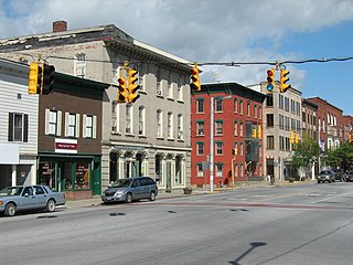
St. Albans is the county seat of Franklin County, Vermont, United States. At the 2020 census, the city population was 6,877. St. Albans City is surrounded by the town of Saint Albans which is incorporated separately from the city of St. Albans. The city is located in Northwestern Vermont in Franklin County. It lies 29 miles north of Burlington, the state's most populous city which is located in Chittenden County.

Swanton (village), Vermont Village in Vermont, United States

Swanton is a village in the town of Swanton in Franklin County, Vermont, United States. It is sometimes called Swanton Village to distinguish it from the surrounding town of the same name. The population was 2,328 at the 2020 census. It was founded in 1888.

Hyde Park (town), Vermont Town in Vermont, United States

Hyde Park is a town in and the shire town of Lamoille County, Vermont, United States. The town was named for Captain Jedediah Hyde, an early landowner who was a veteran of the American Revolutionary War. The population was 3,020 at the 2020 census. There is also a village of the same name within the town.

Westminster (town), Vermont Town in Vermont, United States

Westminster is a town in Windham County, Vermont, United States. The population was 3,016 at the 2020 census.

References

  1. 1 2 "U.S. Census website". United States Census Bureau . Retrieved 2008-01-31.
  2. "US Board on Geographic Names". United States Geological Survey. 2007-10-25. Retrieved 2008-01-31.
  3. "Census - Geography Profile: Fairfax town, Franklin County, Vermont". United States Census Bureau . Retrieved December 30, 2021.
  4. "Geographic Identifiers: 2010 Demographic Profile Data (G001): Fairfax town, Franklin County, Vermont". U.S. Census Bureau, American Factfinder. Retrieved September 7, 2016.[ dead link ]
  5. "U.S. Decennial Census". United States Census Bureau. Retrieved May 16, 2015.
  6. Note: for 2009–2010 see: Hallenbeck, Terri (30 September 2009). "GEORGIA:Residents show support for choice". Burlington, Vermont: Burlington Free Press. pp. 5B.
  7. 1 2 "Bellows Free Academy Fire – Fairfax, VT – January 17, 1941". www.vtgrandpa.com.
  8. Carleton, Hiram (1903). Genealogical and Family History of the State of Vermont. Vol. II. New York, NY: Lewis Publishing Company. pp. 51–52 via Internet Archive.
  9. Aldrich, Lewis Cass (1891). History of Franklin and Grand Isle Counties, Vermont. Syracuse, NY: D. Mason & Co. p.  697.