
Washington County is located in the western part of the U.S. state of Maryland. As of the 2020 census, the population was 154,705. It is the most populous county in the Western Maryland region and its county seat is Hagerstown.

Chance is a census-designated place (CDP) in Somerset County, Maryland, United States. The population was 377 at the 2000 census. It is included in the Salisbury, Maryland-Delaware Metropolitan Statistical Area.

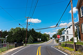
Funkstown is a town in Washington County, Maryland, United States. The population was 904 at the 2010 census.

Antrim Township is a township in Franklin County, Pennsylvania, United States. The population was 15,778 at the 2020 census, an increase over the figure of 12,504 tabulated in 2000. It was named after County Antrim in Northern Ireland.

Peach Bottom Township is a township in York County, Pennsylvania, 60 miles (97 km) south of Harrisburg. The population was 4,961 at the 2020 census.

Jefferson is an unincorporated community and census-designated place (CDP) in Frederick County, Maryland, United States. As of the 2020 census the town had a population of 2,235. Jefferson was established in 1774 and incorporated as a town in 1831. However, a year later, in 1832, the citizens of the town decided that municipal government was unnecessary, and dis-incorporated the town, which has been unincorporated since then.
Bivalve is an unincorporated community and census-designated place along the eastern shore of the lower Nanticoke River, near its mouth on the Chesapeake Bay, in Wicomico County, Maryland, United States. Its population was 201 as of the 2010 census. Bivalve takes its name from the oyster, upon which the town's economy once depended. It is part of the Salisbury, Maryland-Delaware Metropolitan Statistical Area.

Big Pool is an unincorporated community and census-designated place in western Washington County, Maryland, United States. Its population was 82 as of the 2010 census. It is between Clear Spring, Maryland and Hancock, Maryland along Interstate 70 and is officially a part of the Hagerstown Metropolitan Area.
Downsville is an unincorporated community and census-designated place (CDP) in southwestern Washington County, Maryland, United States. Its population was 355 as of the 2010 census. It is located southeast of Williamsport on Maryland Route 63 and on Maryland Route 632, southwest of Hagerstown. It is officially included in the Hagerstown Metropolitan Area.
Cearfoss is an unincorporated community and census-designated place in northwestern Washington County, Maryland, United States. Its population was 178 as of the 2010 census. Cearfoss is located northwest of Hagerstown and Maugansville, near the Pennsylvania border. Many highways intersect in Cearfoss in a roundabout, including Maryland routes 58, 63 and 494. Cearfoss is officially included in the Hagerstown Metropolitan Area.

Beaver Creek is an unincorporated community in eastern Washington County, Maryland, United States. Its population was 251 as of the 2010 census. It is located southeast of Hagerstown and north of Boonsboro near U.S. Route 40 and Maryland Route 66. The community is officially included in the Hagerstown Metropolitan Area. This town was founded in 1766.
Worton is an unincorporated community and census-designated place (CDP) in Kent County, Maryland, United States. As of the 2010 census it had a population of 249.

Kennedyville is an unincorporated community and census-designated place in Kent County, Maryland, United States. As of the 2010 census it had a population of 199.

Libertytown is an unincorporated community and census-designated place (CDP) in Frederick County, in the U.S. state of Maryland. As of the 2010 census it had a population of 950. The Abraham Jones House was listed on the National Register of Historic Places in 1973.

Sabillasville is an unincorporated community and census-designated place in Frederick County, Maryland, United States. As of the 2010 census it had a population of 354.
Antietam is an unincorporated community and census-designated place in Washington County, Maryland, United States. Its population was 89 as of the 2010 census. It is the site of Antietam Iron Furnace Site and Antietam Village, added to the National Register of Historic Places in 1975.
Eakles Mills is an unincorporated community in Washington County, Maryland, United States. Its population was 26 as of the 2020 census. Snively Farm was listed on the National Register of Historic Places in 1979.

Mapleville is an unincorporated community and census-designated place in eastern Washington County, Maryland, United States. Its population was 243 as of the 2020 census. It is officially a part of the Hagerstown Metropolitan Area.

Detour is an unincorporated community in Carroll County, Maryland, United States.
Tilghmanton is an unincorporated community and census-designated place in Washington County, Maryland, United States. Its population was 465 as of the 2010 census.


