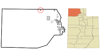
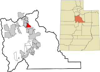
Located at the confluence of the San Pitch River and Cottonwood Creek, Fairview is the largest city in the northeast end of the Sanpete Valley. Founded in 1859, soon after the resettlement of nearby Mount Pleasant, Fairview was one of the first new towns established during the second wave of Mormon settlement in Sanpete County.
Pioneer-era house in Fairview, December 2004
Impressed with the area's possibilities while gathering wild hay in early 1859, James Naylor Jones, Isaac Young Vance, Warren P. Brady, and Jehu Cox wrote to Brigham Young asking for permission to create a settlement. The church president responded pragmatically, "If there is water for thirty families, you have my permission." At an organizing meeting held on 1 October 1859 in Mt. Pleasant, James N. Jones was chosen to lead a band of about twenty families interested in the new colonizing opportunity. The town site was surveyed, and by the end of 1860, a large log meeting house had been completed to house church, school, and social functions. Rows of poplars were planted, streets were graded, and fences were constructed as Fairview took on the appearance of the ubiquitous Mormon village. In 1864 the town obtained a post office and forsook its original name of North Bend in favor of the more descriptive name Fairview because it "commands an excellent view of the great granary extending south even beyond Manti, thirty miles distant."
During the Black Hawk War of the mid-1860s, some Fairview residents moved to Mt. Pleasant for protection after a few men were killed in deadly skirmishes. Those who remained complied with Brigham Young's instructions to build a fort. By the end of 1866, a thick rock wall ten feet high enclosed the center of town. Within a few years, the conflict diminished enough that aggressive settlement and community development commenced. In the ensuing decade, Fairview's population burgeoned to more than 1,000, making it the fourth largest in Sanpete by 1880. In 1900 and again in 1940, the town exceeded 1,700 people; however, in 1980, the population was just 900, ranking Fairview sixth in size among the county's nineteen communities.
Fairview shared its Mormon origin, governance and its overwhelming cultural and religious makeup with its neighboring villages. By 1880, Fairview had the smallest percentage of foreign-born, married adults (50.3 percent) of any of the major towns in a county which averaged 72.2 percent foreign-born. Initially the "child" of larger Mt. Pleasant six miles south, Fairview eventually became its rival, competing vigorously for land, water, timber, grazing rights, and what it considered a fair share of church and government funds. The town's Mormon bishops sometimes found themselves in the center of bitter disputes with leaders of other communities, to the dismay of local apostle and stake president Orson Hyde, who was assigned to arbitrate disputes and settle contentions.
Fairview Utah Tithing Office, July 2011
The people of Fairview took full part in the cooperative society of their times. In 1874 they enthusiastically followed the church council and established a united order. Stock certificates (7,500 shares) were sold at $10 a share to fund the venture. But like most of the other united orders in the territory, Fairview's was doomed to rapid failure. Poor crops and undercapitalization nearly forced its demise in 1874 after only a few months of existence. Despite efforts to keep it alive, the order was abandoned in 1876.
From its first inception, Fairview's economic base has depended on agriculture and the livestock industry. Following trapper Barney Ward's lead, irrigation ditches were dug and reservoir sites identified soon after settlement. Food crops, hay, and grains were planted, and in 1870, the town's first flour mill was constructed south of town. Livestock raising, ranging from beef and sheep to chickens and turkeys, has persisted throughout Fairview's history. Because of its proximity to canyon forests, sawmills were established in the early decades to support the lumber industry. By the start of the 20th century, there were half a dozen steam sawmills in the mountains east of town.
Beginning in the late 1860s, Fairview developed a one-street commercial district along the old territorial road running through the middle of town. In 1869 Zion's Cooperative Mercantile Institution was started in Fairview. Other stores and businesses followed so that by 1900 Fairview's downtown could boast of a public library, several general stores, a furniture store, a creamery, a harness shop, a butcher shop, and two hotels. In 1881 a Presbyterian mission school was funded, with a chapel erected in 1894. A public school system was established in the 1890s; 497 of Fairview's 1,800 population in 1898 were students. Recreational needs were accommodated in a social hall and the Eclipse Pavilion.
As was common across the American West, the arrival of the Rio Grande Western Railroad in the 1890s bolstered the town's ability to import equipment and export its surplus goods, quickly growing Fairview's economic strength as it did for other cities in Sanpete county. Its fortunes rose and fell with the cycle of the regional economy after the railroad-enhanced boom and its population high-water mark was reached in 1900.
Looking north along State Street (US-89) in Fairview, September 2010
The 20th century brought diverse businesses and industries, including dairies, roller mills, coal mining, and fur ranches. The Fairview State Bank was organized in 1914. In the 21st century, agriculture and livestock raising remain the dominant ways to make a living. While other parts of the county raise cattle or turkeys as the leading cash livestock, sheep ranching continues to outpace all other economies in Fairview, accounting for 46 percent of the farm and ranch operations in northeast Sanpete County.
Fairview's architectural legacy appears in its remaining historic structures; constructed of various materials, in crafts and styles employed by Fairview's forebears. The two 1920s-30s masonry LDS meetinghouses replaced simpler early edifices and reflect a continuing Church of Jesus Christ of Latter-day Saints presence. The two-story rock school (now museum) and brick town hall indicate the town's bygone stature. The Fairview Roller Mills is a reminder of the agrarian foundation of Fairview's existence. Business buildings remain clustered along Main Street, while houses and outbuildings dot the blocks to the east and west. Many remnants of the rural landscape remain to identify key elements of Fairview's history and are reflected in its present character.
According to the United States Census Bureau, the city has a total area of 1.2square miles (3.2km2), all land.
Climate
Large seasonal temperature differences typify this climatic region, with warm to hot (and often humid) summers and cold (sometimes severely cold) winters. According to the Köppen Climate Classification system, Fairview has a humid continental climate, abbreviated "Dfb" on climate maps.[6]
As of the census[4] of 2000, there were 1,160 people, 371 households, and 294 families residing in the city. The population density was 930.7 people per square mile (358.3/km2). There were 416 housing units at an average density of 333.8 per square mile (128.5/km2). The racial makeup of the city was 96.03% White, 0.09% African American, 0.86% Native American, 0.43% Asian, 0.52% Pacific Islander, 0.95% from other races, and 1.12% from two or more races. Hispanic or Latino of any race were 2.16% of the population.
There were 371 households, out of which 44.7% had children under 18 living with them, 73.0% were married couples living together, 5.4% had a female householder with no husband present, and 20.5% were non-families. 19.4% of all households were made up of individuals, and 12.7% had someone living alone who was 65 years of age or older. The average household size was 3.11, and the average family size was 3.58.
In the city, the population was spread out, with 35.8% under 18, 7.8% from 18 to 24, 23.0% from 25 to 44, 18.7% from 45 to 64, and 14.7% who were 65 years of age or older. The median age was 31 years. For every 100 females, there were 100.0 males. For every 100 females aged 18 and over, there were 93.0 males.
The median income for a household in the city was $34,946, and the median income for a family was $38,472. Males had a median income of $30,938 versus $19,107 for females. The per capita income for the city was $13,506. About 7.8% of families and 8.9% of the population were below the poverty line, including 10.3% of those under age 18 and 7.6% of those aged 65 or over.
Glade Peterson, 1928–1990. Founder, Utah Opera Company. Principal Tenor for Zurich Opera Company for 12 years. Guest artist at Milan, Paris, Hamburg, and Vienna Opera houses. Starred with Houston Grand Opera and San Francisco Opera. Sung with the NY Metropolitan Opera.
Juab County is a county in western Utah, United States. As of the 2020 United States Census, the population was 11,786. Its county seat and largest city is Nephi.
Sanpete County is a county in the U.S. state of Utah. As of the 2020 United States Census, the population was 28,437. Its county seat is Manti, and its largest city is Ephraim. The county was created in 1850.
Wasatch County is a county in the U.S. state of Utah. As of the 2020 United States Census, the population was 34,788. Its county seat and largest city is Heber City. The county was named for a Ute word meaning "mountain pass" or "low place in the high mountains".
Franklin County is a county located in the U.S. state of Idaho. As of the 2020 Census the county had a population of 14,194. The county seat and largest city is Preston. The county was established in 1913 and named after Franklin D. Richards, an Apostle of the Church of Jesus Christ of Latter-day Saints. It is the only Franklin County in the United States that is not named after Benjamin Franklin. Franklin County is part of the Logan, UT-ID Metropolitan Statistical Area.
Garden Grove is a small town in Decatur County, Iowa, United States. The population was 174 at the time of the 2020 census.
Corinne is a city in Box Elder County, Utah, United States. The population was 809 at the 2020 census, up from the 2010 figure of 685.
Mantua is a town on the eastern edge Box Elder County, Utah, United States. The population of the town was 687 at the 2010 census.
Snowville is a town in Box Elder County, Utah, United States. The population was 167 at the 2010 census.
Willard is a city in Box Elder County, Utah, United States. The population was 1,772 at the 2010 census.
Huntington is a city in northwestern Emery County, Utah, United States. The population was 2,129 at the 2010 census. It is the largest town in Emery County.
Nephi is a city in Juab County, Utah, United States. It is part of the Provo–Orem metropolitan area. The population was 6,443 at the 2020 census. It is the county seat of Juab County. It was settled by Mormon pioneers in 1851 as Salt Creek, and it acquired its current name in 1882. It is the principal city in the Juab Valley, an agricultural area. Nephi was named after Nephi, son of Lehi, from the Book of Mormon.
Ephraim is a city in Sanpete County, Utah, United States. The population was 5,611 at the 2020 census, making it the largest city in Sanpete County. It is the location of Snow College and is located along U.S. Route 89.
Manti is a city in and the county seat of Sanpete County, Utah, United States. The population was 3,276 at the 2010 United States Census.
Moroni is a city in Sanpete County, Utah, United States. The population was 1,423 at the 2010 census.
Mount Pleasant is a city in the U.S. state of Utah. Located in Sanpete County, Mt. Pleasant is known for being home to Wasatch Academy. As of the 2010 census, the city's population was 3,260.
Spring City is a city in Sanpete County, Utah, United States. The population was 988 at the 2010 census.
Sterling is a town in Sanpete County, Utah, United States. The population was 235 at the 2000 census.
Wales is a town in Sanpete County, Utah, United States. The population was 219 at the 2000 census. The town is governed by a mayor and several council members. As of December 2008, Wales had no stores, gas stations, or stoplights. It does have a park, fire station, library and cemetery.
Richfield is a city in and the county seat of Sevier County, Utah, United States, and is the largest city in southern-central Utah.
Pleasant Grove, originally named Battle Creek, is a city in Utah County, Utah, United States, known as "Utah's City of Trees". It is part of the Provo–Orem Metropolitan Statistical Area. The population was 37,726 at the 2020 Census.
(1994) "Fairview" article in the Utah History Encyclopedia. The article was written by Allen Roberts and the Encyclopedia was published by the University of Utah Press. ISBN 9780874804256. Archived from the original on March 22, 2024 and retrieved on April 21, 2024.
Norma Vance Research Papers, MSS 8322; 20th Century Western & Mormon Manuscripts; L. Tom Perry Special Collections, Harold B. Lee Library, Brigham Young University.
This page is based on this Wikipedia article Text is available under the CC BY-SA 4.0 license; additional terms may apply. Images, videos and audio are available under their respective licenses.