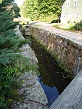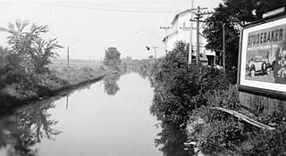
The Illinois and Michigan Canal connected the Great Lakes to the Mississippi River and the Gulf of Mexico. In Illinois, it ran 96 miles (154 km) from the Chicago River in Bridgeport, Chicago to the Illinois River at LaSalle-Peru. The canal crossed the Chicago Portage, and helped establish Chicago as the transportation hub of the United States, before the railroad era. It was opened in 1848. Its function was partially replaced by the wider and deeper Chicago Sanitary and Ship Canal in 1900, and it ceased transportation operations with the completion of the Illinois Waterway in 1933.

Farmington is a town in Hartford County in the Farmington Valley area of central Connecticut in the United States. The town is part of the Capitol Planning Region. The population was 26,712 at the 2020 census. It sits 10 miles west of Hartford at the hub of major I-84 interchanges, 20 miles south of Bradley International Airport and two hours by car from New York City and Boston. It has been home to the world headquarters of several large corporations including Otis Elevator Company, United Technologies, and Carvel. The northwestern section of Farmington is a suburban neighborhood called Unionville.

The Chesapeake and Ohio Canal, abbreviated as the C&O Canal and occasionally called the Grand Old Ditch, operated from 1831 until 1924 along the Potomac River between Washington, D.C. and Cumberland, Maryland. It replaced the Potomac Canal, which shut down completely in 1828, and could operate during months in which the water level was too low for the former canal. The canal's principal cargo was coal from the Allegheny Mountains.

The Caledonian Canal connects the Scottish east coast at Inverness with the west coast at Corpach near Fort William in Scotland. The canal was constructed in the early nineteenth century by Scottish engineer Thomas Telford.

The Llangollen Canal is a navigable canal crossing the border between England and Wales. The waterway links Llangollen in Denbighshire, north Wales, with Hurleston in south Cheshire, via the town of Ellesmere, Shropshire. The name, which was coined in the 1980s, is a modern designation for parts of the historic Ellesmere Canal and the Llangollen navigable feeder, both of which became part of the Shropshire Union Canals in 1846.

The Ohio and Erie Canal was a canal constructed during the 1820s and early 1830s in Ohio. It connected Akron with the Cuyahoga River near its outlet on Lake Erie in Cleveland, and a few years later, with the Ohio River near Portsmouth. It also had connections to other canal systems in Pennsylvania.

The James River and Kanawha Canal was a partially built canal in Virginia intended to facilitate shipments of passengers and freight by water between the western counties of Virginia and the coast. Ultimately its towpath became the roadbed for a rail line following the same course.
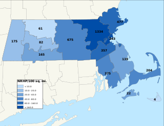
The National Register of Historic Places is a United States federal official list of places and sites considered worthy of preservation. In the state of Massachusetts, there are over 4,300 listings, representing about 5% of all NRHP listings nationwide and the second-most of any U.S. state, behind only New York. Listings appear in all 14 Massachusetts counties.
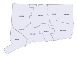
This is a list of properties and districts listed on the National Register of Historic Places in Connecticut. There are more than 1,500 listed sites in Connecticut. All 8 counties in Connecticut have listings on the National Register.

Enfield Falls Canal is a canal that was built to circumvent the shallows at Enfield Falls on the Connecticut River, between Hartford, Connecticut and Springfield, Massachusetts. It is situated along the west side of the river, adjacent to the towns of Suffield and Windsor Locks in Hartford County in the state of Connecticut, United States. Windsor Locks is named after the series of locks on the canal.

The Forth and Clyde canal pathway runs between the Firth of Forth and the Firth of Clyde and is a 106-kilometre-long (66 mi) footpath and cycleway that runs across Scotland, between Bowling, west of Glasgow, and Lochrin Basin in Edinburgh. The path runs on the towpaths of the Forth & Clyde and Union Canals and is entirely off-road. The path is well maintained and its surface is generally good, although there are some stretches particularly between Falkirk and the outskirts of Edinburgh where wet weather leads to muddy conditions unsuitable for road intended bicycles. It is well used by walkers and cyclists, and designated as one of Scotland's Great Trails by NatureScot. It also forms part of the National Cycle Network, being designated as Route 754. Sustrans advises that the path is best followed from the Clyde to the Forth because the prevailing wind is from the south west. Much of the path is also suitable for experienced horseriders, although in some places low bridges, narrow aqueducts and gates may restrict access for horses.

The Lehigh Canal is a navigable canal that begins at the mouth of Nesquehoning Creek on the Lehigh River in the Lehigh Valley and Northeastern regions of Pennsylvania. It was built in two sections over a span of 20 years beginning in 1818. The lower section spanned the distance between Easton and present-day Jim Thorpe. In Easton, the canal met the Pennsylvania Canal's Delaware Division and Morris Canals, which allowed anthracite coal and other goods to be transported further up the U.S. East Coast. At its height, the Lehigh Canal was 72 miles (116 km) long.

The Pennsylvania Canal, sometimes known as the Pennsylvania Canal system, was a complex system of transportation infrastructure improvements, including canals, dams, locks, tow paths, aqueducts, and viaducts. The canal was constructed and assembled over several decades beginning in 1824, the year of the first enabling act and budget items.

The South Hadley Canal was a canal along the Connecticut River in South Hadley, Massachusetts. It was the earliest navigable canal in the United States, with operation commencing in 1795. It has been listed on the National Register of Historic Places as the South Hadley Canal Historic District.

The Hampshire and Hampden Canal was the Massachusetts segment of an 86-mile (138 km) canal that once connected New Haven, Connecticut, to the Connecticut River north of Northampton, Massachusetts. Its Connecticut segment was called the Farmington Canal.
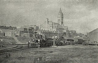
The New Haven and Northampton Railroad was a railroad originally built alongside a canal between 1847 and 1850 in Connecticut. Leased by the New York and New Haven Railroad from 1849 to 1869, the railroad expanded northwards to Massachusetts and its second namesake city in 1859. Upon the end of the lease in 1869, the company expanded further into Massachusetts, reaching as far north as Shelburne and Turners Falls.

The Farmington Canal Heritage Trail is an 82-mile (132 km) multi-use rail trail located in Connecticut and Massachusetts.

St Pancras Lock is a lock on the Regent's Canal, in the London Borough of Camden, England. The St Pancras Basin is nearby.

The Lockington Locks are a group of canal locks on the former Miami and Erie Canal in Lockington, Ohio, United States. Built beginning in 1833, the locks opened for regular use in 1845. The system consists of seven locks: six together at one end, and a seventh at the southern end. Along with features such as basins to allow canal boats to turn around, the locks stretch for 3.75 miles (6.04 km) between Lockington in far southern Shelby County and Washington Township in far northern Miami County.

Farmington Canal State Park Trail is a Connecticut state park forming a portion of the Farmington Canal Heritage Trail in the towns of Cheshire and Hamden. The developed section of the trail within state park boundaries runs over 17.0 miles (27.4 km) from Lazy Lane in Southington to Todd Street in Hamden and includes the historic Farmington Canal's restored Lock 12, located south of Brooksvale Road in Cheshire. The paved, multiple-use trail is used for hiking, biking, jogging, in-line skating and cross-country skiing.


