
Marion County is a county in the U.S. state of West Virginia. As of the 2010 census, the population was 56,418. Its county seat is Fairmont. The county was named in honor of General Francis Marion, known to history as "The Swamp Fox".

Calhoun County is a county in the U.S. state of West Virginia. As of the 2010 census, the population was 7,627. Its county seat is Grantsville. The county was founded in 1856 and named for South Carolina politician John C. Calhoun.

Springfield is a census-designated place (CDP) in northwestern Hampshire County in the U.S. state of West Virginia. As of the 2010 census, Springfield had a population of 477. Springfield is located north of Romney along West Virginia Route 28 at its junction with Green Spring Road and Springfield Pike. It is currently considering incorporation.

Frank is a census-designated place (CDP) located in Pocahontas County, West Virginia, United States. As of the 2010 census, its population is 90. It was named to honour Frank Hoffman in 1926. Hoffman was the proprietor of a local tannery.
Reader is a census-designated place (CDP) in Wetzel County, West Virginia, United States. As of the 2010 census, its population was 397.
Crumpler is a census-designated place (CDP) located in McDowell County, West Virginia, United States. As of the 2010 census, its population was 204.
McConnell is a census-designated place (CDP) in Logan County, West Virginia, United States, on the Guyandotte River. As of the 2010 census, its population was 514. It was established in 1933.

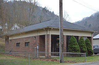
Big Chimney is a census-designated place (CDP) located on U.S. Route 119 in Kanawha County, West Virginia, United States. As of the 2010 census, its population was 627. It is accessible by West Virginia Route 114 or exit 5 from I-79. The center of town includes a Hardee's, a drug store, hardware store and grocery store, along with a few smaller businesses. The town is named after the tall chimney of the local salt works, which was a prominent landmark.
Belva is an unincorporated community and census-designated place in west Nicholas County and north Fayette County, West Virginia, United States; while the CDP only includes the Nicholas County portion, the Fayette County portion is considered part of the community. The town is situated at the bottomland surrounding the convergence of Bells Creek with Twentymile Creek and, subsequently, Twenty Mile Creek with the Gauley River. Belva is also the location of the convergence of two state highways: West Virginia Route 16 and West Virginia Route 39.
Beards Fork is a census-designated place (CDP) and coal town in Fayette County, West Virginia, United States that was founded as a coal town. As of the 2010 census, its population was 199.
Prince is a census-designated place (CDP) in Fayette County, West Virginia, United States. As of the 2010 census, its population was 116. Located at an altitude of 1,263 feet (385 m), it is served by an Amtrak station.
Bud is a census-designated place (CDP) in Wyoming County, West Virginia, United States, along Barkers Creek and West Virginia Route 10. As of the 2010 census, its population was 487.
Sarah Ann is a census-designated place (CDP) in Logan County, West Virginia, United States. Sarah Ann is located along West Virginia Route 44 and Island Creek, 6.5 miles (10.5 km) west-southwest of Man. Sarah Ann has a post office with ZIP code 25644. As of the 2010 census, its population was 345. It was named for Sarah O'Toole, wife of coal company official Edward O'Toole, and Ann Shanklin, wife of the coal company's coal town doctor, Doctor Shanklin.

Roderfield is a census-designated place (CDP) in McDowell County, West Virginia, United States. Roderfield is 7 miles (11 km) west-northwest of Welch. Roderfield has a post office with ZIP code 24881. As of the 2010 census, its population is 188.
Scarbro is a census-designated place (CDP) and coal town in Fayette County, West Virginia, United States. Scarbro is 1.5 miles (2.4 km) southwest of Oak Hill. Scarbro has a post office with ZIP code 25917. As of the 2010 census, its population was 486.

Glen White is a census-designated place (CDP) in Raleigh County, West Virginia, United States. Glen White is located on West Virginia Route 54 and West Virginia Route 97 1 mile (1.6 km) southeast of Lester. Glen White has a post office with ZIP code 25849. As of the 2010 census, its population is 266.
Dixie is a census-designated place (CDP) in Fayette and Nicholas counties, West Virginia, United States. Dixie is located on West Virginia Route 16 5.5 miles (8.9 km) north of Gauley Bridge. Dixie has a post office with ZIP code 25059. As of the 2010 census, its population was 291, with 202 residents in Nicholas County and 89 in Fayette County.
Verdunville is a census-designated place (CDP) in Logan County, West Virginia, United States. Verdunville is 3.5 miles (5.6 km) west of Logan. Verdunville has a post office with ZIP code 25649. As of the 2010 census, its population was 687.

Brush Fork is a census-designated place (CDP) in Mercer County, West Virginia, United States. Brush Fork is 2 miles (3.2 km) northwest of Bluefield. As of the 2010 census, its population was 1,197.


