Flat Rock, Henderson County, North Carolina

Last updated

Flat Rock, North Carolina
NCMap-doton-FlatRock.PNG
Location of Flat Rock, North Carolina
Coordinates: 35°16′04″N82°27′09″W / 35.26778°N 82.45250°W / 35.26778; -82.45250
Country United States
State North Carolina
County Henderson
Incorporated1996 [1]
Named for Rock formation [1]
Government
  MayorNick Weedman [2]
Area
[3]
  Total8.23 sq mi (21.31 km2)
  Land8.10 sq mi (20.98 km2)
  Water0.13 sq mi (0.33 km2)
Elevation
[4]
2,543 ft (775 m)
Population
 (2020)
  Total3,486
  Density430.32/sq mi (166.14/km2)
Time zone UTC-5 (Eastern (EST))
  Summer (DST) UTC-4 (EDT)
ZIP code
28731
Area code 828
FIPS code 37-23600 [5]
GNIS feature ID2407454 [4]
Website www.villageofflatrock.org

Flat Rock is a village in Henderson County, North Carolina, United States. The population was 3,114 at the 2010 census. [6] It is part of the Asheville Metropolitan Statistical Area.

Contents

History

Charles Baring and Susan Heyward Baring built Mountain Lodge in 1827 as the community became known as the "Little Charleston of the Mountains" due to an influx of wealthy summer residents from the South Carolina Low Country. Historic Flat Rock Inc. bought the abandoned house and sold it in 2014 to Julien Smythe, a descendant of an owner of Connemara who along with wife Lori renovated the house. [7]

A post office called Flat Rock has been in operation since 1829. [8] The village was named for granite rock formations which dotted the landscape. [9]

Historic Flat Rock Inc. began in 1968 after the loss of Ravenswood and began buying historic properties. [7]

A number of buildings in the village are included in the Flat Rock Historic District listed on the National Register of Historic Places. Also on the Register are Brookland and Carl Sandburg Home National Historic Site. [10]

Geography

Flat Rock is located in south-central Henderson County. It is bordered to the north by Hendersonville, the county seat, and to the east by unincorporated East Flat Rock. North Carolina Highway 225 (Greenville Highway) is the main road through the village, leading north 4 miles (6 km) to the center of Hendersonville and south 3 miles (5 km) to Zirconia. Asheville is 25 miles (40 km) to the north, and the South Carolina border is 8 miles (13 km) to the south.

According to the United States Census Bureau, the village has a total area of 8.2 square miles (21.3 km2), of which 8.1 square miles (21.0 km2) are land and 0.1 square miles (0.3 km2), or 1.56%, are water. [6] The town is drained by King Creek and Meminger Creek, tributaries of the French Broad River and part of the Tennessee River watershed.

Government

The village of Flat Rock is governed under a mayor/council form of government. The Mayor and City Council members are elected to staggered four-year terms. Currently the mayor of Flat Rock is Nick Weedman who was elected unopposed on November 5, 2019. [11] There are also 5 city council members. [12]

Demographics

Historical population
CensusPop.Note
1960 1,808
1970 1,688−6.6%
1980 1,92213.9%
1990 1,812−5.7%
2000 2,56541.6%
2010 3,11421.4%
2020 3,48611.9%
U.S. Decennial Census [13]

2020 census

Flat Rock racial composition [14]
RaceNumberPercentage
White (non-Hispanic)3,25993.49%
Black or African American (non-Hispanic)230.66%
Native American 80.23%
Asian 160.46%
Pacific Islander 40.11%
Other/Mixed 802.29%
Hispanic or Latino 962.75%

As of the 2020 United States census, there were 3,486 people, 1,590 households, and 1,071 families residing in the village.

2000 census

As of the census [5] of 2000, there were 2,565 people, 1,169 households, and 937 families residing in the village. The population density was 327.1 inhabitants per square mile (126.3/km2). There were 1,459 housing units at an average density of 186.0 per square mile (71.8/km2). The racial makeup of the village was 98.83% White, 0.47% African American, 0.04% Native American, 0.12% Asian, 0.04% from other races, and 0.51% from two or more races. Hispanic or Latino of any race were 1.17% of the population.

There were 1,169 households, out of which 15.3% had children under the age of 18 living with them, 76.5% were married couples living together, 1.8% had a female householder with no husband present, and 19.8% were non-families. 18.0% of all households were made up of individuals, and 10.9% had someone living alone who was 65 years of age or older. The average household size was 2.19 and the average family size was 2.46.

In the village, the population was spread out, with 13.6% under the age of 18, 2.3% from 18 to 24, 13.4% from 25 to 44, 34.9% from 45 to 64, and 35.8% who were 65 years of age or older. The median age was 58 years. For every 100 females, there were 99.3 males. For every 100 females age 18 and over, there were 95.0 males.

The median income for a household in the village was $67,813, and the median income for a family was $81,811. Males had a median income of $55,263 versus $34,375 for females. The per capita income for the village was $42,222. About 0.3% of families and 1.5% of the population were below the poverty line, including none of those under age 18 and 2.5% of those age 65 or over.

Arts and culture

Flat Rock is home to the Flat Rock Playhouse, the State Theatre of North Carolina. The Associate Reformed Presbyterian Church retreat Bonclarken is located in Flat Rock. It also is home to the main campus of Blue Ridge Community College.

The Historic Flat Rock Cultural Center and Museum opened in the former post office June 3, 2017. [7]

Notable people

Related Research Articles

<span class="mw-page-title-main">Transylvania County, North Carolina</span> County in North Carolina, United States

Transylvania County is a county in the U.S. state of North Carolina. As of the 2020 census the population is 32,986. Its county seat is Brevard.

<span class="mw-page-title-main">Polk County, North Carolina</span> County in North Carolina, United States

Polk County is a county located in the U.S. state of North Carolina. As of the 2020 census, the population was 19,328. Its county seat is Columbus.

<span class="mw-page-title-main">Henderson County, North Carolina</span> County in North Carolina, United States

Henderson County is a county located in the U.S. state of North Carolina. As of the 2020 census, the population was 116,281. Its county seat is Hendersonville.

<span class="mw-page-title-main">Buncombe County, North Carolina</span> County in North Carolina, United States

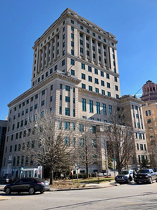
Buncombe County is a county located in the U.S. state of North Carolina. It is classified within Western North Carolina. The 2020 census reported the population was 269,452, making it the 7th-most populous county in North Carolina. Its county seat is Asheville. Buncombe County is part of the Asheville, NC Metropolitan Statistical Area.

<span class="mw-page-title-main">Avery Creek, North Carolina</span> Census-designated place in North Carolina, United States

Avery Creek is a census-designated place (CDP) in Buncombe County, North Carolina, United States. The population was 1,950 at the 2010 census. It is part of the Asheville Metropolitan Statistical Area.

<span class="mw-page-title-main">Woodfin, North Carolina</span> Town in North Carolina, United States

Woodfin is a town in Buncombe County, North Carolina, United States. The population was 6,123 as of the 2010 census. It is part of the Asheville Metropolitan Statistical Area. The town is named for Nicholas Washington Woodfin, a renowned lawyer and statesman of early North Carolina, under whom Governor Zebulon Vance clerked as an attorney. Woodfin is the only municipality bearing the name Woodfin in the United States. The town was incorporated in 1971, although the community itself dates back to at least the mid-19th century.

<span class="mw-page-title-main">Balfour, North Carolina</span> Census-designated place in North Carolina, United States

Balfour is an unincorporated community and census-designated place (CDP) in Henderson County, North Carolina, United States. The population was 1,187 at the 2010 census. It is part of the Asheville Metropolitan Statistical Area.

<span class="mw-page-title-main">Barker Heights, North Carolina</span> Census-designated place in North Carolina, United States

Barker Heights is an unincorporated area and census-designated place (CDP) in Henderson County, North Carolina, United States. The population was 1,254 at the 2010 census. It is part of the Asheville Metropolitan Statistical Area.

<span class="mw-page-title-main">East Flat Rock, North Carolina</span> Census-designated place in North Carolina, United States

East Flat Rock is an unincorporated area and census-designated place (CDP) in Henderson County, North Carolina, United States. The population was 4,995 at the 2010 census, up from 4,151 at the 2000 census. It is part of the Asheville Metropolitan Statistical Area.

<span class="mw-page-title-main">Etowah, North Carolina</span> Census-designated place in Henderson County, North Carolina, USA

Etowah is an unincorporated community and census-designated place (CDP) in Henderson County, North Carolina, United States. The population was 6,944 at the 2010 census. It is part of the Asheville Metropolitan Statistical Area.

<span class="mw-page-title-main">Fletcher, North Carolina</span> Town in North Carolina, United States

Fletcher is a town in Henderson County, North Carolina, United States. The population was 7,187 at the 2010 census, and was estimated to be 8,333 in 2018.

<span class="mw-page-title-main">Hendersonville, North Carolina</span> City in North Carolina, United States

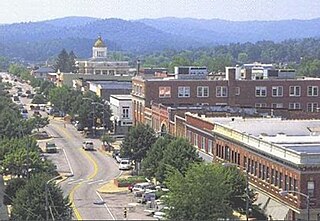
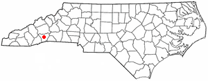
Hendersonville is a city in and the county seat of Henderson County, North Carolina, United States, located 22 miles (35 km) south of Asheville. Like the county, the city is named for 19th-century North Carolina Supreme Court Chief Justice Leonard Henderson.

<span class="mw-page-title-main">Laurel Park, North Carolina</span> Town in North Carolina, United States

Laurel Park is a town in Henderson County, North Carolina, United States. The population was 2,250 at the 2020 census. It is part of the Asheville Metropolitan Statistical Area.

<span class="mw-page-title-main">Mountain Home, North Carolina</span> Census-designated place in North Carolina, United States

Mountain Home is an unincorporated community and census-designated place (CDP) in Henderson County, North Carolina, United States. The population was 3,622 at the 2010 census, up from 2,169 in 2000. It is part of the Asheville Metropolitan Statistical Area.

<span class="mw-page-title-main">Valley Hill, North Carolina</span> Census-designated place in North Carolina, United States

Valley Hill is an unincorporated community and census-designated place (CDP) in Henderson County, North Carolina, United States. The population was 2,070 at the 2010 census. It is part of the Asheville Metropolitan Statistical Area.

<span class="mw-page-title-main">Hendersonville, Tennessee</span> City in Tennessee, United States

Hendersonville is the most populous city in Sumner County, Tennessee, on Old Hickory Lake. As of the 2020 census the city's population was 61,753.

<span class="mw-page-title-main">Saluda, North Carolina</span> City in North Carolina, United States

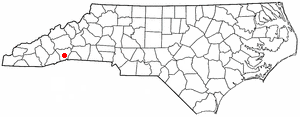
Saluda is a city in Polk and Henderson counties in the U.S. state of North Carolina. The population was 713 at the 2010 census. Saluda is famous for sitting at the top of the Norfolk Southern Railway's Saluda Grade, which was the steepest main line standard-gauge railway line in the United States until Norfolk Southern ceased operations on the line in 2001. Saluda is close to the South Carolina state line, between Asheville, North Carolina, and Spartanburg, South Carolina.

<span class="mw-page-title-main">Mills River, North Carolina</span> Town in North Carolina, United States

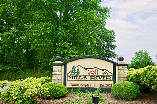
Mills River is a town in Henderson County, North Carolina, United States. The population was 6,802 at the 2010 census, and was estimated to be 7,406 in 2019. The town took its name from the nearby confluence of the Mills River and French Broad River. It is part of the Asheville Metropolitan Statistical Area. It was incorporated into a town in June 2003. Sierra Nevada opened a brewery in Mills River in 2014.

<span class="mw-page-title-main">Carl Sandburg Home National Historic Site</span> National Historic Site of the United States

Carl Sandburg Home National Historic Site, located at 81 Carl Sandburg Lane near Hendersonville in the village of Flat Rock, North Carolina, preserves Connemara, the home of Pulitzer Prize-winning poet and writer Carl Sandburg. Though a Midwesterner, Sandburg and his family moved to this home in 1945 for the peace and solitude required for his writing and the more than 30 acres (120,000 m2) of pastureland required for his wife, Lilian, to raise her champion dairy goats. Sandburg spent the last twenty-two years of his life on this farm and published more than a third of his works while he resided here.

<span class="mw-page-title-main">Asheville metropolitan area</span> Metropolitan area in North Carolina, United States

The Asheville metropolitan area is a metropolitan area centered on the principal city of Asheville, North Carolina. The U.S. Office of Management and Budget defines the Asheville, NC Metropolitan Statistical Area, a metropolitan statistical area used by the United States Census Bureau and other entities, as comprising the four counties of Buncombe, Haywood, Henderson, and Madison. The area's population was 424,858 according to the 2010 census, and 469,454 according to the 2020 census.

References

  1. 1 2 "North Carolina Gazetteer" . Retrieved December 25, 2020.
  2. "Mayor and Council".
  3. "ArcGIS REST Services Directory". United States Census Bureau. Retrieved September 20, 2022.
  4. 1 2 U.S. Geological Survey Geographic Names Information System: Flat Rock, Henderson County, North Carolina
  5. 1 2 "American FactFinder". United States Census Bureau. Archived from the original on February 12, 2020. Retrieved January 31, 2008.
  6. 1 2 "Geographic Identifiers: 2010 Census Summary File 1 (G001): Flat Rock village, North Carolina". American Factfinder. U.S. Census Bureau. Archived from the original on February 13, 2020. Retrieved December 18, 2017.
  7. 1 2 3 4 Neufeld, Rob (September 24, 2017). "Visiting Our Past: A party at Susan's - a Flat Rock Story from 1836". Asheville Citizen-Times . Retrieved September 25, 2017.
  8. "Henderson County". Jim Forte Postal History. Archived from the original on May 24, 2015. Retrieved May 23, 2015.
  9. Kramp, Penn (February 22, 1987). "Tuxedo: It's not formal wear". The Times-News. p. 27. Retrieved May 23, 2015.
  10. "National Register Information System". National Register of Historic Places . National Park Service. July 9, 2010.
  11. "Mayoral election in Flat Rock, North Carolina (2019)". Ballotpedia. Retrieved May 21, 2023.
  12. "Mayor and Council". www.villageofflatrock.org. Retrieved May 21, 2023.
  13. "Census of Population and Housing". Census.gov. Archived from the original on July 9, 2009. Retrieved June 4, 2015.
  14. "Explore Census Data". data.census.gov. Retrieved December 19, 2021.