Florida's Turnpike, designated as unsigned State Road 91, is a controlled-access toll road in the U.S. state of Florida, maintained by Florida's Turnpike Enterprise (FTE). Spanning approximately 309 miles (497 km) along a northwest–southeast axis, the turnpike is in two sections. The SR 91 mainline runs roughly 265 miles (426 km), from its southern terminus at an interchange with Interstate 95 (I-95) in Miami Gardens to an interchange with I-75 in Wildwood at its northern terminus. The Homestead Extension of Florida's Turnpike continues from the southern end of the mainline for another 48 miles (77 km) to US Highway 1 in Florida City. The slogan for the road is "The Less Stressway". The mainline opened in stages between 1957 and 1964, while the extension was completed in 1974. The turnpike runs through Miami, Fort Lauderdale, and West Palm Beach, where it parallels I-95, and through Orlando, where it crosses I-4.

State Road 528 (SR 528), alternatively named the Martin Andersen Beachline Expressway, is a partially-tolled freeway in the U.S. state of Florida; it is maintained by the Florida's Turnpike Enterprise (FTE), the Central Florida Expressway Authority (CFX), and the Florida Department of Transportation (FDOT). Spanning approximately 53 miles (85 km) along a west–east axis, it connects Interstate 4 (I-4) in Orlando with I-95, Titusville, and Cape Canaveral on the Space Coast. It passes close to the tourist areas of Orlando, including SeaWorld and Universal Orlando, and serves the north entrance to Orlando International Airport. Near its east end, it passes over the Intracoastal Waterway on the Emory L. Bennett Causeway, and ends at SR A1A and SR 401 near Port Canaveral.
State Road 417 (SR 417), also known as the Central Florida GreeneWay, Seminole County Expressway, Eastern Beltway and Orlando East Bypass, is a controlled-access toll road forming the eastern beltway around the city of Orlando, Florida, United States. It is owned and maintained by the Central Florida Expressway Authority (CFX) and Florida's Turnpike Enterprise. The CFX section was posthumously named after former Orlando Orange County Expressway Authority chairman Jim Greene.
State Road 408 (SR 408), officially named the Spessard L. Holland East–West Expressway, is a controlled-access toll road running east–west through Orlando, Florida, United States. It is owned and operated by the Central Florida Expressway Authority (CFX), except for the westernmost mile (1.5 km), which is owned by Florida's Turnpike Enterprise as a connection to Florida's Turnpike. The road runs from the Turnpike in Gotha, east through downtown Orlando, where it intersects with I-4, ending near SR 50 south of the University of Central Florida. The road is named for Spessard L. Holland.
State Road 589 (SR 589), also known as the Veterans Expressway and Suncoast Parkway, is a controlled-access toll road near the Florida Gulf Coast. Maintained and operated by Florida's Turnpike Enterprise, this 68-mile (109 km) transportation corridor extends from State Road 60 in Tampa, north to State Road 44 near Lecanto. The Veterans Expressway was built to accommodate the increasing commuter traffic in the Tampa-St. Petersburg metropolitan area, with the Suncoast Parkway opening in 2001, extending from near the northern terminus of the Veterans Expressway to U.S. Route 98, with a possible northern extension to U.S. Route 19/U.S. Route 98 in Crystal River in Citrus County in the planning and development stages. As of February 28, 2022, Phase I of the extension is now open between US 98 and Florida State Road 44. Phase II, which would further extend the highway to County Road 486, is undergoing the design phase.
State Road 202 (SR 202) is a 13.042-mile-long (20.989 km) state highway that extends from U.S. Route 1, in Jacksonville, Florida to SR A1A, in Jacksonville Beach, near the Atlantic Ocean, just north of Ponte Vedra Beach, and includes a bridge over the Intracoastal Waterway. To locals, the road is better known as J. Turner Butler Boulevard, Butler Boulevard, or JTB. Despite being named as a boulevard, the road is a completely limited-access expressway, with the exception of the westernmost 0.5 miles between US 1 and Interstate 95 (I-95),. It was constructed in sections by the Jacksonville Transportation Authority. The first section opened in 1979, but the entire road was not completed until 1997.
State Road 878 (SR 878), named the Snapper Creek Expressway, is a 2.7-mile (4.3 km) east–west controlled-access toll road south of Miami, Florida. The expressway is named for the nearby Snapper Creek which runs parallel to SR 878. It acts as a spur route of SR 874, providing access to U.S. Route 1 (US 1) near South Miami and local access to the eastern Kendall area while bypassing the Dadeland district. The road is maintained and tolled by the Greater Miami Expressway Agency (GMX).

State Road 112 (SR 112) is a 9.9-mile-long (15.9 km) east–west state highway connecting Miami International Airport in Miami to Miami Beach in the U.S. state of Florida. Between the airport and Interstate 95, it is locally known as the Airport Expressway, and is a controlled-access toll road between SR 9 and I-95. Between I-95 and Alton Road (SR 907A) in Miami Beach, SR 112 is signed only as Interstate 195 as it crosses Biscayne Bay by way of the Julia Tuttle Causeway. Between I-195 and its eastern terminus at Collins Avenue (SR A1A), the SR 112 signs are present but infrequent, and the road is locally maintained as Arthur Godfrey Road.
State Road 924 (SR 924) is an 8.5-mile (13.7 km) east–west highway connecting I-75 and SR 826 in Hialeah and SR 909 in North Miami. The westernmost 4.85 miles, named Gratigny Parkway, is a controlled-access toll road maintained by the Greater Miami Expressway Agency ; the easternmost 3.6 miles (5.8 km) is a surface street also known as Gratigny Road. Despite its relatively short length, SR 924 is a major east–west artery in northern Miami-Dade County.
State Road 913 is an access road between the village of Key Biscayne on the island of Key Biscayne and I-95 in Miami on the western end of Biscayne Bay.

The Dolphin East–West Expressway is a 15.4-mile (24.8 km) freeway, with the westernmost 14 miles (23 km) as an all-electronic tollway signed as State Road 836, and the easternmost 1.292 miles (2.079 km) between Interstate 95 (I-95) and SR A1A cosigned as Interstate 395 (I-395).
The Pinellas Bayway System is a series of bridges on two state roads in Pinellas County, Florida. It is a toll road complex maintained and operated by the Florida Department of Transportation. It also is compatible with the SunPass ETC system currently in use on all other FDOT-owned toll roads. The Pinellas Bayway consists of:

State Road 20 is a 358.154-mile-long (576.393 km) east-to-west route across northern Florida and the Florida Panhandle in the United States.

Interstate 95 (I-95) is the main Interstate Highway of Florida's Atlantic Coast. It begins at a partial interchange with US Highway 1 (US 1) just south of downtown Miami and heads north through Jacksonville, and to the Georgia state line at the St. Marys River near Becker. The route also passes through the cities of Fort Lauderdale, West Palm Beach, Port St. Lucie, Titusville, and Daytona Beach.

The Mid-Bay Bridge is a 141-span, 3.6-mile (5.8 km), two-lane toll bridge in Okaloosa County in the Florida Panhandle. It connects U.S. Highway 98 in Destin to State Road 20 in Niceville. The bridge generally runs north-south; the approaches to the bridge carry the State Road 293 designation while the bridge itself carries the TOLL 293 shield.

Interstate 75 (I-75) is a part of the Interstate Highway System that runs from the Hialeah–Miami Lakes border, a few miles northwest of Miami, to Sault Ste. Marie in the Upper Peninsula of Michigan. I-75 begins its national northward journey near Miami, running along the western parts of the Miami metropolitan area before traveling westward across Alligator Alley, resuming its northward direction in Naples, running along Florida's Gulf Coast, and passing the cities of Fort Myers, Punta Gorda, Venice, and Sarasota. The freeway passes through the Tampa Bay area before turning inward toward Ocala, Gainesville, and Lake City before leaving the state and entering Georgia. I-75 runs for 471 miles (758 km) in Florida, making it the longest Interstate in the state and also the longest in any state east of the Mississippi River. The Interstate's speed limit is 70 mph (110 km/h) for its entire length in Florida.

U.S. Route 98 is a major east-west thoroughfare through the U.S. state of Florida. Spanning 670.959 miles (1,079.804 km), it connects Pensacola and the Alabama/Florida state line to the west with Palm Beach and the Atlantic coast in the east. It is the longest US road in Florida, as well as the longest US road in any state east of the Mississippi River.

U.S. Route 441 (US 441) in Florida is a north–south United States Highway. It runs 433 miles (697 km) from Miami in South Florida northwest to the Georgia state line, with the overall route continuing to Tennessee in the Rocky Top area.
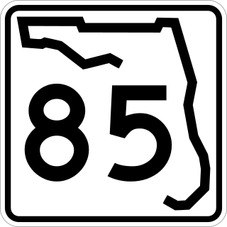
State Road 85 is a north–south state highway that runs from US 98 in Fort Walton Beach, Florida north to State Route 55 at the Florida/Alabama state line. In its earliest inception, it was just a clayed road over graded sandy soil, and was known early in the twentieth century as the Georgia, Alabama and Florida Highway.

U.S. Route 20 (US 20) in Indiana is a main east–west highway that is parallel to the Indiana Toll Road. The western terminus of US 20 is at the Illinois state line and the eastern terminus is at the Ohio state line. US 20 through Whiting, East Chicago, and Gary is concurrent with US 12 twice. The route varies between one-way, two-lane, and four-lane streets, in Northwest Indiana. From the east side of Gary to west of South Bend, US 20 is a four-lane undivided highway. The route then heads around the west and south sides of South Bend and Elkhart as a four-lane limited access divided highway. East of State Road 15 (SR 15), US 20 is two-lane rural highway.

