Fortescue, Missouri

Last updated
Fortescue, Missouri
Aerial view of Fortescue, Missouri 9-2-2013.JPG
Aerial view of Fortescue, Missouri
Holt County Missouri Incorporated and Unincorporated areas Fortescue Highlighted.svg
Location of Fortescue, Missouri
Coordinates: 40°03′07″N95°19′03″W / 40.05194°N 95.31750°W / 40.05194; -95.31750 Coordinates: 40°03′07″N95°19′03″W / 40.05194°N 95.31750°W / 40.05194; -95.31750
Country United States
State Missouri
County Holt
Area
[1]
  Total0.08 sq mi (0.20 km2)
  Land0.08 sq mi (0.20 km2)
  Water0.00 sq mi (0.00 km2)
Elevation
[2]
860 ft (260 m)
Population
 (2020)
  Total21
  Density272.73/sq mi (105.15/km2)
Time zone UTC-6 (Central (CST))
  Summer (DST) UTC-5 (CDT)
ZIP code
64437
Area code 660
FIPS code 29-25228 [3]
GNIS feature ID2396942 [2]

Fortescue is a village in Holt County, Missouri, United States. The population was 21 at the 2020 census. [4]

Contents

History

Fortescue was founded circa 1884. [5] An early railroad promoter named Fortesque gave the community the maiden name of his mother. [6] A post office called Fortescue was established in 1884, and remained in operation until 1973. [7]

Geography

According to the United States Census Bureau, the village has a total area of 0.08 square miles (0.21 km2), all land. [8]

Demographics

Historical population
CensusPop.Note
1920 153
1930 141−7.8%
1940 17524.1%
1950 117−33.1%
1960 78−33.3%
1970 63−19.2%
1980 51−19.0%
1990 46−9.8%
2000 5110.9%
2010 32−37.3%
2020 21−34.4%
U.S. Decennial Census [9]
Looking west from Forstecue on June 26, 2011 in the midst of the 2011 Missouri River floods Big-lake-levee-breach.jpg
Looking west from Forstecue on June 26, 2011 in the midst of the 2011 Missouri River floods

2010 census

As of the census [10] of 2010, there were 32 people, 10 households, and 9 families living in the village. The population density was 400.0 inhabitants per square mile (154.4/km2). There were 16 housing units at an average density of 200.0 per square mile (77.2/km2). The racial makeup of the village was 100.0% White.

There were 10 households, of which 40.0% had children under the age of 18 living with them, 80.0% were married couples living together, 10.0% had a male householder with no wife present, and 10.0% were non-families. 0.0% of all households were made up of individuals. The average household size was 3.20 and the average family size was 3.33.

The median age in the village was 31 years. 34.4% of residents were under the age of 18; 6.3% were between the ages of 18 and 24; 28.2% were from 25 to 44; 28.2% were from 45 to 64; and 3.1% were 65 years of age or older. The gender makeup of the village was 43.8% male and 56.3% female.

2000 census

As of the census [3] of 2000, there were 51 people, 18 households, and 10 families living in the town. The population density was 674.1 inhabitants per square mile (260.3/km2). There were 23 housing units at an average density of 304.0 per square mile (117.4/km2). The racial makeup of the town was 100.00% White.

There were 18 households, out of which 61.1% had children under the age of 18 living with them, 44.4% were married couples living together, and 38.9% were non-families. 38.9% of all households were made up of individuals, and 11.1% had someone living alone who was 65 years of age or older. The average household size was 2.83 and the average family size was 3.82.

In the town the population was spread out, with 41.2% under the age of 18, 7.8% from 18 to 24, 35.3% from 25 to 44, 11.8% from 45 to 64, and 3.9% who were 65 years of age or older. The median age was 26 years. For every 100 females, there were 131.8 males. For every 100 females age 18 and over, there were 172.7 males.

The median income for a household in the town was $26,250, and the median income for a family was $28,125. Males had a median income of $33,125 versus $11,250 for females. The per capita income for the town was $5,695. There were 38.5% of families and 29.5% of the population living below the poverty line, including 21.4% of under eighteens and none of those over 64.

Related Research Articles

<span class="mw-page-title-main">Leslie, Missouri</span> Village in Missouri, United States

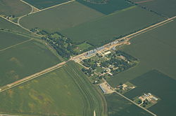
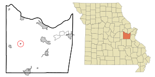
Leslie is a village in west central Franklin County, Missouri, United States. The population was 171 at the 2010 census.

<span class="mw-page-title-main">Parkway, Missouri</span> Village in Missouri, United States

Parkway is a village in Franklin County, Missouri, United States. The population was 439 at the 2010 census.

<span class="mw-page-title-main">River Bend, Missouri</span> Village in Missouri, United States

River Bend is a village in Jackson County, Missouri, United States. The population was 3 at the 2020 census. It is the only part of Jackson County that lies north of the Missouri River. In 1951, the Missouri River was relocated to a new channel, creating River Bend,. The county line still follows the original riverbed. It is part of the Kansas City metropolitan area. The mayor is Alex Dockler.

<span class="mw-page-title-main">Evergreen, Missouri</span> Village in Missouri, United States

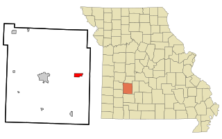
Evergreen is a village in Laclede County, Missouri, United States. The population was 28 at the 2010 census. It was named Twin Bridges at the 2000 census.

<span class="mw-page-title-main">Cave, Missouri</span> Populated Place in Missouri, United States

Cave is a populated place in Lincoln County, Missouri, United States. The population was 5 at the 2010 census. With a 2020 population of 5, it is the 939th largest city in Missouri and the 19481st largest city in the United States. Cave is currently declining at a rate of 0.00% annually and its population has decreased by 0.00% since the most recent census, which recorded a population of 5 in 2010.

<span class="mw-page-title-main">Truxton, Missouri</span> Village in Missouri, United States

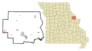
Truxton is a village in Lincoln County, Missouri, United States. The population was 91 at the 2010 census.

<span class="mw-page-title-main">Leawood, Missouri</span> Village in Missouri, United States

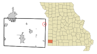
Leawood is a village in Newton County, Missouri, United States. The population was 682 at the 2010 census. It is part of the Joplin, Missouri Metropolitan Statistical Area.

<span class="mw-page-title-main">Wentworth, Missouri</span> Village in Missouri, United States

Wentworth is a village in northeastern Newton County, Missouri, United States. The population was 151 at the 2010 census. It is part of the Joplin, Missouri Metropolitan Statistical Area.

<span class="mw-page-title-main">Bakersfield, Missouri</span> Village in Missouri, United States

Bakersfield is a village in southeastern Ozark County in the Ozarks of southern Missouri, United States. The population was 186 at the 2020 census.

<span class="mw-page-title-main">Flemington, Missouri</span> Village in Missouri, United States

Flemington is a village in Polk County, Missouri, United States. The population was 148 at the 2010 census. It is part of the Springfield, Missouri Metropolitan Statistical Area.

<span class="mw-page-title-main">Halfway, Missouri</span> Village in Missouri, United States

Halfway is a village in Polk County, Missouri, United States. According to the 2010 census, the population of Halfway is 173. It is part of the Springfield, Missouri Metropolitan Statistical Area.

<span class="mw-page-title-main">Collins, Missouri</span> Village in Missouri, United States

Collins is a village in St. Clair County, Missouri, United States. The population was 125 at the 2020 census.

<span class="mw-page-title-main">Roscoe, Missouri</span> Village in Missouri, United States

Roscoe is a village in St. Clair County, Missouri, United States. The population was 89 at the 2020 census.

<span class="mw-page-title-main">Norwood Court, Missouri</span> Village in Missouri, United States

Norwood Court is a village in St. Louis County, Missouri, United States. The population was 959 at the 2010 census.

<span class="mw-page-title-main">Velda Village Hills, Missouri</span> Village in Missouri, United States

Velda Village Hills is a village in northeastern St. Louis County, Missouri, United States. The population was 1,055 at the 2010 census.

<span class="mw-page-title-main">Westwood, Missouri</span> Village in Missouri, United States

Westwood is a village in west St. Louis County, Missouri, United States. The population was 278 at the 2010 census.

<span class="mw-page-title-main">Penermon, Missouri</span> Village in Missouri, United States

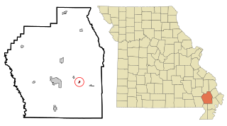
Penermon is a village in Stoddard County, Missouri, United States. The population was 64 at the 2010 census.

<span class="mw-page-title-main">Baldwin Park, Missouri</span> Village in Missouri, United States

Baldwin Park is a village in Cass County, Missouri, United States. The population was 92 at the 2010 census. It is part of the Kansas City metropolitan area.

<span class="mw-page-title-main">Champ, Missouri</span> Village in Missouri, United States

Champ is a village in St. Louis County, Missouri, United States. The population was 10 at the 2020 census.

<span class="mw-page-title-main">Ionia, Missouri</span> Village in Missouri, United States

Ionia is a village in northern Benton and southern Pettis counties in the U.S. state of Missouri. The population was 88 at the 2010 census.

References

  1. "ArcGIS REST Services Directory". United States Census Bureau. Retrieved August 28, 2022.
  2. 1 2 U.S. Geological Survey Geographic Names Information System: Fortescue, Missouri
  3. 1 2 "U.S. Census website". United States Census Bureau . Retrieved 2008-01-31.
  4. "Explore Census Data". data.census.gov. Retrieved 2021-12-16.
  5. Earngey, Bill (1995). Missouri Roadsides: The Traveler's Companion. University of Missouri Press. p. 92. ISBN   9780826210210.
  6. "Holt County Place Names, 1928–1945 (archived)". The State Historical Society of Missouri. Archived from the original on 24 June 2016. Retrieved 8 October 2016.{{cite web}}: CS1 maint: bot: original URL status unknown (link)
  7. "Post Offices". Jim Forte Postal History. Retrieved 8 October 2016.
  8. "US Gazetteer files 2010". United States Census Bureau. Archived from the original on 2012-07-02. Retrieved 2012-07-08.
  9. "Census of Population and Housing". Census.gov. Retrieved June 4, 2015.
  10. "U.S. Census website". United States Census Bureau . Retrieved 2012-07-08.