Fox Lake, Montana

Last updated
Fox Lake, Montana
CDP
Richland County Montana Incorporated and Unincorporated areas Fox Lake Highlighted.svg
Location of Fox Lake, Montana
Coordinates: 47°41′3″N104°37′30″W / 47.68417°N 104.62500°W / 47.68417; -104.62500 Coordinates: 47°41′3″N104°37′30″W / 47.68417°N 104.62500°W / 47.68417; -104.62500
Country United States
State Montana
County Richland
Area
[1]
  Total5.66 sq mi (14.67 km2)
  Land4.17 sq mi (10.81 km2)
  Water1.49 sq mi (3.86 km2)
Elevation
[2]
2,372 ft (723 m)
Population
 (2020)
  Total231
  Density55.33/sq mi (21.36/km2)
Time zone UTC-7 (Mountain (MST))
  Summer (DST) UTC-6 (MDT)
Area code 406
GNIS feature ID U.S. Geological Survey Geographic Names Information System: Fox Lake
GNIS feature ID [3]

Fox Lake is a census-designated place (CDP) in Richland County, Montana, United States. The population was 158 at the 2010 census. [4]

Contents

History

Within the CDP, as well as the settlement of Fox Lake, is located the settlement of Lambert. Lambert was built as a station stop along the Great Northern Railway branch line extending west from Sidney, Montana. [5] Due to the station's proximity to Fox Lake, the post office was originally named Fox Lake. The Lambert post office was established in 1914 with Edmund Bronson as the local postmaster. [6]

Geography

Fox Lake is located at 47°41′3″N104°37′30″W / 47.68417°N 104.62500°W / 47.68417; -104.62500 (47.684208, -104.625103), [7] 21 miles (34 km) west of Sidney on Montana Highway 200 near the Fox Lake Wildlife Management Area.

According to the United States Census Bureau, the CDP has a total area of 5.7 square miles (14.8 km2), of which 4.2 square miles (10.9 km2) is land and 1.5 square miles (3.9 km2) (26.14%) is water.

Demographics

Historical population
CensusPop.Note
2000 157
2010 1580.6%
2020 23146.2%
U.S. Decennial Census

As of the census [8] of 2000, there were 157 people, 58 households, and 41 families residing in the CDP. The population density was 37.3 inhabitants per square mile (14.4/km2). There were 64 housing units at an average density of 15.2 per square mile (5.9/km2). The racial makeup of the CDP was 98.73% White, and 1.27% from two or more races. Hispanic or Latino of any race were 1.27% of the population.

There were 58 households, out of which 46.6% had children under the age of 18 living with them, 63.8% were married couples living together, 3.4% had a female householder with no husband present, and 29.3% were non-families. 29.3% of all households were made up of individuals, and 15.5% had someone living alone who was 65 years of age or older. The average household size was 2.71 and the average family size was 3.39.

In the CDP, the population was spread out, with 36.9% under the age of 18, 2.5% from 18 to 24, 31.2% from 25 to 44, 17.2% from 45 to 64, and 12.1% who were 65 years of age or older. The median age was 30 years. For every 100 females, there were 101.3 males. For every 100 females age 18 and over, there were 94.1 males.

The median income for a household in the CDP was $31,000, and the median income for a family was $36,667. Males had a median income of $21,250 versus $19,250 for females. The per capita income for the CDP was $14,443. About 11.4% of families and 16.2% of the population were below the poverty line, including 27.7% of those under the age of eighteen and none of those 65 or over.

Education

Lambert Public Schools, Districts 4 and 86, operates an elementary, a junior, and a senior high school with a total student enrollment of 90 students in the community. [9] For the purpose of inter-school athletic competition, the Montana High School Association classifies Lambert as a Class C school. [10] The mascot for Lambert Public School athletic teams is the Fusion. [11]

Notable people

Related Research Articles

<span class="mw-page-title-main">Richland County, Montana</span> County in Montana, United States

Richland County is a county in the U.S. state of Montana. As of the 2020 census, the population was 11,491. Its county seat is Sidney.

<span class="mw-page-title-main">Hays, Montana</span> Census-designated place in Montana, United States

Hays is a census-designated place (CDP) in Blaine County, Montana, United States. The population was 843 at the 2010 census. The community lies within the Fort Belknap Indian Reservation, near the reservation's southern end. The nearby community of Lodge Pole lies to the east.

<span class="mw-page-title-main">Black Eagle, Montana</span> CDP in Montana, United States

Black Eagle is a census-designated place (CDP) in Cascade County, Montana, United States. The population was 904 at the 2010 census. It is a suburb of Great Falls.

<span class="mw-page-title-main">Ulm, Montana</span> CDP in Montana, United States

Ulm is a census-designated place (CDP) in Cascade County, Montana, United States. It was originally a large ranch owned by Indiana-born cattleman William Ulm. The population was 738 at the 2010 census. It is part of the Great Falls, Montana Metropolitan Statistical Area.

<span class="mw-page-title-main">Somers, Montana</span> Unincorporated community in Montana, United States

Somers is an unincorporated community and census-designated place (CDP) in Flathead County, Montana, United States. The population was 1,109 at the 2010 census, up from 556 in 2000.

<span class="mw-page-title-main">Big Arm, Montana</span> Census-designated place in Montana, United States

Big Arm is a census-designated place (CDP) in Lake County, Montana, United States. The population was 177 at the 2010 census, up from 131 in 2000.

<span class="mw-page-title-main">Charlo, Montana</span> Census-designated place in Montana, United States

Charlo is an unincorporated community and census-designated place (CDP) in Lake County, Montana, United States. The population was 379 at the 2010 census, down from 439 in 2000. The 2018 population estimate was 320.

<span class="mw-page-title-main">Elmo, Montana</span> Census-designated place in Montana, United States

Elmo is a census-designated place (CDP) in Lake County, Montana, United States. The population was 180 at the 2010 census, up from 143 in 2000.

<span class="mw-page-title-main">Finley Point, Montana</span> Census-designated place in Montana, United States

Finley Point is a census-designated place (CDP) in Lake County, Montana, United States. As of the 2010 census the population was 480.

<span class="mw-page-title-main">Kicking Horse, Montana</span> Census-designated place in Montana, United States

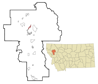
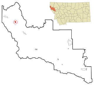
Kicking Horse is a census-designated place (CDP) in Lake County, Montana, United States. The population was 286 at the 2010 census, up from 80 in 2000.

<span class="mw-page-title-main">Kings Point, Montana</span> Census-designated place in Montana, United States

Kings Point is a census-designated place (CDP) in Lake County, Montana, United States. The population was 151 at the 2010 census, down from 169 in 2000.

<span class="mw-page-title-main">Rocky Point, Montana</span> Census-designated place in Montana, United States

Rocky Point is a census-designated place (CDP) in Lake County, Montana, United States. The population was 97 at the 2010 census.

<span class="mw-page-title-main">Turtle Lake, Montana</span> Census-designated place in Montana, United States

Turtle Lake is a census-designated place (CDP) in Lake County, Montana, United States. The population was 209 at the 2010 census.

<span class="mw-page-title-main">Augusta, Montana</span> Census-designated place in Montana, United States

Augusta is an unincorporated community and census-designated place (CDP) in Lewis and Clark County, Montana, United States. The population was 309 at the 2010 census and rose to 316 in the 2020 census. The most accepted version in the naming of this town is after Augusta Hogan, thought to be the first child born in this town, the daughter of J. D. Hogan, an early rancher.

<span class="mw-page-title-main">Seeley Lake, Montana</span> CDP in Montana, United States

Seeley Lake is a census-designated place (CDP) in Missoula County, Montana, United States. It is part of the 'Missoula, Montana Metropolitan Statistical Area'. The town sits beside the 1,031.5 acres lake Seeley Lake. The population was 1,659 at the 2010 census, an increase from its population of 1,436 in 2000.

<span class="mw-page-title-main">Noxon, Montana</span> CDP in Montana, United States

Noxon is a census-designated place (CDP) in Sanders County, Montana, United States. The population of the whole CDP was 255 at the 2020 census.

<span class="mw-page-title-main">West Glendive, Montana</span> Census-designated place in Montana, United States

West Glendive is a census-designated place (CDP) in Dawson County, Montana, United States. The population was 1,998 at the 2020 census.

<span class="mw-page-title-main">Dayton, Montana</span> Census-designated place in Montana, United States

Dayton is an unincorporated community and census-designated place (CDP) in Lake County, Montana, United States. The population was 84 at the 2010 census.

<span class="mw-page-title-main">Jette, Montana</span> Census-designated place in Montana, United States

Jette is a census-designated place (CDP) in Lake County, Montana, United States. The population was 253 at the 2010 census.

<span class="mw-page-title-main">East Port Orchard, Washington</span> CDP in Washington, United States

East Port Orchard is a census-designated place (CDP) in Kitsap County, Washington, United States. The population was 5,919 at the 2010 census.

References

  1. "ArcGIS REST Services Directory". United States Census Bureau. Retrieved September 5, 2022.
  2. U.S. Geological Survey Geographic Names Information System: Lambert, Montana
  3. U.S. Geological Survey Geographic Names Information System: Lambert
  4. "2010 Census Redistricting Data (Public Law 94-171) Summary File". American FactFinder. United States Census Bureau . Retrieved 2 May 2011.[ dead link ]
  5. "Lambert". Montana Place Names Companion. Montana Historical Society. Retrieved 5 April 2021.
  6. "Montana's Missouri River Country - Lambert". Missouri River Country, Inc. Retrieved 2007-09-23.
  7. "US Gazetteer files: 2010, 2000, and 1990". United States Census Bureau. 2011-02-12. Retrieved 2011-04-23.
  8. "U.S. Census website". United States Census Bureau . Retrieved 2008-01-31.
  9. "Directory of Montana Public Schools, 2007-2008" (PDF). Montana Office of Public Instruction. Archived from the original (PDF) on 2009-08-07. Retrieved 2007-09-23.
  10. "2006-2007 Montana High School Enrollments by Classification" (PDF). Montana High School Association. Archived from the original (PDF) on 2008-09-07. Retrieved 2007-09-23.
  11. "Member Schools". Montana High School Association. Retrieved 19 April 2021.
  12. "Montana Governor Donald Grant Nutter". National Governors Association. Retrieved October 14, 2012.