
The Catskill Park is in the Catskill Mountains in New York in the United States. It consists of 700,000 acres of land inside a Blue Line in four counties: Delaware, Greene, Sullivan, and Ulster. As of 2005, 287,500 acres (116,300 ha) or 41 percent of the land within, is owned by the state as part of the Forest Preserve; it is managed by the Department of Environmental Conservation (DEC). Another 5% is owned by New York City to protect four of the city's reservoirs in the region that lie partially within the park and their respective watersheds.

South Mountain Reservation, covering 2,110 acres (8 km2), is a nature reserve on the Rahway River that is part of the Essex County Park System in northeastern New Jersey, United States. It is located in central Essex County, New Jersey, within portions of Maplewood, Millburn and West Orange, and borders South Orange, between the first and second ridges of the Watchung Mountains.

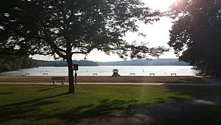
Brown County State Park is located in the United States in the center of the southern half of the state of Indiana. The park is by far the largest of 24 state parks in Indiana, and occupies 15,776 acres (63.84 km2)—making it one of the larger state parks in the United States. It is among Indiana's most visited state parks with about 1.2 million visitors annually. Although Bloomington, Indiana, is the closest city, the park is closer to the small town of Nashville in Brown County. Brown County is named for General Jacob Brown, who fought in the War of 1812 and became Commanding General of the United States Army.

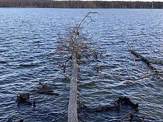
The Round Valley Reservoir in Clinton Township in Hunterdon County, New Jersey, United States, was formed in 1960 when the New Jersey Water Authority constructed two large dams and flooded a large valley. The reservoir is named after the naturally formed circular valley surrounded by Cushetunk Mountain. The deep valley was caused by erosion of the soft sedimentary rock. The surrounding ridges of Cushetunk Mountain endure because they were underlaid with dense and durable volcanic rock diabase that cooled slowly under the surface of the earth. The reservoir covers what used to be a farming community, with remains of a school and a church on the lake floor among other buildings.

The Long Path is a 357-mile (575 km) long-distance hiking trail beginning in New York City, at the West 175th Street subway station near the George Washington Bridge and ending at Altamont, New York, in the Albany area. While not yet a continuous trail, relying on road walks in some areas, it nevertheless takes in many of the popular hiking attractions west of the Hudson River, such as the New Jersey Palisades, Harriman State Park, the Shawangunk Ridge and the Catskill Mountains. It offers hikers a diversity of environments to pass through, from suburbia and sea-level salt marshes along the Hudson to wilderness and boreal forest on Catskill summits 4,000 feet (1,220 m) in elevation.

Ramapo Mountain State Forest is a 4,200-acre (17 km2) state forest in Bergen and Passaic Counties in New Jersey. The park is operated and maintained by the New Jersey Division of Parks and Forestry.
Swartswood State Park is a 3,460-acre (14.0 km2) protected area located in the Swartswood section of Stillwater and Hampton townships in Sussex County, New Jersey, in the United States. Established in 1915 by the state's Forest Park Reservation Commission, it was the first state park established by the state of New Jersey for the purposes of recreation at the state's third-largest freshwater lake. Today, Swartswood State Park is operated and maintained by the New Jersey Division of Parks and Forestry.
The Manasquan Reservoir is a source of water for municipalities and utilities, as well as a 1,204-acre (4.87 km2) park, located in Howell Township, in Monmouth County, New Jersey, United States. The reservoir doubles as a park that is part of the Monmouth County Park System. The park has trails, a visitor's center, a nature/environmental center, a boat launching area and several dikes for fishing, among its facilities. The reservoir itself, which is dammed from the Manasquan River, is operated by the New Jersey Water Supply Authority, which is a part of the much larger Raritan Basin Watershed. The nature trails circling around the reservoir are what makes this county park as one of the most popular hiking destinations in Central New Jersey, as the park receives over one million visitors a year. It is reachable by car and there are five parking lots, including one for vehicles hauling trailers. The park's trails are open to walkers, runners, hikers, bicyclists and equestrians.
High Mountain Park Preserve is a protected area of the Preakness Range of the Watchung Mountains in Wayne, New Jersey, United States. Established in 1993, it comprises 1,153 acres (5 km2) of woodlands and wetlands owned and managed by The Nature Conservancy.
Hackensack RiverWalk a is partially constructed greenway along the Newark Bay and Hackensack River on the west side of the Bergen Neck peninsula in Hudson County, New Jersey. The eight-mile walkway, following the contour of the water's edge, will run between the southern tip at Bergen Point, where it may connect to the Hudson River Waterfront Walkway, and Eastern Brackish Marsh in the north. Existing parks and promenades have been incorporated and some new sections have been built, but there remain large gaps. There is a RiverWalk in the city of Hackensack, sometimes called the Hackensack RiverWalk, but they are not part of the same project nor are they connected. A parallel walkway on the west banks of the river is known as the Meadow Path.
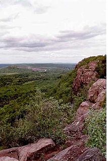
Higby Mountain or Mount Higby 892 feet (272 m), is a traprock mountain ridge located 3.75 miles (6.04 km) east of Meriden, Connecticut. It is part of the narrow, linear Metacomet Ridge that extends from Long Island Sound near New Haven, Connecticut, north through the Connecticut River Valley of Massachusetts to the Vermont border. Higby Mountain is known for its high cliff faces, unique microclimate ecosystems, and rare plant communities. It rises steeply 600 feet (180 m) above the Quinnipiac River valley and the city of Meriden to the west as a continuous 2-mile (3 km) long ledge. The mountain is traversed by the 50-mile (80 km) Mattabesett Trail.

Saltonstall Mountain, also known as Saltonstall Ridge, with a high point of (est.) 320 feet (98 m) above sea level, is a traprock mountain ridge located 3 miles (5 km) east of New Haven, Connecticut and 1.75 miles (2.8 km) north of Long Island Sound. It is part of the Metacomet Ridge that extends from Long Island Sound near New Haven, Connecticut, north through the Connecticut River Valley of Massachusetts to the Vermont border. Saltonstall Mountain is known for its 100 foot (30 m) scenic cliff faces and sharp ridgeline, unique microclimate ecosystems, rare plant communities, and for Lake Saltonstall, a 3 miles (5 km) long by 0.3 miles (400 m) wide municipal reservoir nearly enclosed by the mountain. Saltonstall Mountain is traversed by a number of hiking trails managed by the South Central Connecticut Regional Water Authority (SCCRWA) and Branford Land Trust.

West Rock Ridge or West Rock of south-central Connecticut, is a 7-mile (11 km) long trap rock mountain ridge located on the west side of New Haven with a high point of 700 feet (213 m). The ridge forms a continuous line of exposed cliffs visible from metropolitan New Haven and points west. West Rock Ridge is part of the narrow, linear Metacomet Ridge which extends from Long Island Sound near New Haven north through the Connecticut River Valley of Massachusetts to the Vermont border.

Graham Mountain is the seventh highest of the Catskill High Peaks and the highest privately owned mountain in the range. It is located in the town of Hardenburgh, New York, United States.
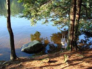
Pawtuckaway State Park is a 5,000-acre (20 km2) preserve in New Hampshire, United States. It is one of the largest state parks in southeastern New Hampshire and is named for Pawtuckaway Lake and the Pawtuckaway Mountains. The park extends from the west shore of the lake to the west side of the mountains.
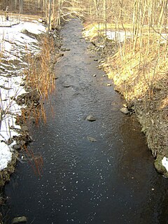
Molly Ann Brook is a tributary of the Passaic River which flows south between the northern ranges of First Watchung Mountain and Second Watchung Mountain in Passaic County and Bergen County, New Jersey. Traveling north from its confluence with the Passaic River, Molly Ann Brook passes through the city of Paterson and the boroughs of Haledon, Prospect Park, North Haledon and Franklin Lakes.

Goffle Hill, also referred to as Goffle Mountain and historically known as Totoway Mountain and Wagaraw Mountain, is a range of the trap rock Watchung Mountains on the western edge of the Newark Basin in northern New Jersey. The hill straddles part of the border of Bergen County and Passaic County, underlying a mostly suburban setting. While hosting patches of woodlands, perched wetlands, and traprock glades, the hill is largely unprotected from development. Extensive quarrying for trap rock has obliterated large tracts of the hill in North Haledon, and Prospect Park. Conservation efforts seeking to preserve undeveloped land, such as the local Save the Woods initiative (2007–present), are ongoing.

Kings Pond Park, including the associated Gypsy Pond Park, is a public, municipal park spanning close to the entire length of Goffle Brook through the village of Ridgewood in Bergen County, New Jersey. It is the second largest wildscape in the village of Ridgewood and one of the larger wooded areas along the lower Bergen-Passaic border.

The Paugussett Trail is a 14-mile (23 km) Blue-Blazed hiking trail "system" in the lower Housatonic River valley in Fairfield County and, today, is entirely in Shelton and Monroe, Connecticut. Much of the trail is in Indian Well State Park and the Town of Monroe's Webb Mountain Park. The mainline trail is primarily southeast to northwest with three short side or spur trails.
Breakneck Brook, sometimes Breakneck Valley Brook, is a 1.7-mile-long (2.8 km) tributary of the Hudson River located entirely in the Putnam County town of Philipstown, New York, United States. It rises at Surprise Lake and flows southwest towards the Hudson from there, mostly through Hudson Highlands State Park. The name comes from Breakneck Ridge to its north.


