Freeport, Ohio

Last updated

Freeport is also the former name of the Warren County town of Oregonia.
Freeport, Ohio
John Reaves House 01.jpg
USA Ohio location map.svg
Red pog.svg
Freeport, Ohio
Usa edcp location map.svg
Red pog.svg
Freeport, Ohio
Coordinates: 40°12′40″N81°16′07″W / 40.21111°N 81.26861°W / 40.21111; -81.26861
Country United States
State Ohio
County Harrison
Area
[1]
  Total0.60 sq mi (1.55 km2)
  Land0.60 sq mi (1.55 km2)
  Water0.00 sq mi (0.00 km2)
Elevation
[2]
1,017 ft (310 m)
Population
 (2020)
  Total321
  Density535.89/sq mi (206.92/km2)
Time zone UTC-5 (Eastern (EST))
  Summer (DST) UTC-4 (EDT)
ZIP code
43973
Area code 740
FIPS code 39-28798 [3]
GNIS feature ID2398926 [2]

Freeport is a village in southwestern Harrison County, Ohio, United States. The population was 321 at the 2020 census.

Contents

History

Freeport was laid out in 1810. [4] A post office has been in operation at Freeport since 1814. [5]

Geography

According to the United States Census Bureau, the village has a total area of 0.60 square miles (1.55 km2), all land. [6]

Demographics

Historical population
CensusPop.Note
1830 211
1850 288
1880 387
1890 67273.6%
1900 6902.7%
1910 624−9.6%
1920 6260.3%
1930 578−7.7%
1940 562−2.8%
1950 5660.7%
1960 503−11.1%
1970 490−2.6%
1980 5257.1%
1990 475−9.5%
2000 398−16.2%
2010 369−7.3%
2020 321−13.0%
U.S. Decennial Census [7]

2010 census

As of the census [8] of 2010, there were 369 people, 161 households, and 87 families living in the village. The population density was 615.0 inhabitants per square mile (237.5/km2). There were 181 housing units at an average density of 301.7 per square mile (116.5/km2). The racial makeup of the village was 97.6% White and 2.4% from two or more races.

There were 161 households, of which 28.0% had children under the age of 18 living with them, 41.6% were married couples living together, 5.6% had a female householder with no husband present, 6.8% had a male householder with no wife present, and 46.0% were non-families. 39.1% of all households were made up of individuals, and 15.5% had someone living alone who was 65 years of age or older. The average household size was 2.29 and the average family size was 3.16.

The median age in the village was 41.2 years. 23.3% of residents were under the age of 18; 5.5% were between the ages of 18 and 24; 26.3% were from 25 to 44; 27% were from 45 to 64; and 17.9% were 65 years of age or older. The gender makeup of the village was 49.9% male and 50.1% female.

2000 census

As of the census [3] of 2000, there were 398 people, 170 households, and 99 families living in the village. The population density was 664.5 inhabitants per square mile (256.6/km2). There were 200 housing units at an average density of 333.9 per square mile (128.9/km2). The racial makeup of the village was 98.49% White, 0.50% Native American, 0.25% Asian, and 0.75% from two or more races.

There were 170 households, out of which 27.6% had children under the age of 18 living with them, 47.1% were married couples living together, 9.4% had a female householder with no husband present, and 41.2% were non-families. 35.9% of all households were made up of individuals, and 22.4% had someone living alone who was 65 years of age or older. The average household size was 2.34 and the average family size was 3.12.

In the village, the population was spread out, with 22.6% under the age of 18, 10.3% from 18 to 24, 27.9% from 25 to 44, 22.1% from 45 to 64, and 17.1% who were 65 years of age or older. The median age was 39 years. For every 100 females there were 85.1 males. For every 100 females age 18 and over, there were 80.1 males.

The median income for a household in the village was $18,558, and the median income for a family was $35,833. Males had a median income of $26,667 versus $14,000 for females. The per capita income for the village was $15,877. About 11.5% of families and 19.4% of the population were below the poverty line, including 23.6% of those under age 18 and 12.9% of those age 65 or over.

Arts and culture

Freeport has a public library, a branch of the Puskarich Public Library. [9]

Education

The village is served by Lakeland Academy, a K-12 public school. [10]

Related Research Articles

<span class="mw-page-title-main">Fort Shawnee, Ohio</span> CDP in Ohio, United States

Fort Shawnee is census-designated place (CDP) in Allen County, Ohio, United States. The population was 6,263 at the 2020 census. It is included in the Lima, Ohio Metropolitan Statistical Area. Fort Shawnee is adjacent to the city of Lima and the village of Cridersville in Auglaize County. In 2012, village residents voted to disincorporate the village. According to the United States Census Bureau, the village had a total area of 7.25 square miles (18.78 km2), of which 7.21 square miles (18.67 km2) is land and 0.04 square miles (0.10 km2) is water.

<span class="mw-page-title-main">Polk, Ohio</span> Village in Ohio, United States

Polk is a village in Ashland County, Ohio, United States. The population was 310 at the 2020 census.

<span class="mw-page-title-main">North Kingsville, Ohio</span> Village in Ohio, United States

North Kingsville is a village in Ashtabula County, Ohio, United States. The population was 2,742 at the 2020 census.

<span class="mw-page-title-main">Holloway, Ohio</span> Village in Ohio, United States

Holloway is a village in Belmont County, Ohio, United States. The population was 330 at the 2020 census. It is part of the Wheeling metropolitan area. Holloway was laid out in 1883, and named after the local Holloway family.

<span class="mw-page-title-main">Hamersville, Ohio</span> Village in Ohio, United States

Hamersville is a village in Clark Township, Brown County, Ohio, United States. The population was 485 at the 2020 census.

<span class="mw-page-title-main">Crown City, Ohio</span> Village in Ohio, United States

Crown City is a village in Gallia County, Ohio, United States, along the Ohio River. The population was 424 at the 2020 census.

<span class="mw-page-title-main">Vinton, Ohio</span> Village in Ohio, United States

Vinton is a village in Gallia County, Ohio, United States. The population was 224 at the 2020 census. It is part of the rural Point Pleasant micropolitan area.

<span class="mw-page-title-main">Addyston, Ohio</span> Village in Ohio, United States

Addyston is a village in Miami Township, Hamilton County, Ohio, United States. Located along the Ohio River, it is a western suburb of the neighboring city of Cincinnati. The population was 927 at the 2020 census.
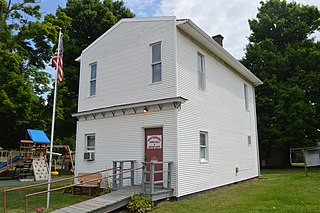
<span class="mw-page-title-main">Martinsburg, Ohio</span> Village in Ohio, United States

Martinsburg is a village in Knox County, Ohio, United States. The population was 222 at the 2020 census.

<span class="mw-page-title-main">South Solon, Ohio</span> Village in Ohio, United States

South Solon is a village in Madison County, Ohio, United States. The population was 329 at the 2020 census. Despite their similar names, South Solon is not adjacent to the city of Solon, Ohio, a suburb of Cleveland in Cuyahoga County. The two towns are approximately 170 miles (270 km) apart.
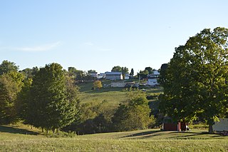
<span class="mw-page-title-main">Antioch, Ohio</span> Village in Ohio, United States

Antioch is a village in Monroe County, Ohio, United States. The population was 71 at the 2020 census.

<span class="mw-page-title-main">Shawnee, Perry County, Ohio</span> Village in Ohio, United States

Shawnee is a village in Perry County, Ohio, United States. The population was 505 at the 2020 census. It is 9 miles (14 km) south of the county seat of New Lexington.

<span class="mw-page-title-main">Tarlton, Ohio</span> Village in Ohio, United States

Tarlton is a village in Fairfield and Pickaway counties in the U.S. state of Ohio. The population was 254 at the 2020 census.

<span class="mw-page-title-main">Port Jefferson, Ohio</span> Village in Ohio, United States

Port Jefferson is a village in Salem Township, Shelby County, Ohio, United States. The population was 308 at the 2020 census.

<span class="mw-page-title-main">Limaville, Ohio</span> Census-designated place in Ohio, United States

Limaville is a census-designated place (CDP) and former village in Stark County, Ohio, United States. The population was 151 at the 2020 census. It is part of the Canton–Massillon Metropolitan Statistical Area.

<span class="mw-page-title-main">Wilkesville, Ohio</span> Village in Ohio, United States

Wilkesville is a village in Vinton County, Ohio, United States. The population was 116 at the 2020 census.

<span class="mw-page-title-main">Congress, Ohio</span> Village in Ohio, United States

Congress is a village in Wayne County, Ohio, United States. The population was 132 at the 2020 census.

<span class="mw-page-title-main">Wilson, Ohio</span> Village in Ohio, United States

Wilson is a village in Belmont and Monroe counties in the U.S. state of Ohio. The population was 129 at the 2020 census. It is part of the Wheeling metropolitan area.

<span class="mw-page-title-main">Clifton, Ohio</span> Village in Ohio, United States

Clifton is a village in Clark and Greene counties in the U.S. state of Ohio and is home to the Clifton Mill, one of the largest water-powered grist mills still in existence. The population was 131 at the 2020 census.
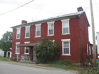
<span class="mw-page-title-main">Winchester, Adams County, Ohio</span> Village in Ohio, United States

Winchester is a village in Adams County, Ohio, United States. The population was 987 at the 2020 census. The name of the surrounding township is also named Winchester.

References

  1. "ArcGIS REST Services Directory". United States Census Bureau. Retrieved September 20, 2022.
  2. 1 2 U.S. Geological Survey Geographic Names Information System: Freeport, Ohio
  3. 1 2 "U.S. Census website". United States Census Bureau . Retrieved January 31, 2008.
  4. Overman, William Daniel (1958). Ohio Town Names. Akron, OH: Atlantic Press. p. 47.
  5. "Harrison County". Jim Forte Postal History. Archived from the original on December 22, 2015. Retrieved December 11, 2015.
  6. "US Gazetteer files 2010". United States Census Bureau. Archived from the original on July 2, 2012. Retrieved January 6, 2013.
  7. "Census of Population and Housing". Census.gov. Retrieved June 4, 2015.
  8. "U.S. Census website". United States Census Bureau . Retrieved January 6, 2013.
  9. "Libraries". Harrison County, OH. Retrieved February 25, 2018.
  10. "Homepage". Lakeland Academy. Retrieved February 25, 2018.