Gann, Ohio

Last updated

Brinkhaven, Ohio
Brinkhaven, Ohio Post Office.jpg
Brinkhaven Post Office
OHMap-doton-Gann.png
Location of Brinkhaven, Ohio
Map of Knox County Ohio Highlighting Gann Village.png
Location of Brinkhaven in Knox County
Coordinates: 40°28′09″N82°11′29″W / 40.46917°N 82.19139°W / 40.46917; -82.19139
Country United States
State Ohio
County Knox
Township Union
Area
[1]
  Total0.20 sq mi (0.51 km2)
  Land0.18 sq mi (0.48 km2)
  Water0.01 sq mi (0.03 km2)
Elevation
[2]
925 ft (282 m)
Population
 (2020)
  Total114
  Density616.22/sq mi (237.98/km2)
Time zone UTC-5 (Eastern (EST))
  Summer (DST) UTC-4 (EDT)
FIPS code 39-29288 [3]
GNIS feature ID2398942 [2]

Brinkhaven, once known as Mount Holly and Gann, [4] [5] is a village in Knox County, Ohio, United States. The population was 114 at the 2020 census.

Contents

Geography

Brinkhaven is located along the Mohican River. [4]

According to the United States Census Bureau, the village has a total area of 0.20 square miles (0.52 km2), of which 0.19 square miles (0.49 km2) is land and 0.01 square miles (0.03 km2) is water. [6] The Bridge of Dreams is located on the Mohican River in Brinkhaven.

Demographics

Historical population
CensusPop.Note
1880 153
1900 250
1910 34136.4%
1920 3420.3%
1930 277−19.0%
1940 187−32.5%
1950 177−5.3%
1960 1917.9%
1970 172−9.9%
1980 1730.6%
1990 1793.5%
2000 143−20.1%
2010 125−12.6%
2020 114−8.8%
U.S. Decennial Census [7]

2010 census

As of the census [8] of 2010, there were 125 people, 54 households, and 40 families living in the village. The population density was 657.9 inhabitants per square mile (254.0/km2). There were 65 housing units at an average density of 342.1 per square mile (132.1/km2). The racial makeup of the village was 100.0% White. Hispanic or Latino of any race were 2.4% of the population.

There were 54 households, of which 33.3% had children under the age of 18 living with them, 42.6% were married couples living together, 18.5% had a female householder with no husband present, 13.0% had a male householder with no wife present, and 25.9% were non-families. 22.2% of all households were made up of individuals, and 9.3% had someone living alone who was 65 years of age or older. The average household size was 2.31 and the average family size was 2.58.

The median age in the village was 42.2 years. 24.8% of residents were under the age of 18; 4% were between the ages of 18 and 24; 28% were from 25 to 44; 30.4% were from 45 to 64; and 12.8% were 65 years of age or older. The gender makeup of the village was 51.2% male and 48.8% female.

2000 census

As of the census [3] of 2000, there were 143 people, 51 households, and 36 families living in the village. The population density was 749.6 inhabitants per square mile (289.4/km2). There were 55 housing units at an average density of 288.3 per square mile (111.3/km2). The racial makeup of the village was 100.00% White. Hispanic or Latino of any race were 0.70% of the population.

There were 51 households, out of which 41.2% had children under the age of 18 living with them, 58.8% were married couples living together, 9.8% had a female householder with no husband present, and 29.4% were non-families. 27.5% of all households were made up of individuals, and 11.8% had someone living alone who was 65 years of age or older. The average household size was 2.80 and the average family size was 3.42.

In the village, the population was spread out, with 30.8% under the age of 18, 11.9% from 18 to 24, 28.7% from 25 to 44, 16.1% from 45 to 64, and 12.6% who were 65 years of age or older. The median age was 30 years. For every 100 females there were 93.2 males. For every 100 females age 18 and over, there were 110.6 males.

The median income for a household in the village was $37,500, and the median income for a family was $37,857. Males had a median income of $30,938 versus $11,750 for females. The per capita income for the village was $10,717. There were 5.6% of families and 17.7% of the population living below the poverty line, including 25.6% of under eighteens and none of those over 64.

See also

Related Research Articles

<span class="mw-page-title-main">Jacksonville, Ohio</span> Village in Ohio, United States

Jacksonville is a village in Athens County, Ohio, United States. The population was 400 at the 2020 census.

<span class="mw-page-title-main">Morristown, Ohio</span> Village in Ohio, United States

Morristown is a village in Belmont County, Ohio, United States. The population was 248 at the 2020 census. It is part of the Wheeling metropolitan area.

<span class="mw-page-title-main">Woodstock, Ohio</span> Village in Ohio, United States

Woodstock is a village in Champaign County, Ohio, United States. The population was 287 at the 2020 census.

<span class="mw-page-title-main">Plainfield, Ohio</span> Village in Ohio, United States

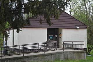
Plainfield is a village in Coshocton County, Ohio, United States, along Wills Creek. The population was 141 at the 2020 census.

<span class="mw-page-title-main">Walton Hills, Ohio</span> Village in Ohio, United States

Walton Hills is a village in Cuyahoga County, Ohio, United States. The population was 2,033 at the 2020 census. A suburb of Cleveland, it is a part of the Cleveland metropolitan area.

<span class="mw-page-title-main">Gordon, Ohio</span> Village in Ohio, United States

Gordon is a village in Darke County, Ohio, United States. The population was 245 at the 2020 census.

<span class="mw-page-title-main">Valleyview, Ohio</span> Village in Ohio, United States

Valleyview is a village in Franklin County, Ohio, United States. The population was 669 at the 2020 census.

<span class="mw-page-title-main">North Bend, Ohio</span> Village in Ohio, United States

North Bend is a village in Miami Township, Hamilton County, Ohio, United States, along the Ohio River. It is a part of the Greater Cincinnati area. The population was 835 at the 2020 census.

<span class="mw-page-title-main">St. Bernard, Ohio</span> Village in Ohio, United States

St. Bernard or Saint Bernard is a village in Hamilton County, Ohio, United States. It is an enclave and suburb of Cincinnati. The population was 4,070 at the 2020 census.

<span class="mw-page-title-main">Arcadia, Ohio</span> Village in Ohio, United States

Arcadia is a village in Hancock County, Ohio, United States. The population was 564 at the 2020 census.

<span class="mw-page-title-main">New Athens, Ohio</span> Village in Ohio, United States

New Athens is a village in Harrison County, Ohio, United States. The population was 222 at the 2020 census.

<span class="mw-page-title-main">Wakeman, Ohio</span> Village in Ohio, United States

Wakeman is a village in Huron County, Ohio, United States, along the Vermilion River. Its namesake was Jesup Wakeman, an early settler of Fairfield County, Connecticut, who was involved in western land speculation between 1800 and 1840. The population was 990 at the 2020 census.

<span class="mw-page-title-main">Fultonham, Ohio</span> Village in Ohio, United States

Fultonham is a village in Muskingum County, Ohio, United States. The population was 115 at the 2020 census. It is part of the Zanesville micropolitan area. Fultonham was named for Robert Fulton, inventor of the first commercially successful steamboat.

<span class="mw-page-title-main">Cecil, Ohio</span> Village in Ohio, United States

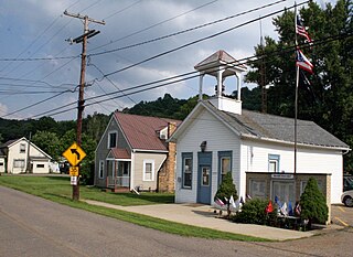
Cecil is a village in Paulding County, Ohio, United States. The population was 146 at the 2020 census.

<span class="mw-page-title-main">Continental, Ohio</span> Village in Ohio, United States

Continental is a village in Putnam County, Ohio, United States. The population was 1,102 at the 2020 census.

<span class="mw-page-title-main">Kingston, Ohio</span> Village in Ohio, United States

Kingston is a village in Ross County, Ohio, United States. The population was 1,262 at the 2020 census.

<span class="mw-page-title-main">Barnhill, Ohio</span> Village in Ohio, United States

Barnhill is a village in Tuscarawas County, Ohio, United States. The population was 383 at the 2020 census.

<span class="mw-page-title-main">Bairdstown, Ohio</span> Village in Ohio, United States

Bairdstown is a village in Wood County, Ohio, United States. The population was 115 at the 2020 census.

<span class="mw-page-title-main">West Millgrove, Ohio</span> Village in Ohio, United States

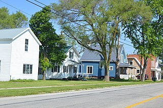
West Millgrove is a village in Wood County, Ohio, United States. The population was 131 at the 2020 census.

<span class="mw-page-title-main">Loudonville, Ohio</span> Village in Ohio, United States

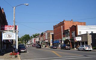
Loudonville is a village in Ashland and Holmes counties in the U.S. state of Ohio. The population was 2,786 at the 2020 census. Loudonville is nicknamed the "Canoe Capital of Ohio" for the many canoe liveries along the Mohican River. It is also home to Mohican State Park and Mohican-Memorial State Forest

References

  1. "ArcGIS REST Services Directory". United States Census Bureau. Retrieved September 20, 2022.
  2. 1 2 U.S. Geological Survey Geographic Names Information System: Gann, Ohio
  3. 1 2 "U.S. Census website". United States Census Bureau . Retrieved January 31, 2008.
  4. 1 2 DeLorme. Ohio Atlas & Gazetteer. 7th ed. Yarmouth, Maine, 2004, p.60. ISBN   0-89933-281-1
  5. Overman, William Daniel (1958). Ohio Town Names. Akron, OH: Atlantic Press. p. 19.
  6. "US Gazetteer files 2010". United States Census Bureau. Archived from the original on July 2, 2012. Retrieved January 6, 2013.
  7. "Census of Population and Housing". Census.gov. Retrieved June 4, 2015.
  8. "U.S. Census website". United States Census Bureau . Retrieved January 6, 2013.

Commons-logo.svg Media related to Gann, Ohio at Wikimedia Commons