The German New Guinea Company (German : Deutsche Neuguinea-Kompagnie) was a German Chartered Company which exploited insular territory in and near present Papua New Guinea.
The German New Guinea Company (German : Deutsche Neuguinea-Kompagnie) was a German Chartered Company which exploited insular territory in and near present Papua New Guinea.
In the 1870s and 1880s German commercial firms began to site trading stations in New Guinea. Agents of J.C. Godeffroy & Sohn reached the Bismarck Archipelago from the Caroline Islands in 1872. In 1875 Hersheim & Company [1] moved to the Archipelago.
In 1884, the New Guinea Company was founded in Berlin by Adolph von Hansemann and a syndicate of German bankers for the purpose of colonizing and exploiting resources on Neuguinea (German New Guinea), [2] where German interest grew after British Queensland's annexation of part of eastern New Guinea. This expedition was with the knowledge and blessing of the German Chancellor, Count Otto von Bismarck, and with secrecy and speed an expedition was fitted out under Dr Otto Finsch, ornithologist and explorer.


His task was to select land for plantation development on the north-east coast of New Guinea and establish trading posts. Its influence soon grew to encompass the entire north-eastern part of New Guinea and some of the islands off the coast.
The Neuguinea Compagnie expedition left Sydney for New Guinea in the steamer Samoa captained by Eduard Dallmann. On 19 August, Chancellor Bismarck ordered the establishment of a German protectorate in the New Britain Archipelago and north-eastern New Guinea.
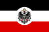
German colonial rule in New Guinea lasted for a period of thirty years, For the first fifteen years the colony was administered under imperial charters by a private company, in the manner of the old British and Dutch East India companies, but with far less success. From 1899 to 1914, the Imperial Government administered German New Guinea through a governor, who was assisted after 1904 by a nominated Government Council.
When the Imperial Government took over the running of the colony in 1899, its overriding objective was rapid economic development, based on a German- controlled plantation economy. [3]
| Colonies |
| |||||
|---|---|---|---|---|---|---|
| Concessions |
| |||||
| Unrecognised |
| |||||
| International | |
|---|---|
| National | |
| | This German history article is a stub. You can help Wikipedia by expanding it. |
| | This Papua New Guinea-related article is a stub. You can help Wikipedia by expanding it. |

The prehistory of Papua New Guinea can be traced to about 50,000–60,000 years ago, when people first migrated towards the Australian continent. The written history began when European navigators first sighted New Guinea in the early part of the 17th century.

Bougainville, officially the Autonomous Region of Bougainville, is an autonomous region in Papua New Guinea. The largest island is Bougainville Island, while the region also includes Buka Island and a number of outlying islands and atolls. The current capital is Buka, situated on Buka Island.

German New Guinea consisted of the northeastern part of the island of New Guinea and several nearby island groups and was the first part of the German colonial empire. The mainland part of the territory, called Kaiser-Wilhelmsland, became a German protectorate in 1884. Other island groups were added subsequently. The Bismarck Archipelago, and the North Solomon Islands were declared a German protectorate in 1885. The Caroline Islands, Palau, and the Mariana Islands were bought from Spain in 1899. German New Guinea annexed the formerly separate German Protectorate of Marshall Islands, which also included Nauru, in 1906. German Samoa, though part of the German colonial empire, was not part of German New Guinea.
Kamerun was an African colony of the German Empire from 1884 to 1920 in the region of today's Republic of Cameroon. Kamerun also included northern parts of Gabon and the Congo with western parts of the Central African Republic, southwestern parts of Chad and far northeastern parts of Nigeria.
Bougainville, an autonomous region of Papua New Guinea (PNG), has been inhabited by humans for at least 29,000 years, according to artefacts found in Kilu Cave on Buka Island. The region is named after Bougainville Island, the largest island of the Solomon Islands archipelago, but also contains a number of smaller islands.

Kaiser-Wilhelmsland formed part of German New Guinea, the South Pacific protectorate of the German Empire. Named in honour of Wilhelm I, who reigned as German Emperor from 1871 to 1888, it included the northern part of present-day Papua New Guinea. From 1884 until 1920 the territory was a protectorate of the German Empire. Kaiser-Wilhelmsland, the Bismarck Archipelago, the northern Solomon Islands, the Caroline Islands, Palau, Nauru, the Northern Mariana Islands, and the Marshall Islands comprised German New Guinea.

The Bismarck Sea lies in the southwestern Pacific Ocean within the nation of Papua New Guinea. It is located northeast of the island of New Guinea and south of the Bismarck Archipelago. It has coastlines in districts of the Islands Region, Momase Region, and Papua Region.
Madang is the capital of Madang Province and is a town with a population of 27,420 on the north coast of Papua New Guinea. It was first settled by the Germans in the 19th century.

Morobe Province is a province on the northern coast of Papua New Guinea. The provincial capital and largest city is Lae. The province covers 33,705 km2, with a population of 674,810, and since the division of Southern Highlands Province in May 2012 it is the most populous province. It includes the Huon Peninsula, the Markham River, and delta, and coastal territories along the Huon Gulf. The province has nine administrative districts. At least 101 languages are spoken, including Kâte and Yabem language. English and Tok Pisin are common languages in the urban areas, and in some areas pidgin forms of German are mixed with the native language.
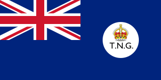
The Territory of New Guinea was an Australian-administered United Nations trust territory on the island of New Guinea from 1914 until 1975. In 1949, the Territory and the Territory of Papua were established in an administrative union by the name of the Territory of Papua and New Guinea. That administrative union was renamed as Papua New Guinea in 1971. Notwithstanding that it was part of an administrative union, the Territory of New Guinea at all times retained a distinct legal status and identity until the advent of the Independent State of Papua New Guinea.

Kokopo is the capital of East New Britain Province in Papua New Guinea. It is administered under Kokopo/Vunamami Urban LLG. The capital was moved from Rabaul in 1994 when the volcanoes Tavurvur and Vulcan erupted. As a result, the population of the town increased more than sixfold from 3,150 in 1990 to 20,262 in 2000.

The Duke of York Islands are a group of islands located in East New Britain Province, Papua New Guinea. They are found in St George's Channel between New Britain and New Ireland islands and form part of the Bismarck Archipelago. The Duke of York Islands were named in 1767 by Philip Carteret to honour Prince Edward, son of Frederick, Prince of Wales and younger brother of George III of the United Kingdom.

The Territory of Papua and New Guinea, officially the Administrative Union of the Territory of Papua and the Territory of New Guinea, was established by an administrative union between the Australian-administered territories of Papua and New Guinea in 1949. In December 1971, the name of the Territory changed to "Papua New Guinea" and in 1975 it became the Independent State of Papua New Guinea.

New Ireland, or Latangai, is a large island in Papua New Guinea, approximately 7,404 km2 (2,859 sq mi) in area with c. 120,000 people. It is named after the island of Ireland. It is the largest island of New Ireland Province, lying northeast of the island of New Britain. Both islands are part of the Bismarck Archipelago, named after Otto von Bismarck, and they are separated by Saint George's Channel.
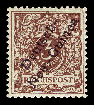
The postage stamps of New Guinea, part of present-day Papua New Guinea, were issued up to 1942.
The Battle of Bita Paka was fought south of Kabakaul, on the island of New Britain, and was a part of the invasion and subsequent occupation of German New Guinea by the Australian Naval and Military Expeditionary Force (AN&MEF) shortly after the outbreak of the First World War. Similar to New Zealand's operation against German Samoa in August, the main target of the operation was a strategically important wireless station—one of several used by the German East Asia Squadron—which the Australians believed to be located in the area. The powerful German naval fleet threatened British interests and its elimination was an early priority of the British and Australian governments during the war.

Hermann Philipp Detzner was a German engineer and surveyor, who served as an officer in the German colonial security force (Schutztruppe) in Kamerun (Cameroon) and German New Guinea. He gained fame for evading capture after Australian troops invaded German New Guinea at the start of World War I.
Adolph von Hansemann was an Imperial German businessman and banker.

The Sepik is the longest river on the island of New Guinea, and the second largest in Oceania by discharge volume after the Fly River. The majority of the river flows through the Papua New Guinea (PNG) provinces of Sandaun and East Sepik, with a small section flowing through the Indonesian province of Papua.
As the township of Lae, in Morobe Province, Papua New Guinea is a relatively new entity, the history of the Lae environs is much older.