Golden Gate, Oakland, California

Last updated
Golden Gate
Love Our Neighborhood Day 2014 San Pablo Avenue.jpg
San Pablo Avenue during Love Our Neighborhood Day 2014
Oakland golden gate locator map.png
Location of Golden Gate in Oakland
Coordinates: 37°50′41″N122°17′01″W / 37.8447°N 122.2835°W / 37.8447; -122.2835
Country United States
State California
County Alameda
City Oakland
Government
   Oakland City Council, District 1 Dan Kalb
Elevation
40 ft (10 m)

The Golden Gate neighborhood of Oakland, California is located in the northwest corner of the city, east of Emeryville and south of Berkeley. It includes the Golden Gate Shopping District, the stretch of San Pablo Avenue between 53rd Street on the south, and the Oakland-Berkeley border at 67th Street to the north. [1] The neighborhood includes the area from a few blocks west of San Pablo Avenue (the Emeryville border) to Adeline Street on the east. [2] [3]

Contents

The district includes cafes and arts establishments. [4] [5] [6]

History

Golden Gate branch of the Oakland Public Library. Oakland Public Library Golden Gate Branch 2009.jpg
Golden Gate branch of the Oakland Public Library.

The area was inhabited by the Huchiun band of the Ohlone people, then was part of the Rancho San Antonio grant, which was split up following the Treaty of Guadalupe Hidalgo. [7]

Charles Alexander Klinkner [8] built 75 homes in the area and called it Klinknerville, established in 1885. A Klinknerville post office was established in 1887. The name was changed to Golden Gate in 1888. [9] The town was annexed to Oakland in 1897. [10]

The Golden Gate branch of the Oakland Library opened in 1918. It was built with funds from a 1914 Carnegie grant. Its design, by Donovan and Dickie, is a good example of early 20th century Georgian Revival Architecture. [11]

In the first half of the 20th century, Golden Gate was an entertainment district, with over 50 bars [12] including the original Trader Vic's location at the northeast corner of San Pablo Ave & 65th St where the Mai Tai drink was purportedly invented. [13] In the last half of the 20th century the retail district underwent a period of decline [14] and by 1998 was considered blighted by the city of Oakland. [15]

During the 1950s, the area became majority African American. [7]

In 1982, the East Bay Negro Historical Society (EBNHS) was invited into the Golden Gate Branch of the Oakland Public Library, making it the first Oakland city library with a predominantly African American focused collection. The collection was housed in the entire left side of the library where the children's section of the library is now located. The assistance of Mayor Lionel Wilson, Assemblyman Elihu Harris, and others helped the organization establish a solid foundation in their new home. Following the appointment of Dr. Lawrence Crouchett as its executive director in 1988, the organization changed its name to the Northern California Center for Afro-American History & Life (NCCAAHL). In 1994, the City of Oakland and the NCCAAHL merged to create the African American Museum & Library at Oakland (AAMLO). This unique public/private partnership entered a historic juncture with the opening of AAMLO in February 2002. Located at 659 14th Street, AAMLO is now housed in the former Charles S. Greene library, an historic 1902 Carnegie building.

The Golden Gate Shopping District was the location of Your Black Muslim Bakery, which made national headlines in August 2007 when the bakery was raided by the Oakland police and shut down. [16]

By 2010 the area was undergoing a process of gentrification, including controversially being dubbed "NOBE" by some realtors. [7]

Starting in 2014, the neighborhood has hosted Love Our Neighborhood Day, an open streets festival in which San Pablo Avenue is car free. [17]

Media

Oakland North has covered the neighborhood since 2008 [18] and Oakland Local since 2009. [19]

Related Research Articles

Berkeley, California City in California, United States

Berkeley is a city on the eastern shore of San Francisco Bay in northern Alameda County, California, United States. It is named after the 18th-century Irish bishop and philosopher George Berkeley. It borders the cities of Oakland and Emeryville to the south and the city of Albany and the unincorporated community of Kensington to the north. Its eastern border with Contra Costa County generally follows the ridge of the Berkeley Hills. The 2020 census recorded a population of 124,321.

Emeryville, California City in California, United States

Emeryville is a small city located in northwest Alameda County, California, in the United States. It lies in a corridor between the cities of Berkeley and Oakland, with a border on the shore of San Francisco Bay. The resident population was 12,905 as of 2020. Its proximity to San Francisco, the Bay Bridge, the University of California, Berkeley, and Silicon Valley has been a catalyst for recent economic growth.

Richmond District, San Francisco Neighborhood in San Francisco, California, United States

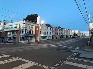
The Richmond District is a neighborhood in the northwest corner of San Francisco, California, developed initially in the late 19th century. It is sometimes confused with the city of Richmond, which is 20 miles (32 km) northeast of San Francisco.

Sunset District, San Francisco Neighborhood in San Francisco, California, United States

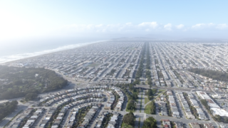
The Sunset District is a neighborhood located in the southwest quadrant of San Francisco, California, United States.

California State Route 123 Highway in California

State Route 123 is a state highway in the U.S. state of California in the San Francisco Bay Area. Named San Pablo Avenue for virtually its entire length, SR 123 is a major north–south state highway along the flats of the urban East Bay. Route 123 runs about 7.39 miles (11.9 km) between Interstate 580 in Oakland in the south and Interstate 80 in Richmond in the north. San Pablo Avenue itself, a portion of Historic US 40, continues well past these termini, south to Downtown Oakland and north to Crockett, but without the Route 123 designation.

San Francisco Public Library

The San Francisco Public Library is the public library system of the city of San Francisco. The Main Library is located at Civic Center, at 100 Larkin Street. The library system has won several awards, such as Library Journal's Library of the Year award in 2018. The library is well-funded due to the city's dedicated Library Preservation Fund that was established by a 1994 ballot measure, which was subsequently renewed until 2022 by a ballot measure in 2007.

Emeryville station Amtrak station in Emeryville, California, United States

Emeryville station is an Amtrak station in Emeryville, California, United States. The station is served by the California Zephyr, Capitol Corridor, Coast Starlight, and San Joaquins.

Temescal, Oakland, California Neighborhood of Oakland in Alameda, California, United States

Temescal is one of the oldest neighborhoods in Oakland, California, located in North Oakland, and centered on Telegraph Avenue. The neighborhood derives its name from Temescal Creek, a significant watercourse in the city.

Dimond District, Oakland, California Neighborhood of Oakland in Alameda, California, United States

The Dimond District is a neighborhood centered on the intersection of MacArthur Boulevard and Fruitvale Avenue in East Oakland, California, in the United States. It is located about two miles east of Lake Merritt, north of the Fruitvale District, and west of the Laurel District. It lies at an elevation of 213 feet. Dimond's ZIP code is 94602. It is a multicultural neighborhood where the hills meet the flatlands and is a unique melting pot of cultures and social classes. Dimond Park is located in the district.

Temescal Creek (Northern California)

Temescal Creek is one of the principal watercourses in the city of Oakland, California, United States.

Oaks Park (stadium)

Oaks Park, formally known as the Oakland Baseball Park, and at times nicknamed Emeryville Park, was a baseball stadium in Emeryville, California. It was primarily used for baseball, and was the home field of the Oakland Oaks baseball team in the Pacific Coast League (PCL). It opened in 1913, and held 11,000 people. The Oaks played there until 1955.

African American Museum and Library at Oakland United States historic place

The African American Museum and Library at Oakland (AAMLO) is a museum and non-circulating library dedicated to preserving African American history, experiences and culture on 14th Street in Downtown Oakland. It contains an extensive archival collection of such artifacts as diaries, correspondence, photos, and periodicals.

Oakland Public Library

The Oakland Public Library is the public library in Oakland, California. Opened in 1878, the Oakland Public Library currently serves the city of Oakland, along with neighboring smaller cities Emeryville and Piedmont. The Oakland Public Library has the largest collection of any public library in the East Bay, featuring approximately 1.5 million items. It consists of a main library located in downtown Oakland, and 16 branch libraries throughout the city.

Downtown Oakland Central business district of Oakland, California

Downtown Oakland is the central business district of Oakland, California, United States; roughly bounded by both the Oakland Estuary and Interstate 880 on the southwest, Interstate 980 on the northwest, Grand Avenue on the northeast, and Lake Merritt on the east.

North Oakland, Oakland, California Neighbourhood region in Oakland, California

North Oakland is an area in Oakland, California, United States, bordered by Downtown Oakland, Oakland Hills, and the adjacent cities of Berkeley, Emeryville and Piedmont. Annexed to Oakland in 1897. It is known as the birthplace of the Black Panther Party and is the childhood home of both the co-founders, which are Dr. Huey P. Newton and Bobby Seale. It is also the birthplace and childhood home of Sue Draheim, internationally recognized fiddler.

Parkside, San Francisco Neighborhood in San Francisco, California, United States

The Parkside is a neighborhood in the western part of San Francisco, California, usually considered to be part of the Sunset District. It is located in the southern part of the Avenues south of Quintara and north of Sloat Boulevard.

Uptown Oakland Neighborhood of Oakland in Alameda, California, United States

Uptown Oakland is a neighborhood Oakland, California, located in the northern end of Downtown. It is located roughly between West Grand Avenue to the north, Interstate 980 to the west, City Center and 14th Street to the south, and Broadway to the east. The neighborhood has become an important entertainment district in recent years.

San Antonio is a large district in Oakland, California, encompassing the land east of Lake Merritt to Sausal Creek. It is one of the most diverse areas of the city. It takes its name from Rancho San Antonio, the name of the land as granted to Luís María Peralta by the last Spanish governor of California.

San Pablo Arts District

The San Pablo Arts District (SPAD) is a nascent arts district along the San Pablo Avenue corridor, between 53rd and 67th Streets in the Golden Gate neighborhood of Oakland, California.

References

  1. Golden Gate District Profile
  2. City of Oakland Pedestrian Safety Project (2004). Walk Oakland! (Map). Rufus Graphics, San Francisco. ISBN   1882276167.
  3. "Neighborhood Search Map". Oakland Museum of California. Archived from the original on 2009-04-30. Retrieved 2011-07-29.
  4. Laura McCamy (2013-12-26). "New destinations, part one: Golden Gate merchants reflect their eclectic neighborhood". Oakland Local.
  5. Laura McCamy (2013-12-26). "Sidebar: Three good reasons to stop by Oakland's Golden Gate". Oakland Local.
  6. Stephanie Wright Hession (2014-01-09). "San Pablo Avenue, Golden Gate district, Oakland". San Francisco Chronicle.
  7. 1 2 3 Brock Winstead (2014). "On Becoming a Historic Resident of Oakland". Boom: A Journal of California.
  8. Charles A. Klinkner and family, from the Joseph R. Knowland collection at the Oakland History Room, Oakland Public Library
  9. California's Geographic Names: A Gazetteer of Historic and Modern Names of the State, By David L. Durham, Published by Word Dancer Press, 1998, ISBN   1-884995-14-4, ISBN   978-1-884995-14-9
  10. Past and Present of Alameda County, California - S. J. Clarke Pub. Co., 1914
  11. Carnegie Libraries, Oakland/Golden Gate
  12. Ryan Phillips (2012-03-26). "The shuttered bars of the Golden Gate". Oakland North.
  13. Teresa Chin (November 15, 2010). "After the fire, Oakland's love of tiki burns on".
  14. "The Golden Gate District: Then & Now". Archived from the original on 2011-07-23. Retrieved 2011-02-27.
  15. A 1998 photo essay on the neighborhood
  16. "Bean pies, power, sex and death at Oakland's Your Black Muslim Bakery". San Francisco Chronicle . August 12, 2007.
  17. Annalee Allen (2015-05-24). "Allen: San Pablo Avenue comes alive Saturday for "Love our Neighborhood Day"". Oakland Tribune.
  18. Golden Gate coverage at Oakland North
  19. Golden Gate coverage at Oakland Local


Coordinates: 37°50′41″N122°17′01″W / 37.8447°N 122.2835°W / 37.8447; -122.2835