Location of the Grampian Mountains within Scotland
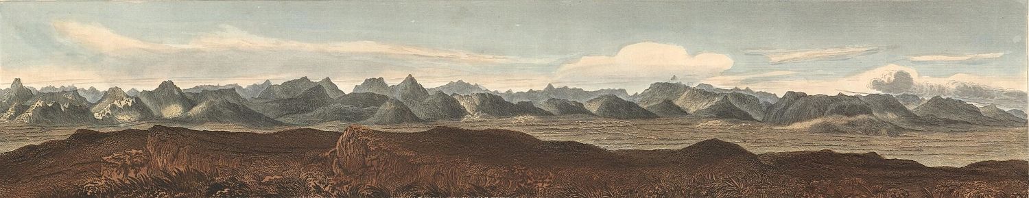
The Grampian Mountains (Scottish Gaelic: Am Monadh) is one of the three major mountain ranges in Scotland, that together occupy about half of Scotland. The other two ranges are the Northwest Highlands and the Southern Uplands. The Grampian range extends northeast to southwest between the Highland Boundary Fault and the Great Glen. The range includes many of the highest mountains in the British Isles, including Ben Nevis (whose peak contains the highest point in the British Isles at 1,345m or 4,413ft above sea level) and Ben Macdui (whose peak contains second-highest at 1,309m or 4,295ft).
There is some ambiguity about the extent of the range, and until the nineteenth century, they were generally considered to be more than one range, which all formed part of the wider Scottish Highlands. This view is still held by many today, and they have no single name in the Scottish Gaelic language or the Doric dialect of Lowland Scots. In both languages, a number of names are used. The name "Grampian" has been used in the titles of organisations covering parts of Scotland north of the Central Belt, including the former local government area of Grampian Region (translated into Scots Gaelic as Roinn a' Mhonaidh), NHS Grampian, and Grampian Television.
The Roman historian Tacitus recorded Mons Graupius as the site of the defeat of the native Caledonians by Gnaeus Julius Agricola c. 83 AD. The actual location of Mons Graupius, literally 'Mount Graupius' (the element 'Graupius' is of unknown meaning), is a matter of dispute among historians, though most favour a location within the Grampian massif, possibly at Raedykes, Megray Hill or Kempstone Hill. The spelling Graupius comes from the Codex Aesinas, a mediaeval copy of Tacitus's Germania believed to be from the mid-9th century.[2] In the Middle Ages, this locale was known as the Mounth, a name still held by a number of geographical features.
Etymology
Recorded first as Graupius in 83 A.D,[3] the origin of the name Grampians is uncertain.[3] The name may be Brittonic and represent a corrupted form, of which the genuine would be *Cripius, containing *crip meaning "ridge" (cf. Welshcrib).[3]
"Graupius" was incorrectly rendered "Grampius" in the 1476 printed edition of Tacitus's Agricola.[4] The name Grampians is believed to have first been applied to the mountain range in 1520 by the Scottish historian Hector Boece, perhaps an adaptation of the incorrect Mons Grampius. Thus the range may owe its name to a typesetter's mistake.[4]
Extent
There is some ambiguity about the extent of the range. Fenton Wyness, writing about Deeside, puts the northern edge of the Grampians at the River Dee in the introduction to his 1968 book Royal Valley: The Story Of The Aberdeenshire Dee:
... until comparatively recent times, Deeside was an isolated and little frequented region and the reason for this is the extensive mountain barrier of the Grampians which begins in a low range on the seacoast immediately south of Aberdeen and rise through various intervening heights such as Cairn-mon-earn (1,245 ft), Kerloch (1,747 ft), Mount Battoch (2,555 ft), Mount Keen (3,007 ft), Lochnagar (3,786 ft), Beinn a' Ghlo (3,671 ft), to Beinn Dearg (3,556 ft)
This introduction appears to suggest that Wyness defines the Grampians as being the range of mountains running from immediately south of Aberdeen westward to Beinn Dearg in the Forest of Atholl. Similarly, Adam Watson, when defining the extent of the Cairngorms, specifically excluded the range south of the River Dee, writing:
The other main hill group is the long chain running from Drumochter in the west almost to the sea just south of Aberdeen. Many maps and books have given its name as 'the Grampians' but although children have to learn this at school, they do not learn it at home and nowhere is it used in local speech. Some map-makers have confused the issue by printing 'Grampians' over the Cairngorms and Strath Don hills as well!
Both Wyness and Watson appear to exclude the Cairngorms from the Grampians, regarding them as a separate range. In effect, Wyness' and Watson's definition of the Grampians is as a synonym for the Mounth. However Robert Gordon, writing in the 1650s, used the term Grampians to refer to hills on either side of the River Dee, and thus explicitly included the Cairngorms within the range.[7]
Wyness and Watson both exclude areas west of the Pass of Drumochter from the Grampians, but the 1911 Encyclopedia Britannica adopted a wider definition, including the highlands as far as Dunbartonshire in the west.
The following ranges of hills and mountains fall within the generally recognised definition of the Grampians, i.e. lying between the Highland and Great Glen fault lines:[citation needed]
In the popular 1756 play Douglas, the second act begins with a speech that mentions the Grampian Hills:
My name is Norval; on the Grampian Hills My father feeds his flocks; a frugal swain, Whose constant cares were to increase his store. And keep his only son, myself, at home.
The speech "acquired a life of its own, independent of the play, and became widely known through public recitations, lessons in speech, school memorizations and the like" during the 18th and 19th centuries. The speech (and thus the reference to the Grampian Hills) are casually referred to by Jane Austen, Charles Dickens, and George Bernard Shaw.[9]
↑ Wyness, Fenton (1968), Royal Valley: The Story Of The Aberdeenshire Dee, Alex P. Reid & Son, Aberdeen, p.1
↑ Watson, Adam (1975). The Cairngorms. Edinburgh: The Scottish Mountaineering Trust. p.19.
↑ Ian R Mitchell. Scotland's Mountains Before the Mountaineers, pp. 62–63. Published 2013, Luath Press.
1 2 Stephenson, D, and Gould, D. 1995. British regional geology: the Grampian Highlands. Fourth edition. Reprint 2007. Keyworth, Nottingham: British Geological Survey.
This page is based on this Wikipedia article Text is available under the CC BY-SA 4.0 license; additional terms may apply. Images, videos and audio are available under their respective licenses.