Grand Bay, Alabama

Last updated

Grand Bay, Alabama
Motto: 
"A community in action"
Mobile County Alabama Incorporated and Unincorporated areas Grand Bay Highlighted.svg
Location in Mobile County and the state of Alabama
Coordinates: 30°28′26″N88°20′30″W / 30.47389°N 88.34167°W / 30.47389; -88.34167
Country United States
State Alabama
County Mobile
Area
[1]
  Total8.70 sq mi (22.53 km2)
  Land8.68 sq mi (22.47 km2)
  Water0.02 sq mi (0.06 km2)
Elevation
82 ft (25 m)
Population
 (2020) [2]
  Total3,460
  Density398.85/sq mi (153.99/km2)
Time zone UTC-6 (Central (CST))
  Summer (DST) UTC-5 (CDT)
ZIP code
36541
Area code 251
FIPS code 01-31024
GNIS feature ID0155081

Grand Bay is an unincorporated community and census-designated place (CDP) in Mobile County, Alabama, United States. It is part of the Mobile metropolitan area. The population was 3,460 at the 2020 census. [2]

Contents

History

According to local accounts, George Cassibry was the first white person to settle in Grand Bay. He came to the area in 1853, establishing a home site near the headwaters of Franklin Creek located today near the intersection of Highway 90 and Ramsey Road. [3] Exploration and settlement of the area was well underway by the mid-nineteenth century. [4] [5]

During the Civil War, the town saw brief military action as a column of troops under U.S. General Gordon Granger reached the town as a preliminary move in the siege of Mobile. [6] In 1870 the U.S. Postal Service established a post office at a location near the center of the current community. [7]

Settlement began in earnest when the Grand Bay Land Company began offering ten-acre lots for sale in the early 1900s. The lots were marketed to people living in and around Chicago and other northern cities as a way to live self-sufficiently in a mild climate. [8] Supposedly, ten acres planted in pecan and satsuma trees would be enough to supply the needs of anyone. [7] The timber industry also attracted many to the area. Much of the region south of Grand Bay to the coast along the Mississippi Sound was clearcut. [9]

For a time, the town flourished. [10] A weekly newspaper was published there, and telegraph service was offered to the region through an operator at Grand Bay. [11] The town had a number of businesses including a hotel, drug store, [12] several general merchandise stores and a bank. [13] [14] However, hurricanes in 1906 and 1910, along with a severe freeze, sent many scurrying back north. [15] Their efforts, however, have not gone unnoticed even today. Cogon grass, a highly-invasive rhizome, first introduced to the area as packing material in satsuma trees imported from Asia, has now become a serious Southeastern agricultural problem. [16]

In 1993, the old Grand Bay State Bank building became the temporary site of the El Cazador Museum, and held treasure from the El Cazador . The area in and around the old bank building now forms the Grand Bay Historic District and is listed on the National Register of Historic Places. [17]

Geography

Grand Bay is located in southwestern Mobile County at 30°28′27″N88°20′31″W / 30.47417°N 88.34194°W / 30.47417; -88.34194 (30.474055, -88.341836), [18] along U.S. Route 90, a few miles inland from the Mississippi Sound. US 90 leads northeast 26 miles (42 km) to Mobile and southwest 16 miles (26 km) to Pascagoula, Mississippi. The Mississippi state line is 3 miles (5 km) west of Grand Bay. Alabama State Route 188 leads southeast from Grand Bay 8 miles (13 km) to Bayou La Batre and 26 miles (42 km) to Dauphin Island.

According to the United States Census Bureau, the Grand Bay CDP has a total area of 8.7 square miles (23 km2), of which 0.02 square miles (0.052 km2), or 0.23% are water. [1] The community drains north to Franklin Creek and south to a tributary of it; Franklin Creek flows west to the Escatawpa River in Mississippi, part of the Pascagoula River watershed.

Demographics

Historical population
CensusPop.Note
1980 3,185
1990 3,3836.2%
2000 3,91815.8%
2010 3,672−6.3%
2020 3,460−5.8%
U.S. Decennial Census [19]

2000 census

As of the census [20] of 2000, there were 3,918 people, 1,364 households, and 1,078 families residing in the CDP. The population density was 452.3 inhabitants per square mile (174.6/km2). There were 1,441 housing units at an average density of 166.4 per square mile (64.2/km2). The racial makeup of the CDP was 89.00% White, 8.88% Black or African American, 0.23% Native American, 0.79% Asian, 0.05% Pacific Islander, 0.13% from other races, and 0.92% from two or more races. Hispanic or Latino of any race were 0.87% of the population.

There were 1,364 households, out of which 37.5% had children under the age of 18 living with them, 65.5% were married couples living together, 10.0% had a female householder with no husband present, and 20.9% were non-families. 18.1% of all households were made up of individuals, and 6.9% had someone living alone who was 65 years of age or older. The average household size was 2.81 and the average family size was 3.19.

In the CDP, the population was spread out, with 27.7% under the age of 18, 9.2% from 18 to 24, 27.1% from 25 to 44, 23.3% from 45 to 64, and 12.7% who were 65 years of age or older. The median age was 36 years. For every 100 females, there were 100.0 males. For every 100 females age 18 and over, there were 95.6 males.

The median income for a household in the CDP was $38,941, and the median income for a family was $43,654. Males had a median income of $33,177 versus $21,920 for females. The per capita income for the CDP was $15,741. About 6.9% of families and 8.1% of the population were below the poverty line, including 7.1% of those under age 18 and 7.8% of those age 65 or over.

2010 census

As of the census [21] of 2010, there were 3,672 people, 1,339 households, and 1,021 families residing in the CDP. The population density was 420 inhabitants per square mile (160/km2). There were 1,498 housing units at an average density of 172.2 per square mile (66.5/km2). The racial makeup of the CDP was 86.9% White, 9.4% Black or African American, 0.6% Native American, 0.7% Asian, 0.0% Pacific Islander, 0.7% from other races, and 1.7% from two or more races. Hispanics or Latinos of any race were 2.3% of the population.

There were 1,339 households, out of which 29.9% had children under the age of 18 living with them, 56.5% were married couples living together, 14.8% had a female householder with no husband present, and 23.7% were non-families. 19.9% of all households were made up of individuals, and 5.2% had someone living alone who was 65 years of age or older. The average household size was 2.68 and the average family size was 3.07.

In the CDP, the population was spread out, with 23.8% under the age of 18, 8.2% from 18 to 24, 24.1% from 25 to 44, 28.0% from 45 to 64, and 15.9% who were 65 years of age or older. The median age was 40.4 years. For every 100 females, there were 98.8 males. For every 100 females age 18 and over, there were 96.5 males.

The median income for a household in the CDP was $47,722, and the median income for a family was $52,353. Males had a median income of $42,057 versus $27,277 for females. The per capita income for the CDP was $21,141. About 9.8% of families and 13.8% of the population were below the poverty line, including 23.0% of those under age 18 and 3.1% of those age 65 or over.

2020 census

Grand Bay racial composition [22]
RaceNum.Perc.
White (non-Hispanic)2,89183.55%
Black or African American (non-Hispanic)3239.34%
Native American 120.35%
Asian 491.42%
Other/Mixed 1213.5%
Hispanic or Latino 641.85%

As of the 2020 United States census, there were 3,460 people, 1,252 households, and 1,067 families residing in the CDP.

Government and local services

While Grand Bay is unincorporated, the area is served by the Grand Bay Water Works Board for water service and an active volunteer fire department for fire protection. The Mobile County Sheriff's Department maintains a satellite office in Grand Bay as well. Grand Bay Water Works also provides limited sewer service for Breitling Elementary School and the business district around the Interstate 10 exchange. The Mobile County Commission, a three-member elected panel, provides all other services including road and street repair.

Grand Bay is located within District 3 of the Mobile County Commission, which is represented by current commissioner Randall Dueitt (R). [23] In the Alabama Legislature, Grand Bay is located within House District 105, whose current representative is Chip Brown (R). In the State Senate, Grand Bay is located within District 35, which is currently represented by David Sessions (R), a native of Grand Bay.

In the US House, Grand Bay, and all of Mobile County is located within the 1st Congressional District, which is currently represented by Jerry Carl (R).

Watermelon Festival

A July 4 tradition since 1973, the current version of the Grand Bay Watermelon Festival offers tourists and locals an opportunity to sample locally grown watermelon while enjoying local music, arts & crafts, and informative displays from area merchants and service providers. [24]

The annual celebration has a long and storied history, having begun during the earliest years of the 20th Century. As the community and surrounding area changed during World War II, the annual celebration was discontinued. It was revived in 1973 by the Grand Bay Junior Chamber of Commerce. Currently, it is sponsored by the Grand Bay Independent Order of Odd Fellows #73. It is currently held at the Odd Fellows Festival Park and local baseball park just north of U.S. Highway 90 on the west side of Grand Bay. It begins on July 3 from 3-7 p.m. and continues on July 4 from 8 a.m. and concludes at 4 p.m. The website for the Grand Bay Watermelon Festival is: www.grandbaywatermelonfestival.org.

Pecans and fruit

Much of the rural land around Grand Bay is planted in pecan trees, another reminder of the Grand Bay Land Company days. Many of the pecan orchards have been converted from agricultural production for use as residential home sites. However, pecan production is still an important business and provides supplemental income to residents who work in nonagricultural jobs.

In addition, the area has become home to a large peach business and satsumas, once destroyed by freezing temperatures, have now returned to commercial production in a more weather-hardy variety.

Grand Bay watermelons, however, remain the produce most identified with the community.

Community center

The Grand Bay-St. Elmo Community Center is a multi-use facility located on the east side of Grand Bay at 11610 Highway 90. The building is near the intersection of Highway 90 and Ramsay Road Extension. Constructed in 2005, the center operates on a non-profit basis. Facilities are available for rent to the public. [25] The Center is located on the site of the former Grand Bay Elementary School for Colored, a racially segregated elementary school established in 1919.

Economy

The business section of Grand Bay stretches east to west along Highway 90 for about two miles from Festival Park Road on the west side to Highway 188 on the east, and north to south along Grand Bay Wilmer Road from Highway 90 to Old Pascagoula Road. Recent development has centered on two areas, primarily at the intersection of Grand Bay-Wilmer Road and US 90, and at the intersection of Grand Bay-Wilmer Road and Interstate 10.

Education

Mobile County Public Schools operates area public schools. [26] Some residents are zoned to Breitling Elementary School while others are zoned to Cora Castlen Elementary School. [27] [28] All residents are zoned to Grand Bay Middle School and Alma Bryant High School in Irvington. [29] [30]

Notable people

See also

Related Research Articles

<span class="mw-page-title-main">Lowndes County, Mississippi</span> County in Mississippi, United States

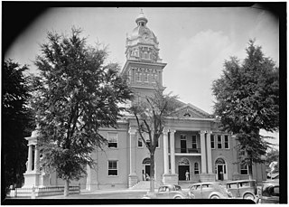
Lowndes County is a county on the eastern border of the U.S. state of Mississippi. As of the 2020 United States Census, the population was 58,879. Its county seat is Columbus. The county is named for U.S. Congressman William Jones Lowndes.

<span class="mw-page-title-main">Point Clear, Alabama</span> Census-designated place & Unincorporated community in Alabama, United States

Point Clear is an unincorporated census-designated place (CDP) in Baldwin County, Alabama, United States. As of the 2010 census, the population was 2,125. It is part of the Daphne-Fairhope-Foley metropolitan area.

<span class="mw-page-title-main">Bayou La Batre, Alabama</span> City in Alabama, United States

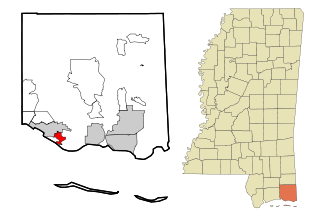
Bayou La Batre is a city in Mobile County, Alabama, United States. It is part of the Mobile metropolitan area. As of the 2020 census, the population was 2,204, down from 2,558 at the 2010 census.

<span class="mw-page-title-main">Chickasaw, Alabama</span> City in Alabama, United States

Chickasaw is a city in Mobile County, Alabama, United States. As of the 2020 census the population was 6,457, up from 6,106 at the 2010 census. It is part of the Mobile metropolitan area.

<span class="mw-page-title-main">Citronelle, Alabama</span> City in the United States

Citronelle is a city on the northern border of Mobile County, Alabama, United States. At the 2020 census, the population was 3,946. It is included in the Mobile metropolitan statistical area and is about 34 miles (55 km) north of Mobile.

<span class="mw-page-title-main">Mount Vernon, Alabama</span> Town in Alabama, United States

Mount Vernon is a town in Mobile County, Alabama, United States. It is part of the Mobile metropolitan area. It incorporated in 1959. At the 2020 census the population was 1,354.

<span class="mw-page-title-main">Satsuma, Alabama</span> City in Alabama, United States

Satsuma is a city in Mobile County, Alabama, United States. At the 2020 census, the population was 6,749, up from 6,168 at the 2010 census. Known prior to 1915 as "Fig Tree Island", the city was named after the satsuma orange, which was successfully cultivated and grown in Alabama starting in 1878, a gift from Emperor Meiji of Japan. Satsuma is a part of the Mobile metropolitan area.

<span class="mw-page-title-main">Theodore, Alabama</span> Census-designated place in Alabama, United States

Theodore is an unincorporated area and census-designated place (CDP) in Mobile County, Alabama, United States. The population was 6,270 at the 2020 census. It is a part of the Mobile metropolitan area. Prior to 1900 this area was known as "Clements", but it is now named for William Theodore Hieronymous, a sawmill operator and postmaster.

<span class="mw-page-title-main">Tillmans Corner, Alabama</span> Unincorporated community in Alabama, United States

Tillmans Corner, or Tillman’s Corner, is an unincorporated community and census-designated place (CDP) in Mobile County, Alabama, United States. At the 2020 census, the population was 17,731. It is part of the Mobile metropolitan area, and is the largest census-designated place in Alabama.

<span class="mw-page-title-main">Bay Hill, Florida</span> Census-designated place in Florida, United States

Bay Hill is a census-designated place (CDP) in Orange County, Florida, United States. The population was 4,884 at the 2010 census. It is part of the Orlando–Kissimmee Metropolitan Statistical Area. The Bay Hill area is generally located on either side of Apopka-Vineland Road in southwest Orange County, north of Lake Buena Vista and south of Windermere.

<span class="mw-page-title-main">Kaʻaʻawa, Hawaii</span> Census-designated place in the United States

Kaʻaʻawa is a small community and census-designated place (CDP) located in the windward district of Koʻolauloa, City & County of Honolulu on the island of Oʻahu, Hawaiʻi, United States. As of the 2010 Census, the total population for Kaʻaʻawa was 1,379. In Hawaiian, kaʻaʻawa means "the wrasse (fish)". From the Hawaiian spelling Kaʻaʻawa it is seen that each a is pronounced separately and distinctly, set apart by the two ʻokinas: or.

<span class="mw-page-title-main">Greilickville, Michigan</span> Census-designated place & unincorporated community in Michigan, United States

Greilickville is an unincorporated community and census-designated place (CDP) in Leelanau County in the U.S. state of Michigan. At the 2020 census, the population was 1,634, up from 1,530 at the 2010 census. The community is located within Elmwood Charter Township, and is located in the extreme southeast of the Leelanau Peninsula.

<span class="mw-page-title-main">Big Point, Mississippi</span> Census-designated place in Mississippi, United States

Big Point is an unincorporated community and census-designated place (CDP) in Jackson County, Mississippi, United States. It is part of the Pascagoula, Mississippi Metropolitan Statistical Area. Per the 2020 Census, the population was 618.

<span class="mw-page-title-main">Gulf Park Estates, Mississippi</span> Census-designated place in Mississippi, United States

Gulf Park Estates is an unincorporated community and census-designated place (CDP) located south of Ocean Springs in Jackson County, Mississippi, United States. It is part of the Pascagoula Metropolitan Statistical Area. The population was 5,719 at the 2010 census, up from 4,272 at the 2000 census.

<span class="mw-page-title-main">Hurley, Mississippi</span> Census-designated place in Mississippi

Hurley is an unincorporated community and census-designated place (CDP) in Jackson County, Mississippi, United States. It is part of the Pascagoula Metropolitan Statistical Area. The population was 1,551 at the 2010 census, up from 985 at the 2000 census.

<span class="mw-page-title-main">Wade, Mississippi</span> Census-designated place in Mississippi, United States

Wade is an unincorporated community and census-designated place (CDP) in Jackson County, Mississippi, United States. It is part of the Pascagoula Metropolitan Statistical Area. The population was 1,074 at the 2010 census, up from 491 at the 2000 census.

<span class="mw-page-title-main">West Hattiesburg, Mississippi</span> Census-designated place in Mississippi, United States

West Hattiesburg is an unincorporated area and census-designated place (CDP) in Lamar County, Mississippi, west of the city of Hattiesburg and east of the community of Oak Grove. It is part of the Hattiesburg metropolitan area. It had a decline in population from 6,305 at the 2000 census to 5,909 at the 2010 census.

<span class="mw-page-title-main">Concord, Missouri</span> CDP in Missouri, United States

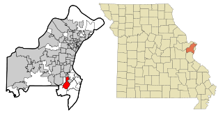
Concord is a census-designated place (CDP) in St. Louis County, Missouri, United States. The population was 16,421 at the 2010 census. It should not be confused with Concord Township, which the CDP shares much land with, but these areas' boundaries are not identical.

<span class="mw-page-title-main">North Koolaupoko, Hawaii</span> An area of a census-designated place in Hawaii, United States

Waikāne or Waikane, also known as North Koʻolaupoko, is an area and census-designated place in the County of Honolulu, Hawaii, United States, on the island of Oʻahu. It had a population of 778 at the 2010 census. In Hawaiian, koʻolau poko means "short windward", referring to the fact that this is the shorter of the two windward districts on the island. Koʻolaupoko extends from Makapuʻu Point on the southeast to Kaʻōʻio Point on the north. Included within the district, south of North Koʻolaupoko, are the largest windward towns of Kāneʻohe, Kailua, and Waimānalo.

Poinciana is a settlement and census-designated place (CDP) in Osceola and Polk counties in the U.S. state of Florida. It is part of the Greater Orlando area. As of the 2020 census, the CDP had a population of 69,309.

References

  1. 1 2 "2021 U.S. Gazetteer Files". United States Census Bureau. Retrieved April 22, 2022.
  2. 1 2 "Grand Bay CDP, Alabama: 2020 DEC Redistricting Data (PL 94-171)". U.S. Census Bureau. Retrieved April 22, 2022.
  3. Southern Farm and Home: A Magazine of Agriculture, Manufactures and Domestic Economy. J.W. Burke. 1871.
  4. Alabama, Geological Survey of (1858). Biennial Report on the Geology of Alabama. M.D.J. Slade.
  5. De Bow's Review. J.D.B. De Bow. 1859.
  6. Andrews, Christopher Columbus (1889). History of the Campaign of Mobile: Including the Coöperative Operations of Gen. Wilson's Cavalry in Alabama. Van Nostrand. ISBN   978-0-608-43455-1.
  7. 1 2 "Have you ever wondered how Grand Bay got its name". Archived from the original on October 7, 2008. Retrieved December 3, 2008.
  8. National Magazine. 1911.
  9. Harper, Roland McMillan (1913). Economic Botany of Alabama. University of Alabama.
  10. South, North & (1905). North & South Vol. IV. No. 1. May, 1905.
  11. Freeman, Abraham Clark (1891). The American State Reports: Containing the Cases of General Value and Authority Subsequent to Those Contained in the "American Decisions" [1760-1869] and the "American Reports" [1869-1887] Decided in the Courts of Last Resort of the Several States [1886-1911]. Bancroft-Whitney Company.
  12. The Southern Reporter. West Publishing Company. 1916.
  13. "Business Entity Records | Alabama Secretary of State". arc-sos.state.al.us. Retrieved August 23, 2023.
  14. Department, Alabama Banking (1912). Annual Report of the Superintendent of Banks of the State of Alabama for the Fiscal Year Ending ... Brown Printing Company, state printers and binders.
  15. Ballard, Gussie Alexander, Remember Our Yesterdays, Pelican Publishing Company, New Orleans, (1960)
  16. "Archived copy" (PDF). Archived from the original (PDF) on July 25, 2011. Retrieved December 3, 2008.{{cite web}}: CS1 maint: archived copy as title (link)
  17. "National Register of Historic Places - Alabama (AL), Mobile County". nationalregisterofhistoricplaces.com. Retrieved August 23, 2023.
  18. "US Gazetteer files: 2010, 2000, and 1990". United States Census Bureau. February 12, 2011. Retrieved April 23, 2011.
  19. "U.S. Decennial Census". Census.gov. Retrieved June 6, 2013.
  20. "U.S. Census website". United States Census Bureau . Retrieved January 31, 2008.
  21. "U.S. Census website". United States Census Bureau . Retrieved August 4, 2015.
  22. "Explore Census Data". data.census.gov. Retrieved December 14, 2021.
  23. "District 3 : Mobile County". www.mobilecountyal.gov. Retrieved November 1, 2021.
  24. See photos online at http://www.al.com/press-register/photos/gallery.ssf?cgi-bin/view_gallery.cgi/bama/view_gallery.ata?g_id=1942 Archived February 3, 2008, at the Wayback Machine
  25. "Rental Grand Bay Alabama". Archived from the original on August 10, 2009. Retrieved January 1, 2009.
  26. "2010 CENSUS - CENSUS BLOCK MAP: Grand Bay CDP, AL." U.S. Census Bureau. Retrieved on November 27, 2018.
  27. "Breitling Elementary Map [ permanent dead link ]." Mobile County Public School System. Retrieved on November 27, 2018.
  28. "Cora Castlen Elementary Zone [ permanent dead link ]." Mobile County Public School System. Retrieved on November 27, 2018.
  29. "Grand Bay Middle Zone [ permanent dead link ]." Mobile County Public School System. Retrieved on November 27, 2018.
  30. "Bryant High School Map Archived 2020-07-26 at the Wayback Machine ." Mobile County Public School System. Retrieved on November 26, 2018.

30°28′27″N88°20′31″W / 30.474055°N 88.341836°W / 30.474055; -88.341836