Gravois Mills, Missouri

Last updated

Gravois Mills, Missouri
Village of Gravois Mills
Morgan County Missouri Incorporated and Unincorporated areas Gravois Mills Highlighted.svg
Location in Morgan County and the state of Missouri
Coordinates: 38°18′18″N92°49′28″W / 38.30500°N 92.82444°W / 38.30500; -92.82444 [1]
Country United States
State Missouri
County Morgan
Area
[2]
  Total0.82 sq mi (2.13 km2)
  Land0.74 sq mi (1.92 km2)
  Water0.08 sq mi (0.21 km2)
Elevation
[1]
755 ft (230 m)
Population
 (2020) [3]
  Total129
  Density173.85/sq mi (67.10/km2)
Time zone UTC-6 (Central (CST))
  Summer (DST) UTC-5 (CDT)
ZIP codes
65037, 65038
Area code 573
FIPS code 29-28828 [4]
GNIS feature ID0766158 [1]

Gravois Mills is a town in Morgan County, Missouri, United States. The population was 129 at the 2020 census. [3]

Contents

History

Gravois Mills was laid out in 1884 and named for a nearby gristmill on Gravois Creek. [5] A post office called Gravois Mills has been in operation since 1860. [6]

Old St. Patrick's Church was listed on the National Register of Historic Places in 1979. [7]

Geography

Gravois Mills is located in southern Morgan County on the upper end of the Gravois Creek arm of the Lake of the Ozarks. Missouri Route 5 passes through the town, leading north 9 miles (14 km) to Versailles, the Morgan county seat, and south 12 miles (19 km) to Sunrise Beach. [8]

According to the U.S. Census Bureau, Gravois Mills has a total area of 0.82 square miles (2.12 km2), of which 0.74 square miles (1.92 km2) are land and 0.08 square miles (0.21 km2), or 9.73%, are water. [2] The village sits on the southwest side of the Gravois Creek arm of the Lake of the Ozarks, 10 miles (16 km) upstream from (northwest of) the arm's confluence with the Osage River.

Demographics

Historical population
CensusPop.Note
1960 33
1970 343.0%
1980 101197.1%
1990 1010.0%
2000 208105.9%
2010 144−30.8%
2020 129−10.4%
U.S. Decennial Census [9]

2010 census

As of the census [10] of 2010, there were 144 people, 59 households, and 33 families residing in the village. The population density was 194.6 inhabitants per square mile (75.1/km2). There were 108 housing units at an average density of 145.9 per square mile (56.3/km2). The racial makeup of the village was 93.1% White, 1.4% African American, 1.4% Native American, 0.7% from other races, and 3.5% from two or more races. Hispanic or Latino of any race were 4.9% of the population.

There were 59 households, of which 25.4% had children under the age of 18 living with them, 44.1% were married couples living together, 8.5% had a female householder with no husband present, 3.4% had a male householder with no wife present, and 44.1% were non-families. 33.9% of all households were made up of individuals, and 15.3% had someone living alone who was 65 years of age or older. The average household size was 2.44 and the average family size was 3.12.

The median age in the village was 46 years. 21.5% of residents were under the age of 18; 8.4% were between the ages of 18 and 24; 18.8% were from 25 to 44; 31.2% were from 45 to 64; and 20.1% were 65 years of age or older. The gender makeup of the village was 48.6% male and 51.4% female.

2000 census

As of the census [4] of 2000, there were 208 people, 101 households, and 56 families residing in the town. The population density was 268.4 inhabitants per square mile (103.6/km2). There were 144 housing units at an average density of 185.8 per square mile (71.7/km2). The racial makeup of the town was 98.56% White, 0.96% African American, and 0.48% from two or more races.

There were 101 households, out of which 22.8% had children under the age of 18 living with them, 39.6% were married couples living together, 10.9% had a female householder with no husband present, and 43.6% were non-families. 36.6% of all households were made up of individuals, and 9.9% had someone living alone who was 65 years of age or older. The average household size was 2.06 and the average family size was 2.68.

In the town the population was spread out, with 22.1% under the age of 18, 8.7% from 18 to 24, 21.6% from 25 to 44, 28.4% from 45 to 64, and 19.2% who were 65 years of age or older. The median age was 44 years. For every 100 females, there were 92.6 males. For every 100 females age 18 and over, there were 80.0 males.

The median income for a household in the town was $24,167, and the median income for a family was $28,750. Males had a median income of $21,250 versus $12,917 for females. The per capita income for the town was $13,060. About 24.1% of families and 26.0% of the population were below the poverty line, including 69.8% of those under the age of eighteen and 10.0% of those 65 or over.

Related Research Articles

<span class="mw-page-title-main">Morgan County, Missouri</span> County in Missouri, United States

Morgan County is a county located in the central portion of the U.S. state of Missouri. As of the 2020 census, the population was 21,006. Its county seat is Versailles. The county was organized January 5, 1833, and named for General Daniel Morgan of the American Revolutionary War.

<span class="mw-page-title-main">Paragon, Indiana</span> Town in Indiana, United States

Paragon is a town in Ray Township, Morgan County, in the U.S. state of Indiana. The population was 556 at the 2020 census, down from 659 in 2010.

<span class="mw-page-title-main">Whitneyville, Maine</span> Town in the state of Maine, United States

Whitneyville is a town in Washington County, Maine, United States. The town was named after Colonel Joseph Whitney, a mill owner. The population was 202 at the 2020 census.

<span class="mw-page-title-main">Harrisburg, Missouri</span> Village in Missouri, United States

Harrisburg is a village in western Boone County, Missouri, United States. It is part of the Columbia, Missouri Metropolitan Statistical Area. The population was 266 at the 2010 census.

<span class="mw-page-title-main">Lewis and Clark Village, Missouri</span> Village in Missouri, United States

Lewis and Clark Village is a village in Buchanan County, Missouri, United States. The population was 96 at the 2020 census. It is part of the St. Joseph, MO–KS Metropolitan Statistical Area.

<span class="mw-page-title-main">Gordonville, Missouri</span> Village in Missouri, United States

Gordonville is a village in Cape Giradeau County, Missouri, United States. The population was 625 at the 2020 census. It is part of the Cape Girardeau–Jackson, MO-IL Metropolitan Statistical Area.

<span class="mw-page-title-main">Smithville, Missouri</span> City in Missouri, United States

Smithville is a city in Clay and Platte counties in the U.S. state of Missouri and is part of the Kansas City metropolitan area, along the Little Platte River. The population was 10,406 at the 2020 United States Census.

<span class="mw-page-title-main">Otterville, Missouri</span> City in Missouri, United States

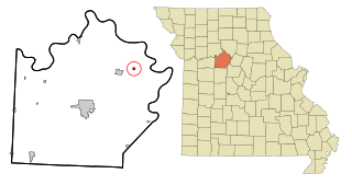
Otterville is a city in southwest Cooper County, Missouri, United States. The population was 454 at the 2010 census.

<span class="mw-page-title-main">Berger, Missouri</span> City in Missouri, United States

Berger is a city in northwest Franklin County, Missouri, United States, located south of the Missouri River. The population was 256 at the 2020 census.

<span class="mw-page-title-main">Bagnell, Missouri</span> Town in Missouri, United States

Bagnell is a town in Miller County, Missouri, United States. The population was 43 at the 2020 census, down from 93 in 2010.

<span class="mw-page-title-main">Anniston, Missouri</span> City in Missouri, United States

Anniston is a city in Mississippi County, Missouri, United States. The population was 180 at the 2020 census, down from 232 in 2010.

<span class="mw-page-title-main">Laurie, Missouri</span> City in Missouri, US

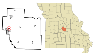
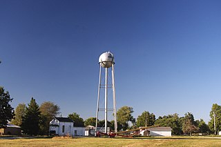
Laurie is a city in southern Morgan and northern Camden counties, Missouri, United States. The population was 939 at the 2020 census.

<span class="mw-page-title-main">Versailles, Missouri</span> City in Missouri, United States

Versailles is a city in Morgan County, Missouri, United States. The population was 2,539 at the 2020 census. It is the county seat of Morgan County. Locally, the town's name is pronounced "Ver-sails", rather than the French "Ver-seye".

<span class="mw-page-title-main">Gilliam, Missouri</span> City in Missouri, United States

Gilliam is a city in Saline County, Missouri, United States. The population was 197 at the 2010 census.

<span class="mw-page-title-main">Lakeshire, Missouri</span> City in Missouri, United States

Lakeshire is a city in St. Louis County, Missouri, United States. The population was 1,432 at the 2010 census.

<span class="mw-page-title-main">Richards, Missouri</span> Village in Missouri, United States

Richards is a village in northwest Vernon County, Missouri, United States. The population was 96 at the 2010 census.

<span class="mw-page-title-main">Mill Spring, Missouri</span> Village in Missouri, United States

Mill Spring is a village in Wayne County, Missouri, United States, along the Black River. The population was 159 at the 2020 census.

<span class="mw-page-title-main">Moscow Mills, Missouri</span> Town in Missouri, US

Moscow Mills is a city in Lincoln County, Missouri, United States. The population was 2,509 at the 2010 census.

<span class="mw-page-title-main">Redings Mill, Missouri</span> Village in Missouri, United States

Redings Mill is a village in Newton County, Missouri, United States. The population was 151 at the 2010 census. It is part of the Joplin, Missouri Metropolitan Statistical Area.

<span class="mw-page-title-main">Mill Creek, West Virginia</span> Town in West Virginia, United States

Mill Creek is a town in Randolph County, West Virginia, United States, along the Tygart Valley River. The population was 563 at the 2020 census.

References

  1. 1 2 3 U.S. Geological Survey Geographic Names Information System: Gravois Mills, Missouri
  2. 1 2 "2023 U.S. Gazetteer Files: Missouri". United States Census Bureau. Retrieved May 10, 2024.
  3. 1 2 "P1. Race – Gravois Mills town, Missouri: 2020 DEC Redistricting Data (PL 94-171)". U.S. Census Bureau. Retrieved May 10, 2024.
  4. 1 2 "U.S. Census website". United States Census Bureau . Retrieved January 31, 2008.
  5. "Morgan County Place Names, 1928–1945". The State Historical Society of Missouri. Archived from the original on June 24, 2016. Retrieved November 17, 2016.
  6. "Post Offices". Jim Forte Postal History. Retrieved November 17, 2016.
  7. "National Register Information System". National Register of Historic Places . National Park Service. July 9, 2010.
  8. Missouri Atlas & Gazetteer, DeLorme, 1998, First edition, p. 45, ISBN   0-89933-224-2
  9. "Census of Population and Housing". Census.gov. Retrieved June 4, 2015.
  10. "U.S. Census website". United States Census Bureau . Retrieved July 8, 2012.