Graystone Peak

Last updated
Graystone Peak
Graystone Peak.jpg
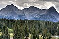
Northwest aspect, from Molas Lake
Highest point
Elevation 13,489 ft (4,111 m) [1] [2]
Prominence 502 ft (153 m) [3]
Parent peak Arrow Peak (13,809 ft) [3]
Isolation 0.56 mi (0.90 km) [3]
Coordinates 37°41′21″N107°37′09″W / 37.6892161°N 107.6191513°W / 37.6892161; -107.6191513 [4]
Geography
USA Colorado relief location map.svg
Red triangle with thick white border.svg
Graystone Peak
Location in Colorado
Usa edcp relief location map.png
Red triangle with thick white border.svg
Graystone Peak
Graystone Peak (the United States)
CountryUnited States
State Colorado
County San Juan County
Protected area Weminuche Wilderness
Parent range Rocky Mountains
San Juan Mountains
Needle Mountains [2]
Topo map USGS Storm King Peak
Geology
Age of rock Statherian
Type of rock Quartzite
Climbing
Easiest route class 2 hiking [3]

Graystone Peak is a 13,489-foot-elevation (4,111-meter) mountain summit located in San Juan County, Colorado, United States.

Contents

Description

Graystone Peak is situated 8.5 miles (13.7 km) south-southeast of the community of Silverton in the Weminuche Wilderness, on land managed by San Juan National Forest. It is part of the Needle Mountains which are a subrange of the San Juan Mountains. [2] Precipitation runoff from the mountain drains into tributaries of the Animas River. Topographic relief is significant as the summit rises 4,800 feet (1,500 meters) above the river in two miles (3.2 km) and 2,890 feet (880 meters) above Tenmile Creek in 0.85 mile (1.37 km). It is set six miles west of the Continental Divide, 0.7 mile south of Electric Peak, and one mile east-southeast of Mount Garfield. These three peaks can be seen from U.S. Route 550 at Molas Lake. The mountain's toponym has been officially adopted by the United States Board on Geographic Names, [4] and was recorded in publications as early as 1906. [5]

Climate

According to the Köppen climate classification system, Graystone Peak is located in an alpine subarctic climate zone with very long, cold, snowy winters, and cool to warm summers. [6] Due to its altitude, it receives precipitation all year, as snow in winter and as thunderstorms in summer, with a dry period in late spring.

Geology

Graystone Peak is part of the Uncompahgre Formation, [7] which is a sequence of quartzite and black phyllite some 8,200 feet (2,500 meters) in thickness. [8] The formation dates to the Statherian period and is interpreted as metamorphosed marine and fluvial sandstone, mudstone, and shale. The formation overlies plutons with an age of 1,707 million years.

See also

Related Research Articles

<span class="mw-page-title-main">Mount Garfield (San Juan County, Colorado)</span> Mountain in the American state of Colorado

Mount Garfield is a 13,074-foot-elevation (3,985-meter) mountain summit located in San Juan County, Colorado, United States. It is situated eight miles south of the community of Silverton, in the Weminuche Wilderness, on land managed by San Juan National Forest. It is part of the San Juan Mountains range which is a subset of the Rocky Mountains of North America. Precipitation runoff from the mountain drains into tributaries of the Animas River. The peak can be seen from U.S. Route 550 and the Durango and Silverton Narrow Gauge Railroad. Topographic relief is significant as the west aspect rises over 4,300 feet above the river and railway in approximately one mile. It is set six miles west of the Continental Divide, one mile west of Electric Peak, and three miles east-southeast of Snowdon Peak.

<span class="mw-page-title-main">Snowdon Peak</span> Mountain in Colorado, United States

Snowdon Peak is a 13,077-foot-elevation (3,986-meter) mountain summit located in San Juan County, Colorado, United States. It is situated seven miles south of the community of Silverton, in the Weminuche Wilderness, on land managed by San Juan National Forest. It is part of the San Juan Mountains range which is a subset of the Rocky Mountains of North America, and is set nine miles west of the Continental Divide. Topographic relief is significant as the east aspect rises 4,300 feet above the Animas River in approximately 1.5 mile. Neighbors include Mount Garfield three miles to the east-southeast, and Twilight Peak, which is the nearest higher peak, 3.7 miles to the south-southwest. This mountain can be seen from U.S. Route 550. The mountain is named after Snowdon, the highest mountain in Wales.

<span class="mw-page-title-main">Mears Peak</span> Mountain in the state of Colorado

Mears Peak is a 13,496-foot-elevation (4,114-meter) mountain summit located on the common boundary of Ouray County with San Miguel County, in Colorado, United States. It is situated six miles northwest of the community of Telluride, in the Mount Sneffels Wilderness, on land managed by Uncompahgre National Forest. It is part of the Sneffels Range which is a subset of the San Juan Mountains, which in turn is part of the Rocky Mountains. Mears Peak is situated west of the Continental Divide, and 3.8 miles west of Mount Sneffels. Topographic relief is significant as the south aspect rises 4,900 feet above the San Miguel River in approximately 5.5 miles.

<span class="mw-page-title-main">Electric Peak (San Juan Mountains)</span> Mountain in Colorado

Electric Peak is a 13,292-foot-elevation (4,051-meter) mountain summit located in San Juan County, Colorado, United States. It is situated eight miles south of the community of Silverton, in the Weminuche Wilderness, on land managed by San Juan National Forest. It is part of the Needle Mountains which are a subset of the San Juan Mountains, which in turn is a subset of the Rocky Mountains. Precipitation runoff from the mountain drains into tributaries of the Animas River. The peak can be seen from U.S. Route 550 and the Durango and Silverton Narrow Gauge Railroad. Topographic relief is significant as the west aspect rises over 4,500 feet above the river and railway in approximately two miles. It is set five miles west of the Continental Divide, and one mile east of Mount Garfield. The mountain's name, which has been officially adopted by the United States Board on Geographic Names, was in use before 1906 when Henry Gannett published it in the Gazetteer of Colorado.

<span class="mw-page-title-main">Sunshine Mountain</span> Mountain in the state of Colorado

Sunshine Mountain is a 12,930-foot-elevation (3,940-meter) mountain summit located in San Miguel County, in Colorado, United States. It is situated nine miles southwest of the community of Telluride, in the Lizard Head Wilderness, on land managed by Uncompahgre National Forest. It is part of the San Juan Mountains which is a subset of the Rocky Mountains. Sunshine Mountain is situated 24 miles west of the Continental Divide, 2.75 miles east of Wilson Peak, and 1.8 mile northeast of Lizard Head, the nearest higher neighbor. Topographic relief is significant as the west aspect rises 2,700 feet above Bilk Creek in approximately one mile. The mountain is composed of rock of the San Juan Formation overlaying Telluride Conglomerate, in turn overlaying Mancos Shale. The mountain's name, which has been officially adopted by the United States Board on Geographic Names, was in use before 1899 when Henry Gannett published it in A Dictionary of Altitudes in the United States.

<span class="mw-page-title-main">Precipice Peak</span> Mountain in the state of Colorado

Precipice Peak is a 13,144-foot-elevation (4,006-meter) mountain summit located in Hinsdale County, of Colorado, United States. It is situated 10.5 miles northeast of the community of Ouray, in the Uncompahgre Wilderness, on land managed by Uncompahgre National Forest. It is part of the San Juan Mountains which is a subset of the Rocky Mountains, and is situated west of the Continental Divide. Topographic relief is significant as the west aspect rises 2,500 feet above the West Fork Cimarron River valley in approximately one mile. Neighbors include Dunsinane Mountain three-quarters of a mile north, Courthouse Mountain 2.4 miles northwest, and Redcliff 2.2 miles south. The mountain's name was officially adopted by the United States Board on Geographic Names in 1966. It is so named because of a very prominent precipice on the mountain's east face.

<span class="mw-page-title-main">Mount Emma</span> Mountain in the state of Colorado

Mount Emma is a 13,581-foot-elevation (4,139-meter) mountain summit located in San Miguel County of Colorado, United States. It is situated three miles north of the community of Telluride, on the south side of Yankee Boy Basin, in the Uncompahgre National Forest. It is part of the Sneffels Range which is a subset of the San Juan Mountains, which in turn is part of the Rocky Mountains. Mount Emma is situated west of the Continental Divide, two miles south of Mount Sneffels, and 0.8 mile south of Gilpin Peak, the nearest higher neighbor. Emma ranks as the 197th-highest peak in Colorado, and the 10th-highest in the Sneffels Range. Topographic relief is significant as the south aspect rises 4,830 feet above Telluride in approximately three miles. An ascent of Mt. Emma is a difficult climb with 2,180 feet of elevation gain covering three miles from Yankee Boy Basin, or 4,836 feet of elevation gain from Telluride. This mountain's name was officially adopted by the U.S. Board on Geographic Names.

<span class="mw-page-title-main">Coxcomb Peak (Colorado)</span> Mountain in the state of Colorado

Coxcomb Peak is a 13,656-foot-elevation (4,162-meter) mountain summit located on the common boundary of Hinsdale County and Ouray County, in Colorado, United States. It is situated nine miles northeast of the community of Ouray, in the Uncompahgre Wilderness, on land managed by Uncompahgre National Forest. It is part of the San Juan Mountains which are a subset of the Rocky Mountains, and is situated west of the Continental Divide. Coxcomb ranks as the 171st-highest peak in Colorado, and topographic relief is significant as the south aspect rises 2,000 feet above Wetterhorn Basin in approximately one mile, and 4,400 feet above Cow Creek in three miles. Neighbors include Precipice Peak 2.7 miles to the north, Redcliff one-half mile north, Matterhorn Peak 2.3 miles to the east-southeast, and nearest higher neighbor Wetterhorn Peak 1.8 mile to the southeast. The mountain's descriptive name, which has been officially adopted by the United States Board on Geographic Names, was in use since at least 1906 when Henry Gannett published it in the Gazetteer of Colorado.

<span class="mw-page-title-main">Engineer Mountain</span> Mountain in Colorado, United States

Engineer Mountain is a 12,968-foot-elevation (3,953-meter) mountain summit located in San Juan County, Colorado, United States. It is part of the San Juan Mountains range which is a subset of the Rocky Mountains, and is west of the Continental Divide. Engineer Mountain is a prominent landmark set 1.5 mile immediately west of Coal Bank Pass, and is visible from multiple viewpoints along Highway 550, making it one of the most photographed mountains in the San Juans. It is situated 11 miles southwest of the community of Silverton, on land managed by San Juan National Forest. Topographic relief is significant as the southwest aspect rises 3,800 feet above Cascade Creek in approximately two miles. Neighbors include Snowdon Peak seven miles to the east, and Twilight Peak, five miles to the southeast.

<span class="mw-page-title-main">Cirque Mountain (Colorado)</span> Mountain in Colorado, United States

Cirque Mountain is a 13,686-foot-elevation (4,171-meter) mountain summit located in Ouray County of southwest Colorado, United States. It is situated six miles west of the community of Ouray, above the north side of Yankee Boy Basin, on land managed by Uncompahgre National Forest. It is part of the Sneffels Range which is a subset of the San Juan Mountains, which in turn is part of the Rocky Mountains. Cirque ranks as the 155th-highest peak in Colorado, and the ninth-highest in the Sneffels Range. It is west of the Continental Divide, 1.12 mile east of Mount Sneffels, and 0.59 mile west of Teakettle Mountain, which is the nearest higher neighbor. Topographic relief is significant as the north aspect rises 3,000 feet above Blaine Basin in one mile, and the south aspect rises over 2,000 feet above Yankee Boy Basin in less than one mile. These basins are cirques which were carved by ancient glaciers. The mountain's name has been officially adopted by the United States Board on Geographic Names.

<span class="mw-page-title-main">Wildhorse Peak</span> Mountain in the state of Colorado

Wildhorse Peak is a 13,266-foot-elevation (4,043-meter) mountain summit located in Ouray County, of Colorado, United States. It is situated five miles east of the community of Ouray, in the Uncompahgre Wilderness, on land managed by Uncompahgre National Forest. It is part of the San Juan Mountains which are a subset of the Rocky Mountains, and is situated west of the Continental Divide. Neighbors include Darley Mountain 2.2 miles to the south, and Abrams Mountain five miles to the southwest. This distinctive peak abruptly rises 1,000 feet above the alpine tundra of American Flats, and topographic relief is significant as the northwest aspect rises 1,600 feet above Wildhorse Creek in less than one mile. The peak can be seen from Montrose and Highway 550. The first ascent of the summit was made August 25, 1899, by Eli Stanton, F. H. Stanton, and William Killen. The mountain's name, which has been officially adopted by the United States Board on Geographic Names, was in use in 1906 when Henry Gannett published it in A Gazetteer of Colorado.

<span class="mw-page-title-main">Hurricane Peak</span> Mountain in the state of Colorado

Hurricane Peak is a 13,447-foot-elevation (4,099-meter) mountain summit located in San Juan County of southwest Colorado, United States. It is situated equidistant between the historic towns of Ouray and Silverton, and is approximately nine miles west of the Continental Divide. It is part of the San Juan Mountains which are a subset of the Rocky Mountains. Topographic relief is significant as the north aspect rises 1,200 feet above Lake Como in one-half mile. Neighbors include Abrams Mountain 3.4 miles to the north, Red Mountain 2.2 miles to the west, and Tuttle Mountain 1.4 mile to the north. The Mountain Queen Mine, which is located on the east slope of Hurricane Peak at the head of California Gulch, is one of the oldest workings in the area and was most active from 1878 to 1880. The mountain's name, which has been officially adopted by the United States Board on Geographic Names, was in use in 1906 when Henry Gannett published it in the Gazetteer of Colorado.

<span class="mw-page-title-main">Sheep Mountain (San Miguel and Dolores Counties, Colorado)</span>

Sheep Mountain is a 13,188-foot-elevation (4,020-meter) mountain summit located on the shared boundary of Dolores County with San Miguel County, in southwest Colorado, United States. It is situated three miles south of Trout Lake and two miles southeast of Lizard Head Pass, on land managed by San Juan National Forest and Uncompahgre National Forest. Sheep Mountain is part of the San Juan Mountains which are a subset of the Rocky Mountains, and is west of the Continental Divide. Topographic relief is significant as the southwest aspect rises 3,200 feet above the Dolores River in approximately 2.5 miles. Neighbors include Golden Horn and Vermilion Peak to the east, and Lizard Head to the northwest. Sheep Mountain can be seen from the San Juan Skyway in the Lizard Head Pass and Trout Lake areas. The mountain's name, which has been officially adopted by the United States Board on Geographic Names, was in use in 1906 when Henry Gannett published it in A Gazetteer of Colorado.

<span class="mw-page-title-main">Ulysses S Grant Peak</span> Mountain in the state of Colorado

Ulysses S Grant Peak is a 13,767-foot-elevation (4,196-meter) mountain summit located on the shared boundary of San Juan County with San Miguel County, in southwest Colorado, United States. It is situated eight miles west of the community of Silverton, on land managed by San Juan National Forest and Uncompahgre National Forest. Ulysses S Grant Peak is part of the San Juan Mountains which are a subset of the Rocky Mountains, and is west of the Continental Divide. It ranks as the 119th-highest peak in Colorado, and topographic relief is significant as the west aspect rises 2,400 feet in approximately one mile. The mountain's name, which has been officially adopted by the United States Board on Geographic Names, was in use in an 1896 scientific publication by Charles Whitman Cross, and listed by Henry Gannett when he published A Gazetteer of Colorado in 1906.

<span class="mw-page-title-main">Pilot Knob (Colorado)</span> Mountain summit in southwest Colorado

Pilot Knob is a 13,738-foot-elevation (4,187-meter) mountain summit located on the shared boundary of San Juan County with San Miguel County, in southwest Colorado, United States. It is situated nine miles west of the community of Silverton, on land managed by San Juan National Forest and Uncompahgre National Forest. Pilot Knob is part of the San Juan Mountains which are a subset of the Rocky Mountains, and is west of the Continental Divide. It ranks as the 132nd-highest peak in Colorado, and topographic relief is significant as the west aspect rises 4,000 feet above Trout Lake in three miles. Neighbors include Ulysses S Grant Peak 1.5 mile to the northeast, and Golden Horn one-half mile to the southeast. The mountain's name, which has been officially adopted by the United States Board on Geographic Names, was listed by Henry Gannett when he published A Gazetteer of Colorado in 1906. The peak is considered one of the most difficult to climb in Colorado because of its poor quality volcanic rock.

<span class="mw-page-title-main">Mount Mahler</span> Mountain in the American state of Colorado

Mount Mahler is a 12,497-foot-elevation (3,809-meter) mountain summit in Jackson County, Colorado, United States.

<span class="mw-page-title-main">Babcock Peak</span> Mountain in the American state of Colorado

Babcock Peak is a 13,161-foot-elevation (4,011-meter) mountain summit in La Plata County, Colorado.

<span class="mw-page-title-main">Little Giant Peak</span> Mountain in the state of Colorado

Little Giant Peak is a 13,417-foot-elevation (4,090-meter) mountain summit in San Juan County, Colorado, United States.

<span class="mw-page-title-main">Kendall Peak (Colorado)</span> Mountain in the state of Colorado

Kendall Peak is a 13,455-foot-elevation (4,101-meter) mountain summit in San Juan County, Colorado, United States.

<span class="mw-page-title-main">Storm Peak (Colorado)</span> Mountain in the state of Colorado

Storm Peak is a 13,495-foot-elevation (4,113-meter) summit located in San Juan County, Colorado, United States.

References

  1. Robert F. Rosebrough, The San Juan Mountains: A Climbing & Hiking Guide, Cordillera Press, 1986, page 170.
  2. 1 2 3 "Graystone Peak, Colorado". Peakbagger.com. Retrieved May 24, 2023.
  3. 1 2 3 4 "Graystone Peak - 13,503' CO". listsofjohn.com. Retrieved May 24, 2023.
  4. 1 2 "Graystone Peak". Geographic Names Information System . United States Geological Survey, United States Department of the Interior . Retrieved May 24, 2023.
  5. Henry Gannett, United States Geological Survey (1906), A Gazetteer of Colorado, US Government Printing Office, p. 80.
  6. Peel, M. C.; Finlayson, B. L.; McMahon, T. A. (2007). "Updated world map of the Köppen−Geiger climate classification". Hydrol. Earth Syst. Sci. 11. ISSN   1027-5606.
  7. Colorado Needle Mountains Quadrangle, Charles D. Walcott, U.S. Geological Survey, 1906.
  8. Rob Blair, Tom Ann Casey, William H. Romme, The Western San Juan Mountains: Their Geology, Ecology, and Human History, 1996, University Press of Colorado, ISBN   9780870813788, page 350.