Gresham, Nebraska

Last updated

Gresham, Nebraska
Gresham, Nebraska from S.jpg
Gresham, seen from the south along
Nebraska Highway 69, October 2011
York County Nebraska Incorporated and Unincorporated areas Gresham Highlighted.svg
Location of Gresham, Nebraska
Coordinates: 41°01′42″N97°24′04″W / 41.02833°N 97.40111°W / 41.02833; -97.40111
Country United States
State Nebraska
County York
Area
[1]
  Total0.27 sq mi (0.70 km2)
  Land0.27 sq mi (0.70 km2)
  Water0.00 sq mi (0.00 km2)
Elevation
[2]
1,614 ft (492 m)
Population
 (2020)
  Total219
  Density814.13/sq mi (314.56/km2)
Time zone UTC-6 (Central (CST))
  Summer (DST) UTC-5 (CDT)
ZIP code
68367
Area code 402
FIPS code 31-20225 [3]
GNIS feature ID2398209 [2]

Gresham is a village in York County, Nebraska, United States. The population was 223 at the 2010 census.

Contents

History

Gresham was originally called Poston, and under the latter name was platted in 1887 when the Fremont, Elkhorn and Missouri Valley Railroad was extended to that point. [4] When it was discovered there was another place in the state with the name Poston, the town was renamed in honor of Walter Q. Gresham, Secretary of State of the United States. [5]

Geography

According to the United States Census Bureau, the village has a total area of 0.27 square miles (0.70 km2), all land. [6]

Demographics

Historical population
CensusPop.Note
1900 297
1910 34415.8%
1920 49243.0%
1930 442−10.2%
1940 352−20.4%
1950 267−24.1%
1960 239−10.5%
1970 2483.8%
1980 32029.0%
1990 253−20.9%
2000 2706.7%
2010 223−17.4%
2020 219−1.8%
U.S. Decennial Census [7]

2010 census

As of the census [8] of 2010, there were 223 people, 94 households, and 59 families residing in the village. The population density was 825.9 inhabitants per square mile (318.9/km2). There were 125 housing units at an average density of 463.0 per square mile (178.8/km2). The racial makeup of the village was 97.8% White, 0.4% African American, 0.4% Native American, and 1.3% from two or more races.

There were 94 households, of which 30.9% had children under the age of 18 living with them, 45.7% were married couples living together, 8.5% had a female householder with no husband present, 8.5% had a male householder with no wife present, and 37.2% were non-families. 34.0% of all households were made up of individuals, and 13.8% had someone living alone who was 65 years of age or older. The average household size was 2.37 and the average family size was 3.03.

The median age in the village was 41.5 years. 28.3% of residents were under the age of 18; 6.2% were between the ages of 18 and 24; 21% were from 25 to 44; 29.6% were from 45 to 64; and 14.8% were 65 years of age or older. The gender makeup of the village was 52.0% male and 48.0% female.

2000 census

As of the census [3] of 2000, there were 270 people, 113 households, and 71 families residing in the village. The population density was 1,011.9 inhabitants per square mile (390.7/km2). There were 135 housing units at an average density of 505.9 per square mile (195.3/km2). The racial makeup of the village was 99.63% White and 0.37% Native American.

There were 113 households, out of which 31.9% had children under the age of 18 living with them, 57.5% were married couples living together, 4.4% had a female householder with no husband present, and 36.3% were non-families. 32.7% of all households were made up of individuals, and 18.6% had someone living alone who was 65 years of age or older. The average household size was 2.39 and the average family size was 3.08.

In the village, the population was spread out, with 28.1% under the age of 18, 4.8% from 18 to 24, 31.9% from 25 to 44, 14.8% from 45 to 64, and 20.4% who were 65 years of age or older. The median age was 39 years. For every 100 females, there were 95.7 males. For every 100 females age 18 and over, there were 88.3 males.

As of 2000 the median income for a household in the village was $29,643, and the median income for a family was $36,563. Males had a median income of $28,333 versus $17,321 for females. The per capita income for the village was $18,141. About 8.5% of families and 13.3% of the population were below the poverty line, including 17.0% of those under the age of eighteen and 22.9% of those 65 or over.

See also

Related Research Articles

<span class="mw-page-title-main">Spencer, Nebraska</span> Village in Nebraska, United States

Spencer is a village in Boyd County, Nebraska, United States. The population was 455 at the 2010 census, down from 541 in 2000.

<span class="mw-page-title-main">Elmwood, Nebraska</span> Village in Nebraska, United States

Elmwood is a village in southeast Cass County, Nebraska, United States. The population was 654 at the 2020 census.
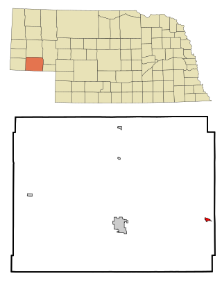
<span class="mw-page-title-main">Lodgepole, Nebraska</span> Village in Nebraska, United States

Lodgepole is a village in Cheyenne County, Nebraska, United States. The population was 318 at the 2010 census.

<span class="mw-page-title-main">Sumner, Nebraska</span> Village in Nebraska, United States

Sumner is a village in Dawson County, Nebraska, United States. It is part of the Lexington, Nebraska Micropolitan Statistical Area. The population was 236 at the 2010 census.

<span class="mw-page-title-main">Dodge, Nebraska</span> Village in Nebraska, United States

Dodge is a village in Dodge County, Nebraska, United States. The population was 612 at the 2010 census.

<span class="mw-page-title-main">Nickerson, Nebraska</span> Village in Nebraska, United States

Nickerson is a village in Dodge County, Nebraska, United States. The population was 369 at the 2010 census.

<span class="mw-page-title-main">Boys Town, Nebraska</span> Village in Douglas County, Nebraska, United States

Boys Town is a village in Douglas County, Nebraska, United States. The population was 410 at the 2020 census. Boys Town is an enclave and a suburb of Omaha.

<span class="mw-page-title-main">Waterloo, Nebraska</span> Village in Douglas County, Nebraska, United States

Waterloo is a village in Douglas County, Nebraska, United States. The population was 935 at the 2020 census.

<span class="mw-page-title-main">Shickley, Nebraska</span> Village in Nebraska, United States

Shickley is a village in Fillmore County, Nebraska, United States. The population was 343 at the 2020 census.

<span class="mw-page-title-main">Hildreth, Nebraska</span> Village in Nebraska, United States

Hildreth is a village in Franklin County, Nebraska, United States. The population was 378 at the 2010 census.
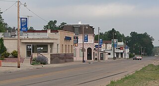
<span class="mw-page-title-main">Hyannis, Nebraska</span> Village in and county seat of Hyannis County, Nebraska, United States

Hyannis is a village in Grant County, Nebraska, United States. The population was 165 at the time of the 2020 census. It is the county seat of Grant County. It is centrally located in the extensive, unique, and remote region of grasslands known as the Sandhills of Nebraska at the intersection of two Nebraska State Highways: NSH 61 which runs north and south, and NSH 2, which runs east and west.

<span class="mw-page-title-main">Orleans, Nebraska</span> Village in Nebraska, United States

Orleans is a village in Harlan County, Nebraska, United States. The population was 386 at the 2010 census.

<span class="mw-page-title-main">Taylor, Nebraska</span> Village in Nebraska, United States

Taylor is a village in, and the county seat of, Loup County, Nebraska, United States. The population was 190 at the 2010 census.

<span class="mw-page-title-main">Nora, Nebraska</span> Village in Nebraska, United States

Nora is a village in Nuckolls County, Nebraska, United States. The population was 21 at the 2010 census.

<span class="mw-page-title-main">Foster, Nebraska</span> Village in Pierce County, Nebraska, United States

Foster is a village in Pierce County, Nebraska, United States. It is part of the Norfolk, Nebraska Micropolitan Statistical Area. The population was 51 at the 2010 census.

<span class="mw-page-title-main">Morse Bluff, Nebraska</span> Village in Saunders County, Nebraska, United States

Morse Bluff is a village in Saunders County, Nebraska, United States. The population was 117 at the 2020 census.
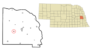
<span class="mw-page-title-main">Weston, Nebraska</span> Village in Saunder County, Nebraska, United States

Weston is a village in Saunders County, Nebraska, United States. The population was 250 at the 2020 census.

<span class="mw-page-title-main">Thurston, Nebraska</span> Village in Thurston County, Nebraska, United States

Thurston is a village in Thurston County, Nebraska, United States. The population was 132 at the 2010 census.

<span class="mw-page-title-main">Washington, Nebraska</span> Village in Washington County, Nebraska, United States

Washington is a village in Washington County, Nebraska, United States. The population was 150 at the 2010 census.
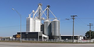
<span class="mw-page-title-main">Bartlett, Nebraska</span> Village in and county seat of Wheeler County, Nebraska, United States

Bartlett is a village in, and the county seat of, Wheeler County, Nebraska, United States. The population was 117 at the 2010 census.

References

  1. "ArcGIS REST Services Directory". United States Census Bureau. Retrieved September 18, 2022.
  2. 1 2 U.S. Geological Survey Geographic Names Information System: Gresham, Nebraska
  3. 1 2 "U.S. Census website". United States Census Bureau . Retrieved January 31, 2008.
  4. "Gresham, York County". Center for Advanced Land Management Information Technologies. University of Nebraska. Retrieved August 24, 2014.
  5. Sedgwick, Theron E. (1921). York County, Nebraska and Its People: Together with a Condensed History of the State. S.J. Clarke. p.  463.
  6. "US Gazetteer files 2010". United States Census Bureau. Archived from the original on January 25, 2012. Retrieved June 24, 2012.
  7. "Census of Population and Housing". Census.gov. Retrieved June 4, 2015.
  8. "U.S. Census website". United States Census Bureau . Retrieved June 24, 2012.

Commons-logo.svg Media related to Gresham, Nebraska at Wikimedia Commons