Guam Highway 10

Last updated

Guam route marker 10.svg

Guam Highway 10
Route information
Maintained by Guam Department of Public Works
Major junctions
West endGuam route marker 4.svg GH-4 in Chalan Pago-Ordot
 

Guam route marker 32.svg GH-32 in Mangilao

Guam route marker 15.svg GH-15 in Mangilao
East endGuam route marker 8.svg GH-8 in Barrigada
Highway system

Guam Highways

Guam route marker 9.svg GH-9 GH-10A Guam route marker 10A.svg

Guam Highway 10 (GH-10) is one of the primary automobile highways in the United States territory of Guam.

United States Federal republic in North America

The United States of America (USA), commonly known as the United States or America, is a country composed of 50 states, a federal district, five major self-governing territories, and various possessions. At 3.8 million square miles, the United States is the world's third or fourth largest country by total area and is slightly smaller than the entire continent of Europe's 3.9 million square miles. With a population of over 327 million people, the U.S. is the third most populous country. The capital is Washington, D.C., and the largest city by population is New York City. Forty-eight states and the capital's federal district are contiguous in North America between Canada and Mexico. The State of Alaska is in the northwest corner of North America, bordered by Canada to the east and across the Bering Strait from Russia to the west. The State of Hawaii is an archipelago in the mid-Pacific Ocean. The U.S. territories are scattered about the Pacific Ocean and the Caribbean Sea, stretching across nine official time zones. The extremely diverse geography, climate, and wildlife of the United States make it one of the world's 17 megadiverse countries.

Guam Island territory of the United States of America

Guam is an unincorporated and organized territory of the United States in Micronesia in the western Pacific Ocean. It is the easternmost point and territory of the United States, along with the Northern Mariana Islands. The capital city of Guam is Hagåtña and the most populous city is Dededo. The inhabitants of Guam are called Guamanians, and they are American citizens by birth. Indigenous Guamanians are the Chamorros, who are related to other Austronesian natives of Eastern Indonesia and Philippines and Taiwan. Guam has been a member of the Pacific Community since 1983.

Contents

Route description

GH-10 begins at a junction off GH-4 near Pago Bay. It trends eastward into the coastal village of Mangilao. GH-32 then spurs off the route towards the University of Guam. GH-10 then turns generally northward and intersects GH-15 before crossing into Barrigada and ending at a junction with GH-8. The road itself continues beyond the intersection into the Tiyan area, formerly Naval Air Station Guam. [1] Although there exists a suffixed GH-10A, it is not in any way connected to GH-10: being located on the other side of Tiyan and primarily serving Antonio B. Won Pat International Airport.

Guam Highway 4 (GH-4) is one of the primary automobile highways in the United States territory of Guam.

Mangilao, Guam Village in Guam, United States

Mangilao is a village on the eastern shore of the United States territory of Guam. The village's population has increased slightly following the island's 2000 census.

University of Guam, or U.O.G., is a land-grant university in Mangilao, Guam. It is accredited by the Western Association of Schools and Colleges and offers thirty-four degree programs at the undergraduate level and eleven master’s level programs. Of the university’s 3,387 students, 94% are of Asian-Pacific Islander ethnicity and nearly 72% are full-time. A full-time faculty of about 180 supports the university’s mission of "Ina, Diskubre, Setbe"— which translates to "To Enlighten, to Discover, to Serve."

Major intersections

LocationmikmDestinationsNotes
Chalan Pago-Ordot Guam route marker 4.svg GH-4 Western terminus
Mangilao Guam route marker 32.svg GH-32
Guam route marker 15.svg GH-15
Barrigada Guam route marker 8.svg GH-8 Eastern terminus
1.000 mi = 1.609 km; 1.000 km = 0.621 mi

Related Research Articles

British Columbia Highway 10 highway in British Columbia

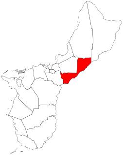
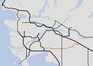
Highway 10 is a minor east-west route through the southern portion of Greater Vancouver. Highway 10 is used mainly as a local access route in North Delta, Surrey and Langley, its former connector role between South Delta and Highway 1 having been taken over by the Highway 17.

Guam Highway 1 highway in Guam

Guam Highway 1 (GH-1), also known as Marine Corps Drive, is one of the primary automobile routes in the United States territory of Guam. It runs in a southwest-to-northeast direction, from the main gate of Naval Base Guam in the western community of Santa Rita in a general northeasterly direction to the main gate of Andersen Air Force Base in the community of Yigo. It passes through Guam's capital, Hagåtña, as well as intersecting various other territorial highways. Along its route, the highway runs through tropical forest areas, urbanized commercial areas, and residential neighborhoods. The US Military built the road starting in 1941. Construction ceased with the Japanese invasion in December 1941 and resumed in 1944. The highway was formally dedicated to the US Marines by the territorial governor in 2004.

Guam Highway 2 is one of the primary automobile routes in the United States territory of Guam.

Guam Highway 3 (GH-3) is one of the primary automobile highways in the United States territory of Guam.

Guam Highway 5 (GH-5) is one of the primary automobile highways in the United States territory of Guam.

Guam Highway 6 (GH-6) is one of the primary automobile highways in the United States territory of Guam. It is known alternately as Spruance Drive and Halsey Drive: both named for noteworthy US Navy Admirals that served in the Pacific Ocean theater of World War II: Raymond A. Spruance and William Halsey Jr., respectively.

Guam Highway 7 (GH-7) is one of the primary automobile highways in the United States territory of Guam.

Guam Highway 8 (GH-8) is one of the primary automobile highways in the United States territory of Guam.

Guam Highway 11 (GH-11) is one of the primary automobile highways in the United States territory of Guam.

Guam Highway 9 (GH-9) is one of the primary automobile highways in the United States territory of Guam.

Guam Highway 16 (GH-16), also named Army Drive, is one of the primary automobile highways in the United States territory of Guam.

Guam Highway 10A (GH-10A) is one of the primary automobile highways in the United States territory of Guam.

Guam Highway 17 (GH-17) is one of the primary automobile highways in the United States territory of Guam.

Guam Highway 18 (GH-18) is one of the primary automobile highways in the United States territory of Guam.

Guam Highway 12 (GH-12) is one of the primary automobile highways in the United States territory of Guam.

Guam Highway 15 (GH-15) is one of the primary automobile highways in the United States territory of Guam.

Guam Highway 14 (GH-14) is one of the primary automobile highways in the United States territory of Guam.

Barrigada Village in Guam, United States

Barrigada is a village in the United States territory of Guam. A largely residential municipality, its main village is located south of the Antonio B. Won Pat International Airport near the intersections of Routes 8, 10, and 16. The community east of the airport known as Barrigada Heights is considered an affluent neighborhood on the island, where homes have excellent views overlooking much of Guam including the island's airport and hotels along Tumon Bay. Another significant location is Mount Barrigada, nearly 200 meters above sea level. Its location in the center of the island means it houses most of the island's radio masts and towers; the position and height make it easier for radio signals to reach the entire island.

Guam Highway 27 (GH-27), also known as Hamburger Highway or Harmon Loop Road, is a short highway in the United States territory of Guam. The highway runs in an east–west direction from a junction with GH-16 to a junction with GH-1, and is located almost entirely in the southern region of the city of Dededo. The highway gets its name from the fact that it provides access to a large McDonald's restaurant located at the intersection with GH-16.

References

  1. Map of Guam U.S.A. (Map). Franko's Maps, Ltd., Guam Visitors Bureau. 2007.

Route map: Google

KML file (edithelp)
KML is from Wikidata