
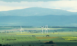
The Harz is a highland area in northern Germany. It has the highest elevations for that region, and its rugged terrain extends across parts of Lower Saxony, Saxony-Anhalt, and Thuringia. The name Harz derives from the Middle High German word Hardt or Hart, Latinized as Hercynia. The Brocken is the highest summit in the Harz with an elevation of 1,141.1 metres (3,744 ft) above sea level. The Wurmberg is the highest peak located entirely within the state of Lower Saxony.
Goslar is a district in Lower Saxony, Germany. It is bounded by the districts of Göttingen, Northeim, Hildesheim and Wolfenbüttel, the city of Salzgitter, and by the states of Saxony-Anhalt and Thuringia (Nordhausen).

Goslar is a historic town in Lower Saxony, Germany. It is the administrative centre of the district of Goslar and located on the northwestern slopes of the Harz mountain range. The Old Town of Goslar and the Mines of Rammelsberg are UNESCO World Heritage Sites. Each year Goslar awards the Kaiserring to an international artist, called the "Nobel Prize" of the art world.

Clausthal-Zellerfeld is a town in Lower Saxony, Germany. It is located in the southwestern part of the Harz mountains. Its population is approximately 15,000. The City is the location of the Clausthal University of Technology. The health resort is located in the Upper Harz at an altitude between 390 and 821 m above sea level.

Osterode was a district in Lower Saxony, Germany. It was bounded by the districts of Göttingen, Northeim and Goslar, and by the state of Thuringia.

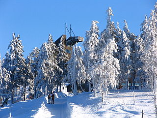
Braunlage is a town and health resort in the Goslar district of Lower Saxony in Germany. Situated within the Harz mountain range, south of the Brocken massif, Braunlage's main business is tourism, particularly skiing. Nearby ski resorts include the Sonnenberg and the slopes on the Wurmberg.

Oberharz is a former Samtgemeinde in the district of Goslar, in Lower Saxony, Germany. It was situated in the western part of the Harz, approx. 15 km southwest of Goslar. Its seat was in the town Clausthal-Zellerfeld. It was disbanded in January 2015, when its member municipalities merged into the town Clausthal-Zellerfeld.

Altenau is a town and a former municipality in the district of Goslar, in Lower Saxony, Germany. Since 1 January 2015 it is part of the town Clausthal-Zellerfeld.

Schulenberg im Oberharz is a village and a former municipality in the district of Goslar in Lower Saxony, Germany. It has been part of the town Clausthal-Zellerfeld since January 1, 2015.

The WeltWald Harz up to 2009 Arboretum Bad Grund, also known as Exotenwald and sometimes called the Arboretum des Forstamtes Grund or the Forstaboretum der Niedersächsischen Landesforstverwaltung, is an arboretum located along the B 242 federal highway near the Hübichenstein, northwest of Bad Grund, Lower Saxony, Germany. It is open daily without charge.

The Schalke is a mountain, 762 m above sea level (NN), in the Upper Harz in the German state of Lower Saxony. It lies in Goslar district north of Clausthal-Zellerfeld and west of Schulenberg.
The Langelsheim–Altenau (Oberharz) railway was a railway line, that ran through the Upper Harz in Central Germany. It was also called the Upper Harz Railway or Harz Railway. It was built in order to enable the Magdeburg-Halberstadt Railway Company to access the mines in the Harz mountains.

The Upper Harz refers to the northwestern and higher part of the Harz mountain range in Germany. The exact boundaries of this geographical region may be defined differently depending on the context. In its traditional sense, the term Upper Harz covers the area of the seven historical mining towns (Bergstädte) - Clausthal, Zellerfeld, Andreasberg, Altenau, Lautenthal, Wildemann and Grund - in the present-day German federal state of Lower Saxony. Orographically, it comprises the Harz catchment areas of the Söse, Innerste and Grane, Oker and Abzucht mountain streams, all part of the larger Weser watershed.

Romkerhall is a popular tourist destination on the River Oker in the Harz Mountains of Germany. There is a public car park here as well as a hotel and restaurant opposite the Romkerhall Waterfall. Romkerhall lies within the unincorporated area of Harz in the Lower Saxon county of Goslar in the Harz Mountains. The hotel and waterfall form a small tourist attraction which is marketed as the "Kingdom of Romkerhall - the smallest kingdom in the world!"

Oberharz am Brocken is a town in the Harz District, in Saxony-Anhalt, Germany. It was formed on 1 January 2010 by the merger of the town of Elbingerode with the municipalities of the former Verwaltungsgemeinschaft Brocken-Hochharz.

The Upper Harz Water Regale is a system of dams, reservoirs, ditches and other structures, much of which was built from the 16th to 19th centuries to divert and store the water that drove the water wheels of the mines in the Upper Harz region of Germany. The term regale, here, refers to the granting of royal privileges or rights in this case to permit the use of water for mining operations in the Harz mountains of Germany.
Brunswick Land is a historical region in the Southeast of the German state of Lower Saxony, centred around the city of Braunschweig. It refers to the core territory of the historic Duchy of Brunswick and its successor, the Free State of Brunswick, which was disestablished in 1946.
The administrative district (Verwaltungsbezirk) of Harz is an unincorporated area in the German district of Göttingen. Until the merger of the old districts of Osterode am Harz and Göttingen, it was known as "Harz ".
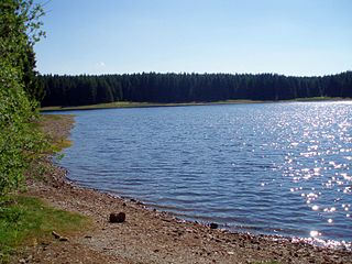
The Jägersbleeker Teich in the Harz Mountains of central Germany is a storage pond near the town of Clausthal-Zellerfeld in the county of Goslar in Lower Saxony. It is one of the Upper Harz Ponds that were created for the mining industry.

Werner Grübmeyer was a German politician. He was a member of the Christian Democratic Union (CDU).


