Heath Springs, South Carolina

Last updated

Heath Springs, South Carolina
HeathSprings SC.jpg
SCMap-doton-HeathSprings.PNG
Location of Heath Springs, South Carolina
Coordinates: 34°35′30″N80°40′28″W / 34.59167°N 80.67444°W / 34.59167; -80.67444
Country United States
State South Carolina
County Lancaster
Area
[1]
  Total1.63 sq mi (4.21 km2)
  Land1.63 sq mi (4.21 km2)
  Water0.00 sq mi (0.00 km2)
Elevation
[2]
686 ft (209 m)
Population
 (2020) [3]
  Total742
  Density456.62/sq mi (176.29/km2)
Time zone UTC-5 (Eastern (EST))
  Summer (DST) UTC-4 (EDT)
ZIP code
29058
Area code(s) 803, 839
FIPS code 45-32965 [4]
GNIS feature ID1245936 [2]
Website townofheathsprings.com

Heath Springs is a town in Lancaster County, South Carolina, United States. The population was 742 at the 2020 census. [5]

Contents

History

Heath Springs was incorporated in 1890. It was named for the firm Heath & Springs. [6]

The Battle of Hanging Rock Historic Site and Heath Springs Depot are listed on the National Register of Historic Places. [7]

Geography

Heath Springs is located at 34°35′30″N80°40′28″W / 34.59167°N 80.67444°W / 34.59167; -80.67444 (34.591550, -80.674510). [8]

According to the United States Census Bureau, the town has a total area of 1.3 square miles (3.4 km2), all land.

The largest company in Heath Springs is Rico Industries, maker of sports-licensed products such as wallets, flags and grill covers.

Demographics

Historical population
CensusPop.Note
1900 266
1910 45269.9%
1920 50511.7%
1930 5203.0%
1940 5709.6%
1950 69421.8%
1960 83219.9%
1970 95514.8%
1980 9792.5%
1990 907−7.4%
2000 864−4.7%
2010 790−8.6%
2020 742−6.1%
U.S. Decennial Census [9] 2010 [10] 2020 [11] [3]

2020 census

Heath Springs town, South Carolina - Demographic Profile
(NH = Non-Hispanic)
Race / EthnicityPop 2010 [10] Pop 2020 [11] % 2010% 2020
White alone (NH)35536944.94%49.73%
Black or African American alone (NH)41833152.91%44.61%
Native American or Alaska Native alone (NH)130.13%0.40%
Asian alone (NH)210.25%0.13%
Pacific Islander alone (NH)100.13%0.00%
Some Other Race alone (NH)650.76%0.67%
Mixed Race/Multi-Racial (NH)6120.76%1.62%
Hispanic or Latino (any race)1210.13%2.83%
Total790742100.00%100.00%

Note: the US Census treats Hispanic/Latino as an ethnic category. This table excludes Latinos from the racial categories and assigns them to a separate category. Hispanics/Latinos can be of any race.

2000 Census

As of the census [4] of 2000, there were 864 people, 328 households, and 225 families residing in the town. The population density was 256.6/km2 (667.1/sq mi). There were 366 housing units at an average density of 282.6 per square mile (109.1/km2). The racial makeup of the town was 48.38% White, 51.04% African American, 0.46% from other races, and 0.12% from two or more races. Hispanic or Latino of any race were 0.93% of the population.

There were 328 households, out of which 26.5% had children under the age of 18 living with them, 43.0% were married couples living together, 19.5% had a female householder with no husband present, and 31.1% were non-families. 28.7% of all households were made up of individuals, and 11.3% had someone living alone who was 65 years of age or older. The average household size was 2.50 and the average family size was 3.07.

In the town, the population was spread out, with 22.8% under the age of 18, 9.6% from 18 to 24, 22.2% from 25 to 44, 26.6% from 45 to 64, and 18.8% who were 65 years of age or older. The median age was 42 years. For every 100 females age 18 and under there were 80.4 males. For every 100 females age 18 and over, there were 75.1 males.

The median income for a household in the town was $24,000, and the median income for a family was $29,688. Males had a median income of $26,458 versus $20,463 for females. The per capita income for the town was $10,407. About 24.0% of families and 32.7% of the population were below the poverty line, including 37.8% of those under age 18 and 42.3% of those age 65 or over.

The official Facebook page for Heath Springs

Related Research Articles

<span class="mw-page-title-main">Morgan County, Alabama</span> County in Alabama, United States

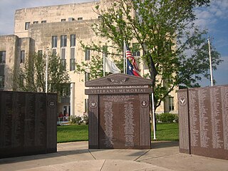
Morgan County is a county in the north-central part of the U.S. state of Alabama. As of the 2020 census, its population was 123,421. The county seat is Decatur. On June 14, 1821, it was renamed in honor of American Revolutionary War General Daniel Morgan of Virginia. It is a prohibition or dry county, although alcohol sales are allowed in the cities of Decatur, Hartselle, and Priceville. Morgan County is included in the Decatur, AL Metropolitan Statistical Area, which is also included in the Huntsville-Decatur-Albertville, AL Combined Statistical Area. It is a part of the North, Northwest, and North-Central regions of Alabama.

<span class="mw-page-title-main">Walker County, Alabama</span> County in Alabama, United States

Walker County is a county located in the central portion of the U.S. state of Alabama. As of the 2020 census, the population was 65,342. Its county seat is Jasper. Its name is in honor of John Williams Walker, the first U.S. senator elected from Alabama.

<span class="mw-page-title-main">Halifax County, Virginia</span> County in Virginia, United States

Halifax County is a county located in the Commonwealth of Virginia. As of the 2020 census, the population was 34,022. Its county seat is Halifax.

<span class="mw-page-title-main">Collingsworth County, Texas</span> County in Texas, United States

Collingsworth County is a county in the U.S. state of Texas. As of the 2020 census, its population was 2,652. Its county seat is Wellington. The county was created in 1876 and later organized in 1890. It is named for James Collinsworth, a signer of the Texas Declaration of Independence and first chief justice of the Republic of Texas. Collingsworth County was one of 30 prohibition, or entirely dry, counties in Texas, but a vote in 2017 changed this law.

<span class="mw-page-title-main">Childress County, Texas</span> County in Texas, United States

Childress County is a county located in the U.S. state of Texas. As of the 2020 census, its population was 6,664. The county seat is Childress. The county was created in 1876 and later organized in 1887. It is named for George Campbell Childress, the author of the Texas Declaration of Independence.

<span class="mw-page-title-main">Ridgeville, Alabama</span> Town in Alabama, United States

Ridgeville is a town in Etowah County, Alabama, United States. It incorporated in 1969 and is part of the Gadsden Metropolitan Statistical Area. At the 2020 census the population was 83, down from 158 in 2000. It is noteworthy for being the only community in Etowah County to have a black majority. Since 1970, it has also been the least populated community wholly within the county.

<span class="mw-page-title-main">Anthonyville, Arkansas</span> Town in Arkansas, United States

Anthonyville is a town in Crittenden County, Arkansas, United States. The population was 161 at the 2010 census, down from 250 in 2000.

<span class="mw-page-title-main">Penney Farms, Florida</span> Town in the state of Florida, United States

Penney Farms is a town in Clay County, Florida, United States. It is part of the Jacksonville metropolitan area. The population was 821 at the 2020 census.

<span class="mw-page-title-main">Fanning Springs, Florida</span> City in Florida, United States

Fanning Springs is a city in Gilchrist and Levy counties in the U.S. state of Florida. It is part of the Gainesville metropolitan area. The population was 1,182 at the 2020 census.

<span class="mw-page-title-main">Palm Springs North, Florida</span> Census-designated place in Florida

Palm Springs North is an unincorporated community and census-designated place (CDP) in Miami-Dade County, Florida, United States. It is part of the Miami metropolitan area of South Florida. The population was 5,030 at the 2020 census.

<span class="mw-page-title-main">Ansonville, North Carolina</span> Town in North Carolina, United States

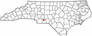
Ansonville is a town in Anson County, North Carolina, United States. The population was 440 at the 2020 census. The town has a total area of 1.5 square miles (3.8 km2), all land. It is located on the northern edge of Anson County, about a mile west of the Pee Dee River.

Boardman is a town in Columbus County, North Carolina, United States. Per the 2020 census, the population was 166.

<span class="mw-page-title-main">Hassell, North Carolina</span> Town in North Carolina, United States

Hassell is a town in Martin County, North Carolina, United States. The population was 84 at the 2010 census.

<span class="mw-page-title-main">Oak City, North Carolina</span> Town in North Carolina, United States

Oak City, formerly known as Goose Nest, is a town in Martin County, North Carolina, United States. The population was 266 at the 2020 census.

<span class="mw-page-title-main">Summerton, South Carolina</span> Town in South Carolina, United States

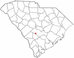
Summerton is a town in Clarendon County, South Carolina, United States. Per the 2020 census, the population was 814.

<span class="mw-page-title-main">Pamplico, South Carolina</span> Town in South Carolina, United States

Pamplico is a town in southeastern Florence County, South Carolina, United States. The population was 1,226 at the 2010 census. It is part of the Florence Metropolitan Statistical Area.

<span class="mw-page-title-main">Blenheim, South Carolina</span> Town in South Carolina, United States

Blenheim is a town in Marlboro County, South Carolina, United States. The population was 154 at the 2010 census. It is named for Blenheim Palace in Oxfordshire, England. Blenheim Palace was the residence of the Duke of Marlborough, after whom Marlboro County is named.

<span class="mw-page-title-main">Cope, South Carolina</span> Town in South Carolina, United States

Cope is a town in Orangeburg County, South Carolina, United States. The population was 65 at the 2020 census, a decline from 80 in 2010.

<span class="mw-page-title-main">Carlisle, South Carolina</span> Town in South Carolina, United States

Carlisle is a town in Union County, South Carolina, United States. The population was 436 according to the 2010 United States Census.

<span class="mw-page-title-main">Rushmere, Virginia</span> Census-designated place in Virginia, United States

Rushmere is a census-designated place (CDP) in Isle of Wight County, Virginia, United States. The population was 1,018 at the 2010 census.

References

  1. "ArcGIS REST Services Directory". United States Census Bureau. Retrieved October 15, 2022.
  2. 1 2 U.S. Geological Survey Geographic Names Information System: Heath Springs, South Carolina
  3. 1 2 "Census Population API". United States Census Bureau. Retrieved October 15, 2022.
  4. 1 2 "U.S. Census website". United States Census Bureau . Retrieved January 31, 2008.
  5. "Heath Springs town, South Carolina". United States Census Bureau . Retrieved February 23, 2021.
  6. Gannett, Henry (1905). The Origin of Certain Place Names in the United States. Govt. Print. Off. pp.  153.
  7. "National Register Information System". National Register of Historic Places . National Park Service. July 9, 2010.
  8. "US Gazetteer files: 2010, 2000, and 1990". United States Census Bureau. February 12, 2011. Retrieved April 23, 2011.
  9. "Decennial Census of Population and Housing by Decades". US Census Bureau.
  10. 1 2 "P2 HISPANIC OR LATINO, AND NOT HISPANIC OR LATINO BY RACE - 2010: DEC Redistricting Data (PL 94-171) - Heath Springs town, South Carolina". United States Census Bureau .
  11. 1 2 "P2 HISPANIC OR LATINO, AND NOT HISPANIC OR LATINO BY RACE - 2020: DEC Redistricting Data (PL 94-171) - Heath Springs town, South Carolina". United States Census Bureau .