Hilton Head Airport

Last updated
Hilton Head Island Airport
Summary
Airport typePublic
Owner Beaufort County
Serves Hilton Head Island, South Carolina
Elevation  AMSL 19 ft / 6 m
Coordinates 32°13′28″N080°41′51″W / 32.22444°N 80.69750°W / 32.22444; -80.69750
Website www.hiltonheadairport.com/...
Map
USA South Carolina relief location map.svg
Airplane silhouette.svg
HHH
Usa edcp relief location map.png
Airplane silhouette.svg
HHH
Runways
Direction LengthSurface
ftm
3/215,0001,524Asphalt
Statistics
Aircraft operations (2018)37,632
Based aircraft (2018)89
Scheduled departures (2019)1,595
Commercial passengers (2018)75,620
Freight/mail (lb.) (2019)1,587

Hilton Head Airport( IATA : HHH, ICAO : KHXD, FAA LID : HXD) is on Hilton Head Island, in Beaufort County, South Carolina, United States. [1] Also known as Hilton Head Island Airport, [3] it is owned by Beaufort County. [1]

Contents

In the spring of 2019, United Airlines began seasonal service to its hubs at Chicago-O’Hare, Newark, and Washington-Dulles, and American Airlines added seasonal service to its Washington-National hub to its existing service to Charlotte. Growth continued in May 2019, when Delta Air Lines resumed year round service to its hub in Atlanta, as well as adding a new seasonal route to New York-LaGuardia. All of these flights are operated by regional affiliates. One public charter airline operates limited service. It is the only airport on Hilton Head Island.

The National Plan of Integrated Airport Systems for 2017–2021 categorized it as a primary commercial service airport. [4] USDOT records say the airport had 56,330 passengers in calendar year 2017. [2]

Many U.S. airports use the same three-letter location identifier for the FAA and IATA, but this airport is HXD to the FAA [1] and HHH to the IATA. [5] [6] The IATA code HHH is used for airline booking.

History

Hilton Head Island has been known for championship golf courses for decades. In the 1960s it was decided that an airport would allow an increase in the number of visitors to the island. Hilton Head Island Airport opened in 1967 after Arnold Palmer told Charles E. Fraser that he would play golf on Hilton Head if there was an airport for him to land. [7] On July 5, 2018, Piedmont AirlinesBombardier Dash 8 service was ceased, and Republic Airways began serving Hilton Head Airport with the E175. This marks the first commercially scheduled jet service to the airport. [8]

In the past the airport was served by the following:[ citation needed ]

Facilities

Hilton Head Island Airport covers 180 acres (53 ha) at an elevation of 19 feet (6 m). Its one runway, 3/21, is 5,000 by 100 feet (1,524 x 30 m). [1] The runway was extended from 4,300 feet to 5,000 feet in the summer of 2018. [10] [11] The FAA had recommended the runway be extended to 5,300 feet but public opinion on Hilton Head Island necessitated a smaller extension. [12] In October 2010, the airport adopted a master plan that called for a 5,400 feet extension. [12] However, that did not come to fruition. [11]

Other safety improvements to the airport have been completed since 2018, including the relocation of Taxiway A by 100 feet, added airfield drainage components, removal of trees in the flight path and the revision of the general aviation parking area.

The current terminal building was built in 1995. At 18,000 square feet (1,700 m2), it has four airline gates. In 2023, the airport began construction on a terminal improvement project. The project will include a new TSA checkpoint, new boarding areas, and the addition of two jet bridges. [13]

For the 12-month period ending July 31, 2018, the airport had 37,632 aircraft operations, an average of 103 per day: 81% general aviation, 17% air taxi and 2% military. In July 2018, there were 89 aircraft based at this airport: 62% single-engine, 26% multi-engine, 9% jet, 2% helicopter and 1% ultralight. [1]

Airlines and destinations

Passenger

AirlinesDestinations
American Eagle Charlotte
Seasonal: Boston, Chicago–O'Hare, Dallas/Fort Worth, New York–LaGuardia, Philadelphia, Washington–National
Delta Connection Seasonal: Atlanta, New York–LaGuardia
United Express Seasonal: Chicago–O'Hare, Newark


Statistics

Top destinations

Busiest domestic routes from HXD (April 2022 – March 2023) [2]
RankCityPassengersCarriers
1 Charlotte, North Carolina 54,000American
2 Atlanta, Georgia 22,000Delta
3 Washington–Reagan, Virginia 13,000American
4 Newark, New Jersey 10,000United
5 Washington–Dulles, Virginia 5,000United
6 Chicago–O'Hare, Illinois 2,000American, United
7 New York-LaGuardia, New York 2,000American
8 Boston, Massachusetts 1,000American
9 Dallas/Fort Worth, Texas 1,000American
10 Philadelphia, Pennsylvania 1,000American

Annual traffic

Annual passenger traffic
(2003 – 2020)
[2]
YearPassengersYearPassengers
2020146,0002010151,000
2019221,0002009136,000
201875,6202008161,000
201756,3302007172,000
201664,7002006126,000
201579,0002005135,000
2014112,0002004128,000
2013117,0002003123,000
2012122,0002002
2011123,0002001
Airline market share (April 2022 – March 2023)
RankAirlinePassengersMarket Share
1 Republic 157,00071.81%
2 Envoy 44,00020.10%
3 GoJet 13,0009.23%
4 Mesa 4,0002.02%

See also

Related Research Articles

<span class="mw-page-title-main">Fort Wayne International Airport</span> Airport in Fort Wayne, Indiana, US

Fort Wayne International Airport lies eight miles southwest of Fort Wayne, in Allen County, Indiana, United States. It is owned by the Fort Wayne-Allen County Airport Authority.

<span class="mw-page-title-main">Key West International Airport</span> International airport in Key West, Florida

Key West International Airport is an international airport located in the City of Key West in Monroe County, Florida, United States, 2 miles east of the main commercial center of Key West.

Panama City–Bay County International Airport(IATA: PFN, ICAO: KPFN, FAA LID: PFN) was a public airport 3 miles (4.8 km) northwest of Panama City, in Bay County, Florida. It was owned and operated by the Panama City–Bay County Airport and Industrial District. All airline services moved to the Northwest Florida Beaches International Airport on May 22, 2010, but the airfield was open to general aviation aircraft until October 1, 2010. The grounds will eventually be turned over to LUK-MB1 LLC, which plans to remove the runways and build homes, shops, walking trails and a marina.

<span class="mw-page-title-main">Savannah/Hilton Head International Airport</span> Airport in Georgia, United States

Savannah/Hilton Head International Airport is a commercial and military-use airport in Savannah, Georgia, United States. Savannah/Hilton Head International provides travelers with access to Savannah, Georgia, and Hilton Head Island, South Carolina, as well as neighboring areas including Bluffton and Beaufort, South Carolina and the Golden Isles region of Coastal Georgia.

<span class="mw-page-title-main">Telluride Regional Airport</span> Airport

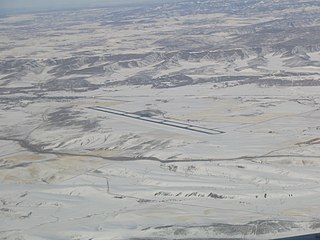
Telluride Regional Airport is a public airport six miles west of Telluride, in San Miguel County, Colorado, United States. It is owned by the Telluride Regional Airport Authority. At an elevation of 9,078 feet above sea level, it was the highest commercial airport in North America with scheduled passenger flights when Great Lakes Airlines resumed scheduled passenger service in December 2016; however, those flights ceased in March 2018. In August 2018, commercial service returned with the introduction of Boutique Air, and the airport remains the highest airfield in the U.S. with scheduled passenger flights, and the second highest overall airfield in the US behind Leadville Airport. Denver Air Connection is currently the only airline flying scheduled passenger flights from Telluride with daily nonstop flights to Denver and Phoenix. Denver Air operates the Fairchild-Dornier 328JET into Telluride. The 328JET is one of the few regional jet airliners in service capable of operating at such high field elevations as TEX.

<span class="mw-page-title-main">Tweed New Haven Airport</span> Airport in Connecticut, United States

Tweed-New Haven Regional Airport is a public airport located three miles southeast of downtown New Haven, in New Haven County, Connecticut, United States. The airport is partly located in the City of New Haven, which owns the airport, and partly in the town of East Haven.

<span class="mw-page-title-main">Grand Junction Regional Airport</span> Airport in Grand Junction, Colorado

Grand Junction Regional Airport is three miles (4.8 km) northeast of Grand Junction, in Mesa County, Colorado, United States. Owned by the Grand Junction Regional Airport Authority, it is the largest airport in western Colorado and third largest in the state, behind Denver International Airport and Colorado Springs Airport.

<span class="mw-page-title-main">Durango–La Plata County Airport</span> Airport in Durango, Colorado, USA

Durango–La Plata County Airport is a city- and county-owned public airport 12 miles southeast of Durango, in La Plata County, Colorado.

<span class="mw-page-title-main">Yampa Valley Airport</span> Airport in Colorado, United States of America

Yampa Valley Regional Airport is in Routt County, Colorado, United States, serving the communities of Steamboat Springs, Hayden, and Craig, Colorado. The airport is two miles southeast of Hayden, about 20 miles east of Craig and about 25 miles (40 km) west of Steamboat Springs. It has the only scheduled passenger flights in northwest Colorado. It is also used by larger business jets that cannot use the smaller Steamboat Springs Airport.

<span class="mw-page-title-main">Gunnison–Crested Butte Regional Airport</span> Airport

Gunnison–Crested Butte Regional Airport is a county-owned, public airport one mile southwest of Gunnison, in Gunnison County, Colorado, United States. Also known as Gunnison County Airport, it serves the valley and nearby Crested Butte, Colorado, with airline and general aviation flights.

<span class="mw-page-title-main">Columbia Regional Airport</span> Airport in Missouri, United States of America

Columbia Regional Airport is a commercial passenger airport serving Columbia, Missouri. Located about 12 miles (19 km) southeast of Columbia in Boone County, Missouri, it is the only commercial airport in Mid-Missouri and also serves the state capital of Jefferson City. As of 2022, commercial passenger service is provided by American Airlines subsidiary American Eagle. The airport opened in 1968, replacing the Columbia Municipal Airport off of Interstate 70. It is frequently used for charter flights by college athletic teams visiting the University of Missouri and for MU team flights.

<span class="mw-page-title-main">Glacier Park International Airport</span> Airport in Montana, United States

Glacier Park International Airport is in Flathead County, Montana, United States, six miles northeast of Kalispell. The airport is owned and operated by the Flathead Municipal Airport Authority, a public agency created by the county in 1974.

<span class="mw-page-title-main">Montgomery Regional Airport</span> Airport

Montgomery Regional Airport is a civil-military airport seven miles southwest of Montgomery, the capital of Alabama. Owned by the Montgomery Airport Authority, it is used for general aviation and military aviation, and sees two airlines.

<span class="mw-page-title-main">Hickory Regional Airport</span> Airport in Hickory, NC

Hickory Regional Airport is three miles (5 km) west of Hickory, in Catawba County, North Carolina. It is owned by the City of Hickory.

<span class="mw-page-title-main">Nantucket Memorial Airport</span> Airport in Nantucket, Massachusetts

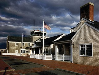
Nantucket Memorial Airport is a public airport on the south side of the island of Nantucket, Massachusetts, United States. It is owned by the Town of Nantucket and is located three miles (5 km) southeast of the town center. It is the second-busiest airport in the state, after Logan International Airport, due to intense corporate travel to and from the island in the high season.

<span class="mw-page-title-main">Martha's Vineyard Airport</span> Airport in Dukes County, Massachusetts, United States

Martha's Vineyard Airport is a public airport located in the middle of the island of Martha's Vineyard, three miles (5 km) south of the central business district of Vineyard Haven, in Dukes County, Massachusetts, United States. This airport is owned by Dukes County and lies on the border between the towns of West Tisbury and Edgartown.

Pinehurst Regional Airport is a public airport located 3 miles (5 km) north of Southern Pines and 5 miles northeast of Pinehurst, in Moore County, North Carolina, USA. The airport covers 500 acres (202 ha) and has one runway. The current runway is paved, 6,502 feet long and 150 feet wide. SOP is primarily used for general aviation.

Tunica Municipal Airport is a public use airport located one nautical mile (2 km) east of the central business district of Tunica, in Tunica County, Mississippi, United States. It is owned by the Tunica County Airport Commission. Also known as Tunica Airport, it should not be confused with the 10 acre privately owned, public use Tunica Airport located 2 nautical miles (4 km) south of the center of town, which has been recently changed to Ralph M Sharpe Airport.

<span class="mw-page-title-main">Steamboat Springs Airport</span> Airport

Steamboat Springs Airport is a city-owned airport three miles northwest of Steamboat Springs, in Routt County, Colorado. The National Plan of Integrated Airport Systems for 2011–2015 categorized it as a general aviation facility.

<span class="mw-page-title-main">Trenton–Mercer Airport</span> Airport in Ewing Township, New Jersey, US

Trenton–Mercer Airport is a county-owned, joint civil–military, public airport located four miles northwest of Trenton in the West Trenton section of Ewing Township, Mercer County, New Jersey. Formerly known as Mercer County Airport, the airport serves one scheduled airline plus general and corporate aviation. The U.S. Department of Transportation reports that approximately 301,000 passengers arrived and 300,000 departed at the airport in the 12 months ending July 2023, for a total of 601,000 passengers.

References

  1. 1 2 3 4 5 6 FAA Airport Form 5010 for HXD PDF . Federal Aviation Administration. effective Nov 30, 2017.
  2. 1 2 3 4 "RITA - BTS - Transtats". bts.gov. Retrieved April 28, 2018.
  3. "Hilton Head Island Airport". Beaufort County. Archived from the original on August 18, 2013. Retrieved July 17, 2013.
  4. "2011–2015 NPIAS Report, Appendix A" (PDF). faa.gov. Federal Aviation Administration. October 4, 2010. Archived from the original (PDF, 2.03 MB) on September 27, 2012.
  5. "IATA Airport Code Search (HHH: Hilton Head)". International Air Transport Association . Retrieved July 17, 2013.
  6. "Hilton Head Airport (IATA: HHH, ICAO: KHXD, FAA: HXD)". Great Circle Mapper. Retrieved July 17, 2013.
  7. "Hilton Head Island Airport Master Plan Update" (PDF). 2010. Retrieved December 30, 2022.
  8. Wilson, Lisa (12 April 2018). "Hilton Head Island airport upgrades attracting larger planes to the runway". Island Packet. Retrieved 6 June 2018.
  9. "Timetables". Sunshine Skies.
  10. "Runway Improvements at Hilton Head Airport Enhance Safety, Service Options & Stormwater Management | Airport Improvement Magazine". airportimprovement.com. Retrieved 2022-06-01.
  11. 1 2 Mayle, Mary Carr (15 March 2017). "Hilton Head airport to expand runway". Savannah Morning News.
  12. 1 2 "Hilton Head airport runway extension to be completed in June". Island Packet. May 10, 2018. Retrieved June 1, 2022.
  13. "HHH is growing to better serve you". www.hiltonheadairport.com. September 29, 2023. Archived from the original on December 29, 2023. Retrieved 29 December 2023.