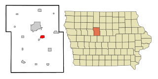
Humboldt is a city in Humboldt County, Iowa, United States. The population was 4,792 at the time of the 2020 census, gaining 102 people over the 2010 total.[2]
Frank A. Gotch Park (just south of present-day Humboldt and Dakota City) was a location of prehistoric and some Dakota Indian villages near where the two forks of the Des Moines River meet. During westward expansion in the 1800s, this area is thought to be the location of a fort/trading post called Fort Confederation. According to Federal records in 1825, permission was granted to build the fort to trade with the Ihanktonwan Dakota (Yankton Sioux) Indians. Information about the exact details of the fort are unclear, such as if American or French Canadian or Metis traders built it, bringing up many questions about this fort.[3][4]
The marshland that inspired Taft still exists today. It was the former river bed for the Des Moines River.
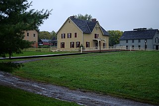
The founder of modern Humboldt, Stephen Harris Taft, laid out the plans for Springvale, the original name of the town, in 1863. It was named Springvale because of the several natural springs found near the Des Moines River. Taft had very big plans for the community, and expected many intellectuals from the East to move to his new community.
The town shall be surrounded and full of trees and forests.
The town shall be free of the sale of intoxicants.
The town shall be founded upon a saw mill and grist mill on the Des Moines River
The town shall have the moral fortitude of a solid church and good schools, and that it shall become a town of thinkers and beauty.
The town shall grow with a college of university importance, and have a church that will not dissent into factions.
Taft undertook the great task of turning empty, blooming prairie into the community of his dreams. He brought out a group of settlers (including a doctor) in 1863, and they lived together in the few houses that had been built. The grist mill was built, known now as the Corydon Brown House.[6] The first few years were spent laying out the town. Taft wanted very wide boulevards throughout the town, and the community is still known for its streets.[7] Taft also edited the Humboldt County True Democrat through the offices of the Fort Dodge Sentinel in Fort Dodge.[5]
Springvale was renamed Humboldt (after the German explorer and naturalist Alexander von Humboldt)[8] in hope of a merger between Springvale and Dakota City (the county seat of Humboldt County), but no merger took place.[9] This is the first of two major shortcomings that would stunt Humboldt's growth and keep it from reaching Taft's goals.
A meeting in 1866 occurred that formed the Springvale Collegiate Association, led by Taft. After the flood in 1867 that destroyed the town's dam, the issue became popular again in 1869. The association was renamed to Humboldt Collegiate Association in accordance with the town's name change. It was reported that "great enthusiasm" was the feeling in the room, however when the question was posed to the county's voters on October 12, 1869, the measure to appropriate swampland for a Northern Iowa College was defeated.[5] Taft was not defeated, however, and looked East for funding. After almost missing a payment deadline that would've sunk the college for good, Taft broke ground on June 17, 1870. He ended his address by saying "Hundreds are here present today. Tens of thousands shall gather here a hundred years hence to commemorate the birth of the institution and rejoice in the blessings it shall have conferred."[5]
Humboldt College opened its doors on September 13, 1872. The first three years were designed as preparatory work intended to supplement the pupils' public education that ended around eighth grade. The subsequent four years were college work. June 1879 brought the first graduation class of three families. They would be the only students to ever receive a degree from the institution.[5] At this time, Taft and the college were in financial trouble. An endowment fund capable of supporting Taft's vision seemed impossible to create, and following turbulent financial times in the East, the college closed in 1916. The building was razed in 1926, following unsuccessful attempts to rent the structure. Without the college, Taft's dreams of Humboldt becoming an intellectual center of knowledge in the West could not be realized.
In July 1955, when contacts between Americans and Soviets were rare, Humboldt hosted a delegation of Soviet officials (and national and international reporters) for an overnight glimpse of rural American life.[10]
On March 27, 1972, ABC-TV broadcast a half-hour documentary on Humboldt entitled "A Small Town in Iowa."[11] The program was written and produced by Andy Rooney and narrated by Harry Reasoner, a Humboldt native.[12] The show portrayed Humboldt as a kind of paradise that struggled to keep its most talented youth from leaving for larger cities, and asked, "what is it about paradise that's turning the bright kids off?"[13] The answer, according to Reasoner and Rooney, was that "what seems to be missing is more a shortcoming of ours, than of the small town. It is that those of us with ego and ambition are not usually happy performing in front of an audience the size a small town provides."[12]
The First National Bank of Humboldt and its shareholders were the primary victims of what the Des Moines Register described as “one of the most spectacular white-collar crimes in state history.”[14] In 1982 Humboldt native Gary Vance Lewellyn, then a Des Moines stockbroker, attempted to pump up the value of the stock of a high-tech company by singlehandedly creating phony market demand for it.[15] To carry out the scheme, he illegally obtained access to bonds of the First National Bank of Humboldt valued at $16.7 million, and secretly pledged the Bank's bonds as security for his personal orders of the company's stock through Wall Street investment firms.[16] When Lewellyn missed margin calls on his stock purchases, the firms obtained the bonds.[17] Suspicious federal regulators closed the Humboldt Bank when it could not account for its missing bonds (and considered, but rejected, the idea of liquidating it).[15] Its accountholders were protected by federal insurance but the shares in the bank became worthless. For his crime, Lewellyn was sentenced to twenty years in prison,[18] but served only five years.[14] Lewellyn died in 2012.[19]
The stream network is poorly developed and widely spaced, with major rivers carving valleys that are relatively deep and steep-sided. Almost all of the natural lakes of Iowa are found in the northern part of this region (the Iowa Great Lakes). Most of the region has been converted from wet prairie to agricultural use with substantial surface water drainage. Only a small fraction of the wetlands remain, and many natural lakes have been drained as a result of agricultural drainage projects via drainage tiles or ditches.[22]
Climate
Humboldt, like almost all of Iowa, has a humid continental climate (KöppenDfa). Humboldt experiences all four seasons characterized by cold winters, wet springs, hot summers, and relatively short autumns. Wide temperature ranges are common within this climate zone.[23]
As of the census[26] of 2010, there were 4,690 people, 2,091 households, and 1,250 families residing in the city. The population density was 1,010.8 inhabitants per square mile (390.3/km2). There were 2,246 housing units at an average density of 484.1 per square mile (186.9/km2). The racial makeup of the city was 94.9% White, 0.6% African American, 0.1% Native American, 0.4% Asian, 3.0% from other races, and 0.9% from two or more races. Hispanic or Latino of any race were 5.0% of the population.
There were 2,091 households, of which 24.9% had children under the age of 18 living with them, 48.2% were married couples living together, 7.9% had a female householder with no husband present, 3.7% had a male householder with no wife present, and 40.2% were non-families. 35.8% of all households were made up of individuals, and 17.9% had someone living alone who was 65 years of age or older. The average household size was 2.18 and the average family size was 2.80.
The median age in the city was 45.3 years. 22.4% of residents were under the age of 18; 7.3% were between the ages of 18 and 24; 19.9% were from 25 to 44; 26% were from 45 to 64; and 24.5% were 65 years of age or older. The gender makeup of the city was 47.7% male and 52.3% female.
2000 census
As of the census[27] of 2000, there were 4,452 people, 1,965 households, and 1,202 families residing in the city. The population density was 957.7 inhabitants per square mile (369.8/km2). There were 2,090 housing units at an average density of 449.6 per square mile (173.6/km2). The racial makeup of the city was 98.41% White, 0.20% African American, 0.04% Native American, 0.25% Asian, 0.65% from other races, and 0.45% from two or more races. Hispanic or Latino of any race were 1.50% of the population.
There were 1,965 households, out of which 24.9% had children under the age of 18 living with them, 52.3% were married couples living together, 6.6% had a female householder with no husband present, and 38.8% were non-families. 35.9% of all households were made up of individuals, and 21.1% had someone living alone who was 65 years of age or older. The average household size was 2.18 and the average family size was 2.84.
Age spread: 21.8% under the age of 18, 6.7% from 18 to 24, 22.9% from 25 to 44, 22.0% from 45 to 64, and 26.5% who were 65 years of age or older. The median age was 44 years. For every 100 females, there were 86.4 males. For every 100 females age 18 and over, there were 82.1 males.
The median income for a household in the city was $39,338, and the median income for a family was $49,526. Males had a median income of $32,438 versus $22,586 for females. The per capita income for the city was $19,656. About 4.4% of families and 7.3% of the population were below the poverty line, including 15.0% of those under age 18 and 4.0% of those age 65 or over.
Des Moines is the capital and most populous city in the U.S. state of Iowa. It is the county seat of Polk County with parts extending into Warren County. It was incorporated on September 22, 1851, as Fort Des Moines, which was shortened to "Des Moines" in 1857. It is located on, and named after, the Des Moines River, which likely was adapted from the early French name, Rivière des Moines, meaning "River of the Monks". The city's population was 214,133 as of the 2020 census. The six-county metropolitan area is ranked 81st in terms of population in the United States, with 709,466 residents according to the 2020 census by the United States Census Bureau, and is the largest metropolitan area fully located within the state.
Humboldt County is a county in the U.S. state of Iowa. As of the 2020 census, the population was 9,597. The county seat is Dakota City. The county was created in 1857 and named in honor of Alexander von Humboldt.
Perry is a city in Dallas County, Iowa, United States, along the North Raccoon River. The population was 7,836 at the time of the 2020 Census. It is part of the Des Moines–West Des Moines Metropolitan Statistical Area.
Urbandale is a city in Polk and Dallas counties, Iowa, United States. As of the 2020 U.S. Census, the city population was 45,580. It is part of the Des Moines–West Des Moines Metropolitan Statistical Area.
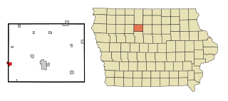
Bradgate is a city in Humboldt County, Iowa, United States, at the conjunction of Sections 5, 6, 7, and 8 of Avery Township, and rests near the banks of the West Fork of the Des Moines River. The population was 75 in the 2020 census, a decline from 101 in 2000.
Dakota City is a city in and the county seat of Humboldt County, Iowa, United States. The population was 759 at the time of the 2020 census. Dakota City shares its western border with the much larger city of Humboldt. It is the least populous county seat in Iowa.
Hardy is a city in Humboldt County, Iowa, United States. The population was 57 at the time of the 2020 census.
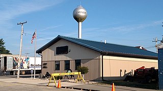
Livermore is a city in Humboldt County, Iowa, United States. The population was 381 at the time of the 2020 census. Livermore is the hometown of former University of Iowa and NFL tight end Dallas Clark.
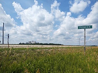
Pioneer is an unincorporated community in Humboldt County, Iowa, United States. The population was 4 at the time of the 2020 census, and elected to unincorporate as a municipality in 2020.
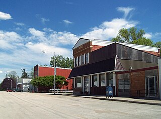
Renwick is a city in Humboldt County, Iowa, United States. The population was 234 at the time of the 2020 census.
Rutland is a city in Humboldt County, Iowa, United States. The population was 113 at the time of the 2020 census.
Montrose is a city in Lee County, Iowa. The population was 738 at the time of the 2020 census. The town is located on the Mississippi River. It is part of the Fort Madison-Keokuk Micropolitan Statistical Area.
Oskaloosa is a city in, and the county seat of, Mahaska County, Iowa, United States. In the late nineteenth and early twentieth century, Oskaloosa was a national center of bituminous coal mining. The population was 11,558 in the 2020 U.S. census.
Johnston is a city in Polk County, Iowa, United States. The population was 24,064 in the 2020 census, a large increase from the 8,649 population in 2000. It is part of the Des Moines–West Des Moines Metropolitan Statistical Area.
Callender is a city in Webster County, Iowa, United States. The population was 368 at the time of the 2020 census.
Coalville is a census-designated place (CDP) in Webster County, Iowa, United States. The population was 610 at the 2010 census. The community is located on U.S. Route 20 near Fort Dodge's large gypsum mines.
Fort Dodge is a city in and the county seat of Webster County, Iowa, United States, along the Des Moines River. The population was 24,871 in the 2020 census, a decrease from 25,136 in 2000. Fort Dodge is a major commercial center for North Central and Northwest Iowa. It is located on U.S. Routes 20 and 169.
Lehigh is a city in Webster County, Iowa, United States. The population was 395 at the time of the 2020 census.
Gilmore City is a city in Humboldt and Pocahontas counties in the U.S. state of Iowa. The population was 487 at the time of the 2020 census.
Carlisle is a city in Warren and Polk counties in the U.S. state of Iowa. The population was 4,160 at the 2020 census. The city is part of the Des Moines–West Des Moines Metropolitan Statistical Area.
↑ "Dr. Daniel P. Russell and his Family." Humboldt County Historical Association. Dr. Russell.Archived 2011-07-26 at the Wayback Machine Retrieved August 10, 2010.
↑ "Good for the Corn," Time, August 8, 1955, and "Russians Learning Wonders of America," Long Beach Press-Telegram, 1955-7-26, p. A-4 (retrieved from Newspaperarchive.com).
1 2 Linda Johnson, "Why are people leaving Utopia? Utopia is Humboldt, Ia., the residents of which were filmed for an ABC documentary last January, March 26, 1972," Des Moines Register, 1972-03-26, at 3-TV.
↑ Editorial, "Paradise is Humboldt, Ia.," Des Moines Register, 1972-03-29, at 6.
↑ Federal Deposit Ins. Corp. v. First Interstate Bank of Des Moines, N.A., 885 F.2d 423, 428–29 (8th Cir. 1989); Federal Deposit Ins. Corp. v. National Ass'n of Securities Dealers, Inc., 582 F.Supp. 72, 73 (S.D. Ia. 1984).
↑ In re Lewellyn & Co., Inc., 929 F.2d 424, 426 (8th Cir. 1991).
↑ "Sees Fighting Chance for Smith in Iowa and the Defeat of Gov. Hammill," The Davenport Democrat and Leader, 1928-11-1, and Iowa State Register 1933-34.
This page is based on this Wikipedia article Text is available under the CC BY-SA 4.0 license; additional terms may apply. Images, videos and audio are available under their respective licenses.