10th Independent Mixed Regiment was a regiment of the Imperial Japanese Army that has association with a number of U.S. National Register of Historic Places-listed places in Guam.
The Ilik River Fortification II near Yona, Guam was built by Japanese forces during World War II. It was listed on the U.S. National Register of Historic Places in 1991.

The As Sombreru Pillbox I, As Sombreru Pillbox II, and As Sombreru Pillbox III are three historic defensive fortifications on Guam, near Tumon, that were listed on the U.S. National Register of Historic Places in 1991. They are pillboxes, a type of defensive fortification, built by the 48th Independent Mixed Brigade; 29th Division of the Imperial Japanese Army during 1941-1944, between Japan capturing Guam on December 8, 1941 from the United States and the U.S. recapturing Guam in 1944.

The Agana Historic District in Hagåtña, Guam is a 2-acre (0.81 ha) historic district that was listed on the U.S. National Register of Historic Places in 1985. It includes five contributing buildings: the Calvo-Torres, Rosario, Martinez-Notley, Lujan and Leon Guerrero houses. The area is roughly bounded by 2nd S., 3rd S., and 9th W., Santa Cruz and Legaspi Sts. in Agana.

The Asan Invasion Beach is a historic site in the village of Asan, Guam. The beaches of Asan were one of the landing sites of American forces in the 1944 Battle of Guam, in which the island was retaken from occupying Japanese forces. The designated historic site includes the beaches extending between Asan Point and Adelup Point, and extends inland roughly to Guam Highway 1. It also includes the water area extending from the beach to the reef, about 100 metres (330 ft) out, an area that includes at least one abandoned Allied landing vehicle.
The Baza Outdoor Oven is a 20th-century version of a traditional hotnu, or outside oven, on the island of Guam. This oven is located at the end of Beatrice Baza Drive in the village of Yona. It was built in 1952 out of brick and concrete, but is based on traditional forms that have been in use on Guam since they were introduced by the Spanish in the 17th century. It is a barrel-shaped structure about 2 metres (6.6 ft) long, 1.5 metres (4.9 ft) wide, and 1.67 metres (5.5 ft) high. The base of the structure is poured concrete about 0.6 metres (2.0 ft) high, with the vaulted portion about 1 metre (3.3 ft) high. The interior of the vault is made out of heat-resistant bricks, while the exterior is finished in cement. The oven was used by heating it until the bricks were white, after which the burning materials were removed, the food to be cooked was added, and the main door was closed. This oven is large enough to roast four pigs.

The Agana-Hagåtña Pillbox is a former Japanese defensive fortification in Hagåtña, Guam. It is a six-sided reinforced concrete structure, located a short way above the high-tide line on the west side of the Paseo de Susana, a small peninsula jutting north from the village center. There is another wall providing cover for the entrance on the land side. The interior is divided into two chambers, each of which has a gun port. The structure was built by Guam's Japanese defenders during their occupation of the island (1941–44) in World War II.

The Asan Ridge Battle Area was the scene of some of the heaviest fighting in the 1944 Battle of Guam, the World War II battle in which Allied forces recaptured Guam from occupying Japanese forces. The area is now part of the Asan Inland Unit of the War in the Pacific National Historical Park, and was listed on the National Register of Historic Places in 1975. The area is just inland of the Asan Invasion Beach, one of the two major beachheads established by the Allies, and has a commanding view over that area. The landforms included in this area are Chorrito Cliff, Bundschuh Ridge, and Nimitz Hill, and they were heavily fortified by the Japanese prior to the battle. Surviving elements of these fortifications include two concrete pillboxes, and an unfinished battery of 4-inch guns.
Fort San Jose is a former Spanish fortification on the island of Guam, now a United States territory. It is located north of the village of Umatac, on a hill overlooking both Fouha Bay and Umatac Bay, the place were Spanish galleons traveling between Manila in the Spanish Philippines and Acapulco, Mexico stopped for water and supplies.

The Gongna Beach defenses are a collection of World War II structures built on or near Gongna Beach in Tamuning on the island of Guam, now a United States territory. These defenses were erected by the Imperial Japanese Army during its occupation of the island 1941–44. The three surviving elements were listed on the National Register of Historic Places in 1991. They are located well north of the main Allied landing areas of the 1944 Battle of Guam.
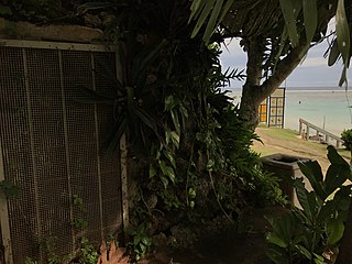
The Ipao Pillbox I is one of three surviving World War II-era fortifications on Ypao Point, located west of Tumon Bay on the west side of the island of Guam. It is built into the limestone cliff overlooking the beach on the property of the Hilton Hotel, about 17 metres (56 ft) in from the high tide line. Its walls are fashioned out of coral rock and cement, varying in thickness from 1 metre (3.3 ft) to 1.6 metres (5.2 ft). Its entrance is on the east wall, and its gun port faces north, overlooking Ypao Channel. Parts of the structure have been restored.
The Malessu' Pillbox is a World War II-era Japanese-built defensive fortification on the shore of Malesso', Guam. Located about 15 metres (49 ft) from the high-tide line at Merizo Beach, it is a rectangular structure built of steel-reinforced concrete and basalt rock. It is 3.9 metres (13 ft) deep, 2.4 metres (7.9 ft) wide, and about 2.42 metres (7.9 ft) high, although only about 0.75 metres (2.5 ft) of the structure is visible above ground. Its gun port has a view of the Merizo pier, and is approximately at ground level. It was built by Japanese defenders during their occupation of the island 1941–44.

Gadao's Cave, also known as Liyang Gadao, is a rock art site on the United States island of Guam. Located near the village of Inarajan, the cave is the site of a panel of approximately 50 Chamorro pictographs, painted with a mixture of coral lime and tree sap. The most unusual images are of two human stick figures that appear to be carrying things. It is not known who painted them or when, and what their significance is. The legendary chief of Inarajan Gadao is believed to be the creator of the cave's images.
The Mana Pillbox is an old World War II-era Japanese-built defensive fortification on the east coast of the island of Guam. It is located south of the village of Talofofo, about 50 metres (160 ft) inland from the point marking the south end of As Anite Cove. It is a structure built out of coral limestone and concrete, with an interior chamber about 3 by 1.8 metres in size. The entrance is on the south side, measuring 0.85 by 1.45 metres. There is one gun port, facing north, measuring 0.32 by .9 metres. The structure was designed to be well hidden in view from the sea and air. It was built, probably by conscripted Chamorro labor, during the Japanese occupation period 1941–44.
The Pago Bay Japanese pillboxes are a pair of World War II-era coastal defense pillboxes located on the shore of Pago Bay, located on the central east coast of Guam. Built out of steel-reinforced concrete mixed with coral stone, these two structures were built by Japanese defenders during their occupation of the island between 1941 and 1944. They were listed on the National Register of Historic Places in 1991 as Pagu' Pillbox I and Pagu' Pillbox II. Neither of these would have seen substantial action during the 1944 liberation of Guam, whose military activities were focused on the western, central, and northern parts of the island.
The Paulino Outdoor Oven is a 20th-century version of a traditional hotnu, or outside oven, on the island of Guam. This oven is located on Paulino family land of Bear Rock Lane on Agfayan Point, a peninsula on the south side of Agfayan Bay in the village of Inarajan. It was built in 1947 for the Paulinos by Jesus Menu Cristostomo out of modern materials, following a traditional form that has been in use on Guam since these ovens were introduced by the Spanish in the 17th century. It is a barrel-shaped structure about 1.85 metres (6.1 ft) long, 1.68 metres (5.5 ft) wide, and 0.8 metres (2.6 ft) high. The base of the structure is coral stone mixed with mortar. The interior of the vault is made out of heat-resistant bricks, while the exterior is finished in alternating layers of red tile and mortar. The oven was used by the Paulino family to prepare baked goods such as dinner rolls and wedding cakes, and to roast pigs. When recorded in 2010, it was in deteriorating condition.

The San Vitores Beach Japanese Fortification are the remains of World War II-era defensive positions facing the beach of Tumon Bay on the west side of the island of Guam. Located near the stairs to the beach of the Guam Reef Hotel are the remains of two concrete pillboxes built by Japanese defenders during the occupation period 1941–44. One structure, of which little more than a gun embrasure is discernible, is located in the limestone cliff about 10 metres (33 ft) inland from the high tide line, and a second is located about 10 meters south and 8 meters further inland, with only a section of roof slab and supporting columns recognizable.
The Talofofo Pillbox is a historic World War II-era defensive fortification in Talofofo, Guam. It is located near the coast, about 127 metres (417 ft) south of the mouth of the Togcha River and 27 metres (89 ft) inland from the high-tide line. It is roughly 2.75 by 3.0 metres, built out of concrete and coral limestone. Its walls are about 0.5 metres (1.6 ft) thick, with an embrasure providing a view of the Togcha River, and a window looking over the coast to the east. Its entrance is on the landward (south) side. This structure was built under the direction of the Imperial Japanese Army during its occupation of Guam in 1941–44.
The Tokcha' Pillbox is a Japanese-built World War II-era defensive fortification on the island of Guam. It is built on a limestone terrace on Togcha Point, about 1 mile (1.6 km) north of the Togcha River and 0.7 miles (1.1 km) south of the Ylig River. It is set in a depression excavated from the limestone about 15 metres (49 ft) inland from the high tide land and 1 metre (3.3 ft) above sea level. It is a roughly rectangular structure built out of steel-reinforced concrete filled with coral and beach aggregate. The entrance is on the north wall, sheltered by a wall of coral blocks, and the gun port is on the south wall. This structure was built under the direction of the Japanese military during their occupation of the island 1941–44.

The Tumon Bay Japanese fortifications are a collection of World War II-era military structures along the coast of Guam in and near the village of Tumon. Many of these structures were listed on the National Register of Historic Places in 1991, using the alternate spelling "Tomhum". They include pillboxes on or close to the beach, and concrete structures and caves located a short way inland on the limestone cliffs that overlook the beach.

