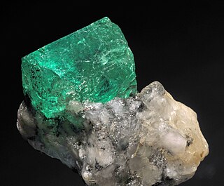
Emerald is a gemstone and a variety of the mineral beryl (Be3Al2(SiO3)6) colored green by trace amounts of chromium or sometimes vanadium. Beryl has a hardness of 7.5–8 on the Mohs scale. Most emeralds have lots of material trapped inside during the gem's formation, so their toughness (resistance to breakage) is classified as generally poor. Emerald is a cyclosilicate.
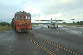
Madagascar Airlines is an airline based in Antananarivo, Madagascar. It is the flag carrier of Madagascar; it operates services to Europe, Asia and neighbouring African and Indian Ocean island destinations, from its main base, Ivato International Airport in Antananarivo. It also operates an extensive domestic network.
Manakara is a city in Madagascar.
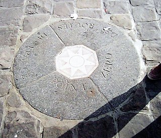
A route nationale, or simply nationale, is a class of trunk road in France. They are important roads of national significance which cross broad portions of the French territory, in contrast to departmental or communal roads which serve more limited local areas.

Tôtes is a commune in the Seine-Maritime department in the Normandy region in north-western France.
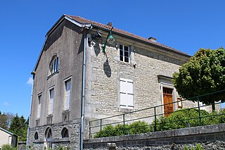
Trampot is a commune in the Vosges department of Lorraine in northeastern France.
Vohilava is a rural municipality in Madagascar. It belongs to the district of Mananjary, which is a part of the region of Vatovavy. The population of the municipality was estimated to be approximately 32,000 in 2001 commune census.

European route E3 is a series of roads in France, part of the United Nations International E-road network. It runs from Cherbourg to La Rochelle.
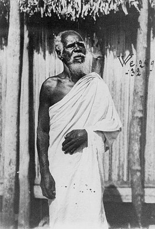
The Antambahoaka are the least numerous ethnic group in Madagascar, numbering around 50,000 in 2013. They inhabit a small region along the southeastern coast of Madagascar near Mananjary and share their origins with the partially Arab Antaimoro people, from whom the group split in the 15th century under a leader named Ravalarivo. Very little is known about the history of this group after its founding. The Antambahoaka speak a dialect of the Malagasy language, which is a branch of the Malayo-Polynesian language group derived from the Barito languages, spoken in southern Borneo.

Route nationale 7 (RN7) is a primary highway in Madagascar running 980km from the capital Antananarivo to Tulear at the south-west coast of the country. It crosses the regions of Analamanga, Vakinankaratra, Amoron'i Mania, Haute Matsiatra, Ihorombe, and Atsimo-Andrefana.

Tropical Cyclone Alibera was the third longest-lasting tropical cyclone on record in the south-west Indian Ocean, with a duration of 22 days. It formed on December 16, 1989, well to the northeast of Madagascar. For several days, it meandered southwestward while gradually intensifying. On December 20, Alibera intensified to tropical cyclone status with 10‑minute maximum sustained winds of 120 km/h (75 mph), or the equivalent of a minimal hurricane. That day, the Météo-France office in Réunion (MFR) estimated 10‑minute winds of 140 km/h (87 mph), while the Joint Typhoon Warning Center (JTWC), an unofficial warning agency for the region, estimated peak 1‑minute winds of 250 km/h (160 mph). After drifting erratically for several days, the storm began a steady southwest motion on December 29 as a greatly weakened system. On January 1, Alibera struck southeastern Madagascar near Mananjary, having re-intensified to just below tropical cyclone status. It weakened over land but again restrengthened upon reaching open waters on January 3. The storm turned to the southeast, then to the southwest, and finally back to the southeast, dissipating on January 5.
Mananjary is a district of Vatovavy in Madagascar. Its capital is the city of Mananjary.
Route nationale 12 is a primary highway in Madagascar of 240 kilometers (150 mi), running from Irondro to Vangaindrano. It crosses the regions of Vatovavy, Fitovinany and Atsimo-Atsinanana.It is paved but partly in bad condition.

Route nationale 25 is a primary highway in Madagascar of 161 km, running from Mananjary, Fianarantsoa to RN7. It crosses the regions of Vatovavy and Haute Matsiatra. It is only partly paved and often in bad condition.
Route nationale 11a is a secondary highway in Madagascar of 204 km, running from Antsampanana to Mahanoro, to the Mangoro River. It crosses the region of Atsinanana.
Route nationale 11 is a secondary highway in Madagascar of 204 km, running from Mahanoro to Mananjary. It crosses the regions of Atsinanana and Vatovavy.

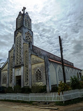
Mananjary is a city on the East coast of Madagascar with a population of 25,222 inhabitants in 2018. It is the chief town of the Mananjary district and the Vatovavy region.
Route nationale 24 is a secondary, unpaved highway in Madagascar of 61 km, running from Manajary to Vohilava. It crosses the region of Vatovavy.
