
This article describes the system of transport in Senegal, both public and private.This system comprises roads, rail transport, water transport, and air transportation.

The Kingdom of Saloum was a Serer/Wolof kingdom in present-day Senegal. Its kings may have been of Mandinka/Kaabu origin. The capital of Saloum was the city of Kahone. It was a sister kingdom of Sine. Their history, geography and culture were intricately linked and it was common to refer to them as the Sine-Saloum.
Kahone or Kawon is a town and commune near Kaolack, Senegal. It is primarily agricultural, but it is participating in industrial development plans. Also, the town is pursuing increased tourism based on its ancient Serer culture.
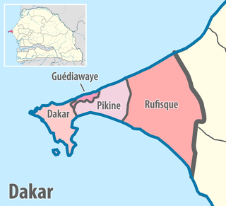
Dakar Region is the smallest and most populated Region of Senegal, encompassing the capital city of the country, Dakar, and all its suburbs along the Cap–Vert Peninsula, Africa's most westerly point.
Thiès is a region of western Senegal. The capital is also called Thiès.

Fatick is the southwest region of the northern outcrop of Senegal. Its alternative name is Jinnak Bolon. The region is named for its capital city, Fatick.

Kaolack is a town of 233,708 people on the north bank of the Saloum River about 100 kilometres (62 mi) from its mouth and the N1 road in Senegal. It is the capital of the Kaolack Region, which borders The Gambia to the south. Kaolack is an important regional market town and is Senegal's main peanut trading and processing center. As the center of the Ibrahimiyya branch of the Tijaniyyah Sufi order founded by Ibrayima Ñas, it is also a major center of Islamic education. The Leona Niassene mosque (right) in Kaolack is one of the largest and best known in Senegal.

Kayes Region is one of ten first level national subdivisions in Mali called Regions. It is the first administrative area of Mali and covers an area of 120,760 square kilometres or 46,630 square miles. Its capital is the town of Kayes. The province was historically part of the Ghana Empire and the Mali Empire.

The Diourbel Region is a region of Senegal with 2,080,811 inhabitans (2023). The regional capital is the city of Diourbel. The region corresponds roughly to the precolonial Kingdom of Bawol and is still called by that name. Bawol is an ancient kingdom formerly ruled by the Joof family, one of the members of the Serer ethnic group found in Senegambia. Inhabitants of the area are called Bawol-Bawol which takes its name from the Serer mode of pluralisation, other examples being : Sine-Sine or Siin-Siin, Saloum-Saloum, etc. The population is primarily comprised by the Serer people especially those from the Cangin group, the Safene in particular. The Serers are believed to be the original inhabitants of this area. The Wolof and other ethnic groups are also present. The Diourbel Region is rich in history and it is where the Cekeen Tumulus are located. Scholars such as Charles Becker, Henry Gravrand, and Victor Martin suggest that these monuments were built by the Serer people and form part of the Serer tumulus of Baol. They are some of the most sacred sites in Serer religion. The Département of Mbacke also includes Murid Islamic Sufi order's holy city of Touba. The installation of this order in Serer country is a controversial one, especially among those Serers who adhere to the tenets of Serer religion (see Serer history. However, some Serers are also Muslims and have headed this religious order.
Mamadu Diakhou Bâ, also known as Maba Jahou Bah, Ma Ba Diakhu, Ma Ba Diakho Ba, Ma Ba Jaaxu, Mabba Jaxu Ba, was a Muslim leader in West Africa during the 19th century. He was a disciple of the Tijaniyya Sufi brotherhood and became the Almami of Saloum.
Guinguinéo is a township in Kaolack Region in the center of Senegal, situated 22 km to the northeast of Kaolack. Before 1956, Guinguinéo experienced the phenomenon of kingdoms piloted by a succession of kings of whom the most famous was Maad Saloum Fode N'Gouye Joof. Guinguinéo became a commune in 1956 and a full municipality in 1960. The first mayor was Doctor Charles Ndiaye.

The Kingdom of Sine was a post-classical Serer kingdom along the north bank of the Saloum River delta in modern Senegal. The inhabitants are called Siin-Siin or Sine-Sine.
Sine-Saloum is a region in Senegal located north of the Gambia and south of the Petite Côte. It encompasses an area of 24,000 square kilometers, about 12% of Senegal, with a population in the 1990s of 1,060,000.

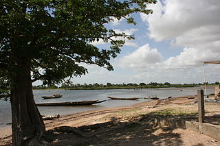
The Saloum River rises about 105 kilometers east of Kaolack, Senegal, and flows into the Atlantic Ocean. The Saloum Delta is located at its mouth, in the protected Saloum Delta National Park. The river basin lies within what was the pre-colonial Serer kingdom, Saloum. Mangrove forests occupy a five-kilometer belt on both banks over sixty kilometers upstream.
Fatick is a town in Senegal, located between M'bour and Kaolack and inhabited by the Serer people. Its 2005 population was estimated at 24,243. It is the capital of the Fatick Region and the Fatick Department.
The French conquest of Senegal started in 1659 with the establishment of Saint-Louis, Senegal, followed by the French capture of the island of Gorée from the Dutch in 1677, but would only become a full-scale campaign in the 19th century.
Paoskoto is a village and rural commune in Paoskoto Arrondissement in the Nioro du Rip Department of the Kaolack Region of Senegal, located near the border with the Gambia.
Maad a Signig Kumba Ndoffene Famak Joof was the King of Sine in modern-day Senegal. Maad a Sinig means king of Sine. He ruled from 1853 until his death on 23 August 1871. He was the son of Maad Souka Ndela Joof and Lingeer Gnilane Jogoy Joof. His father – Maad Souka Ndela came from The Royal House of Semou Njekeh Joof founded by Maad Semou Njekeh Joof in the early 18th century, which was the third and last Royal House of Joof family of Sine and Saloum. His paternal family ruled three Kingdoms : Sine, Kingdom of Saloum and previously the Kingdom of Baol. They descended from Maad Ndaah Njemeh Joof the 13th century King of Lâ (Laah) in Baol.
Alioune Sarr was a Senegalese historian, author and politician whose family gained prominence in the Serer precolonial Kingdom of Sine and Saloum around the 14th century. They also made up the "sulbalƃe" class of Futa Toro. Sarr was born at Foundiougne. His father was a former Chief of Foundiougne, Gandoune, former head of the constituency of Ndiaye-Ndiaye and former prime minister of Diognick in Senegal. Although Sarr was a prominent politician like his father during the colonial era, he is best known as a historian and author especially after his famous work Histoire du Sine-Saloum which was officially published in 1949 and peer reviewed by historians.
Sokone is a town in the Fatick Region of central Senegal.

