
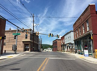
Kempton is a ghost town in Garrett County, Maryland. [1] Kempton is also partially located in Tucker County, West Virginia. [2]
Kempton is a ghost town in Garrett County, Maryland. [1] Kempton is also partially located in Tucker County, West Virginia. [2]
Kempton is located on the North Branch Potomac River, [3] which feeds the larger Potomac River. [4] Runoff from human activity at Kempton feeds the wetlands at Laurel Run. [3] Kempton contains a vast mining complex, much of which has been reforested. [5] Mining at Kempton takes up more than 7,680 acres of land. [4] Kempton is partially located in Tucker County, West Virginia, close to Thomas. [2] The location of the town is nearby to several notable natural sites, such as Blackwater Falls State Park and the Dolly Sods Wilderness. [2]

Kempton was founded in 1913 as a company town of the coal industry. [6] Kempton was founded by the Davis Coal and Coke Company. [7] In 1915, mining operations began at Kempton Mine Company, a subsidiary of Davis C&C Company. [8] By the 1930s, Kempton's population had grown to approximately 900 residents. [6] In 1950, the main mine, Mine No.42, [9] closed unexpectedly. [6]
After the mining industry dried up during the 1950s following unexpected mine closures, the population of Kempton declined sharply. [6] As of 2003, a small number of residents remain in old company housing at Kempton. [10] Over the years, mining at Kempton has put significant strain on the local watershed. [3] The mining complexes at Kempton are the most significant contributor to acid mine drainage (AMD) on the North Branch, which used to house thriving trout and bass industries. [4] After the closure of Mine No.42 in 1950, lack of maintenance on the abandoned mines caused large amounts of AMD into surrounding waterways. [9] In 1977, the Surface Mining Control and Reclamation Act was passed to help regulate the environmental impacts of both active and abandoned coal mines. [11] By this time, many of the mines were abandoned and Kempton had already been a ghost town for several years. [11]

Barton is a town in Allegany County, Maryland, United States, located along the Georges Creek Valley. It is part of the Cumberland, MD-WV Metropolitan Statistical Area. The population was 457 at the 2010 census.

Frostburg is a city in Allegany County, Maryland. It is located at the head of the Georges Creek Valley, 8 miles (13 km) west of Cumberland. The town is one of the first cities on the "National Road", US 40, and the western terminus of the Western Maryland Scenic Railroad. It is part of the Cumberland MD-WV metropolitan statistical area,

Acid mine drainage, acid and metalliferous drainage (AMD), or acid rock drainage (ARD) is the outflow of acidic water from metal mines or coal mines.

Henry Gassaway Davis was a millionaire and Senator from West Virginia. He was the Democratic Party's nominee for Vice President of the United States in 1904.
Georges Creek is a 17.6-mile-long (28.3 km) tributary stream of the North Branch Potomac River in western Maryland. The creek has its headwaters on Savage Mountain near Frostburg and empties into the North Branch Potomac River at Westernport, all in western Allegany County. Along the Georges Creek Valley, there exists a series of small towns founded in the nineteenth century for miners' homes. The Georges Creek Valley is rich in wide veins of coal, once extracted by deep mines but still mined today through surface mining.

The Blackwater River is a 34.3-mile-long (55.2 km) river in the Allegheny Mountains of eastern West Virginia, USA. Via the Black Fork, it is a principal tributary of the Cheat River. Via the Cheat, the Monongahela and the Ohio rivers, it is part of the watershed of the Mississippi River and drains an area of 142 square miles (370 km2). It is a true blackwater stream, owing to spruce and hemlock trees in its watershed, the tannins of which impart a tea or amber color to its water.
Georges Creek Valley is located in Allegany County, Maryland along the Georges Creek. The valley is rich in wide veins of coal, known historically as "The Big Vein." Coal was once extracted by deep mines but is only mined today through surface mining. The Georges Creek Valley was once a major center for the US coal industry.

Maryland Route 36 is a 29.43-mile (47.36 km) state highway located in Allegany County, Maryland, United States. MD 36's southern terminus is at the West Virginia Route 46 (WV 46) bridge in Westernport and its northern terminus at U.S. Route 40 Alternate near Cumberland. Between Westernport and Frostburg, it is known as Georges Creek Road, and from Frostburg to Cumberland it is known as Mount Savage Road. Like the majority of Maryland state highways, MD 36 is maintained by the Maryland State Highway Administration (MDSHA).
The Cumberland and Pennsylvania Railroad (C&P) was an American railroad which operated in Western Maryland. Primarily a coal hauler, it was owned by the Consolidation Coal Company, and was purchased by the Western Maryland Railway (WM) in 1944.
Eckhart Mines is an unincorporated community and census-designated place (CDP) in Allegany County, Maryland, United States. As of the 2010 census it had a population of 932.

The Maryland Mining Company is a historic coal mining, iron producer and railroad company that operated in Allegany County, Maryland, United States.
Cumberland, Maryland is named after the son of King George II, Prince William, the Duke of Cumberland. It is built on the site of the old Fort Cumberland, a launch pad for British General Edward Braddock's ill-fated attack on the stronghold of Fort Duquesne during the French and Indian War.
Davis, Massachusetts is the abandoned location of the Davis Pyrite Mine, located in the town of Rowe, Massachusetts. Once the largest iron pyrite mine in Massachusetts, Davis grew to be a decent sized mining village at the beginnings of the Second Industrial Revolution (1870–1915). But in 1911, a non-fatal collapse of the mine due to “poor mining practices” ended the nearly 30-year run. By 1937, the mining camp had faded, and all that remained were a blacksmith shop and about 150 cellar holes.
The Hoffman tunnel, or Hoffman drainage tunnel, was constructed to drain water from coal mines northwest of Clarysville in Allegany County, Maryland. The two-mile-long tunnel drains into the Braddock Run tributary of Wills Creek.
Klondike is an unincorporated community and census-designated place (CDP) in Allegany County, Maryland, United States. As of the 2010 census it had a population of 118.
The Askam Borehole is a borehole that is located in Luzerne County, Pennsylvania, in the United States. It is situated in the watershed of Nanticoke Creek north of PA 29 and Dundee Road and contributes several million gallons of acid mine drainage to that creek daily. The borehole also discharges large loads of iron and other substances. It was constructed by the Pennsylvania Department of Environmental Protection in the early 1970s and drains mine water from the South-East Mine Pool Complex. The discharges of the borehole have been treated by active treatment systems and artificial wetlands.

Abandoned mine drainage is a form of water pollution involving water that has been polluted by contact with mines, typically coal mines. Although it is sometimes called "acid mine drainage", not all abandoned mine drainage is acidic.
Dodson is a ghost town in Garrett County, Maryland. Dodson was a "boom town" that sprung up with the coal industry in Appalachia in the early 1900s. It died out with other nearby towns in the 1920s and 1930s.
{{cite journal}}: Cite journal requires |journal= (help)39°12′24″N79°29′07″W / 39.20667°N 79.48528°W
| | This United States ghost town-related article is a stub. You can help Wikipedia by expanding it. |