Notes
Coordinates: 44°12′6.83″N69°58′18.93″W / 44.2018972°N 69.9719250°W
| | This Maine state location article is a stub. You can help Wikipedia by expanding it. |
The Kennebec Valley is a region of the U.S. state of Maine, consisting of the Somerset, Kennebec, and Androscoggin Counties. The area formed as a result of the Wisconsin Glaciation.
Coordinates: 44°12′6.83″N69°58′18.93″W / 44.2018972°N 69.9719250°W
| | This Maine state location article is a stub. You can help Wikipedia by expanding it. |

Kennebec County is a county located in the South-central portion of the U.S. state of Maine. At the 2020 census, the population was 123,642. Its county seat is Augusta, the state capital. The county was established on February 20, 1799, from portions of Cumberland and Lincoln Counties. The name Kennebec comes from the Eastern Abenaki /kínipekʷ/, meaning "large body of still water, large bay."

Kennebec is a town in and county seat of Lyman County, South Dakota, United States. The population was 281 at the 2020 census.
Perkins Township is an unorganized territory in Sagadahoc County, Maine, United States. Originally incorporated as the town of Perkins, it was later abandoned, and has been uninhabited since the 1940s. The township comprises Swan Island, Little Swan Island and some tidal flats—all within the Kennebec River between the towns of Richmond and Dresden. The Swan Island Historic District comprises most of the township, with 8 buildings, 5 structures and 1,500 acres (610 ha). Some of the buildings date to the 1750s. The district was added to the National Register of Historic Places in 1995. The entire township is now protected as the Steve Powell Wildlife Management Area, and is under the jurisdiction of the Maine Department of Inland Fisheries and Wildlife. Camping, hunting, fishing, and wildlife viewing are permitted between May and October; reservations are required.
Winslow is a town and census-designated place in Kennebec County, Maine, United States, along the Kennebec River across from Waterville. The population was 7,948 at the 2020 census.

The Kennebec River is a 170-mile-long (270 km) river within the U.S. state of Maine. It rises in Moosehead Lake in west-central Maine. The East and West Outlets join at Indian Pond and the river flows southward. Harris Station Dam, the largest hydroelectric dam in the state, was constructed near that confluence. The river is joined at The Forks by its tributary the Dead River, also called the West Branch.
Devonshire County, Massachusetts was a short-lived county formed in 1674 during colonial territorial disputes between the Massachusetts Bay Colony and the Province of New York. The county existed from 1674 to 1675, and encompassed land claimed by Massachusetts between the Kennebec River and Penobscot Bay in what is now Maine. This overlapped the New York claim, which extended from the Kennebec to the Saint Croix River. Settlements in the territory were attacked during King Philip's War (1675-1676) and the area was abandoned until the 18th century. It was incorporated into the Province of Massachusetts Bay in 1692, which initially governed it as part of York County. The area is now divided into a number of Maine counties.
The Kennebec Journal is a six-day morning daily newspaper published in Augusta, Maine. It is owned by MaineToday Media, which also publishes the state's largest newspaper, the Portland Press Herald.
The East Branch Eastern River is a 6.5-mile-long (10.5 km) river in Maine. It is part of the Kennebec River watershed. It rises in the town of Whitefield and flows southwest to its confluence with the West Branch Eastern River at East Pittston to form the Eastern River.
The East Branch Sebasticook River is a tributary of the Sebasticook River in central Maine in the United States. It is part of the Kennebec River watershed. From the outflow of Lake Wassookeag in Dexter, the river runs about 12.7 miles (20.4 km) south to Sebasticook Lake. From the outflow of the lake in Newport, the river runs about 9.5 miles (15.3 km) southwest to its confluence with the Sebasticook in Detroit.
The Eastern River is a 14.0-mile-long (22.5 km) tributary of the Kennebec River in Maine. It rises in East Pittston at the confluence of its west and east branches and flows southwest past Dresden Mills to its mouth at the Kennebec, at the town boundary between Dresden and Perkins.
The Little River is a 4.0-mile-long (6.4 km) river in the town of Georgetown, Maine. It flows directly into the Atlantic Ocean, between the mouth of the Sheepscot River to the east and the Kennebec River to the west. The lower portion of its course forms the western boundary of Reid State Park.
The Little River is a tidal channel connecting at each end with the Kennebec River in the town of Perkins in the U.S. state of Maine. It passes to the west of Little Swan Island while the main stem of the Kennebec passes to the east.

The Sheepscot River is a 66-mile-long (106 km) river in the U.S. state of Maine. Its lower portion is a complex island estuary with connections to the Kennebec River downstream of Merrymeeting Bay.
The West Branch Eastern River is a 10.4-mile-long (16.7 km) tributary of the Eastern River in Maine. It is part of the Kennebec River watershed. The West Branch begins near South Windsor and flows southwest through the town of Whitefield, joining the East Branch at East Pittston to form the Eastern River.

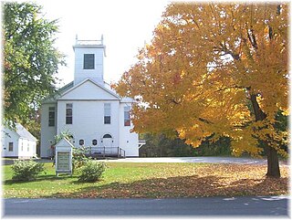
St. Matthew's Episcopal Church is an Episcopal Church at 20 Union Street in Hallowell, Maine. The church was built in 1860, and is part of the Hallowell Historic District defined in the National Register of Historic Places.
East Winthrop is a village in the town of Winthrop in Kennebec County, Maine, United States. It is located just west of Manchester and south of Readfield, borders most of Cobbosseecontee Lake, and all of Little Cobbosseecontee, Upper & Lower Narrows. It has a separate post office and ZIP code (04343) from the rest of Winthrop, although this serves only mail delivered to post office boxes in the East Winthrop Post Office. The area has magnificent views of the Cobbosseecontee bodies of water.

Farmingdale is a census-designated place (CDP) in the town of Farmingdale in Kennebec County, Maine, United States. The population was 1,970 at the 2010 census, out of 2,956 in the entire town.

The Memorial Bridge, also known as the Kennebec Memorial Bridge, is a bridge in Augusta, Maine, that crosses the Kennebec River, joining the east and west sides of the city. It carries U.S. Route 201, U.S. Route 202, Route 11, and Route 100. The bridge is approximately 2,100 feet long and has two lanes for traffic and a barrier-protected sidewalk for pedestrians on each side of the roadway. It was built in 1949.
The Pearl Harbor Remembrance Bridge, is a steel girder and concrete bridge that crosses the Kennebec River between Gardiner and Randolph, Maine. It carries Maine State Routes 9, 126, and 27. It was built in 1980 to replace an older truss bridge several hundred yards downstream. The bridge was given its current name in 2001 to honor the 60th anniversary of the attack on Pearl Harbor.

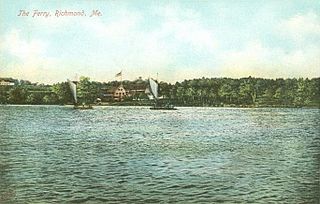
The Maine Kennebec Bridge is a bridge that crosses the Kennebec River between Richmond and Dresden, Maine. It was built in 2014 to replace the 84-year-old Richmond-Dresden Bridge, a swing bridge that had previously acted as the only method of crossing the river in that area. The Maine Kennebec Bridge is significantly taller than the old bridge, and was designed for at least 75 feet of clearance during high tide, allowing boats to pass without the need for a swing-span design.